File:1936-02 oshd row 5B-2-14 2.jpg
Jump to navigation
Jump to search
Size of this preview: 800 × 480 pixels. Other resolutions: 320 × 192 pixels | 2,613 × 1,567 pixels.
Original file (2,613 × 1,567 pixels, file size: 1.83 MB, MIME type: image/jpeg)
Summary
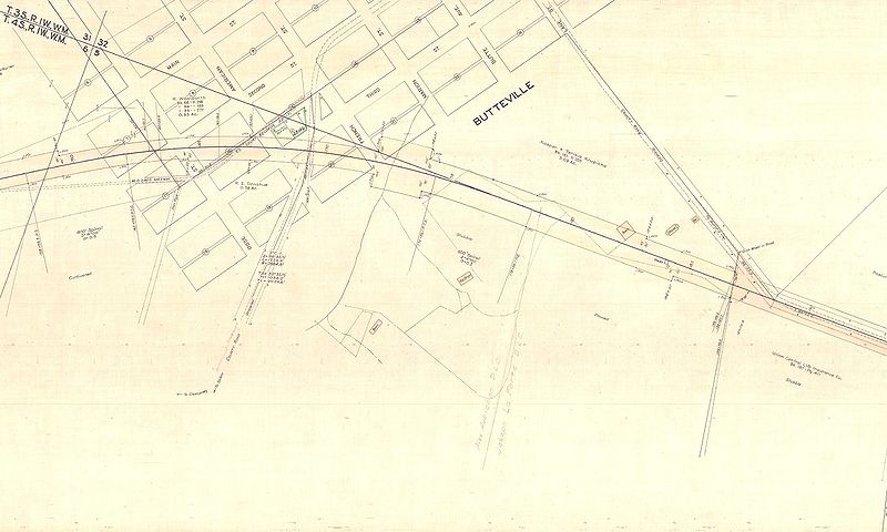
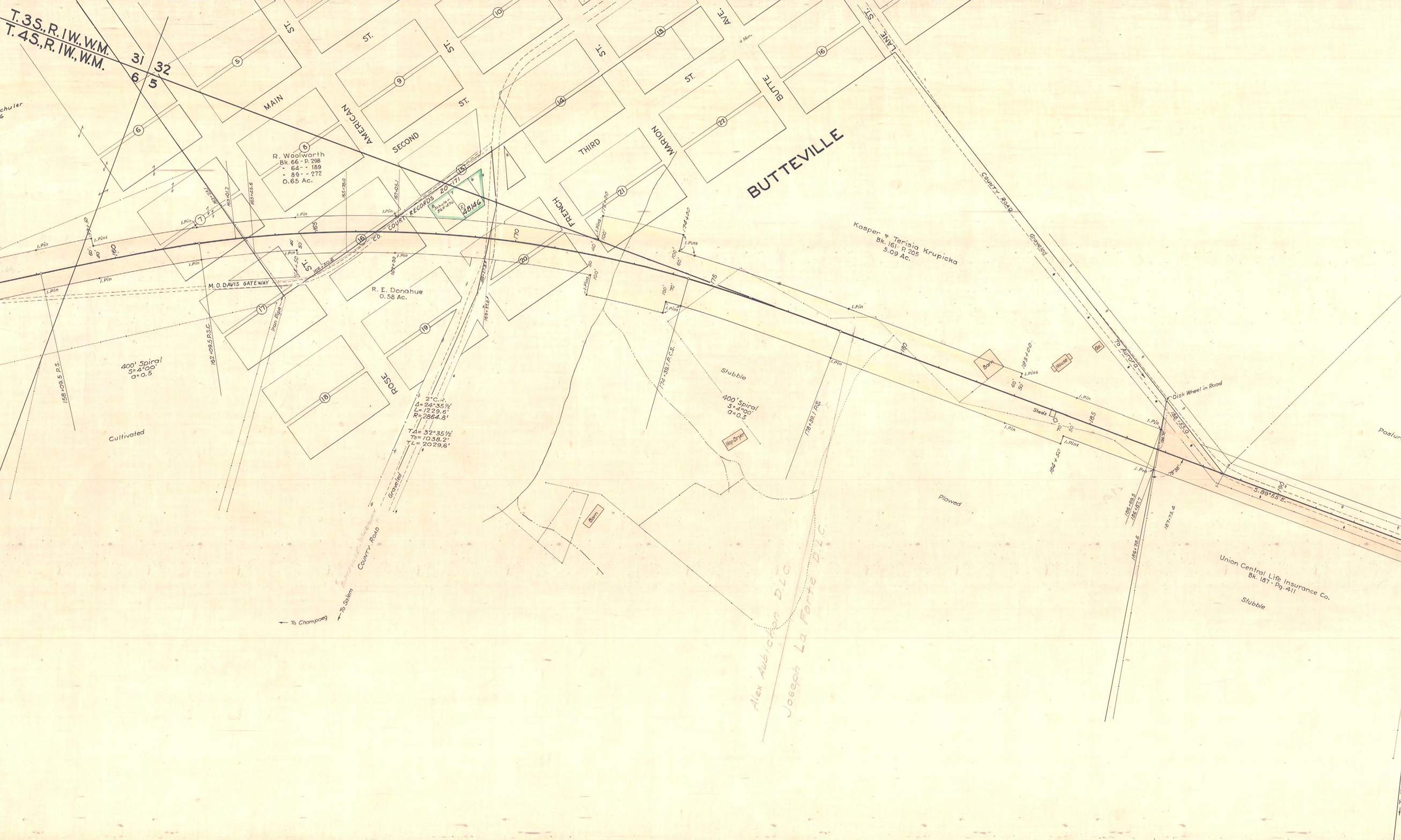
Close-up of the Champoeg Memorial Highway located line ROW map showing the routing through Butteville.
📆 February 1936
🖼 Oregon State Highway Department
🆔 5B-2-14
File history
Click on a date/time to view the file as it appeared at that time.
| Date/Time | Thumbnail | Dimensions | User | Comment | |
|---|---|---|---|---|---|
| current | 16:47, 28 June 2025 | | 2,613 × 1,567 (1.83 MB) | Jonathan (talk | contribs) | Close-up of the Champoeg Memorial Highway located line ROW map showing the routing through Butteville.<br /> 📆 February 1936<br /> 🖼 Oregon State Highway Division<br /> 🆔 5B-2-14 |
- You cannot overwrite this file.
File usage
The following page uses this file: