US Route 320
Jump to navigation
Jump to search
 |
|||
| US Route 320 | |||
| Salmon River Highway #39 Willamina-Salem Highway #30 Pacific Highway East #1E North Santiam Highway #162 |
|||
 |
|||
| Route Information | |||
|---|---|---|---|
| Maintained by Oregon Department of Transportation | |||
| Length | ≈140 mi. | ||
| Existed | May 9, 1958 to June 26, 1958 | ||
| Junctions | |||
| West End | |||
| South End | |||
| Navigation | |||
|
|||
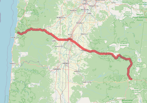
US Route 320 was a proposed US route that ran between US-191 at Otis and US-20 at Santiam Junction. If approved, it would have taken over a portion of OR-18 (the Salmon River Highway #39) between Otis to near Willamina and most of OR-22 (consisting of the entirety of the Willamina-Salem Highway #30 and North Santiam Highway #162) from Valley Junction to Santiam Junction. Within Salem, it would have also been co-signed with US-99 Business (Salem) (Pacific Highway East #1E) for 0.5 miles. It was approved by the OSHC in 1958, but AASHO denied the petition later that year.