File:A2005-001-792-sw-jefferson-northeast-1947-2.jpg
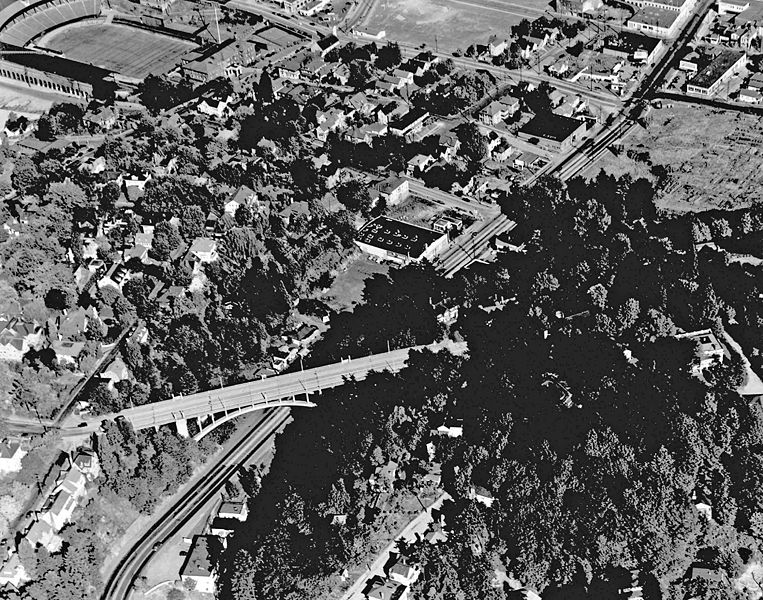
Revision as of 13:40, 14 February 2021 by Jonathan (talk | contribs) (Aerial photo of SW Jefferson Street (Sunset Highway) near the Vista Bridge.<br /> 📆 1947<br /> 🖼 City of Portland Archives via [https://vintageportland.wordpress.com/2012/08/24/aerial-view-goose-hollow-1947/ Vintage Portland]<br /> 🆔 A2005-001.792)

Size of this preview: 763 × 600 pixels. Other resolutions: 305 × 240 pixels | 3,000 × 2,359 pixels.
Original file (3,000 × 2,359 pixels, file size: 865 KB, MIME type: image/jpeg)
Summary
Aerial photo of SW Jefferson Street (Sunset Highway) near the Vista Bridge.
📆 1947
🖼 City of Portland Archives via Vintage Portland
🆔 A2005-001.792
File history
Click on a date/time to view the file as it appeared at that time.
| Date/Time | Thumbnail | Dimensions | User | Comment | |
|---|---|---|---|---|---|
| current | 13:40, 14 February 2021 |  | 3,000 × 2,359 (865 KB) | Jonathan (talk | contribs) | Aerial photo of SW Jefferson Street (Sunset Highway) near the Vista Bridge.<br /> 📆 1947<br /> 🖼 City of Portland Archives via [https://vintageportland.wordpress.com/2012/08/24/aerial-view-goose-hollow-1947/ Vintage Portland]<br /> 🆔 A2005-001.792 |
- You cannot overwrite this file.
File usage
There are no pages that use this file.