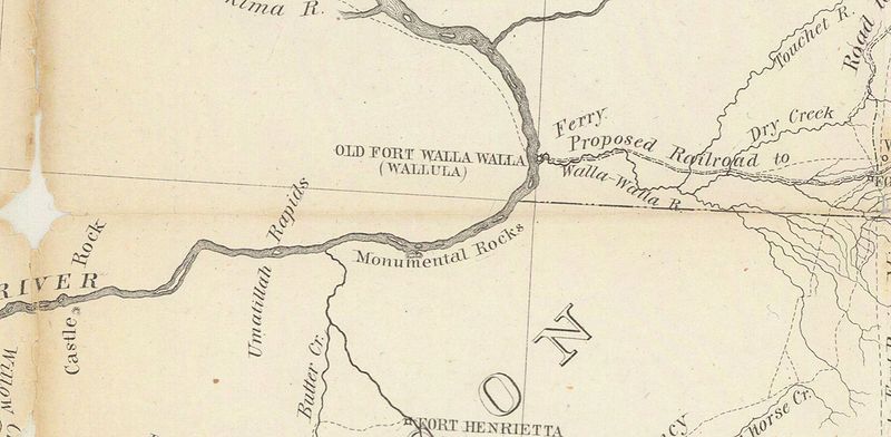
File:1863 US map-military-road-ft-benton-ft-walla-walla-snippet.jpg
Jump to navigation
Jump to search


Size of this preview: 800 × 392 pixels. Other resolutions: 320 × 157 pixels | 1,768 × 866 pixels.
Original file (1,768 × 866 pixels, file size: 791 KB, MIME type: image/jpeg)
Summary
A snippet of a map that shows the military road from Fort Walla Walla to Fort Benson. The snippet itself centers on the present-day Wallula and Umatilla area, showing no known roads or trails along the southern bank of the Columbia.
📆 1863
🖼 US War Department via University of Washington Libraries
File history
Click on a date/time to view the file as it appeared at that time.
| Date/Time | Thumbnail | Dimensions | User | Comment | |
|---|---|---|---|---|---|
| current | 19:11, 1 February 2024 |  | 1,768 × 866 (791 KB) | Jonathan (talk | contribs) | A snippet of a map that shows the military road from Fort Walla Walla to Fort Benson. The snippet itself centers on the present-day Wallula and Umatilla area, showing no known roads or trails along the southern bank of the Columbia.<br /> 📆 1863<br /> 🖼 US War Department via [https://content.libraries.wsu.edu/digital/collection/maps/id/232/ University of Washington Libraries] |
- You cannot overwrite this file.
File usage
The following page uses this file: