File list
Jump to navigation
Jump to search
This special page shows all uploaded files.
| Date | Name | Thumbnail | Size | User | Description | Versions |
|---|---|---|---|---|---|---|
| 22:17, 6 February 2021 | OR 52.png (file) |  |
52 KB | Jonathan | Modern version of route shield for OR-52 | 1 |
| 22:18, 6 February 2021 | OR 53.png (file) |  |
54 KB | Jonathan | Modern version of route shield for OR-53 | 1 |
| 22:19, 6 February 2021 | OR 58.png (file) |  |
57 KB | Jonathan | Modern version of route shield for OR-58 | 1 |
| 22:20, 6 February 2021 | OR 70.png (file) |  |
51 KB | Jonathan | Modern version of route shield for OR-70 | 1 |
| 22:24, 6 February 2021 | OR 74.png (file) |  |
42 KB | Jonathan | Modern version of route shield for OR-74 | 1 |
| 22:25, 6 February 2021 | OR 78.png (file) |  |
53 KB | Jonathan | Modern version of route shield for OR-78 | 1 |
| 22:29, 6 February 2021 | I-82.png (file) |  |
96 KB | Jonathan | Modern version of route shield for I-82 | 1 |
| 22:30, 6 February 2021 | OR 82.png (file) |  |
58 KB | Jonathan | Modern version of route shield for OR-82 | 1 |
| 22:31, 6 February 2021 | I-84.png (file) |  |
86 KB | Jonathan | Modern version of route shield for I-84 | 1 |
| 22:33, 6 February 2021 | OR 86.png (file) |  |
60 KB | Jonathan | Modern version of route shield for OR-86 | 1 |
| 22:34, 6 February 2021 | OR 86S.png (file) |  |
74 KB | Jonathan | Modern version of route shield for OR-86 Spur (letter suffix) | 1 |
| 03:01, 7 February 2021 | OR 132.png (file) |  |
52 KB | Jonathan | Modern version of route shield for OR-132 | 1 |
| 03:02, 7 February 2021 | I-105.png (file) |  |
95 KB | Jonathan | Modern version of route shield for I-105 | 1 |
| 03:04, 7 February 2021 | OR 569.png (file) |  |
68 KB | Jonathan | Modern version of route shield for OR-569 | 1 |
| 03:05, 7 February 2021 | OR 126.png (file) |  |
58 KB | Jonathan | Modern version of route shield for OR-126 | 1 |
| 03:06, 7 February 2021 | OR 131.png (file) |  |
43 KB | Jonathan | Modern version of route shield for OR-131 | 1 |
| 03:06, 7 February 2021 | OR 138.png (file) |  |
61 KB | Jonathan | Modern version of route shield for OR-138 | 1 |
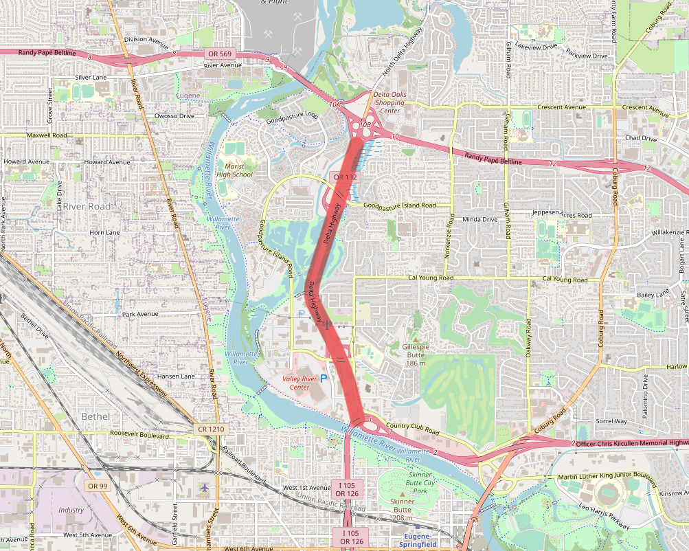
| 03:16, 7 February 2021 | OR 132-map.jpg (file) |  |
989 KB | Jonathan | Map of OR-132 alignment | 1 |
| 13:01, 7 February 2021 | OR 127.png (file) |  |
47 KB | Jonathan | Modern version of route shield for OR-127 | 1 |
| 15:06, 7 February 2021 | OR 130.png (file) |  |
59 KB | Jonathan | Modern version of route shield for OR-130 | 1 |
| 20:57, 7 February 2021 | OR 127-map.jpg (file) |  |
470 KB | Jonathan | Map of OR-127 alignment | 1 |
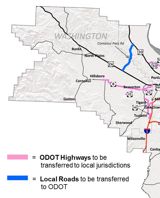
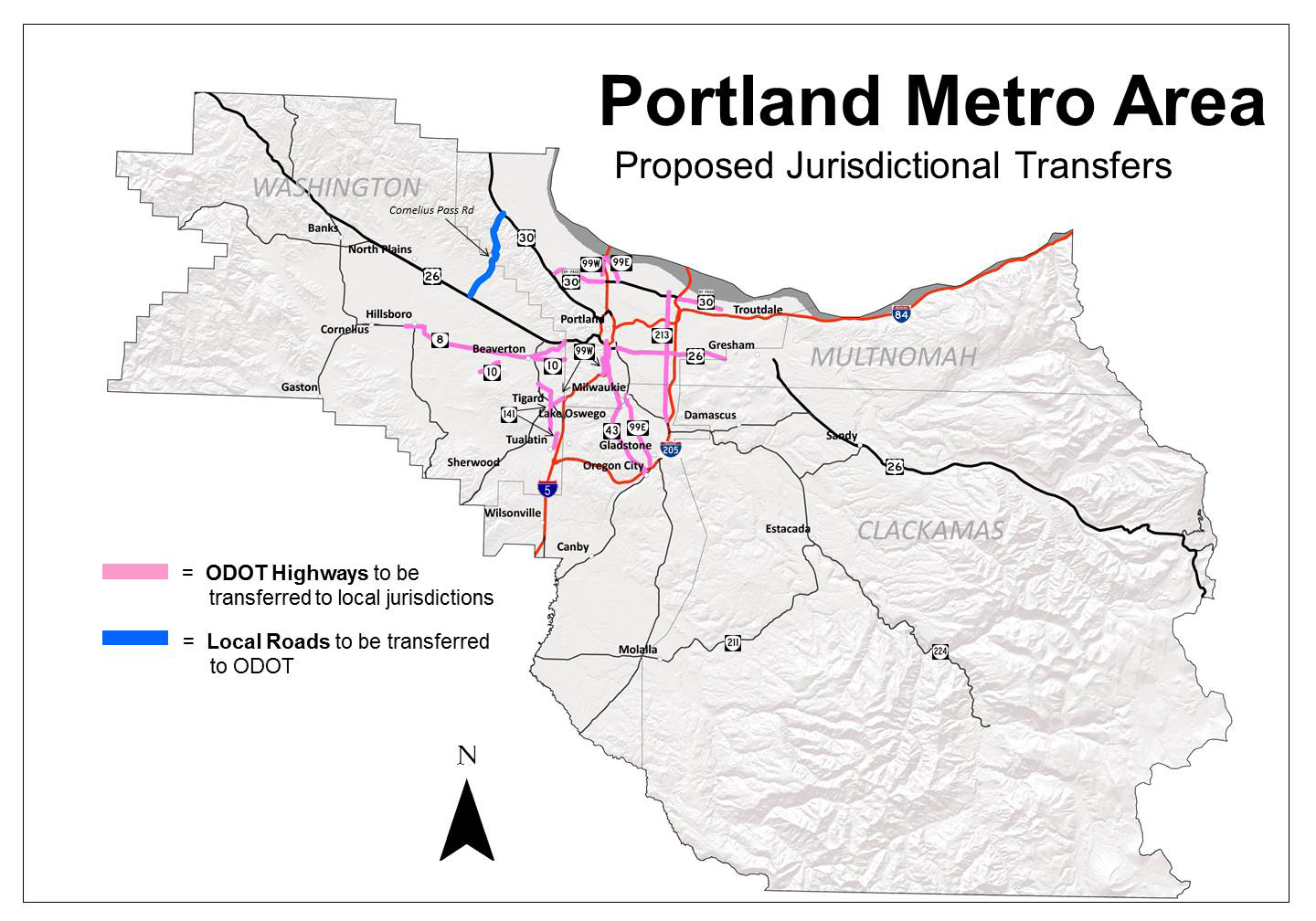
| 02:33, 8 February 2021 | 2015-03-16 Portland Metro Area Jurisdictional Transfers part.jpg (file) | 169 KB | Jonathan | 1 | ||
| 02:36, 8 February 2021 | 2015-03-16 Portland Metro Area Jurisdictional Transfers fullmap.jpg (file) | 354 KB | Jonathan | The full version of an ODOT map showing candidates for jurisdictional transfer. | 1 | |
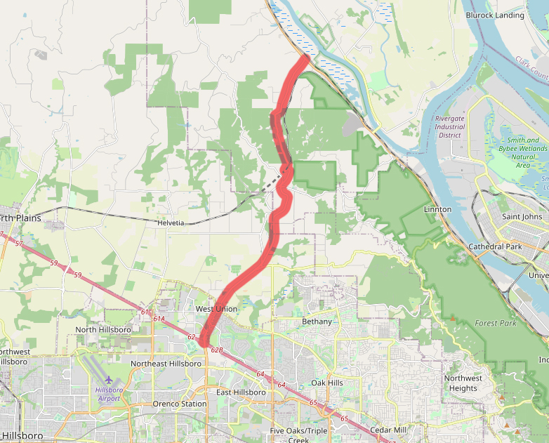
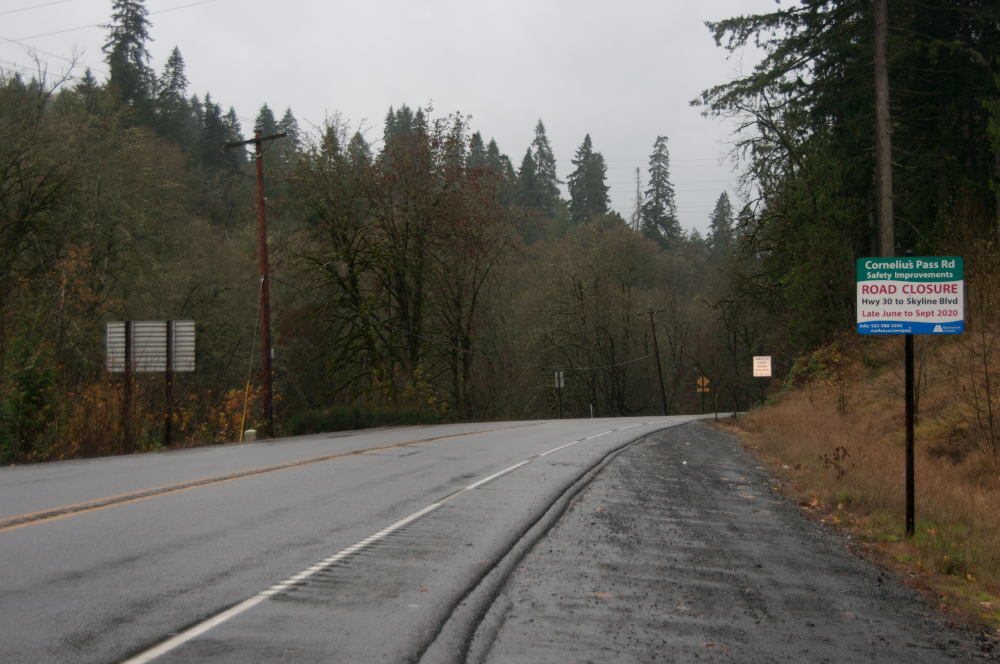
| 22:12, 10 February 2021 | 2020-11-14-cornpass-road-6281.jpg (file) |  |
1.63 MB | Jonathan | Added GPS data | 2 |
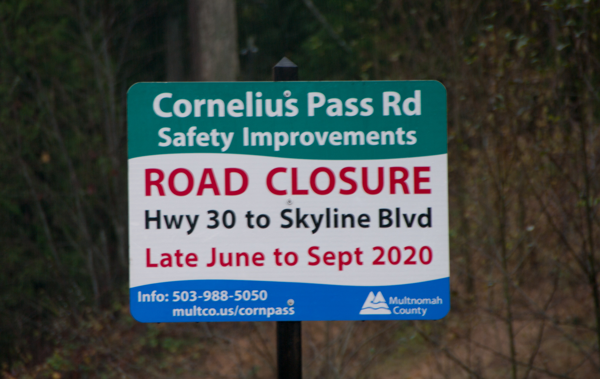
| 22:12, 10 February 2021 | 2020-11-14-cornpass-road-6284.jpg (file) |  |
1.41 MB | Jonathan | Added GPS data | 2 |
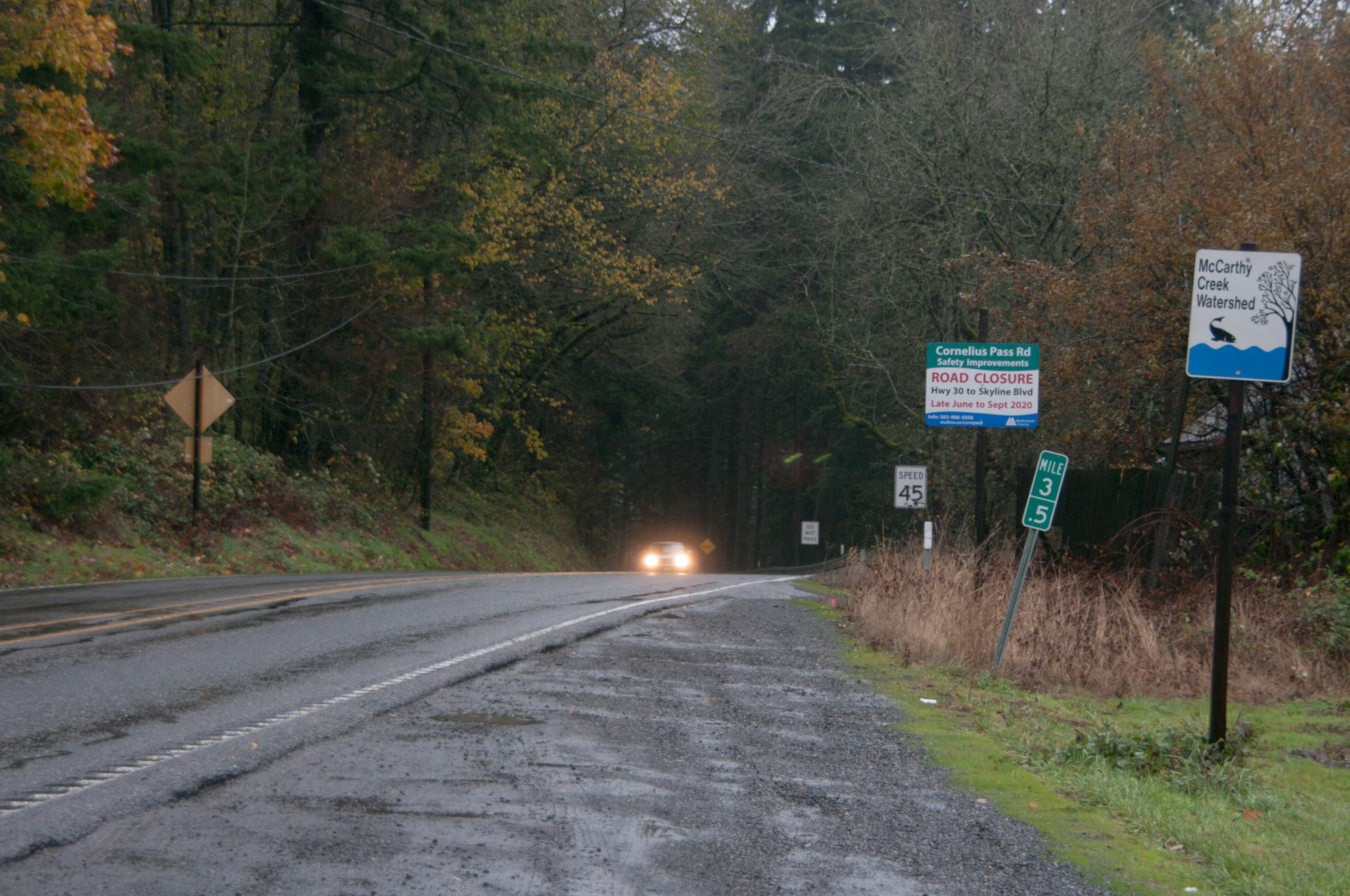
| 22:13, 10 February 2021 | 2020-11-14-cornpass-road-6288.jpg (file) |  |
2.12 MB | Jonathan | Added GPS data | 2 |
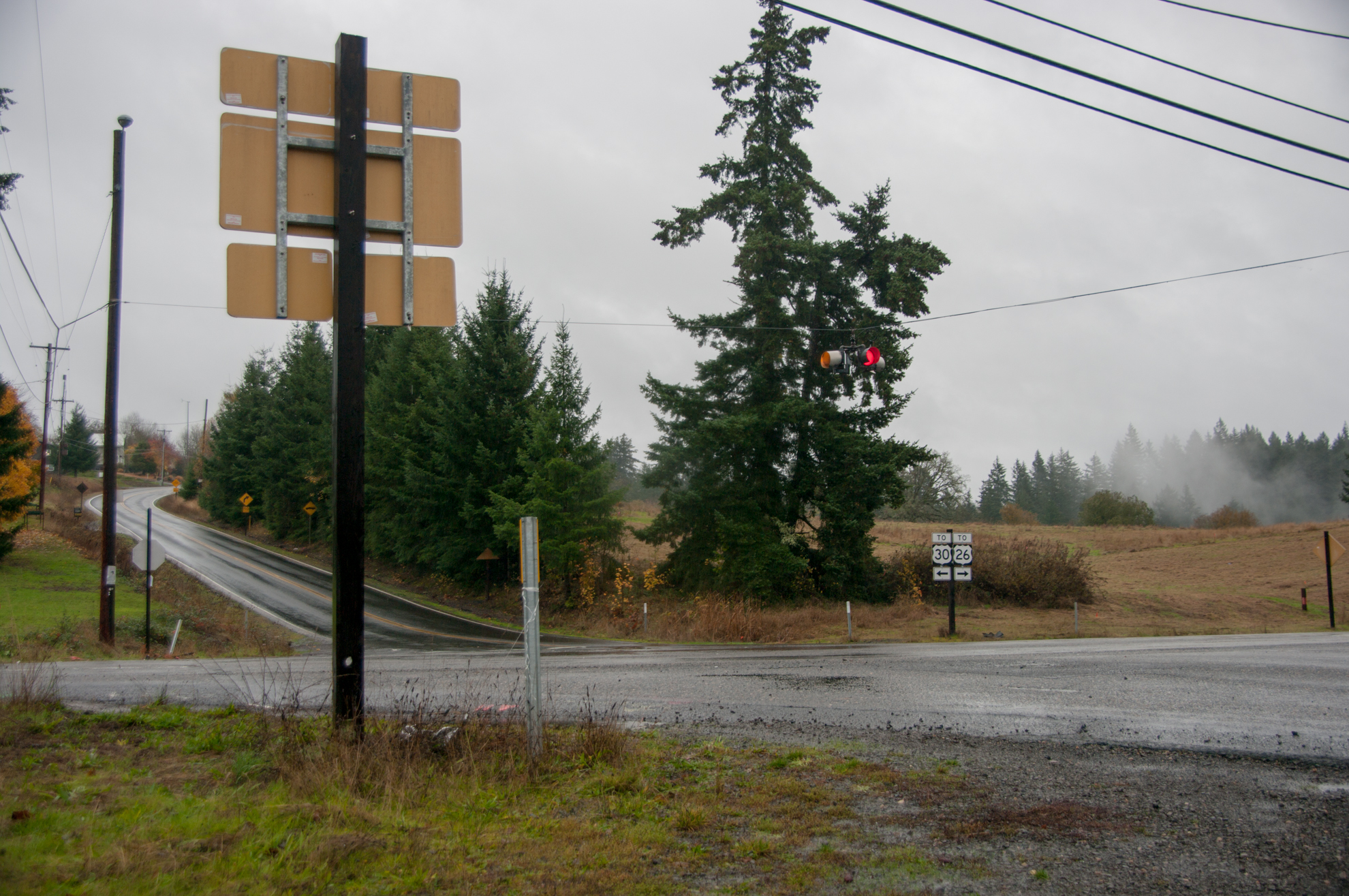
| 22:16, 10 February 2021 | 2020-11-14-cornpass-road-6312.jpg (file) |  |
1.79 MB | Jonathan | Added GPS data | 2 |
| 03:07, 12 February 2021 | US 101 1948.png (file) |  |
112 KB | Jonathan | 1948 version of route shield for US-101 | 1 |
| 03:10, 12 February 2021 | OR 6 1948.png (file) |  |
97 KB | Jonathan | 1948 version of route shield for OR-6 | 1 |
| 03:11, 12 February 2021 | OR 8 1948.png (file) |  |
97 KB | Jonathan | 1948 version of route shield for OR-8 | 1 |
| 03:12, 12 February 2021 | OR 47 1948.png (file) |  |
93 KB | Jonathan | 1948 version of route shield for OR-47 | 1 |
| 03:12, 12 February 2021 | OR 53 1948.png (file) |  |
98 KB | Jonathan | 1948 version of route shield for OR-53 | 1 |
| 03:32, 12 February 2021 | OR 2-map.jpg (file) |  |
529 KB | Jonathan | Map showing old alignments of OR-2 | 1 |
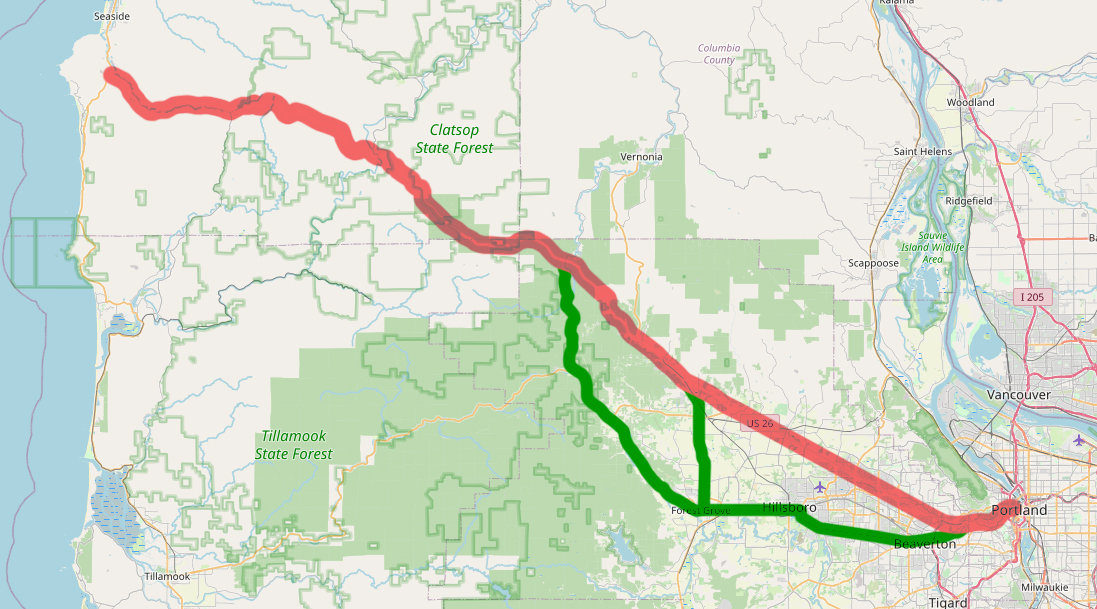
| 01:20, 14 February 2021 | 1936-09-10 - WPA - Wolf Creek Highway Station 3278 W.jpg (file) |  |
328 KB | Jonathan | WPA vehicles and personnel constructing the Wolf Creek Highway near Sylvan (engineering station 3278). 📆 10 September 1936 | 1 |
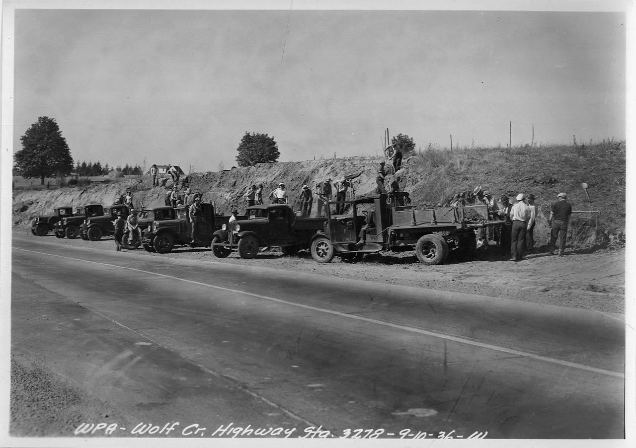
| 01:25, 14 February 2021 | 1936-oct-14 wolf-creek-highway-sylvan-looking-west a2009-009.2029-1.jpg (file) |  |
1.99 MB | Jonathan | The Wolf Creek Highway at Sylvan (engineering station 3278) looking west. 📆 14 October 1936 🖼 City of Portland Archives 🆔 A2009-009.2029 🔗 https://efiles.portlandoregon.gov/record/3901401 via https://vintageportland.wordpress.com/2020/03/23/wolf-creek-highway-1936-2/ | 1 |
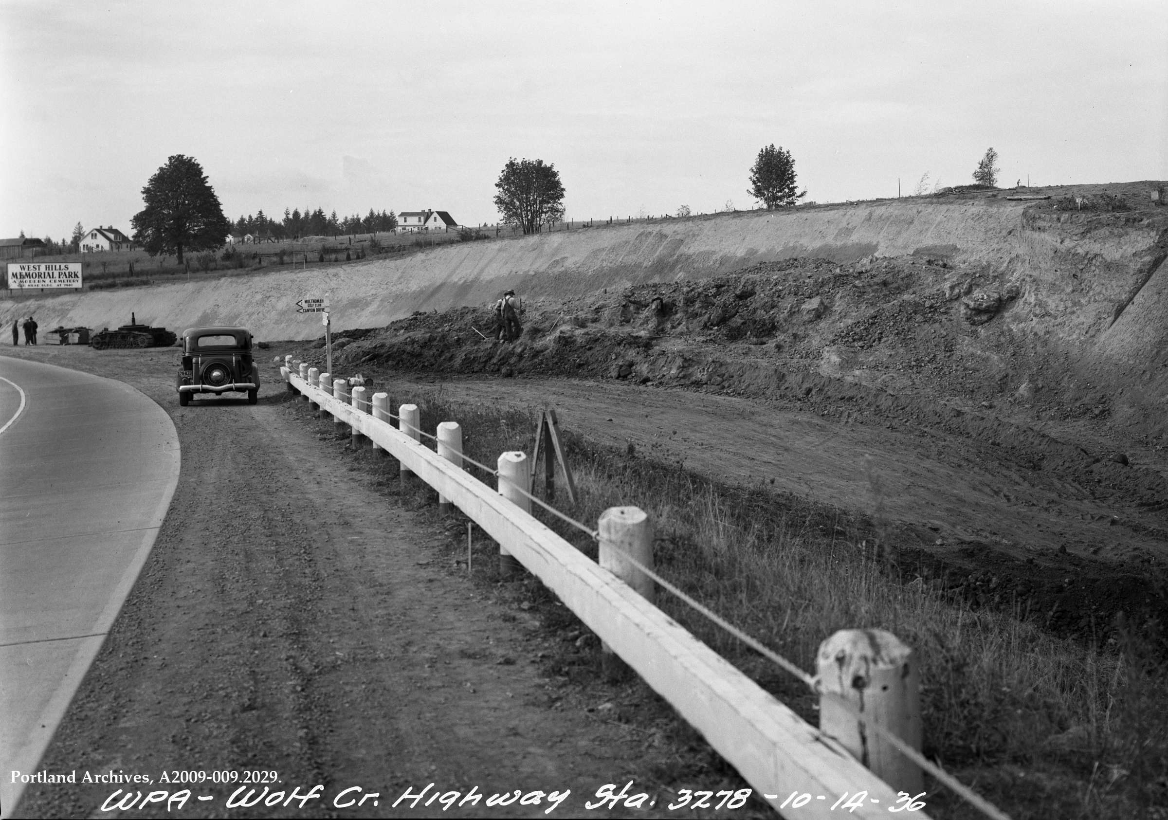
| 01:34, 14 February 2021 | 1936-sep-10 wolf-creek-highway-construction a2009-009.2019.jpg (file) |  |
1.88 MB | Jonathan | Construction of the Wolf Creek Highway (WPA Project #951) near Sylvan (engineering station 3285) looking west.<br /> 📆 10 September 1936<br /> 🔗 [https://efiles.portlandoregon.gov/record/3900699 City of Portland Archives] via [https://vintageportland.wordpress.com/2020/06/15/wolf-creek-highway-1936-4/ Vintage Portland]<br /> 🆔 A2009-009.2029<br /> | 1 |
| 01:44, 14 February 2021 | 1937-03-18 - OSHD HPL 37 - Wolf Creek Hwy. Sunset Logging Co's Operations South of Highway, Looking North.jpg (file) |  |
950 KB | Jonathan | Looking north at the Sunset Logging Company's operations south of the Wolf Creek Highway, looking north.<br /> 📆 18 March 1937<br /> 🖼 Oregon State Highway Department<br /> 🆔 HPL 37<br /> | 1 |
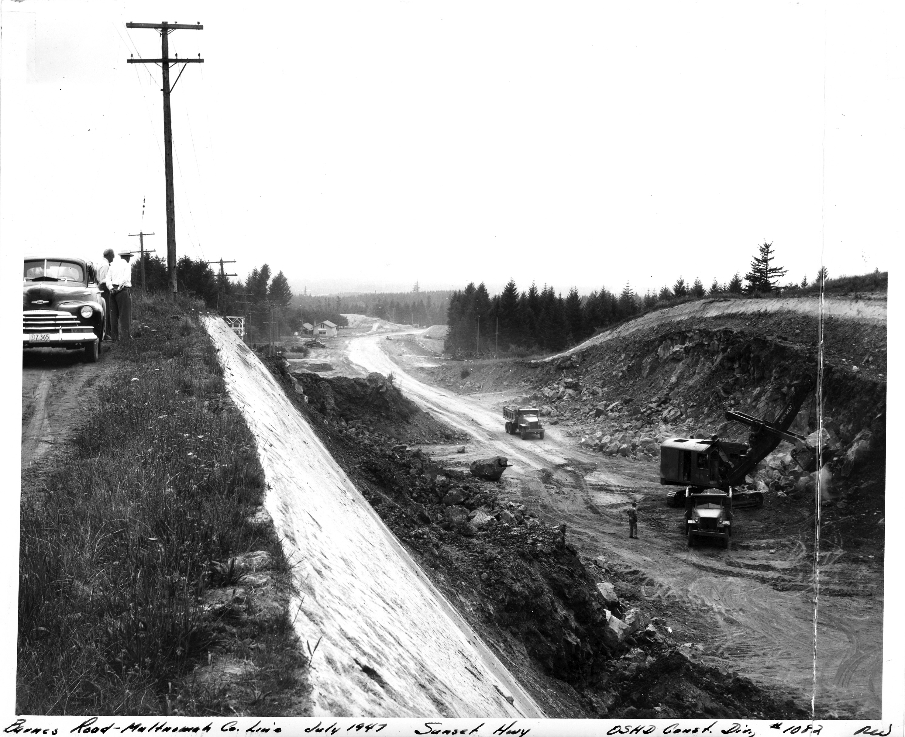
| 01:50, 14 February 2021 | 1947-07 - OSHD 1082 - Barnes Road-Multnomah Co Line.jpg (file) |  |
2.86 MB | Jonathan | Constructing the Barnes Road-Multnomah County Line section of the Sunset Highway.<br /> 📆 July 1947<br /> 🖼 Oregon State Highway Department, Construction Division<br /> 🆔 1082 | 1 |
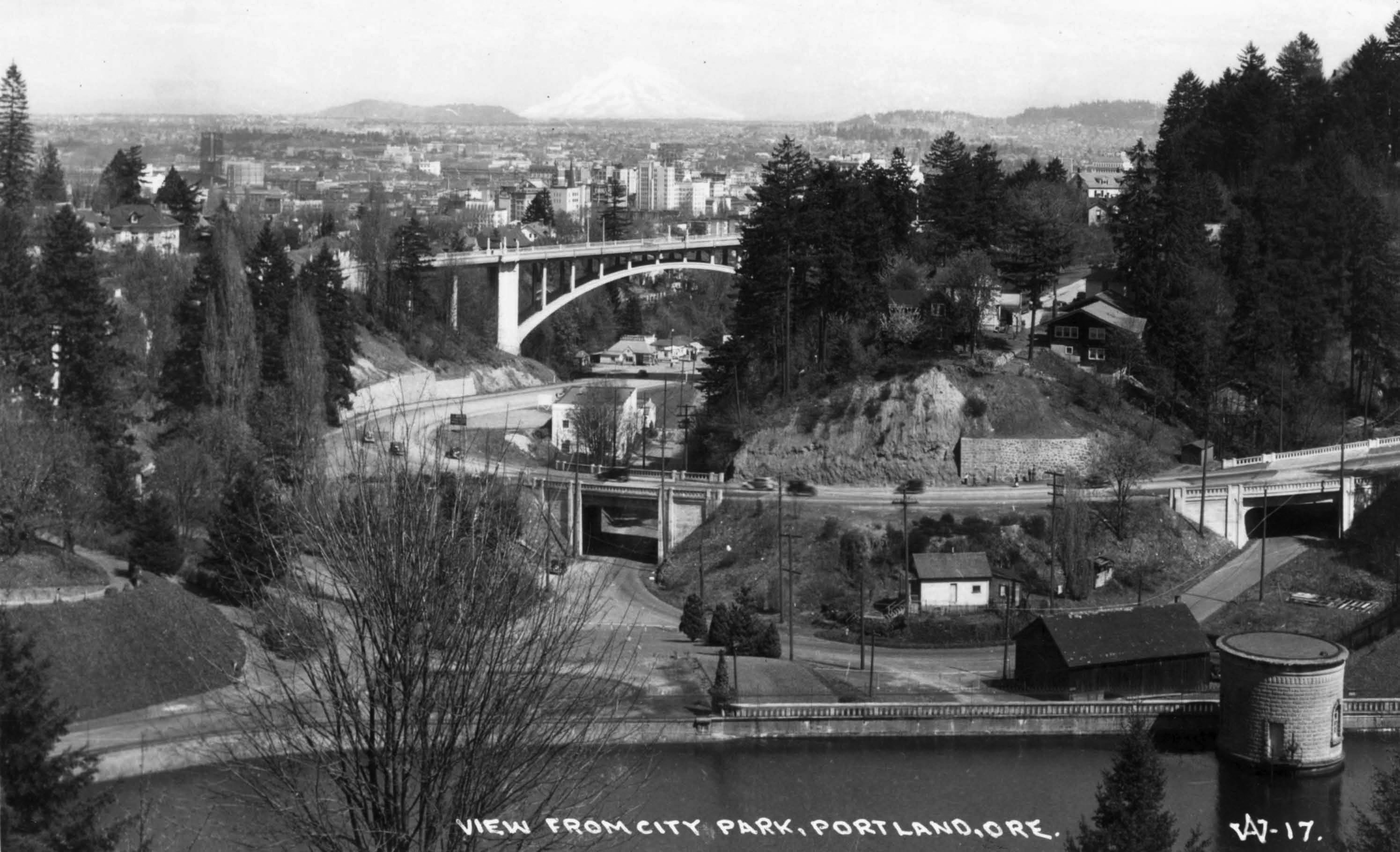
| 02:00, 14 February 2021 | A2004-002-864-view-from-city-washington-park-1935.jpg (file) |  |
584 KB | Jonathan | View of the eastern end of Canyon Road and the Vista Bridge from Washington Park.<br /> 📆 1935<br /> 🖼 City of Portland Archives via [https://vintageportland.wordpress.com/2010/07/08/view-from-washington-park-1935/ Vintage Portland]<br /> 🆔 A2004-002.864<br /> | 1 |
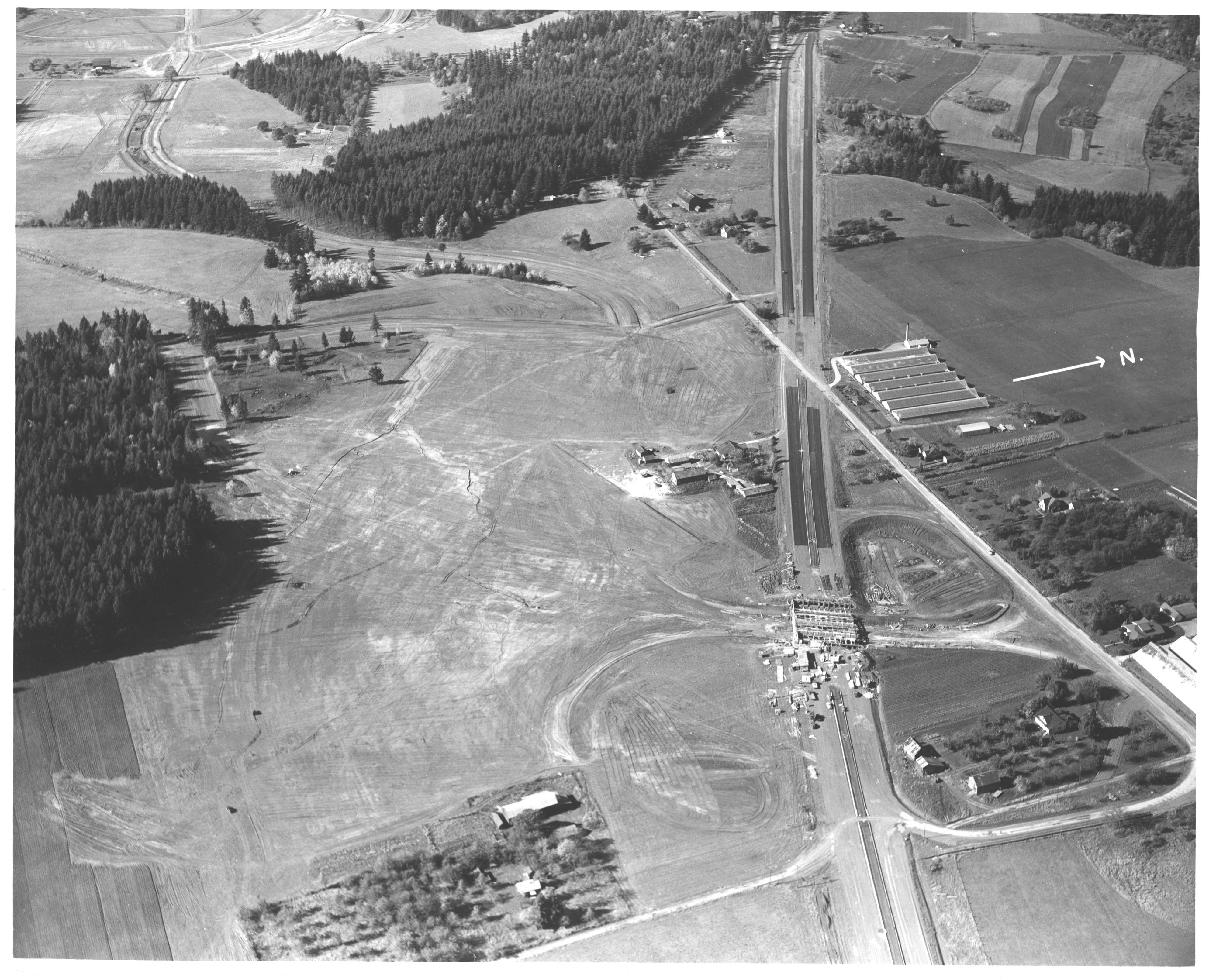
| 02:40, 14 February 2021 | A2004-002-6716-aerial-view-sw-barnes-rd-highway-26-1949.jpg (file) |  |
1.26 MB | Jonathan | Aerial view of the construction of the Barnes Road interchange on the Sunset Highway.<br /> 📆 1949<br /> 🖼 City of Portland Archives via [https://vintageportland.wordpress.com/2011/12/19/sunset-highway-1949/ Vintage Portland]<br /> 🆔 A2004-002.6716<br /> | 1 |
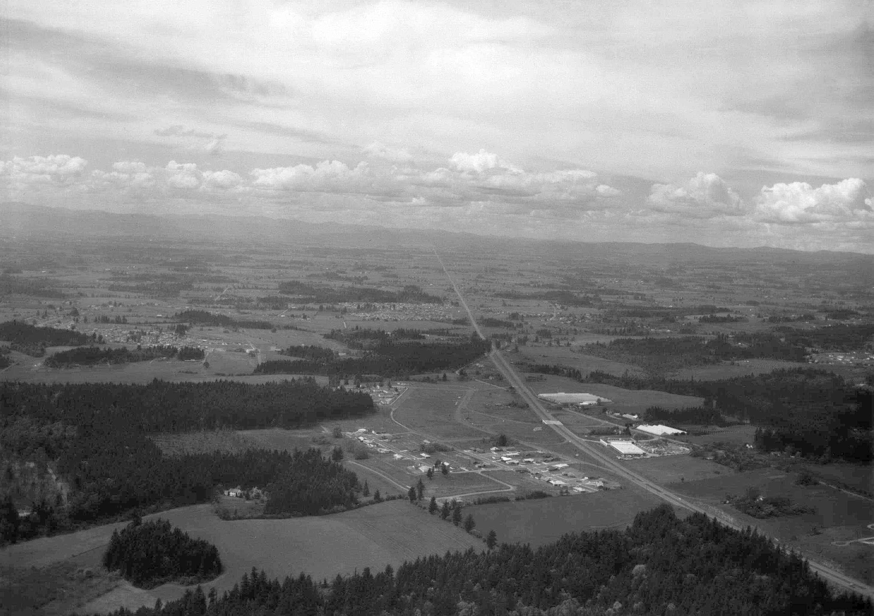
| 02:44, 14 February 2021 | 1950s-sunset-hwy-barnes-road.jpg (file) |  |
471 KB | Jonathan | Looking west near the recently completed Barnes Road interchange along the Sunset Highway.<br /> 📆 1950s<br /> 🖼 City of Beaverton ([https://web.archive.org/web/20160304082933if_/http://apps.beavertonoregon.gov/HistoricPhotos/photos/aerial_02_p.jpg archived])<!--<br /> 🆔 xxx--> | 1 |
| 02:52, 14 February 2021 | Undated - 288 - I-5 at Bonita Road.jpg (file) |  |
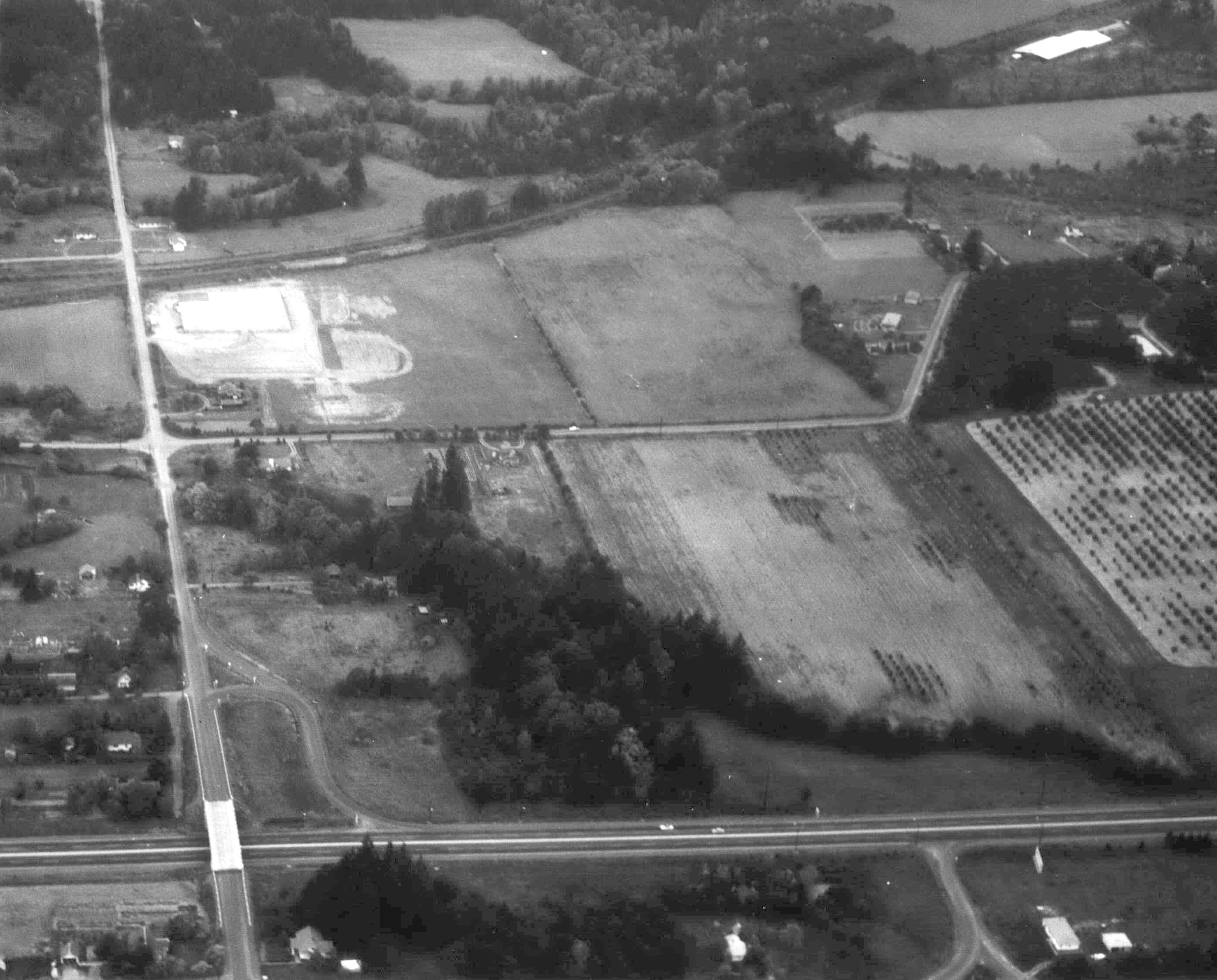
847 KB | Jonathan | Aerial photo of Interstate 5 at Bonita Road.<br /> 🖼 City of Beaverton ([https://web.archive.org/web/20160304065358if_/http://apps.beavertonoregon.gov/HistoricPhotos/photos/aerial_09_p.jpg archived])<br /> 🆔 288 | 1 |
| 14:40, 14 February 2021 | A2005-001-792-sw-jefferson-northeast-1947-2.jpg (file) |  |
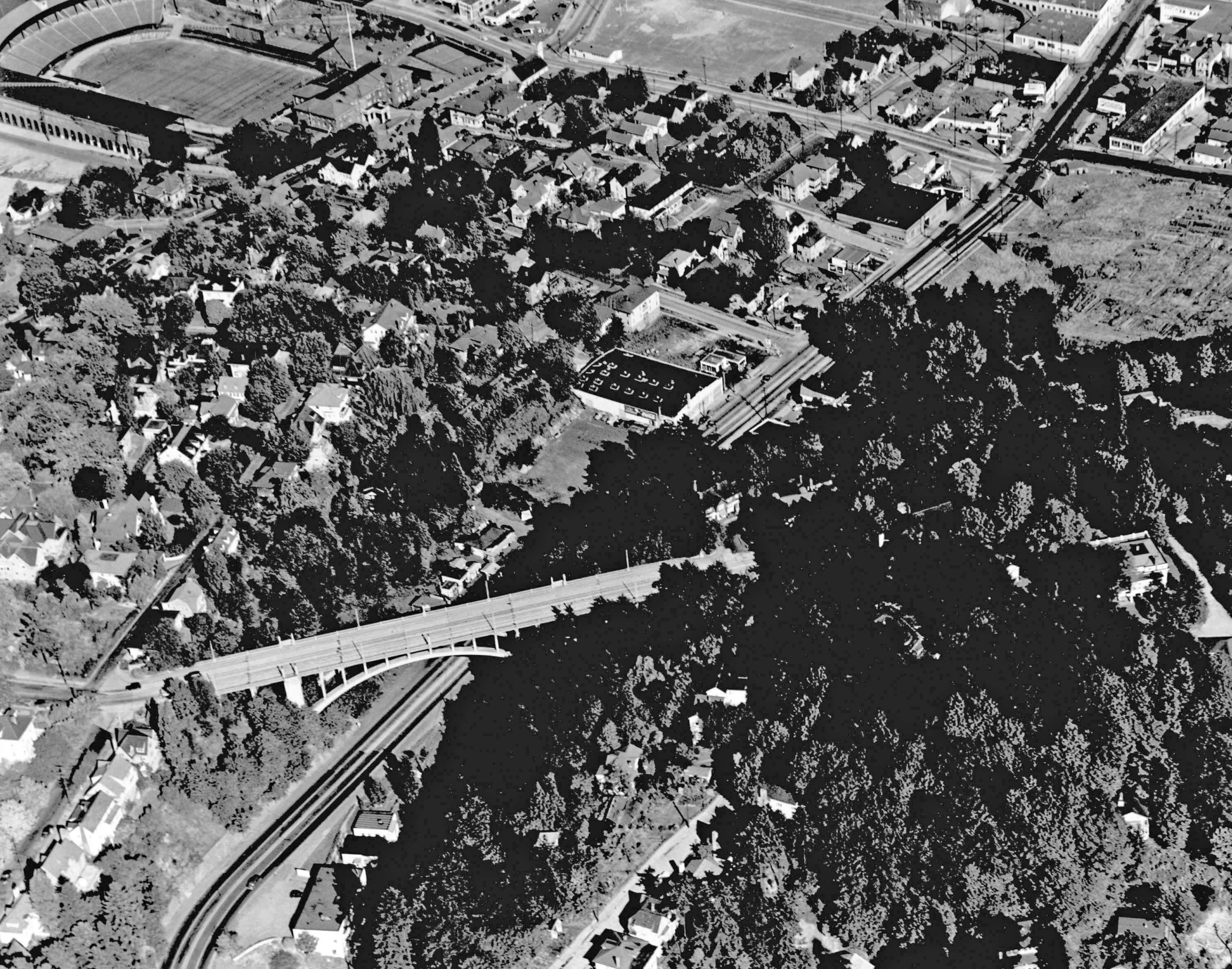
865 KB | Jonathan | Aerial photo of SW Jefferson Street (Sunset Highway) near the Vista Bridge.<br /> 📆 1947<br /> 🖼 City of Portland Archives via [https://vintageportland.wordpress.com/2012/08/24/aerial-view-goose-hollow-1947/ Vintage Portland]<br /> 🆔 A2005-001.792 | 1 |
| 14:47, 14 February 2021 | A2005-001-796-sw-jefferson-west-from-11th-1940.jpg (file) |  |
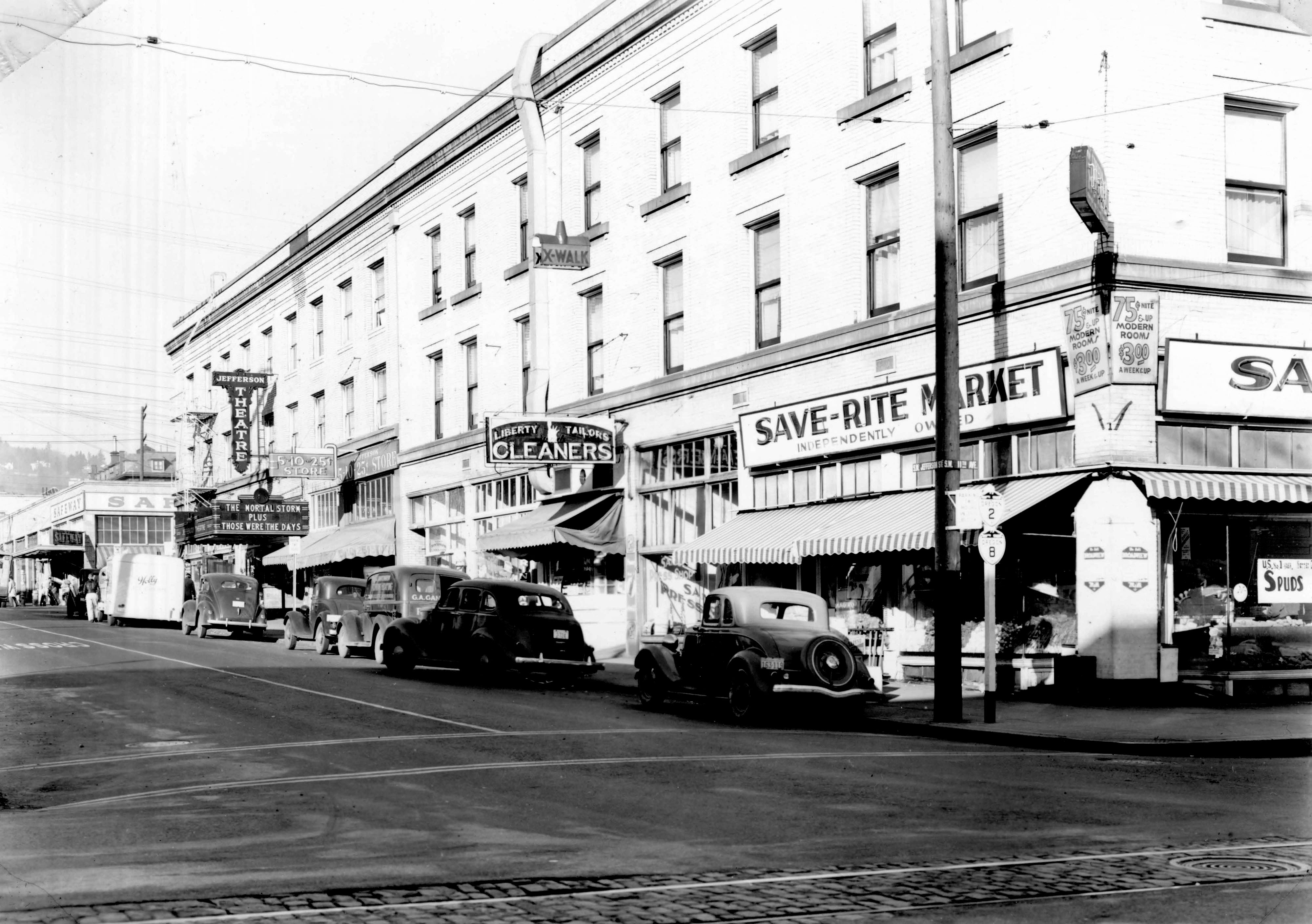
949 KB | Jonathan | The corner of SW Jefferson St. (Oregon Routes 2 and 8) and SW 11th Ave. in Portland.<br /> 📆 1940<br /> 🖼 City of Portland Archives via [https://vintageportland.wordpress.com/2011/04/25/jefferson-west-apartments-1940/ Vintage Portland]<br /> 🆔 A2005-001.796 | 1 |
| 18:08, 14 February 2021 | Harbor-dr-south-of-hawthorne-bridge-looking-north-1949.jpg (file) |  |
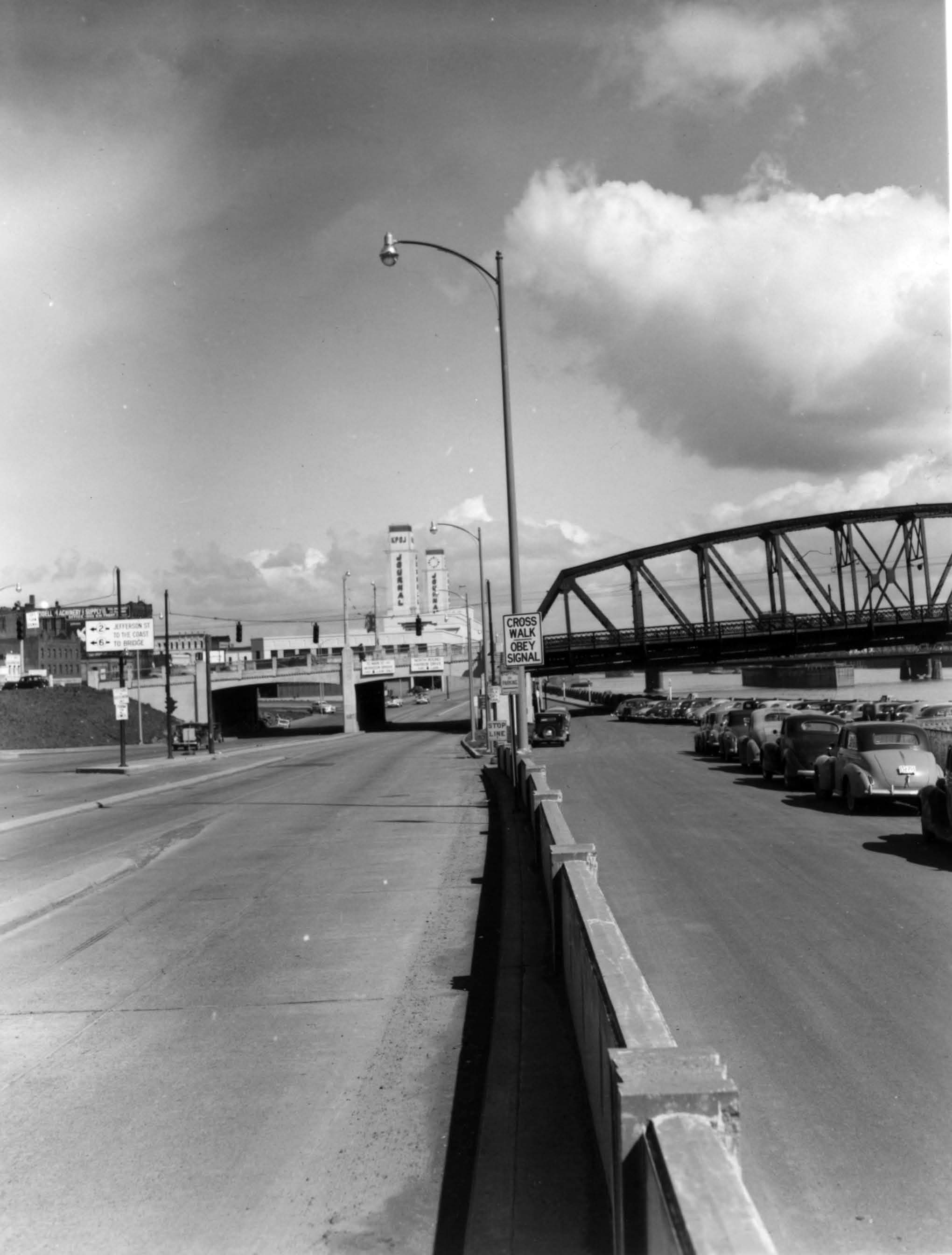
233 KB | Jonathan | Harbor Drive south of the Hawthorne Bridge looking north.<br /> 📆 1949<br /> 🖼 City of Portland Archives via [https://vintageportland.wordpress.com/2011/04/14/harbor-drive-sw-jefferson-1949/ Vintage Portland] | 1 |
| 18:22, 14 February 2021 | Undated - OSHD 3, 4, 10 - Wolf Creek Hwy. Coast Range Summit MP 13.33-13.62.jpg (file) |  |
2.55 MB | Jonathan | Log clearing operations on the Wolf Creek Highway near the Coast Range Summit between Necanicum Junction and Elsie, looking easterly towards Portland. Location is near present-day US-26 mileposts 13.33-13.62 (engineering stations 221+27.5, 222+25 and 227+25 respectively).<br /><!-- 📆 Unknown<br />--> 🖼 Oregon State Highway Department | 1 |
| 18:30, 14 February 2021 | Undated - OSHD G-507 - Wolf Creek construction showing Quartz Creek Bridge.jpg (file) |  |
486 KB | Jonathan | Construction of the Quartz Creek Bridge along the Wolf Creek Highway.<br /> 📆 c. 1938<br /> 🖼 Oregon State Highway Department via [http://records.sos.state.or.us/ORSOSWebDrawer/RecordHtml/6398260 Oregon State Archives]<br /> 🆔 G-507 | 1 |
| 18:34, 14 February 2021 | Undated - OSHD G-508 - Wolf Creek construction showing Quartz Creek Bridge from east end.jpg (file) |  |
1.26 MB | Jonathan | Quartz Creek Bridge construction on Wolf Creek Highway as seen from east end.<br /> 📆 c. 1938<br /> 🖼 Oregon State Highway Department via [http://records.sos.state.or.us/ORSOSWebDrawer/RecordHtml/6398261 Oregon State Archives]<br /> 🆔 G-508 | 1 |
| 18:38, 14 February 2021 | Undated - OSHD G-509 - Wolf Creek construction showing Quartz Bridge from below.jpg (file) |  |
607 KB | Jonathan | Construction of the Quartz Creek Bridge on the Wolf Creek Highway as seen from below.<br /> 📆 c. 1938<br /> 🖼 Oregon State Highway Department via [http://records.sos.state.or.us/ORSOSWebDrawer/RecordHtml/6398262 Oregon State Archives]<br /> 🆔 G-509 | 1 |
| 19:38, 14 February 2021 | Undated - OSHD G-510 - Wolf Creek construction showing Quartz Creek Bridge from below.jpg (file) |  |
665 KB | Jonathan | Construction of the Quartz Creek Bridge on the Wolf Creek Highway as seen from below.<br /> 📆 c. 1938<br /> 🖼 Oregon State Highway Department via [http://records.sos.state.or.us/ORSOSWebDrawer/RecordHtml/6398263 Oregon State Archives]<br /> 🆔 G-510 | 1 |