File list
Jump to navigation
Jump to search
This special page shows all uploaded files.
| Date | Name | Thumbnail | Size | User | Description | Versions |
|---|---|---|---|---|---|---|
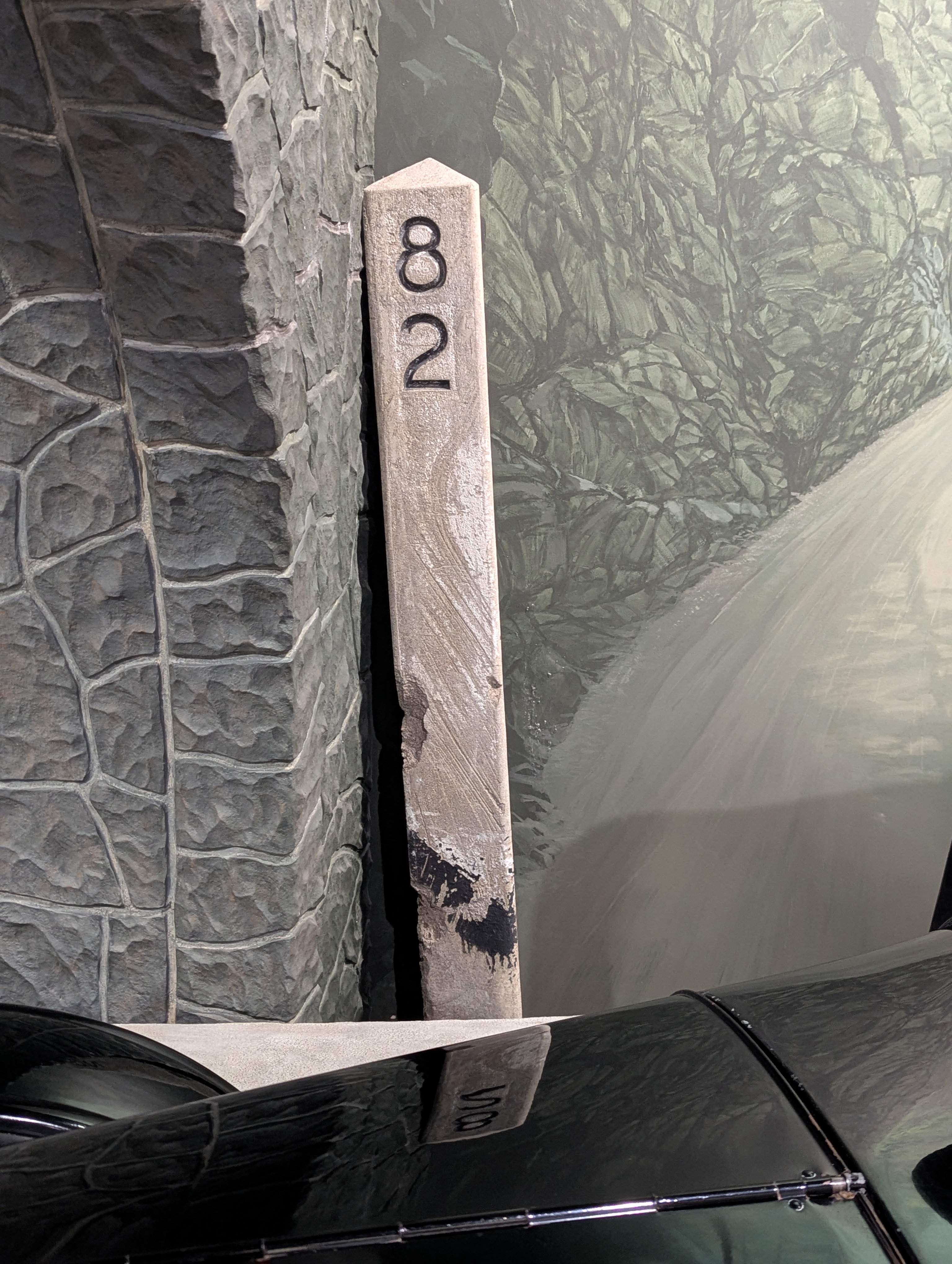
| 17:15, 30 March 2026 | 2026-03-29 orig-stone-milepost-82 213943755.jpg (file) |  |
2.55 MB | Jonathan | Original concrete milepost 82 at the Columbia River Discovery Museum in The Dalles.<br /> 📷 Jonathan Ledbetter<br /> 📆 29 March 2026 | 1 |
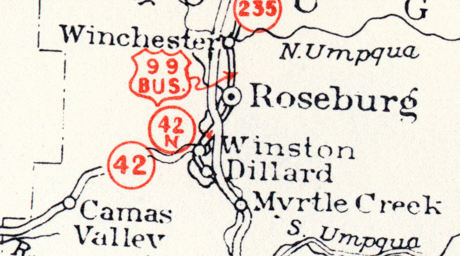
| 18:48, 14 February 2026 | 1955-04 RouteNumbersPrincipalHighways Roseburg.png (file) |  |
314 KB | Jonathan | A portion of an April 1955 Oregon state highway map, showing Roseburg and nearby communities. | 1 |
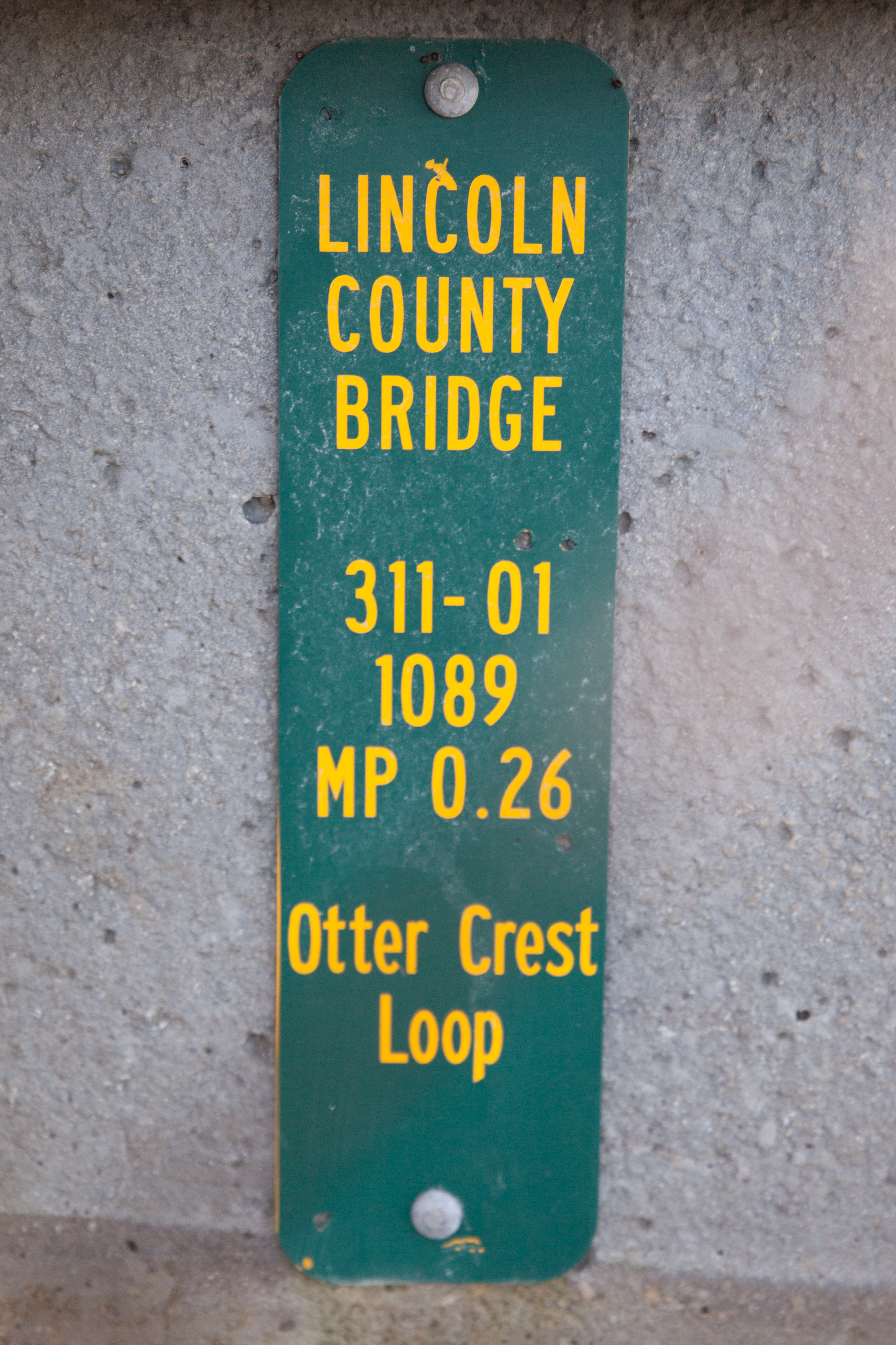
| 14:38, 9 January 2026 | 2025-12-31 lincolnco-inventory-marker 2996.jpg (file) |  |
10.13 MB | Jonathan | A bridge inventory marker for the Rocky Creek Bridge, also known as the Ben Jones Bridge, over Rocky Creek at MP 0.26 on Otter Crest Loop (Old US-101, now Lincoln County #311) south of Depoe Bay.<br /> 📷 Jonathan Ledbetter<br /> 📆 31 December 2025 | 1 |
| 14:18, 9 January 2026 | Mp-county-lincoln-bridge-examples.png (file) |  |
94 KB | Jonathan | An example of a bridge marker found along Lincoln County roads.<br /> 📷 Jonathan Ledbetter<br /> 📆 9 January 2026 | 1 |
| 00:22, 9 January 2026 | 2024-07-20 hoodriverco-end-milepost-aluminum-back 193353123.jpg (file) |  |
3.98 MB | Jonathan | The reverse side of MP 0.46 on Baseline Drive near Parkdale.<br /> 📷 Jonathan Ledbetter<br /> 📆 20 July 2024 | 1 |
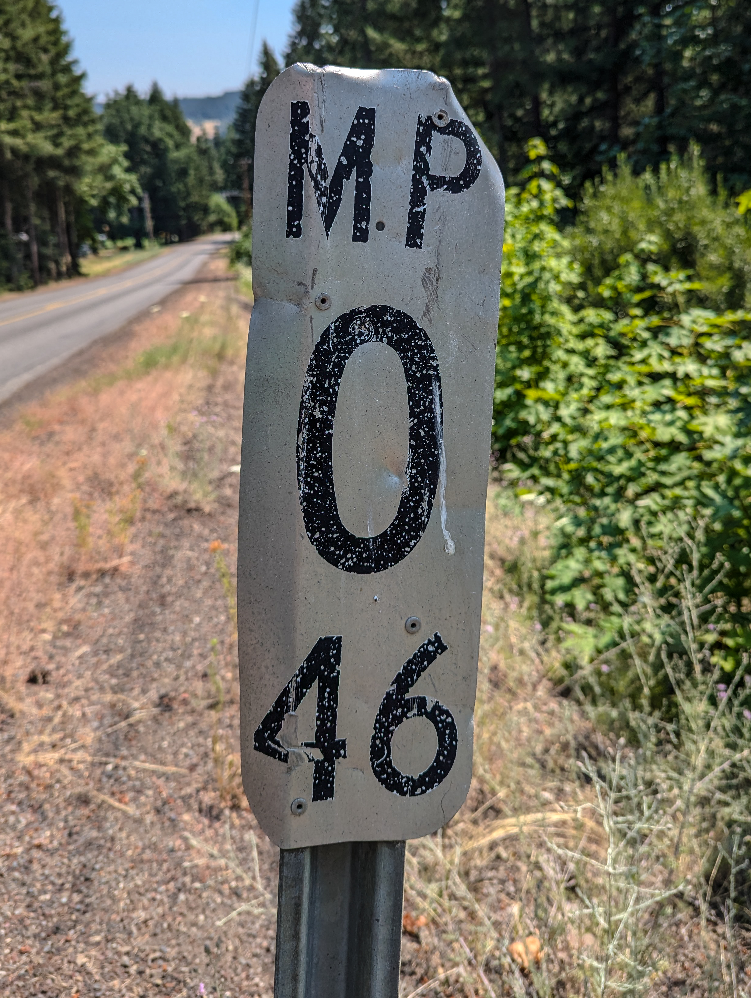
| 00:22, 9 January 2026 | 2024-07-20 hoodriverco-end-milepost-aluminum 193336717.jpg (file) |  |
4.57 MB | Jonathan | A Hood River County milepost at MP 0.46 on Baseline Drive near Parkdale.<br /> 📷 Jonathan Ledbetter<br /> 📆 20 July 2024 | 1 |
| 00:01, 9 January 2026 | Mp-county-hoodriver-examples.png (file) |  |
358 KB | Jonathan | Added aluminum version of hundredths mile marker | 2 |
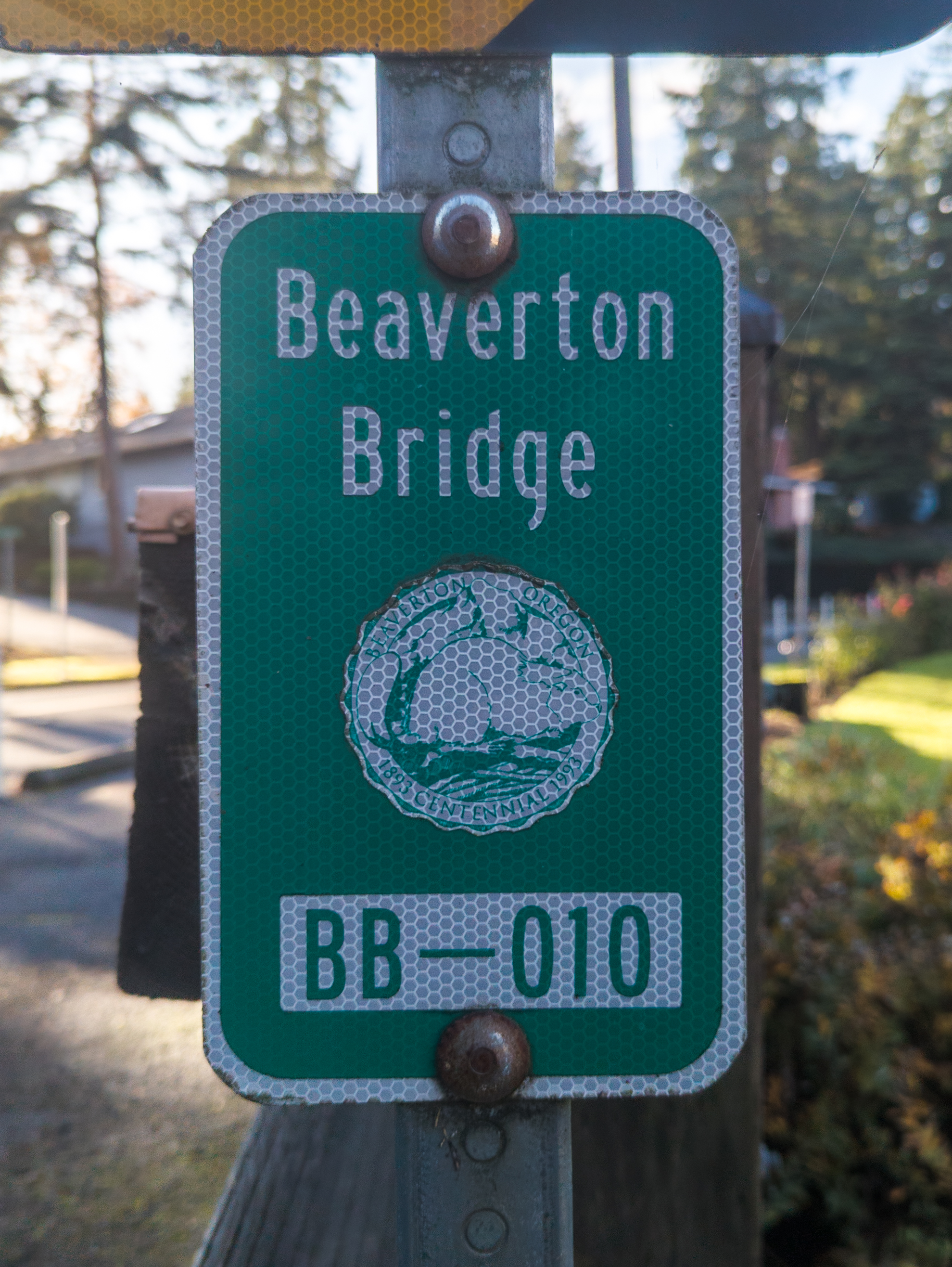
| 17:31, 18 November 2025 | 2025-11-18 beaverton-bridge-marker-seal 6.jpg (file) |  |
3.2 MB | Jonathan | A Beaverton bridge inventory marker with the city seal on the bridge over Johnson Creek on SW Village Ln. 📷 Jonathan Ledbetter<br /> 📆 18 November 2025 | 1 |
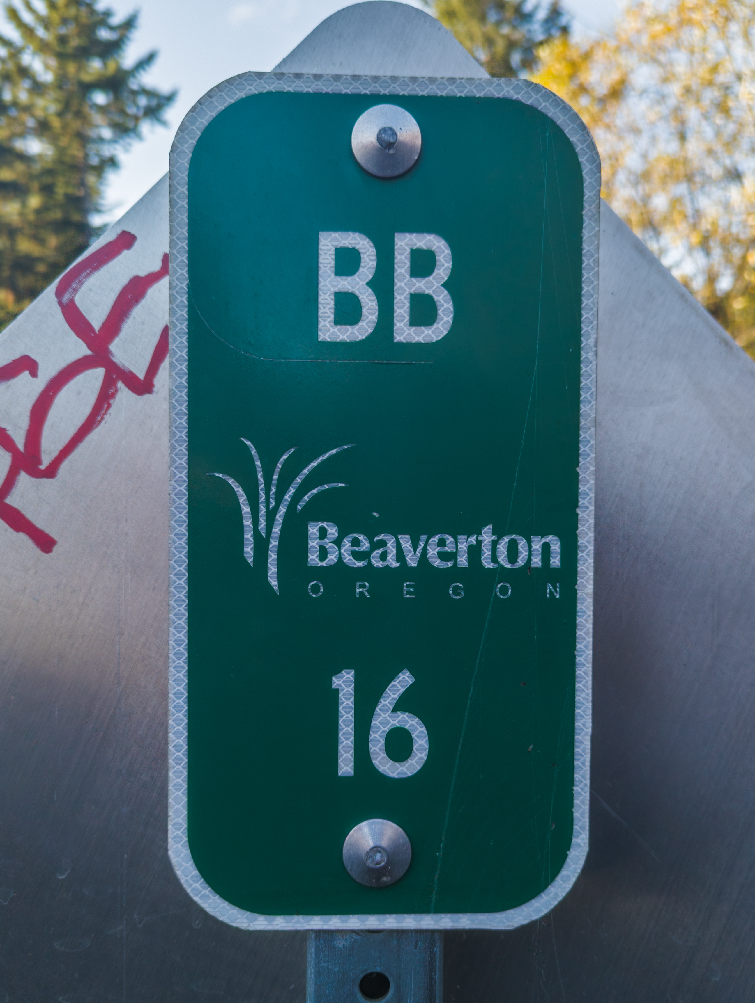
| 17:29, 18 November 2025 | 2025-11-18 beaverton-bridge-marker-bb-16 02.jpg (file) |  |
4 MB | Jonathan | A Beaverton bridge inventory marker with the city logo and "BB" on SW Davis Rd. over Johnson Creek.<br /> 📷 Jonathan Ledbetter<br /> 📆 18 November 2025 | 1 |
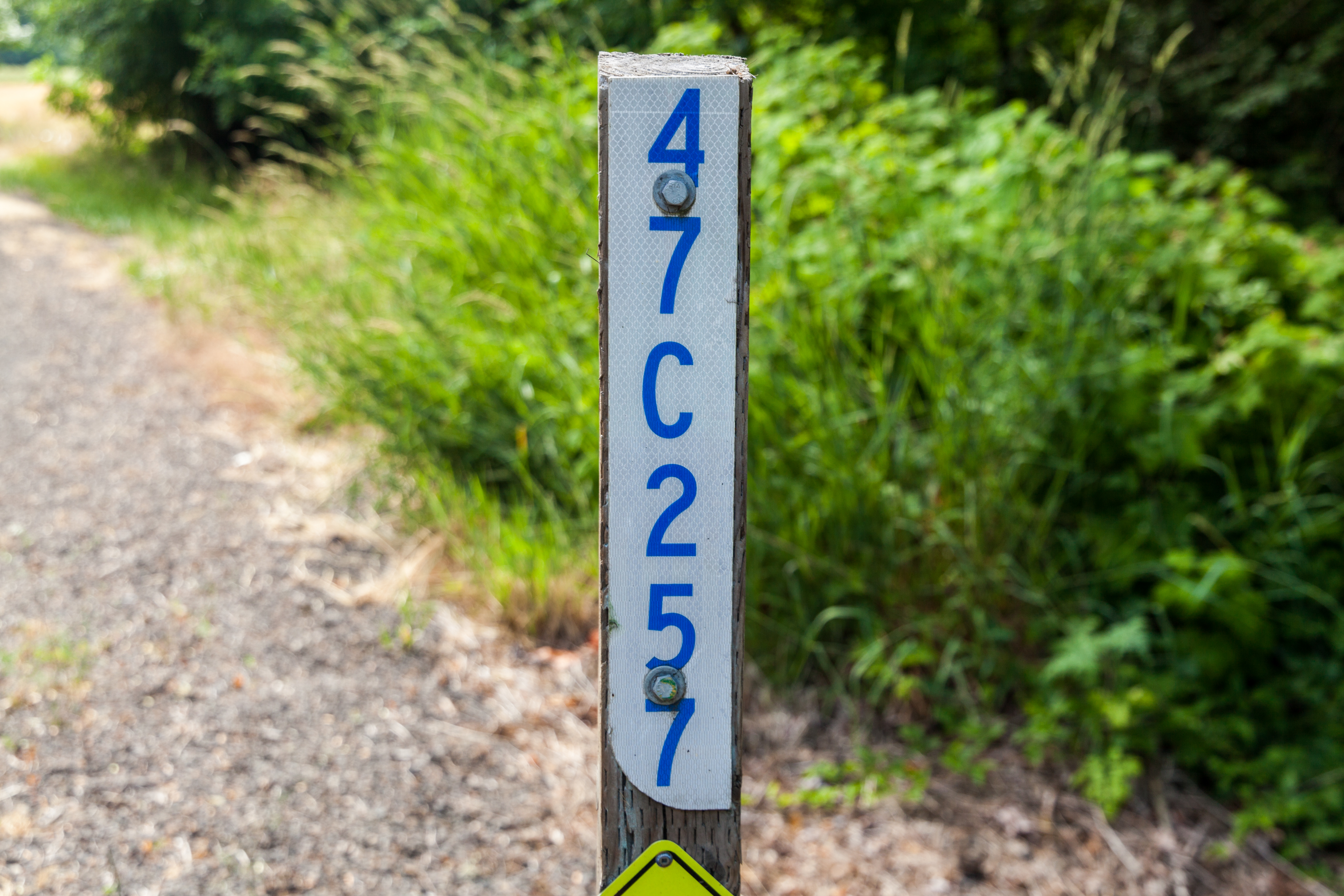
| 17:23, 18 November 2025 | 2025-11-17 beaverton-bridge-marker-bb-19051 4.jpg (file) |  |
3.88 MB | Jonathan | A Beaverton bridge inventory marker with the city logo and "BB" on SW Hart Rd. over Johnson Creek.<br /> 📷 Jonathan Ledbetter<br /> 📆 17 November 2025 | 1 |
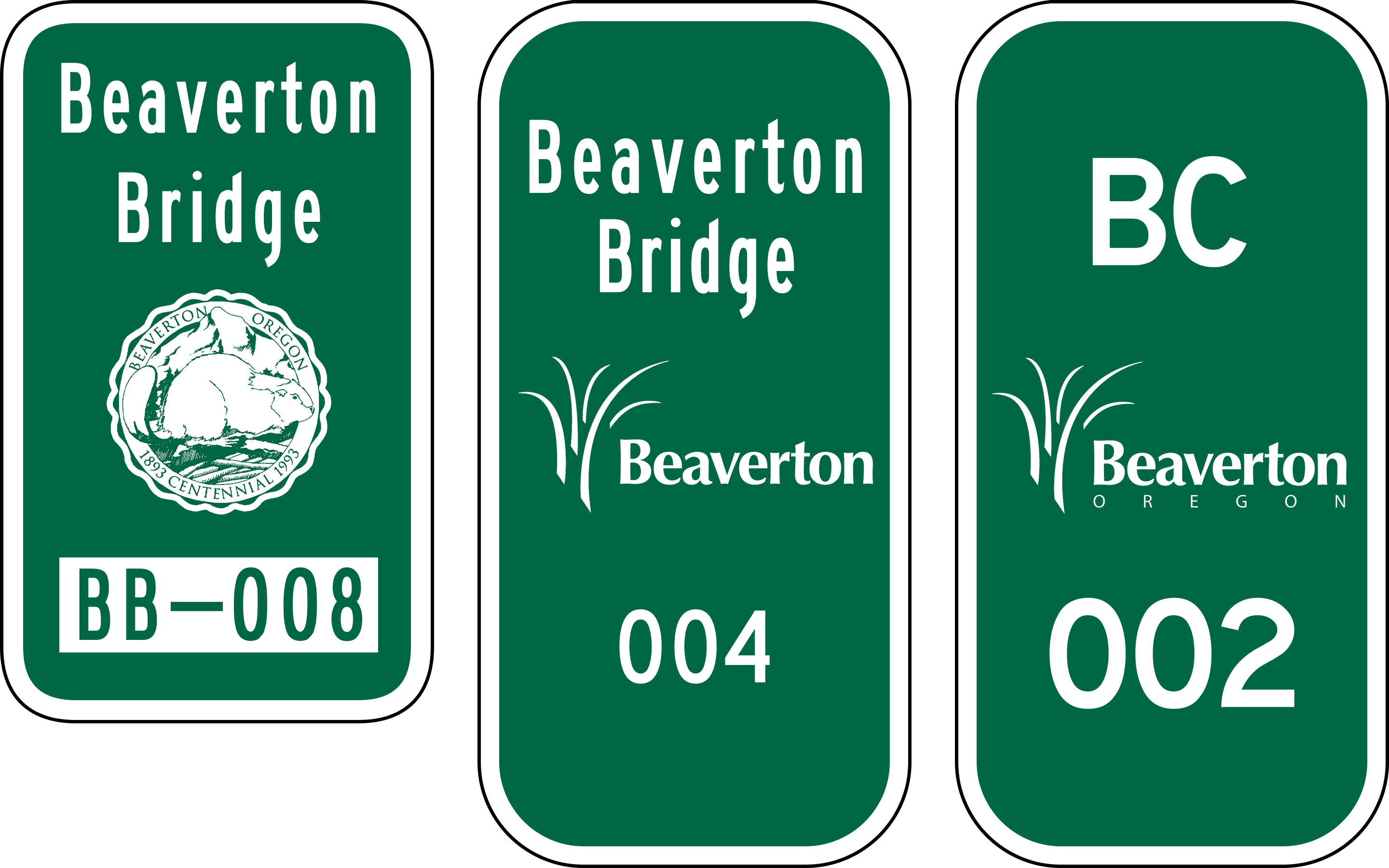
| 00:25, 18 November 2025 | Mp-city-beaverton-bridge-culvert-examples.png (file) |  |
495 KB | Jonathan | Examples of bridge and culvert markers found along Beaverton city roads and footpaths.<br /> 📷 Jonathan Ledbetter<br /> 📆 17 November 2025 | 3 |
| 21:20, 7 August 2025 | Ohs milton-miller.jpg (file) |  |
263 KB | Jonathan | A photo of Milton A. Miller, a controversial politician who played a pivotal role in his attempts to route a highway to Champoeg Park.<br /> 📆 Unknown<br /> 🖼 Oregon Historical Society via J.A. Hussey's ''Champoeg: Place of Transition'' (1967) p. 283 | 1 |
| 23:31, 18 July 2025 | 2025-07-13 hoodnf-nf43-mp-5 1534.jpg (file) |  |
14.11 MB | Jonathan | MP 5 along National Forest 43 north of US-26.<br /> 📷 Jonathan Ledbetter<br /> 📆 13 July 2025 | 1 |
| 20:32, 18 July 2025 | 2025-07-13 warmsprings-milepost 1495.jpg (file) |  |
9.67 MB | Jonathan | A photo of a standard D10-2 milepost on BIA-3 between Wapinitia and Simnasho inside the Warm Springs Reservation.<br /> 📷 Jonathan Ledbetter<br /> 📆 13 July 2025 | 1 |
| 01:28, 17 July 2025 | 2025-07-12 wooden-milepost-43 184449846.jpg (file) |  |
6.76 MB | Jonathan | Wooden milepost 43 along a 1952 realignment of the Historic Columbia River Highway, as found on US-30/Historic US-30/Wa Na Pa Street in Cascade Locks.<br /> 📷 Jonathan Ledbetter<br /> 📆 12 July 2025 | 1 |
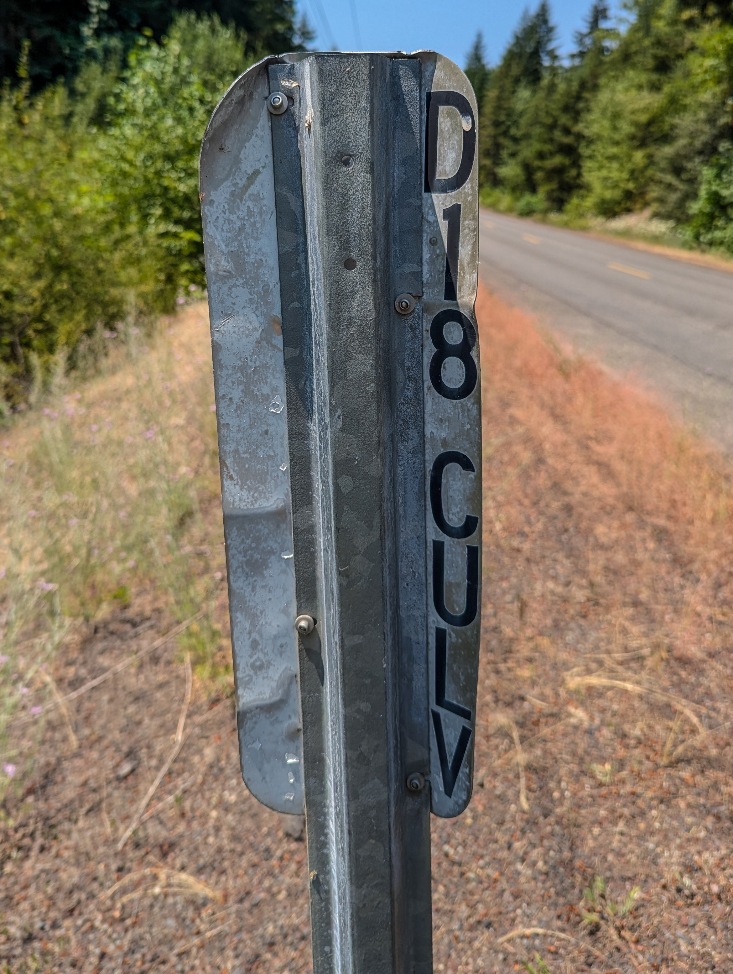
| 21:24, 9 July 2025 | 2025-06-22 marionco-inventory-marker 1025.jpg (file) |  |
10.17 MB | Jonathan | A Marion County culvert inventory marker at on Champoeg Road NE over Ryan Creek.<br /> 📷 Jonathan Ledbetter<br /> 📆 22 June 2025 | 1 |
| 21:13, 9 July 2025 | Mp-county-marion-culvert.png (file) |  |
33 KB | Jonathan | An example of a culvert marker found along Marion County roads.<br /> 📷 Jonathan Ledbetter<br /> 📆 9 July 2025 | 1 |
| 23:24, 2 July 2025 | Mp-bia-warmsprings-examples.png (file) |  |
121 KB | Jonathan | Examples of mileposts along Warm Springs Reservation roads which conform to the 1971 Edition of the MUTCD.<br /> 📷 Jonathan Ledbetter<br /> 📆 2 July 2025 | 1 |
| 16:52, 28 June 2025 | 1936-02 oshd row 5B-2-14 4.jpg (file) |  |
860 KB | Jonathan | Close-up of the Champoeg Memorial Highway located line ROW map showing the eastern terminus at the Beaverton-Aurora Highway (labeled "Tigard-Aurora Highway") near Aurora.<br /> 📆 February 1936<br /> 🖼 Oregon State Highway Department<br /> 🆔 5B-2-14 | 1 |
| 16:50, 28 June 2025 | 1936-02 oshd row 5B-2-14 3.jpg (file) |  |
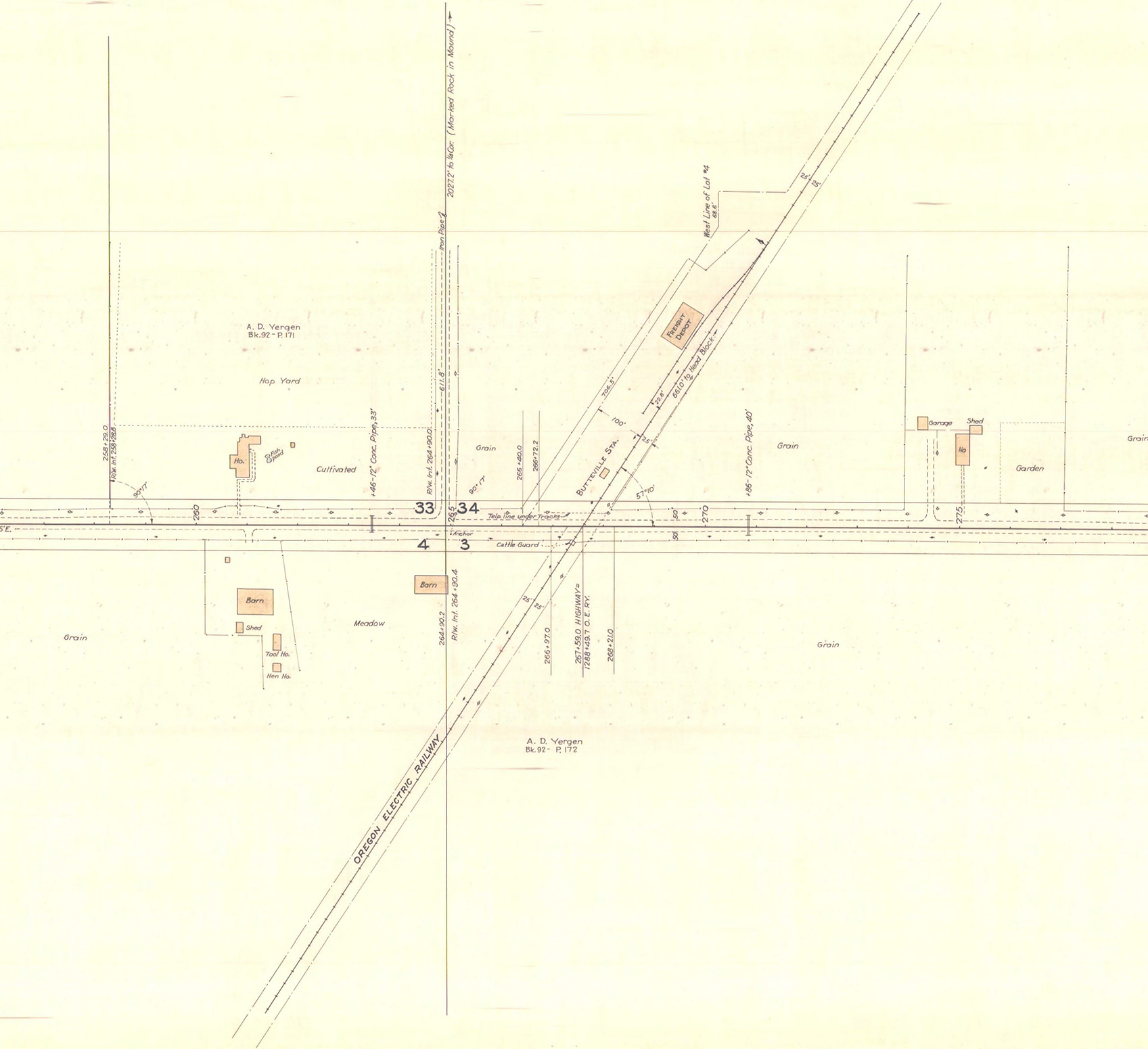
800 KB | Jonathan | Close-up of the Champoeg Memorial Highway located line ROW map showing the routing near Butteville Station.<br /> 📆 February 1936<br /> 🖼 Oregon State Highway Department<br /> 🆔 5B-2-14 | 1 |
| 16:47, 28 June 2025 | 1936-02 oshd row 5B-2-14 2.jpg (file) |  |
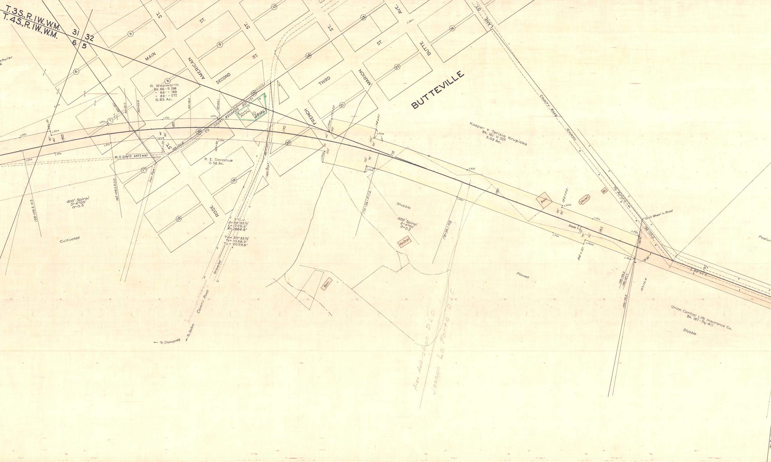
1.83 MB | Jonathan | Close-up of the Champoeg Memorial Highway located line ROW map showing the routing through Butteville.<br /> 📆 February 1936<br /> 🖼 Oregon State Highway Division<br /> 🆔 5B-2-14 | 1 |
| 16:46, 28 June 2025 | 1936-02 oshd row 5B-2-14 1.jpg (file) |  |
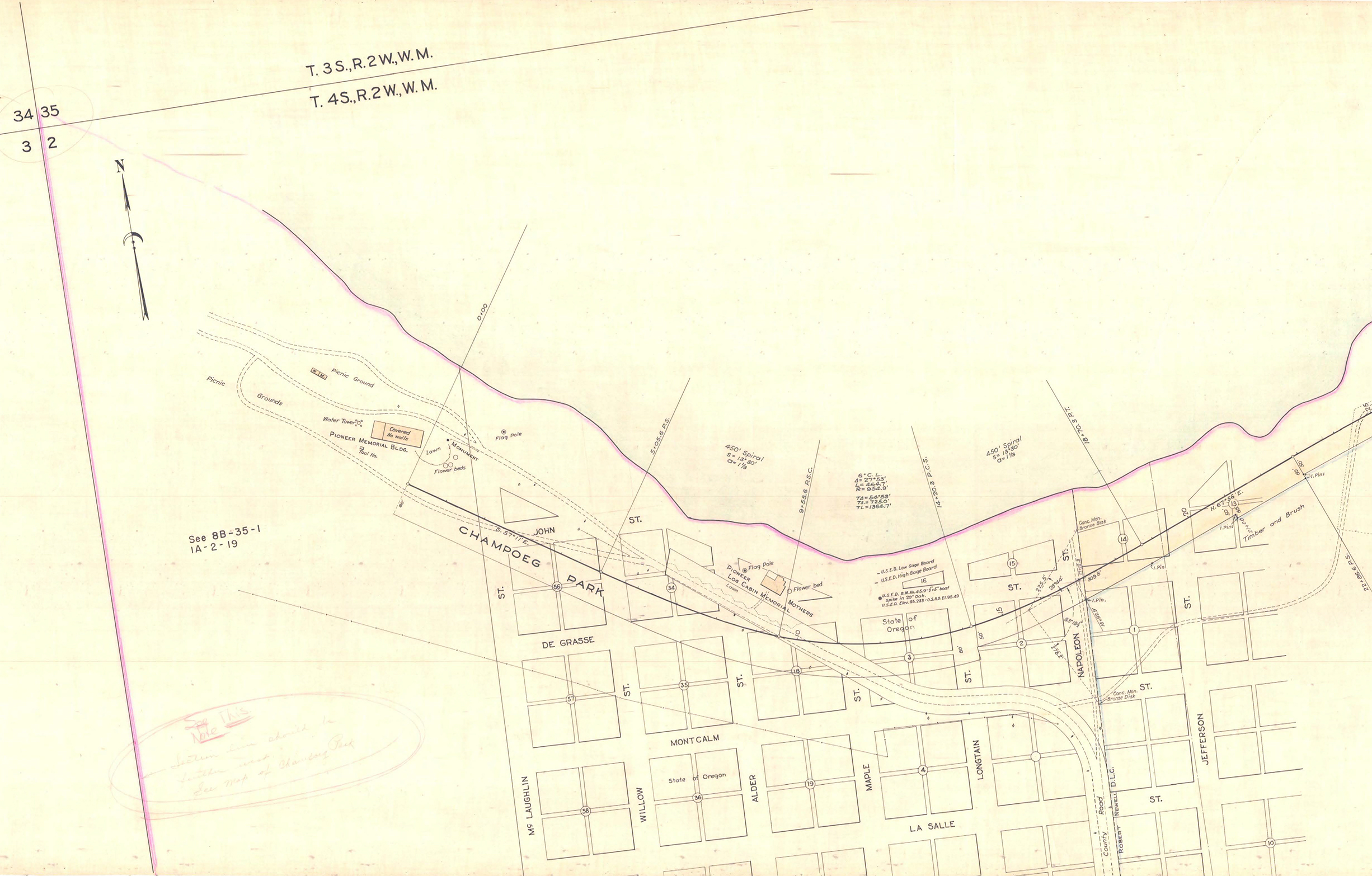
1.55 MB | Jonathan | Close-up of the Champoeg Memorial Highway located line ROW map showing the western terminus and routing through the Champoeg State Heritage Area.<br /> 📆 February 1936<br /> 🖼 Oregon State Highway Division<br /> 🆔 5B-2-14 | 1 |
| 23:28, 18 June 2025 | 1955-06c - OSHD 3419 - Central Oregon Highway MP 169.jpg (file) |  |
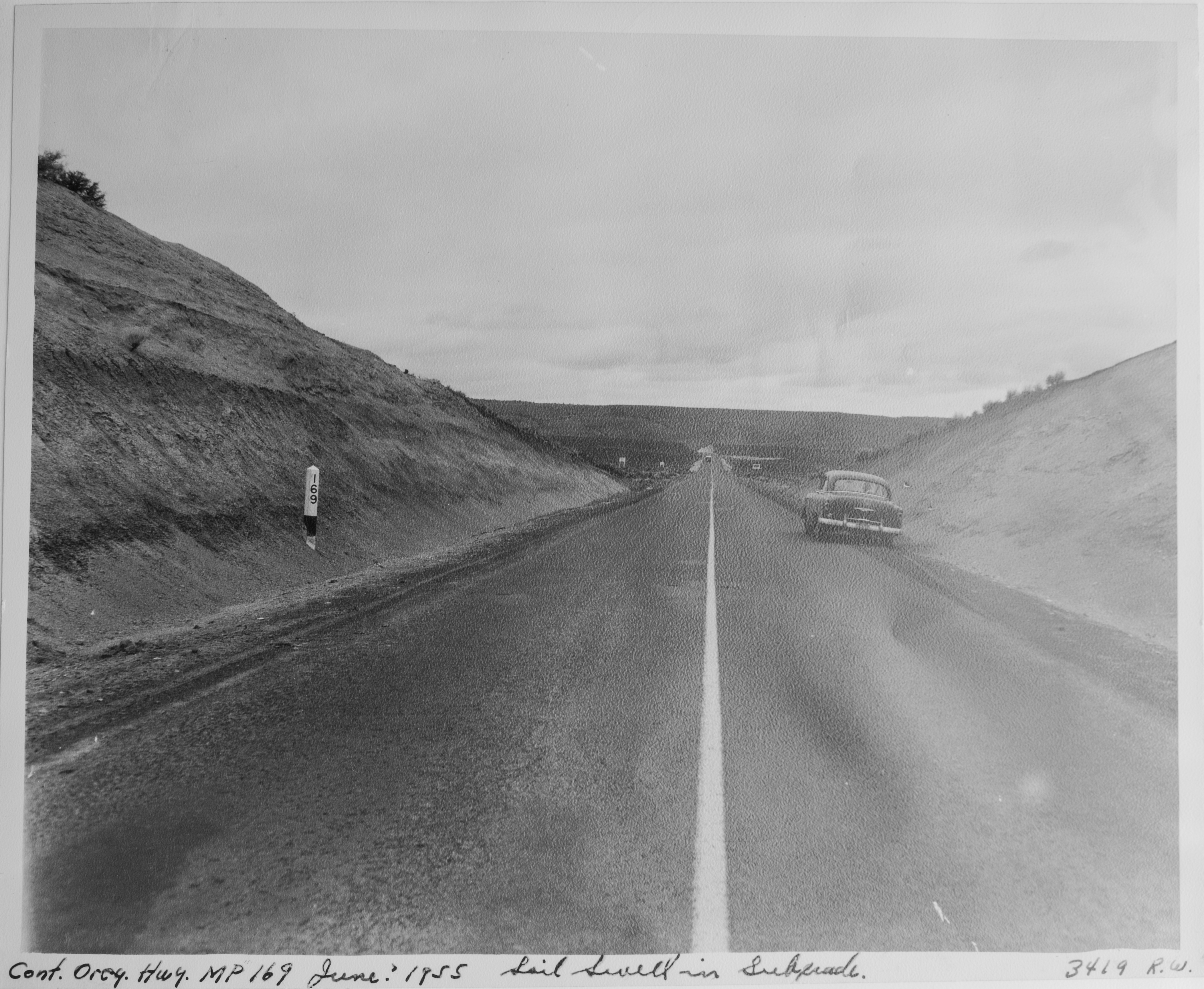
6.06 MB | Jonathan | A desolate section of the Central Oregon Highway near Stinkingwater Creek. A wooden milepost reading "169" can be seen on the left.<br /> 📆 Unknown<br /> 🖼 Oregon State Highway Division via [https://www.oregon.gov/odot/about/pages/library.aspx ODOT Library]<br /> 🆔 3419 | 1 |
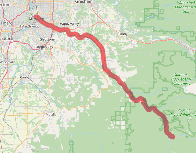
| 00:24, 15 May 2025 | OR 224-map.png (file) |  |
295 KB | Jonathan | Map of modern OR-224 alignment | 1 |
| 00:22, 15 May 2025 | OR 225 1932.png (file) |  |
87 KB | Jonathan | 1932 version of the route shield for OR-225 | 1 |
| 00:20, 15 May 2025 | OR 224 1932.png (file) |  |
88 KB | Jonathan | 1932 version of the route shield for OR-224 | 1 |
| 00:19, 15 May 2025 | NF 46.png (file) |  |
75 KB | Jonathan | Modern version of route shield for NF-46 | 1 |
| 00:17, 15 May 2025 | OR 224.png (file) |  |
31 KB | Jonathan | Modern version of route shield for OR-224 | 1 |
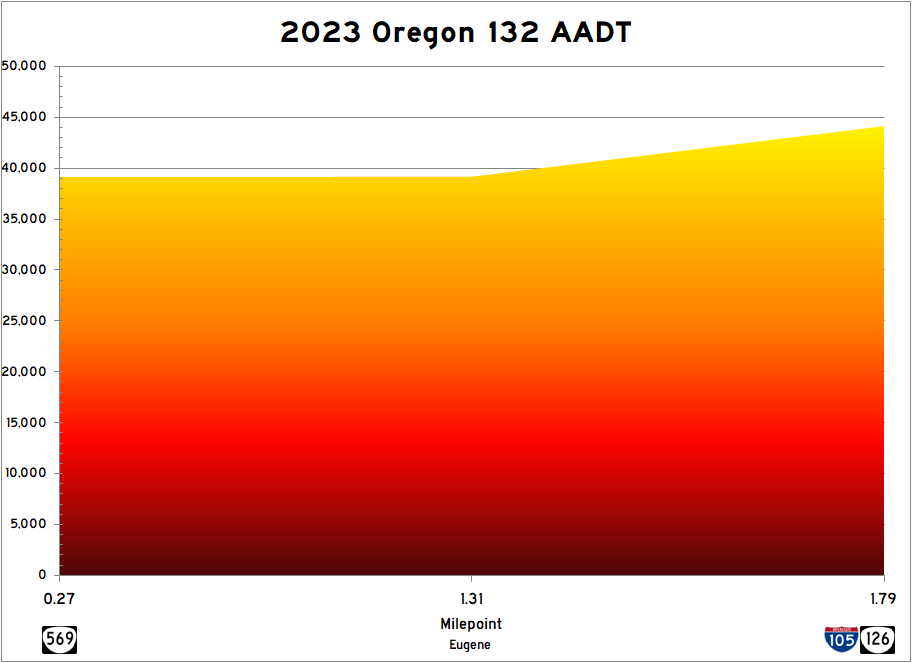
| 02:08, 8 May 2025 | 2023 or-132 aadt.png (file) |  |
20 KB | Jonathan | Graphical representation of ODOT annual average daily traffic (AADT) data for OR-132 from their 2023 Transportation Volume Tables. | 1 |
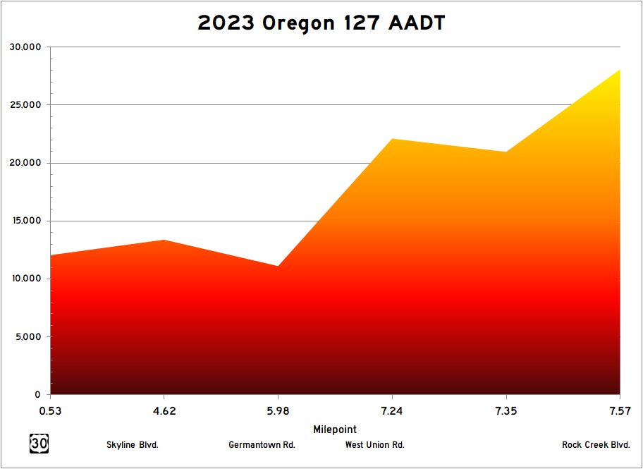
| 19:26, 7 May 2025 | 2023 or-127 aadt.png (file) |  |
20 KB | Jonathan | Graphical representation of ODOT annual average daily traffic (AADT) data for OR-127 from their 2023 Transportation Volume Tables. | 1 |
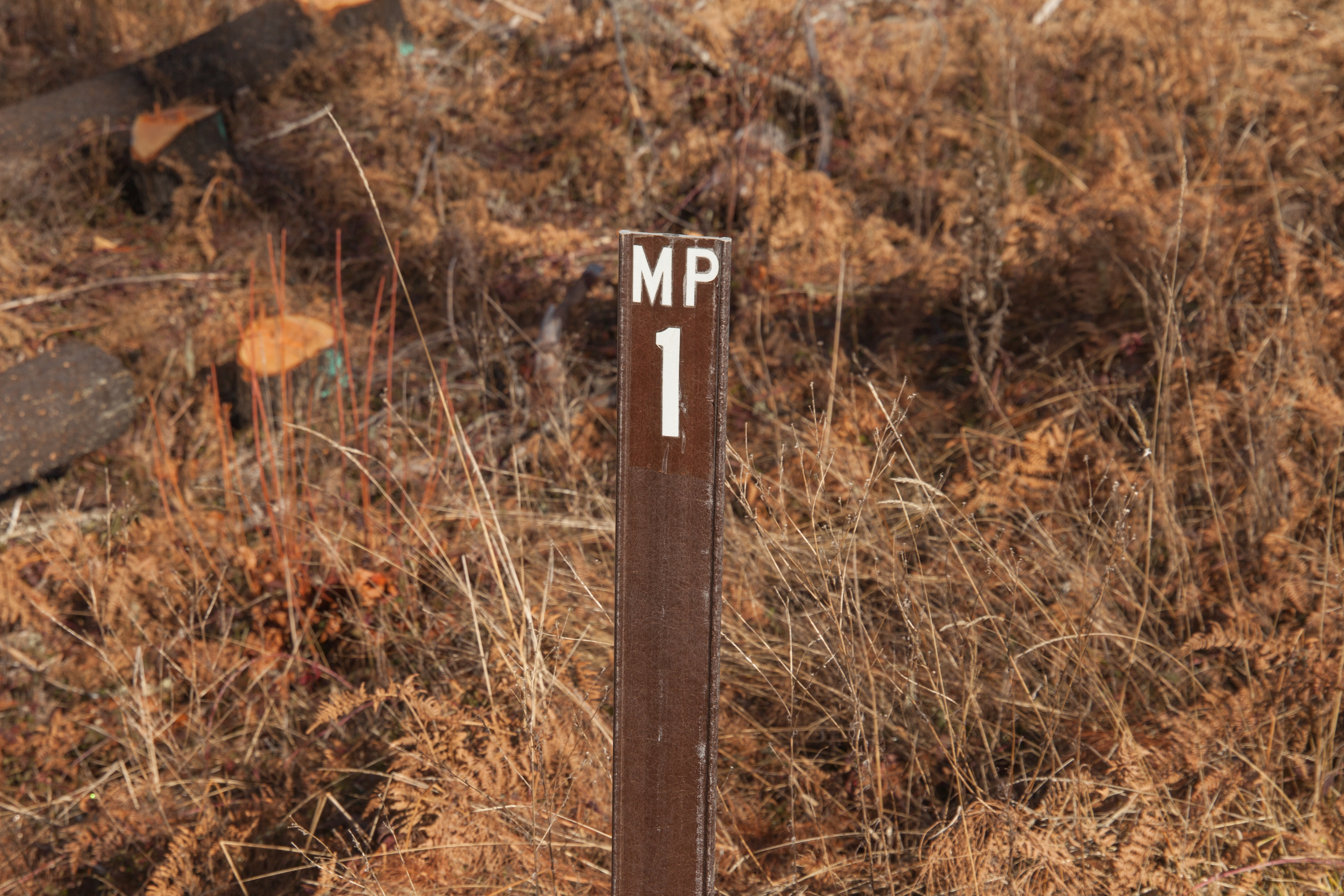
| 23:31, 9 April 2025 | 2019-05-08 quartz-cr-rd-mp-2 0555.jpg (file) |  |
10.32 MB | Jonathan | MP 2 along Quartz Creek Road near Flat Iron Mountain. The font used on the sign is Helvetica Inserat.<br /> 📷 Jonathan Ledbetter<br /> 📆 8 May 2019 | 1 |
| 23:20, 9 April 2025 | Mp-sf-clatsop-examples.png (file) |  |
20 KB | Jonathan | Examples of mileposts found along roads in the Clatsop State Forest.<br /> 📷 Jonathan Ledbetter<br /> 📆 9 April 2025 | 1 |
| 18:51, 9 April 2025 | 2024-07-09 cochran-rd-mp-4.5 6601.jpg (file) |  |
6.43 MB | Jonathan | MP 4.5 along Cochran Road west of Reehers Camp. The font used on the sign is similar to Frutiger or Calibri.<br /> 📷 Jonathan Ledbetter<br /> 📆 9 July 2024 | 1 |
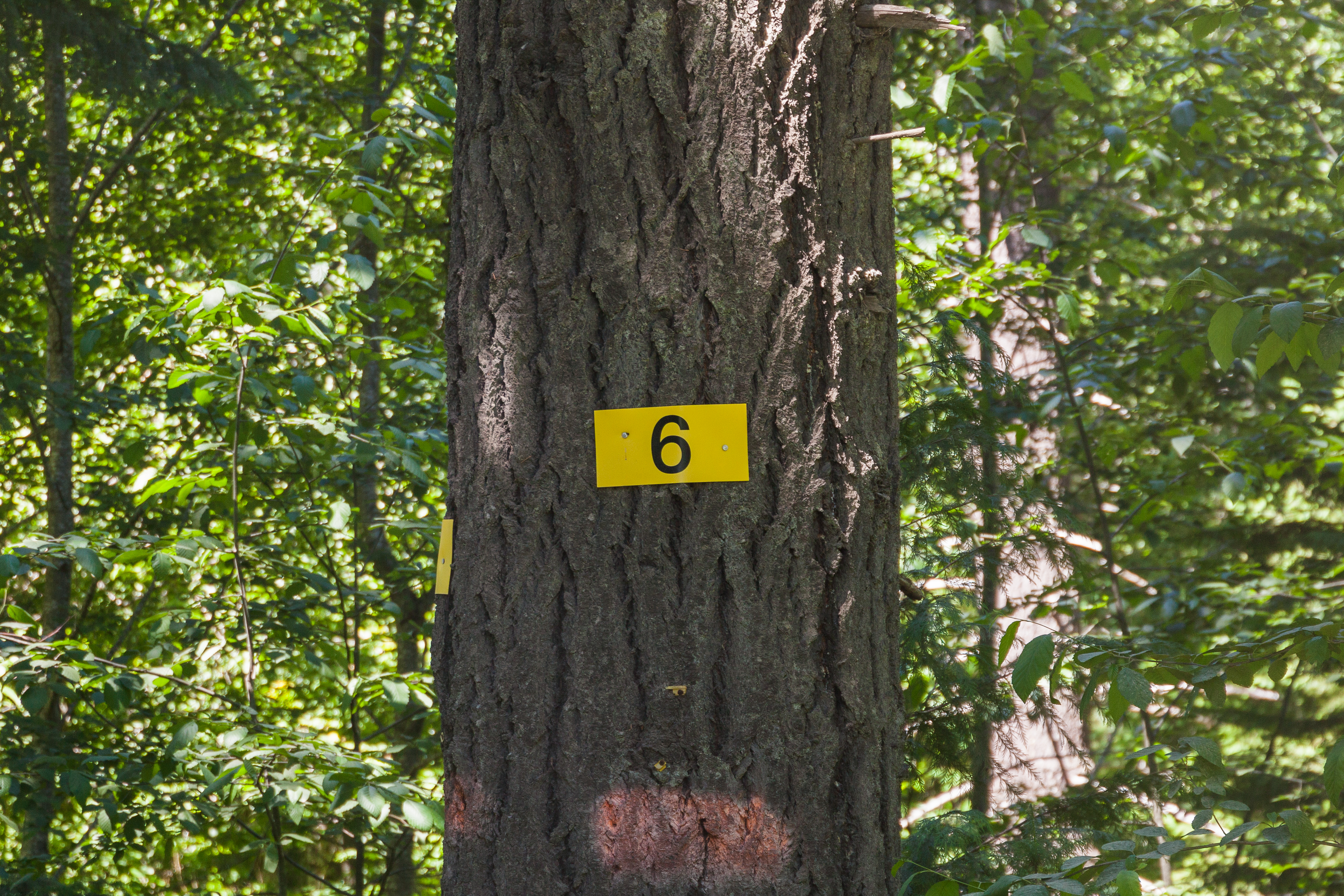
| 18:50, 9 April 2025 | 2024-07-09 cochran-rd-mp-6 6485.jpg (file) |  |
12.33 MB | Jonathan | MP 6 along Cochran Road near Cochran. The font used on the sign is Helvetica.<br /> 📷 Jonathan Ledbetter<br /> 📆 9 July 2024 | 1 |
| 18:25, 9 April 2025 | Mp-sf-tillamook-examples.png (file) |  |
56 KB | Jonathan | Examples of mileposts found along roads in both Clatsop and Tillamook State Forests.<br /> 📷 Jonathan Ledbetter<br /> 📆 9 April 2025 | 1 |
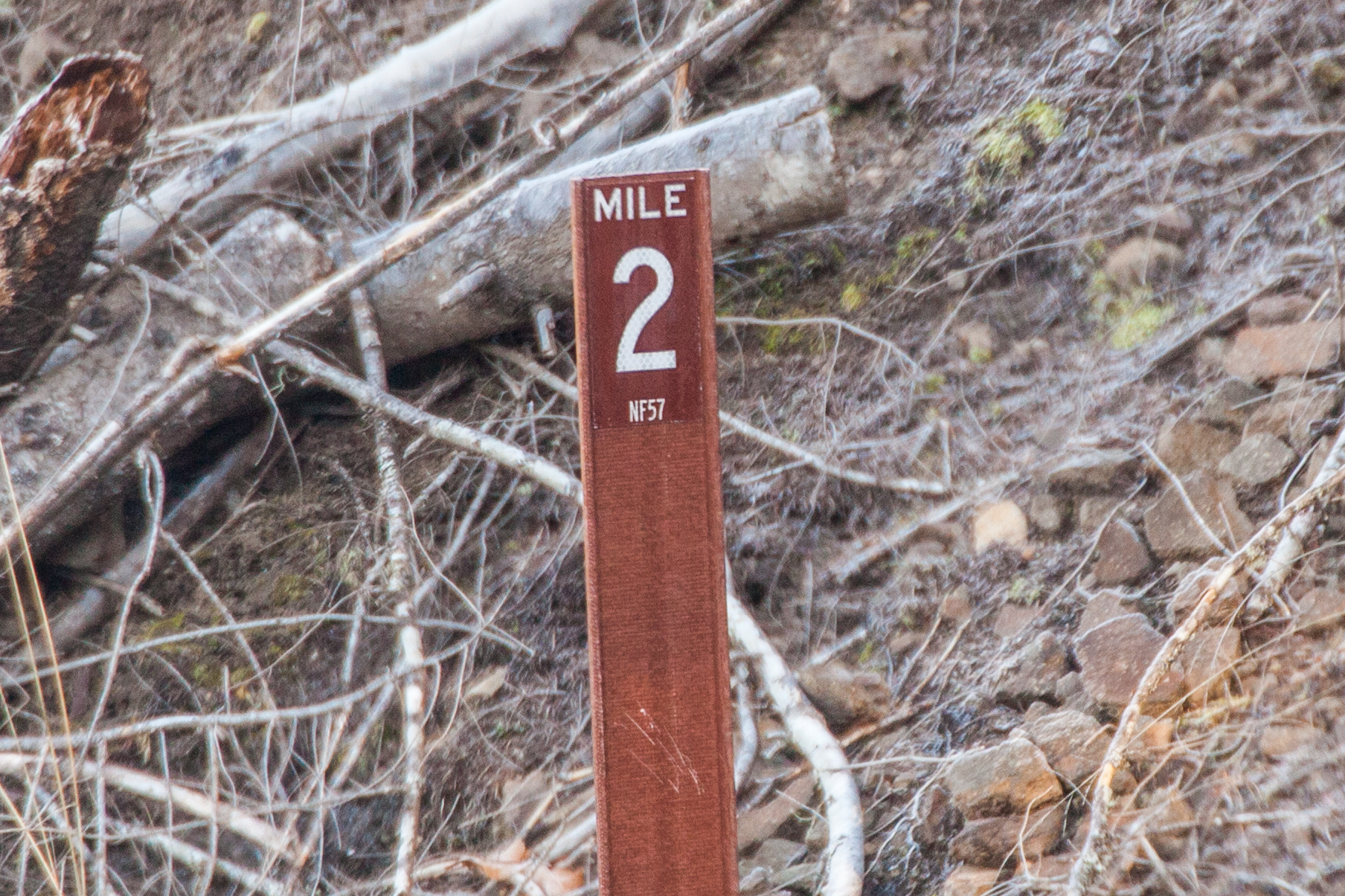
| 02:17, 9 April 2025 | 2025-01-22 hoodnf-milepost-nf57-new 9327.jpg (file) |  |
1.89 MB | Jonathan | New style MP 2 along National Forest 57 between Ripplebrook and Lake Harriet. It is theorized that these mileposts were added during repair/reconstruction efforts after the 2020 Riverside Fire.<br /> 📷 Jonathan Ledbetter<br /> 📆 22 January 2025 | 1 |
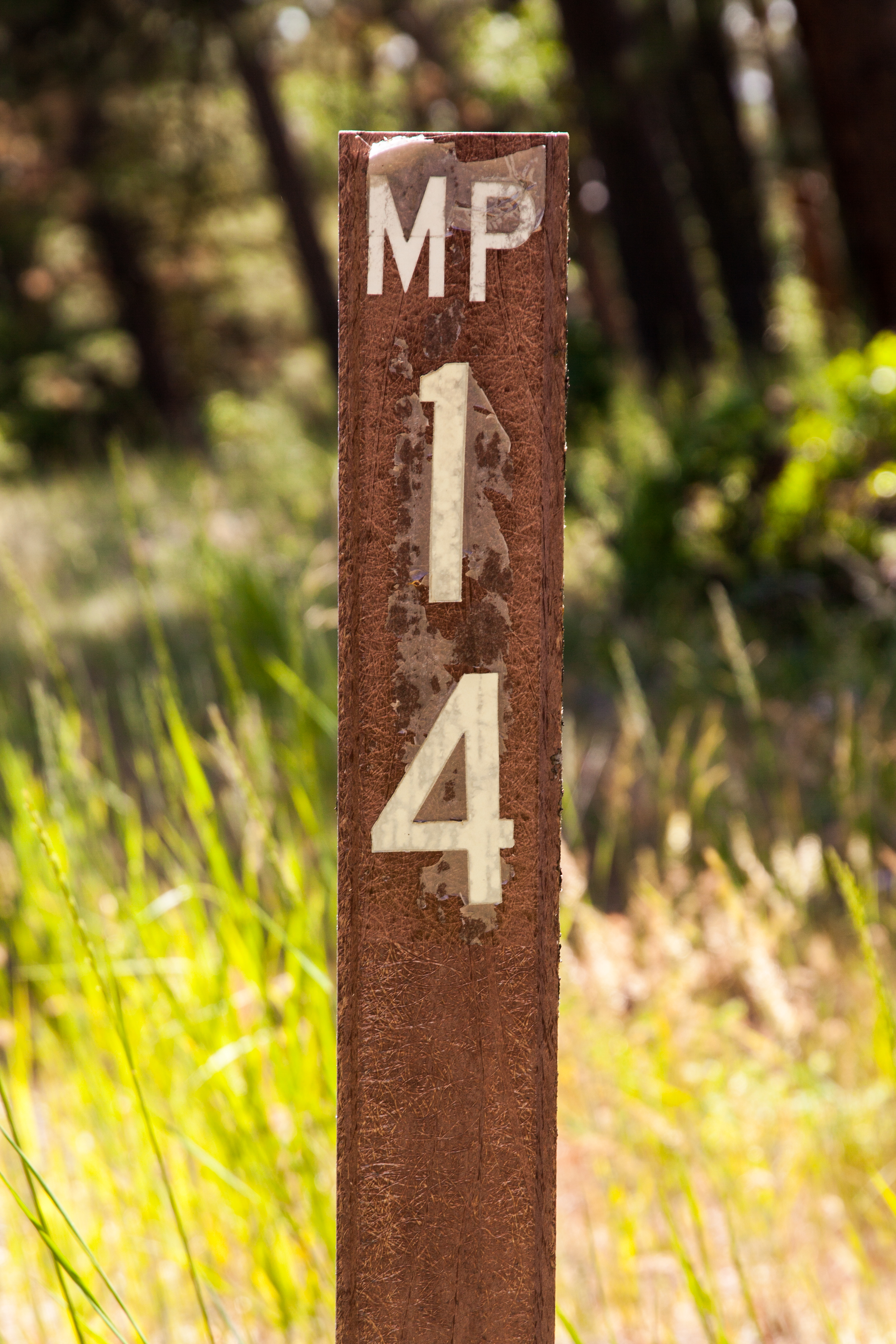
| 02:13, 9 April 2025 | 2025-01-22 hoodnf-milepost-nf46 9174.jpg (file) |  |
6.6 MB | Jonathan | MP 1 along National Forest 46 south of Ripplebrook.<br /> 📷 Jonathan Ledbetter<br /> 📆 22 January 2025 | 1 |
| 02:10, 9 April 2025 | 2022-07-03 hoodnf-milepost 8052.jpg (file) |  |
7.77 MB | Jonathan | MP 14 along National Forest 44 west of Dufur, near the eastern boundary of the Mount Hood National Forest. Very few mileposts remain along National Forest 44, whose zero milepost is at its junction with Oregon 35 near the Little John Sno Park.<br /> 📷 Jonathan Ledbetter<br /> 📆 3 July 2022 | 1 |
| 00:54, 9 April 2025 | Mp-nf-mthood-examples.png (file) |  |
1.7 MB | Jonathan | Examples of mileposts found along Mount Hood National Forest roads.<br /> 📷 Jonathan Ledbetter<br /> 📆 9 April 2025 | 1 |
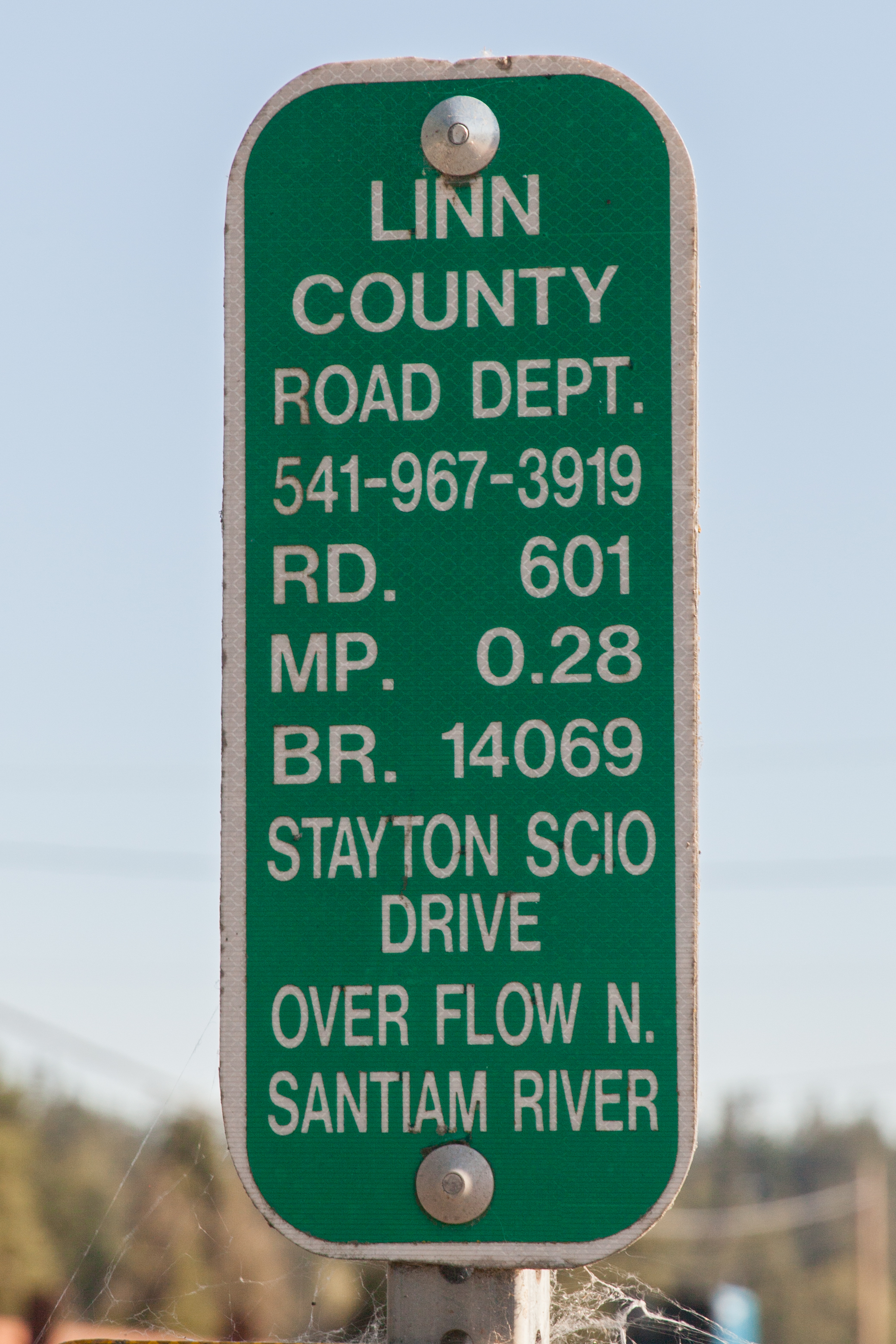
| 02:47, 13 July 2024 | 2024-07-12 linnco-inventory-marker 7835.jpg (file) |  |
4.08 MB | Jonathan | A Linn County bridge inventory marker at MP 0.28 on Stayton-Scio Drive at the bridge over an overflow canal of the North Santiam River.<br /> 📷 Jonathan Ledbetter<br /> 📆 12 July 2024 | 1 |
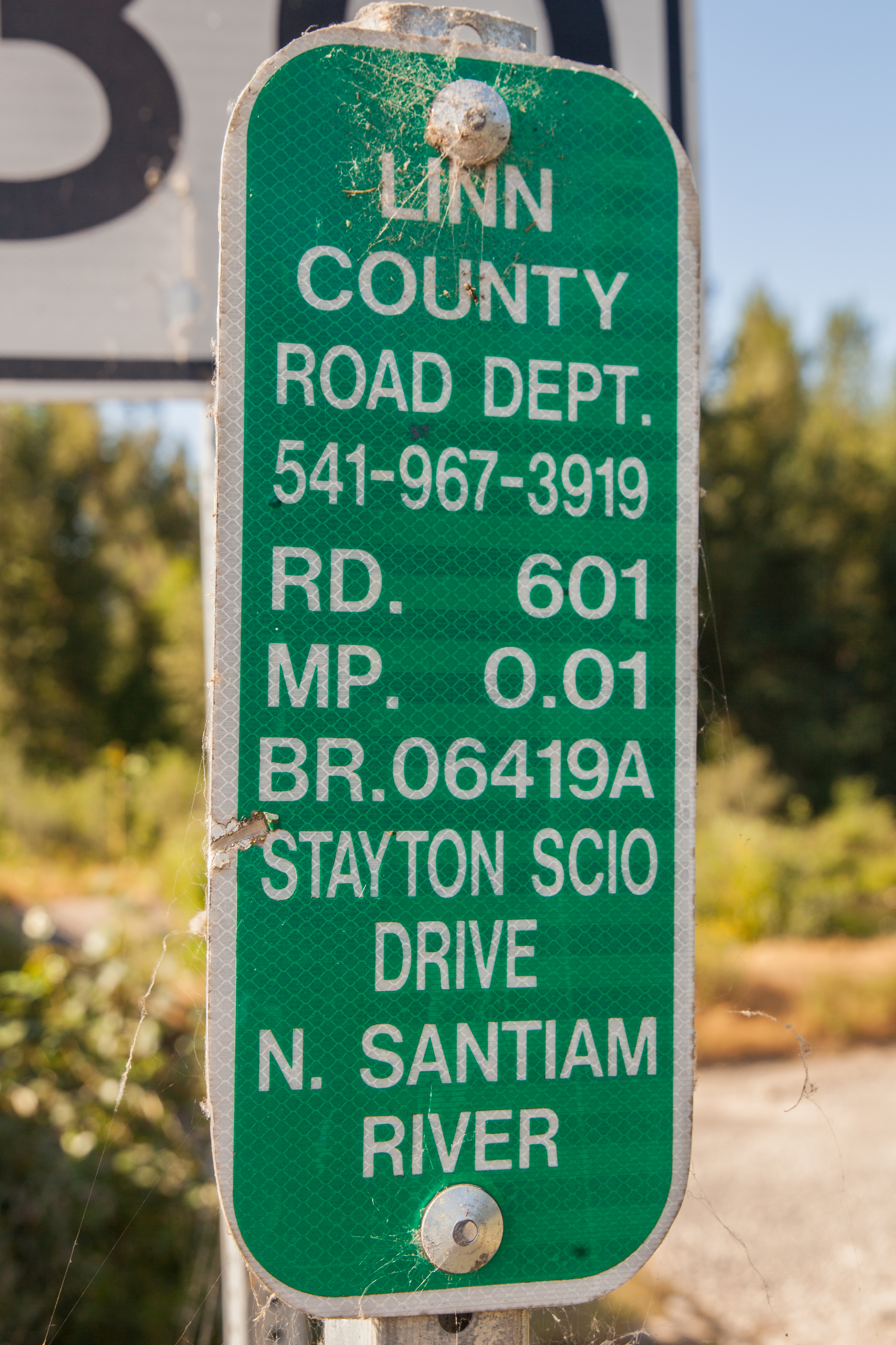
| 02:46, 13 July 2024 | 2024-07-12 linnco-inventory-marker 7859.jpg (file) |  |
9.01 MB | Jonathan | A Linn County bridge inventory marker at MP 0.01 on Stayton-Scio Drive at the bridge over the North Santiam River. Due to this bridge crossing the Linn-Marion county line, a second marker in the other direction is placed in Marion County.<br /> 📷 Jonathan Ledbetter<br /> 📆 12 July 2024 | 1 |
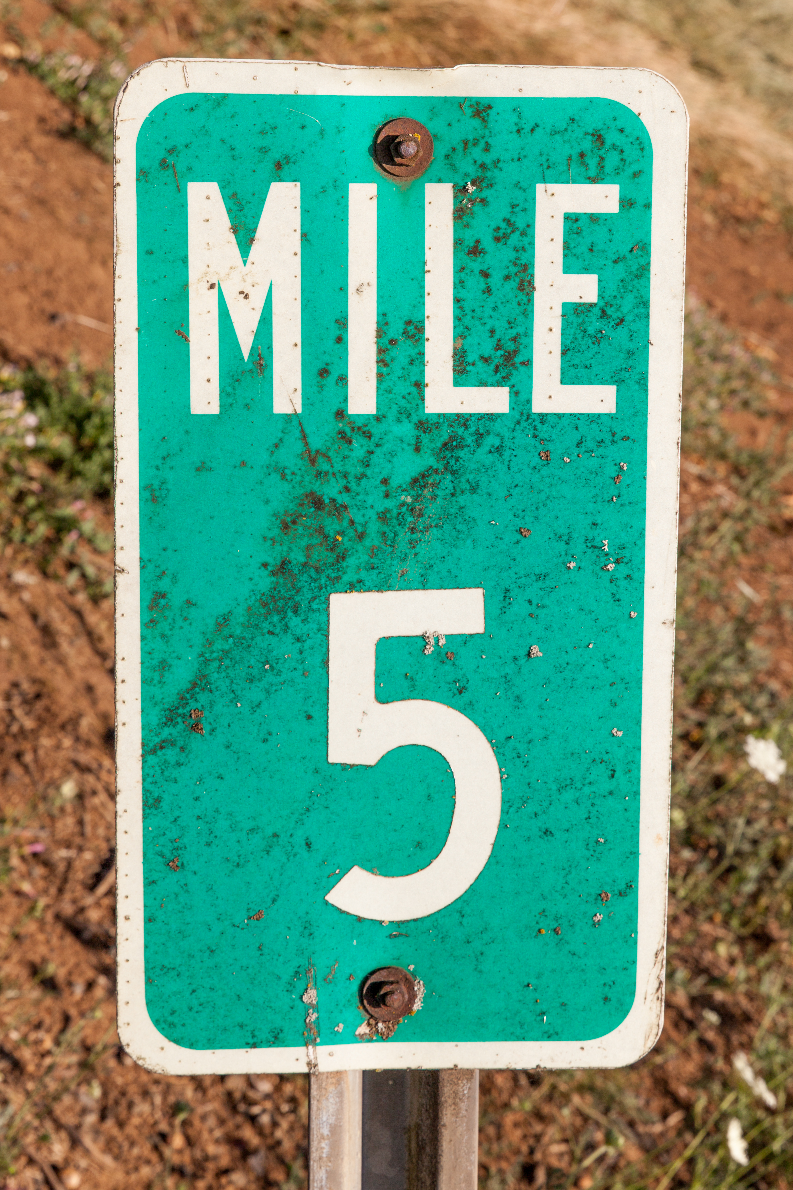
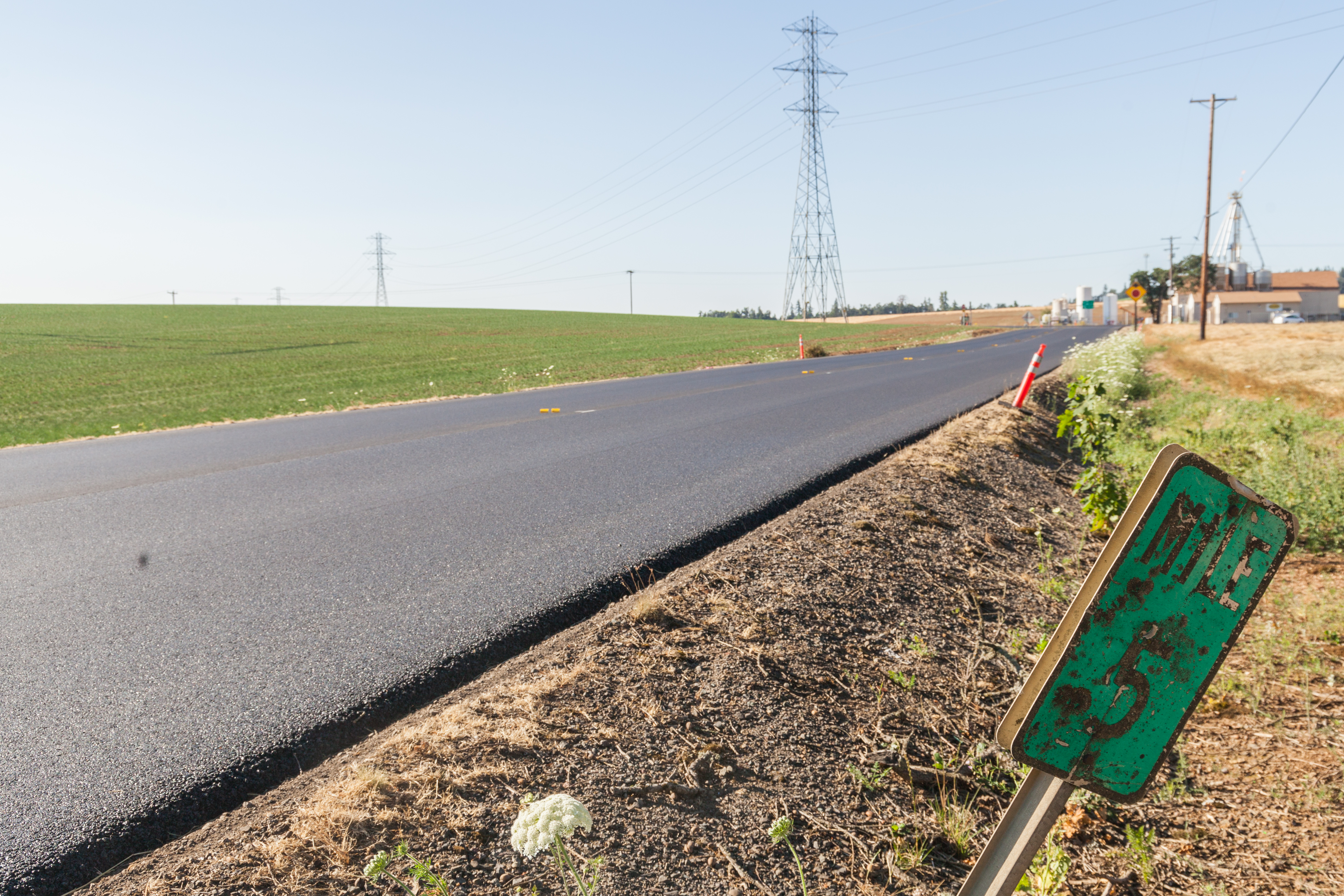
| 22:18, 12 July 2024 | 2024-07-12 marionco-mp5-sb 7920.jpg (file) |  |
8.42 MB | Jonathan | A closeup of milepost 5 along northbound Cascade Highway SE just south of its junction with OR-214.<br /> 📷 Jonathan Ledbetter<br /> 📆 12 July 2024 | 1 |
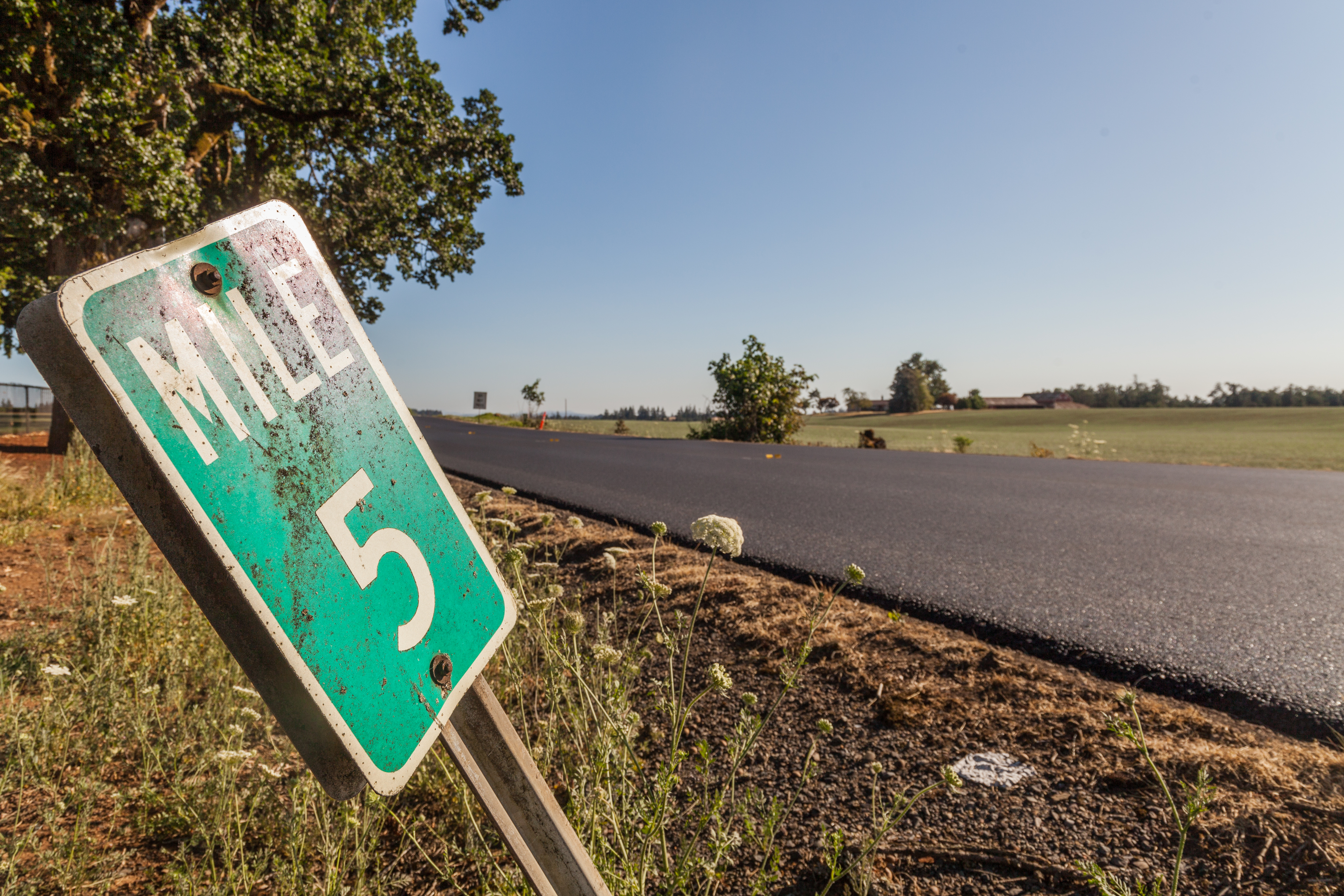
| 22:17, 12 July 2024 | 2024-07-12 marionco-mp5-sb-road 7925.jpg (file) |  |
11.12 MB | Jonathan | Milepost 5 along southbound Cascade Highway SE just south of its junction with OR-214.<br /> 📷 Jonathan Ledbetter<br /> 📆 12 July 2024 | 1 |
| 22:17, 12 July 2024 | 2024-07-12 marionco-mp5-nb-road 7915.jpg (file) |  |
8.98 MB | Jonathan | Milepost 5 along northbound Cascade Highway SE just south of its junction with OR-214.<br /> 📷 Jonathan Ledbetter<br /> 📆 12 July 2024 | 1 |
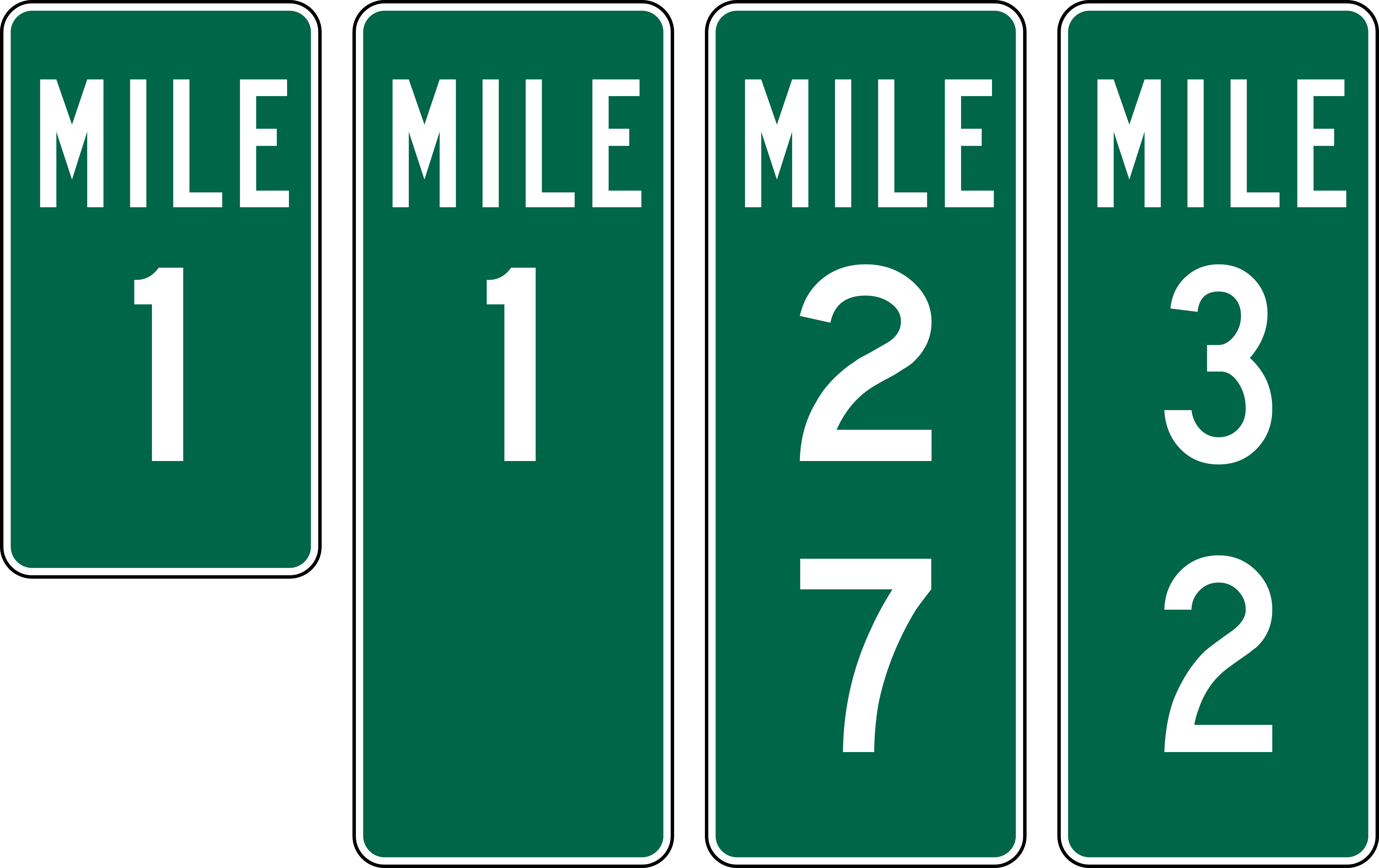
| 22:10, 12 July 2024 | Mp-county-marion-examples.png (file) |  |
40 KB | Jonathan | Examples of mileposts found along Marion County Roads.<br /> 📷 Jonathan Ledbetter<br /> 📆 12 July 2024 | 1 |
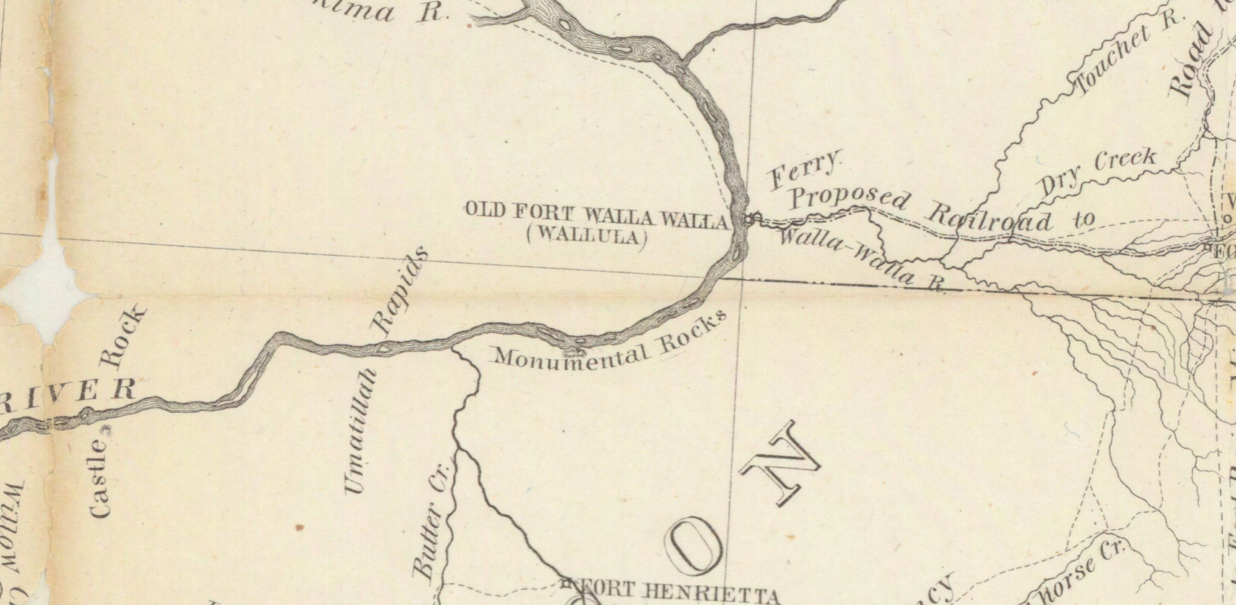
| 19:11, 1 February 2024 | 1863 US map-military-road-ft-benton-ft-walla-walla-snippet.jpg (file) |  |
791 KB | Jonathan | A snippet of a map that shows the military road from Fort Walla Walla to Fort Benson. The snippet itself centers on the present-day Wallula and Umatilla area, showing no known roads or trails along the southern bank of the Columbia.<br /> 📆 1863<br /> 🖼 US War Department via [https://content.libraries.wsu.edu/digital/collection/maps/id/232/ University of Washington Libraries] | 1 |
| 17:09, 22 January 2024 | 1926-02-24 - PWA - A2009-009.2184 - SW Jefferson St looking west to Vista Bridge.jpg (file) |  |
371 KB | Jonathan | Looking westward on SW Jefferson St. towards the Vista Bridge, under construction at the time.<br /> 📆 24 February 1926<br /> 🖼 Public Works Administration via [https://efiles.portlandoregon.gov/record/3905841 City of Portland Archives] and [https://vintageportland.wordpress.com/2023/08/10/sw-jefferson-street-1926/ Vintage Portland] 🆔 A2009-009.2184 🆔 AP/26998 | 1 |
| 03:29, 17 January 2024 | Undated - OSHD 79A-068 G-333 - Sign Department showing signs at junction of Highway 730 and Highway 30 on.jpg (file) |  |
304 KB | Jonathan | The original junction of US-30 and US-730 in Umatilla, looking eastward. Two directional signs display distances to cities along each route.<br /> 📆 Unknown<br /> 🖼 Oregon State Highway Division via [https://records.sos.state.or.us/ORSOSWebDrawer/RecordHtml/6398069 Oregon Secretary of State Archives]<br /> 🆔 ODOT-79A-068 G0333 | 1 |
| 21:31, 12 January 2024 | 2024-01-10 pacific orig-stone-milepost-225 k-poole.jpg (file) |  |
483 KB | Jonathan | Original concrete milepost 225 from the Pacific Highway, as found at the southern end of Bills Rd. (former US-99) south of Tri-City.<br /> 📷 Kirk J. Poole<br /> 📆 10 January 2024 | 1 |
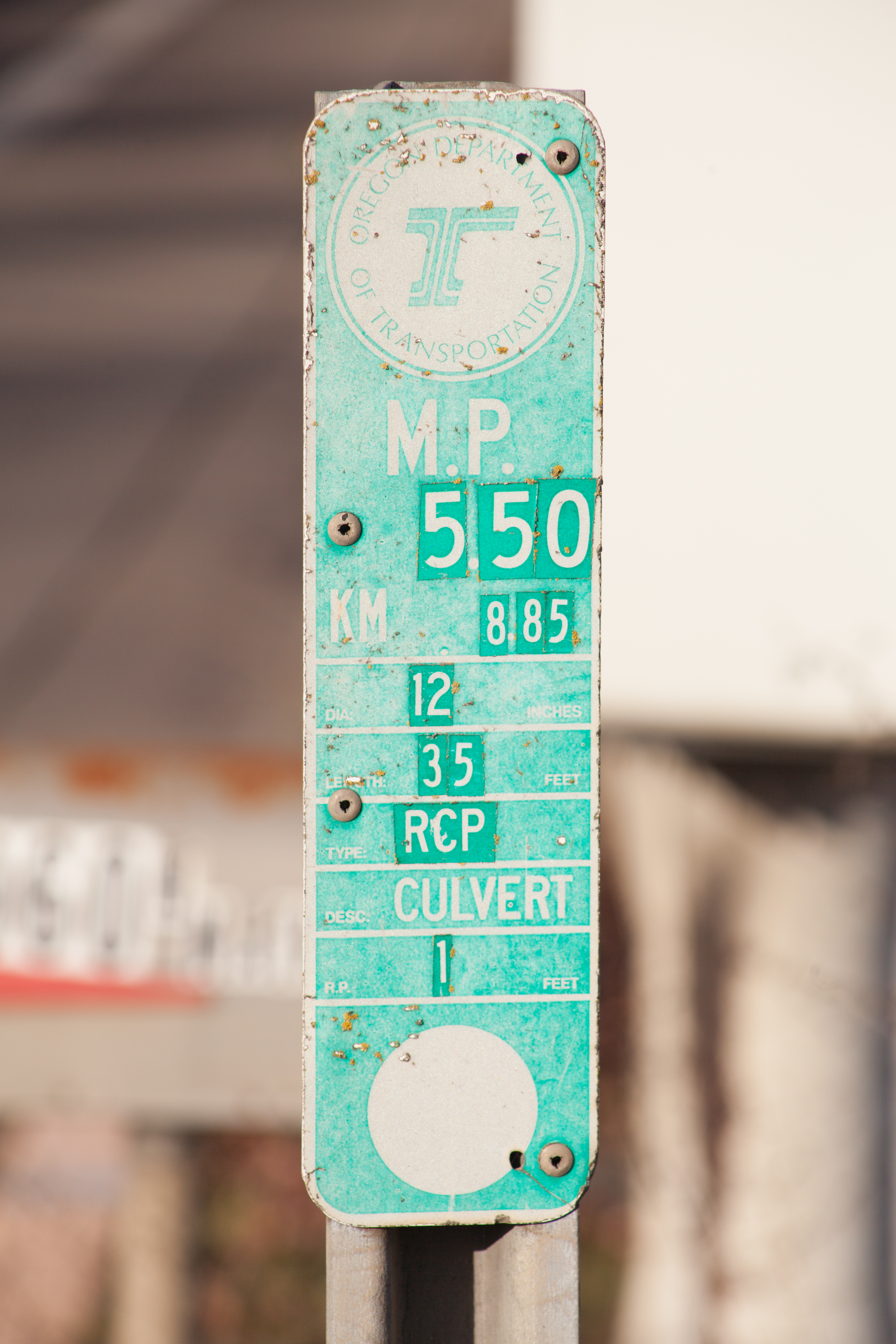
| 03:16, 24 December 2022 | 2022-12-21 state-culvert-marker 3026.jpg (file) |  |
8.76 MB | Jonathan | A green ODOT/OUNC culvert marker on OR-51 in Independence with information affixed with stickers.<br /> 📷 Jonathan Ledbetter<br /> 📆 21 December 2022 | 1 |