File list
Jump to navigation
Jump to search
This special page shows all uploaded files.
| Date | Name | Thumbnail | Size | User | Description | Versions |
|---|---|---|---|---|---|---|
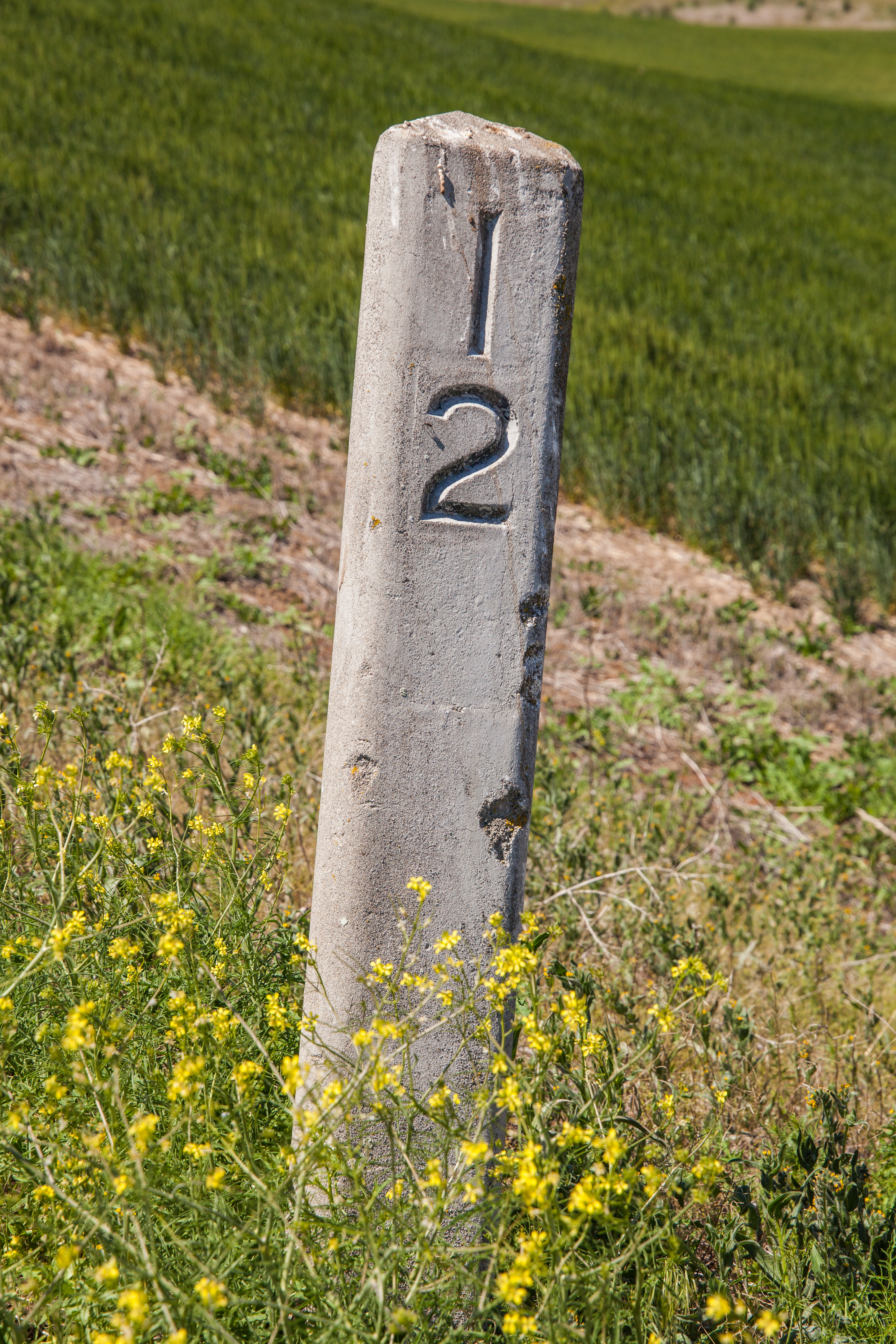
| 18:33, 3 June 2021 | 2021-06-01 orig-stone-milepost-12 2432.jpg (file) |  |
15.64 MB | Jonathan | Original concrete milepost 12 from The Dalles-California Highway, as found on an abandoned section of former OR-23/US-197 near Boyd, north of Dufur.<br /> 📷 Jonathan Ledbetter<br /> 📆 1 June 2021 | 1 |
| 23:32, 7 June 2021 | 2021-06-01 milepost 68.9 3005.jpg (file) |  |
7.31 MB | Jonathan | A photo of milepost 68.9 along US-26 near Clear Creek in the Mount Hood National Forest. This shows an example of how Oregon avoids the "mile 69 problem."<br /> 📷 Jonathan Ledbetter<br /> 📆 1 June 2021 | 1 |
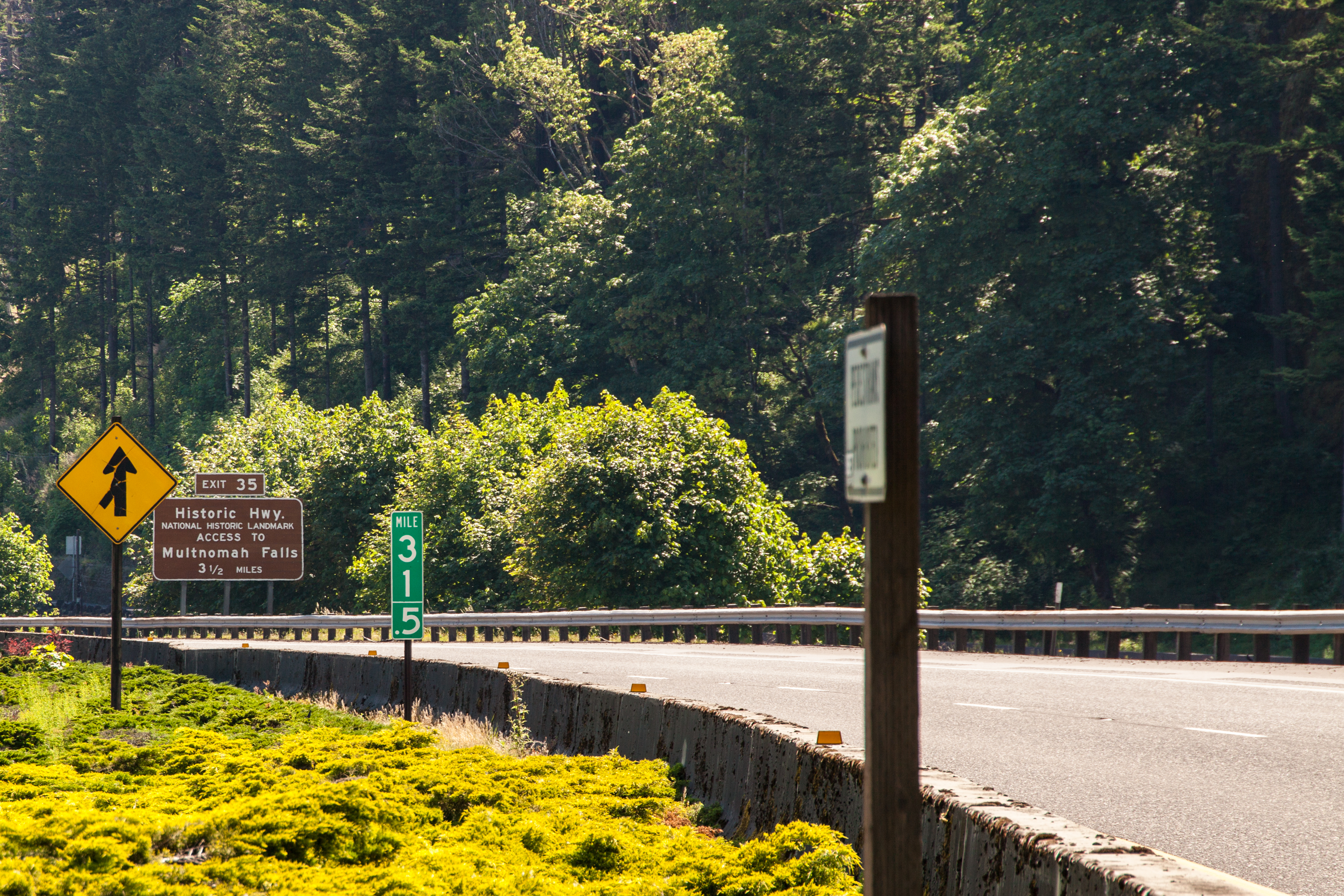
| 01:22, 8 June 2021 | 2021-06-01 milepost 31.5 1659.jpg (file) |  |
9.06 MB | Jonathan | A freeway-sized fractional mile marker at MP 31.5 along I-84/US-30 at Multnomah Falls.<br /> 📷 Jonathan Ledbetter<br /> 📆 1 June 2021 | 1 |
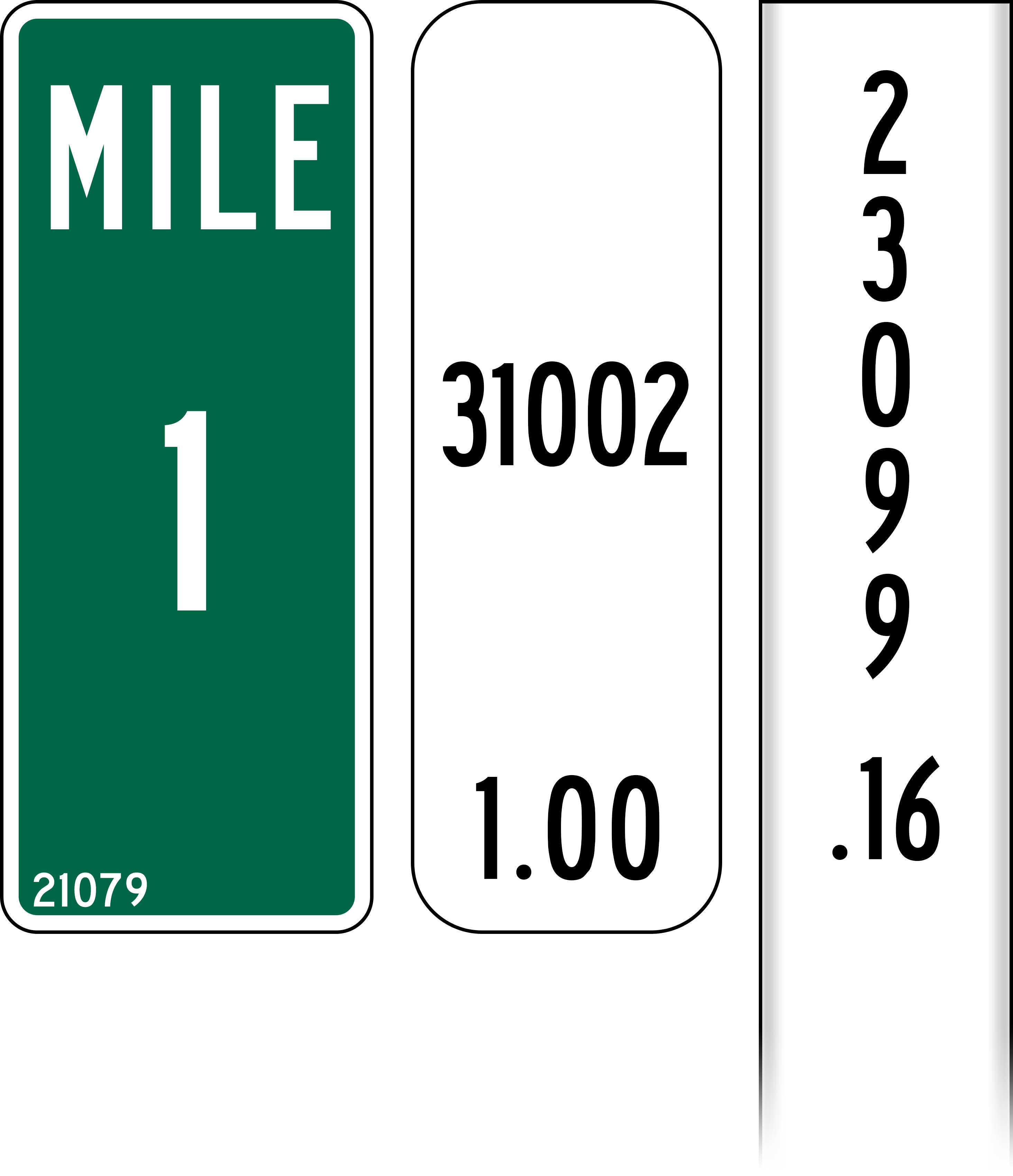
| 23:36, 9 June 2021 | Mp-county-clatsop-examples.png (file) |  |
587 KB | Jonathan | Fixed dimensions of MILE sticker on white wicket milepost | 1 |
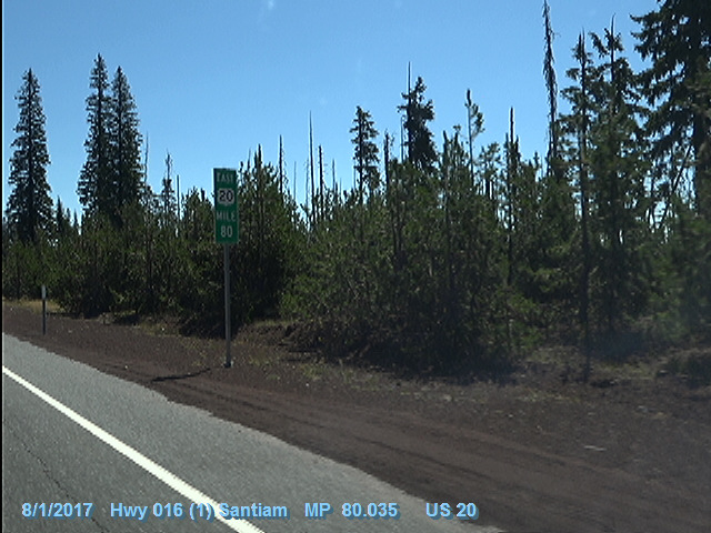
| 00:36, 10 June 2021 | 2017-08-01 odot-vidlog US-20(16) MP80.035-EB.jpg (file) | _MP80.035-EB.jpg) |
136 KB | Jonathan | An enhanced milepost at MP 80 on US-20 eastbound in the Cascades.<br /> 🖼 [https://dvlprod-ordot.msappproxy.net/cf/dvl/index.cfm?&fuseaction=entry ODOT Digital Video Log]<br /> 📆 1 August 2017 | 1 |
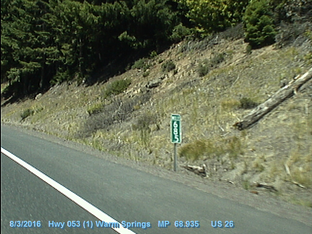
| 01:21, 10 June 2021 | 2016-08-03 odot-vidlog US-26(53) MP68.935-WB.jpg (file) | _MP68.935-WB.jpg) |
147 KB | Jonathan | An oddly-numbered and oddly-placed "Mile 68.5" marker at MP 68.935 on US-26 near Clear Creek in the Mount Hood National Forest.<br /> 🖼 [https://dvlprod-ordot.msappproxy.net/cf/dvl/index.cfm?&fuseaction=entry ODOT Digital Video Log]<br /> 📆 3 August 2016 | 1 |
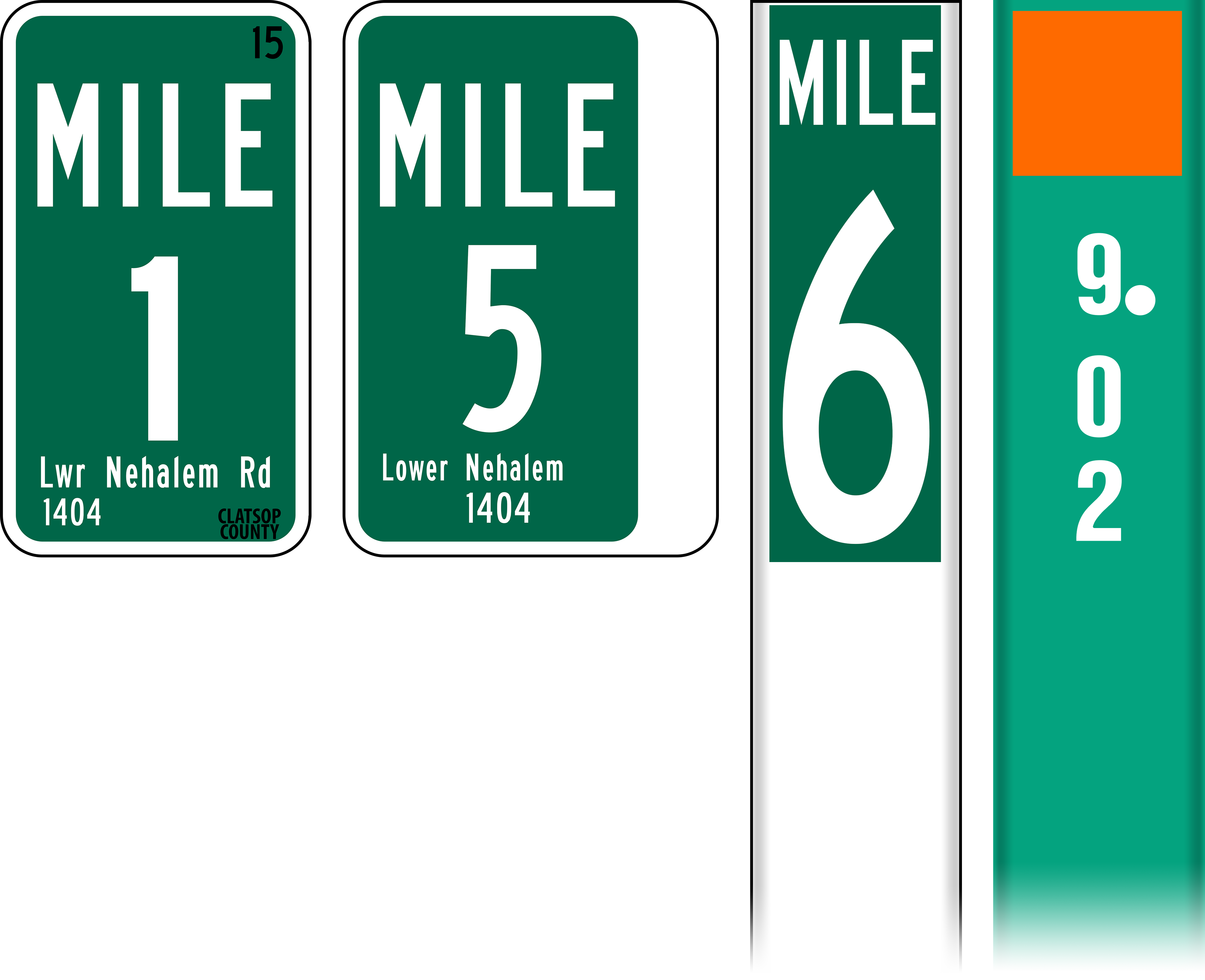
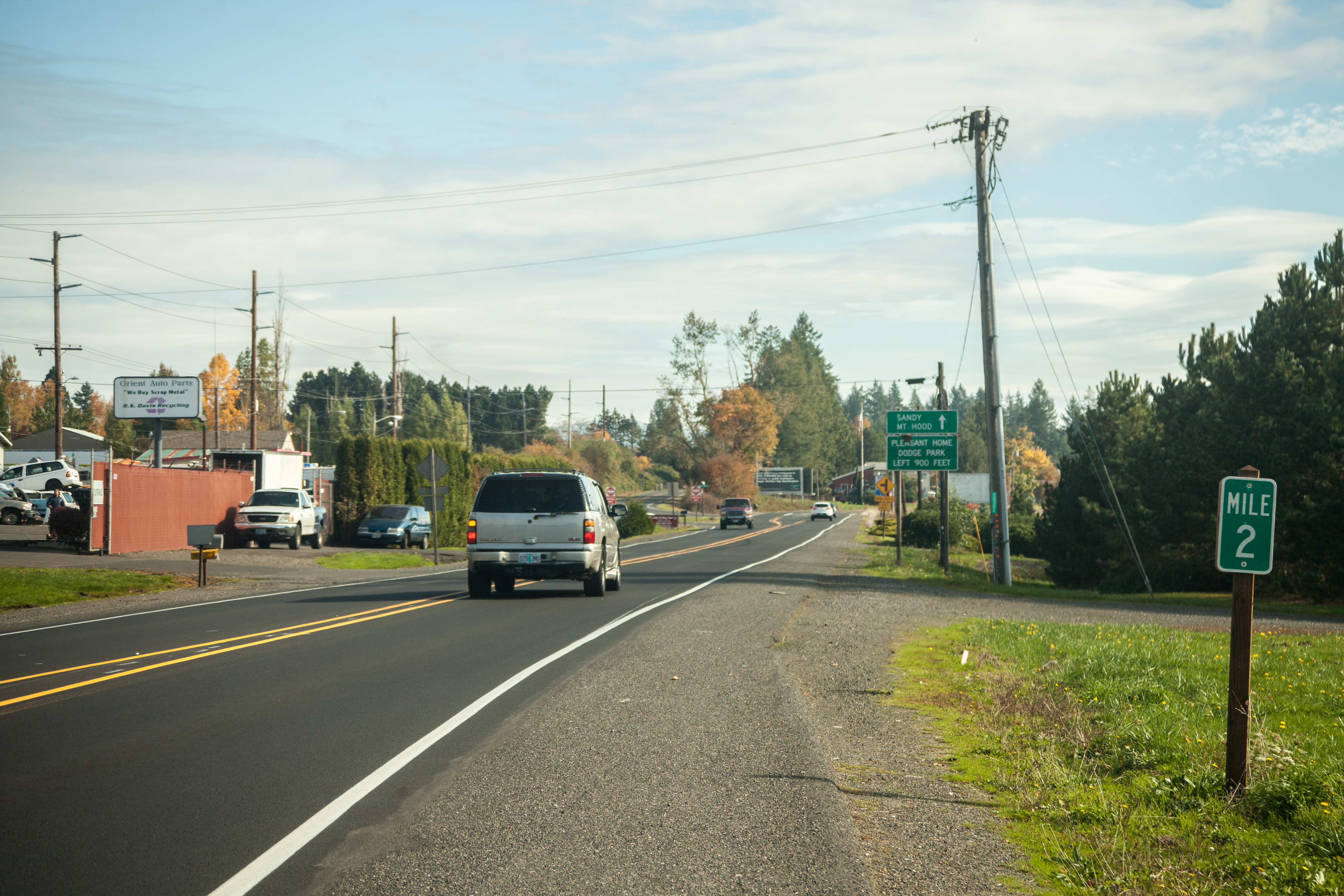
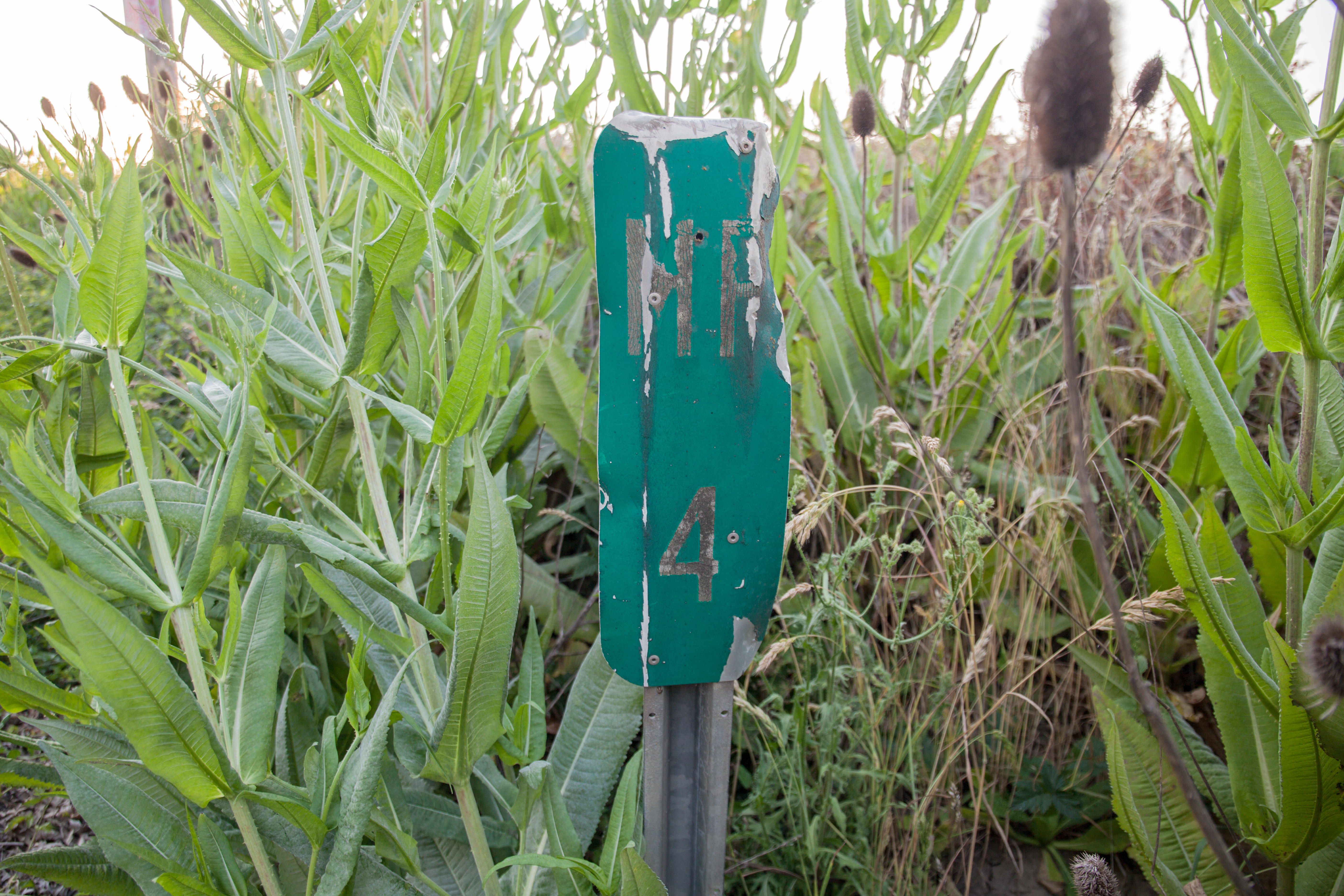
| 10:38, 13 June 2021 | 2017-10-25 multco-milepost 3928.jpg (file) |  |
11.26 MB | Jonathan | Milepost 2 along SE Orient Drive (former OR-50/US-26) in Orient.<br /> 📷 Jonathan Ledbetter<br /> 📆 25 October 2017 | 1 |
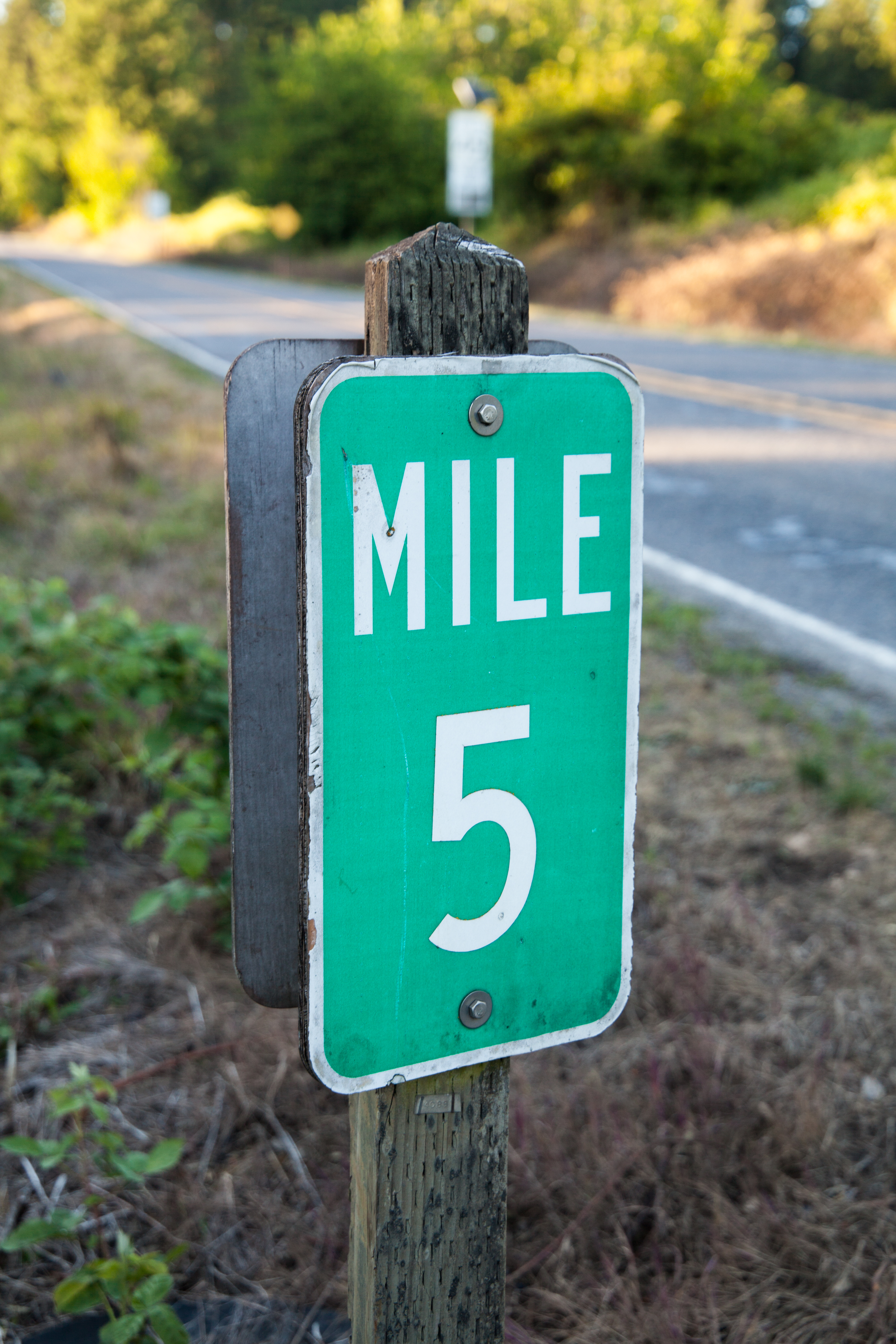
| 10:42, 13 June 2021 | 2021-05-28 multco-milepost-5 1536.jpg (file) |  |
12.16 MB | Jonathan | Milepost 5 along Cornelius Pass Road (OR-127) north at the Multnomah-Washington County Line.<br /> 📷 Jonathan Ledbetter<br /> 📆 28 May 2021 | 1 |
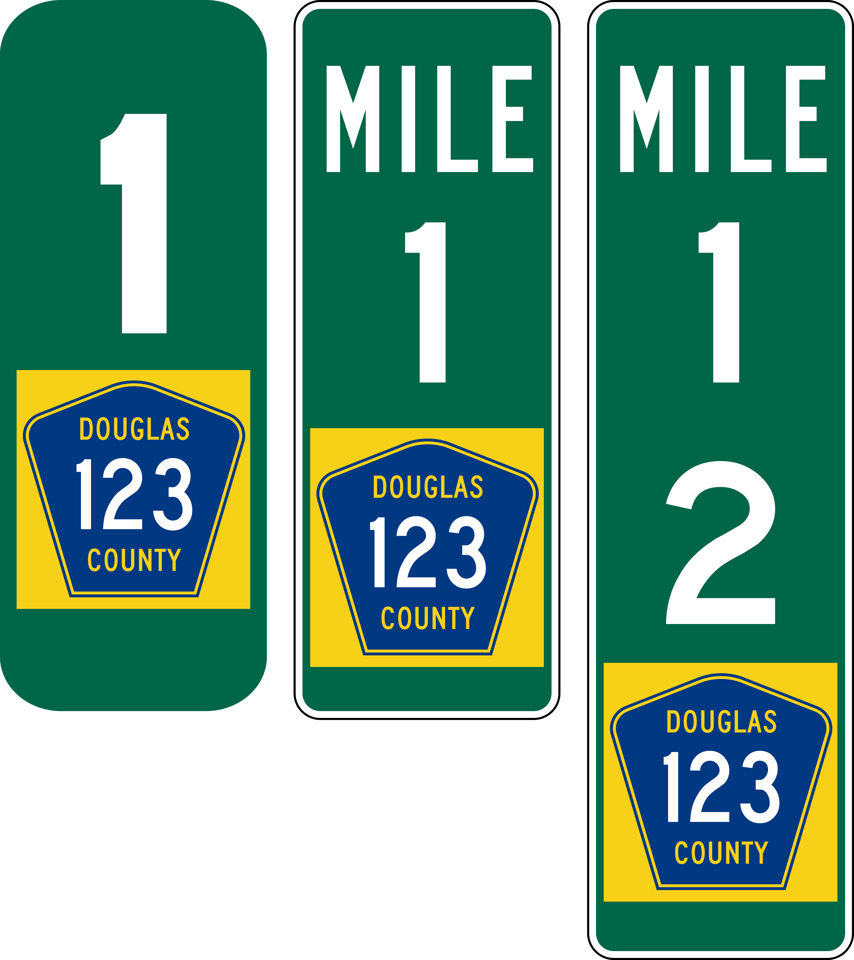
| 11:37, 13 June 2021 | Mp-county-multnomah-examples.png (file) |  |
119 KB | Jonathan | Examples of mileposts found along Multnomah County Roads.<br /> 📷 Jonathan Ledbetter<br /> 📆 13 June 2021 | 1 |
| 23:30, 13 June 2021 | Mp-county-columbia-examples.png (file) |  |
99 KB | Jonathan | Examples of mileposts found along Columbia County Roads.<br /> 📷 Jonathan Ledbetter<br /> 📆 13 June 2021 | 1 |
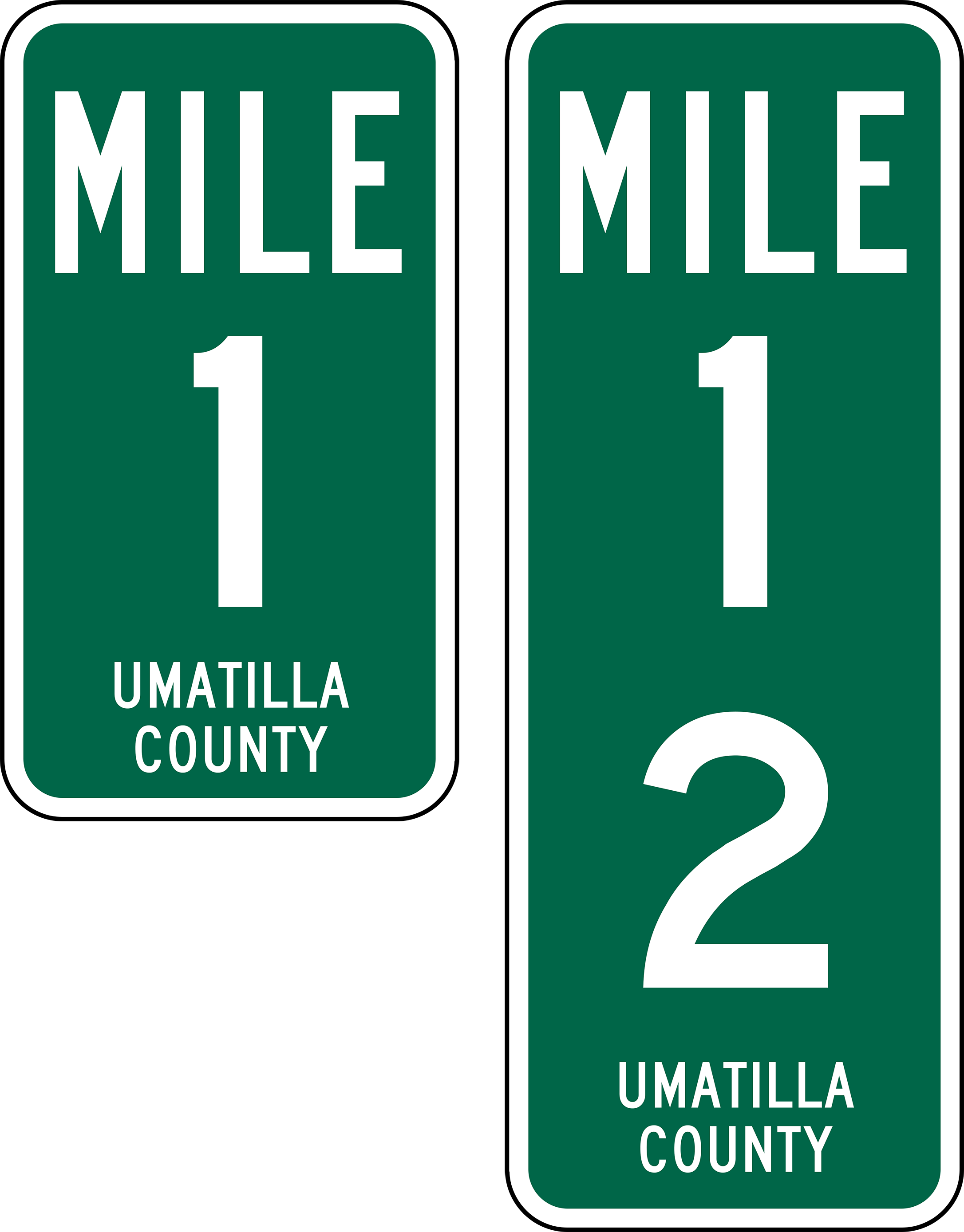
| 01:11, 14 June 2021 | Mp-county-umatilla-examples.png (file) |  |
164 KB | Jonathan | Examples of mileposts found along Umatilla County Roads.<br /> 📷 Jonathan Ledbetter<br /> 📆 14 June 2021 | 1 |
| 01:26, 14 June 2021 | Mp-county-coos.png (file) |  |
115 KB | Jonathan | Examples of mileposts found along Coos County Roads.<br /> 📷 Jonathan Ledbetter<br /> 📆 14 June 2021 | 1 |
| 22:14, 14 June 2021 | Mp-county-washington.png (file) |  |
129 KB | Jonathan | Examples of mileposts found along Washington County Roads, including accompanying county road number plaque.<br /> 📷 Jonathan Ledbetter<br /> 📆 14 June 2021 | 1 |
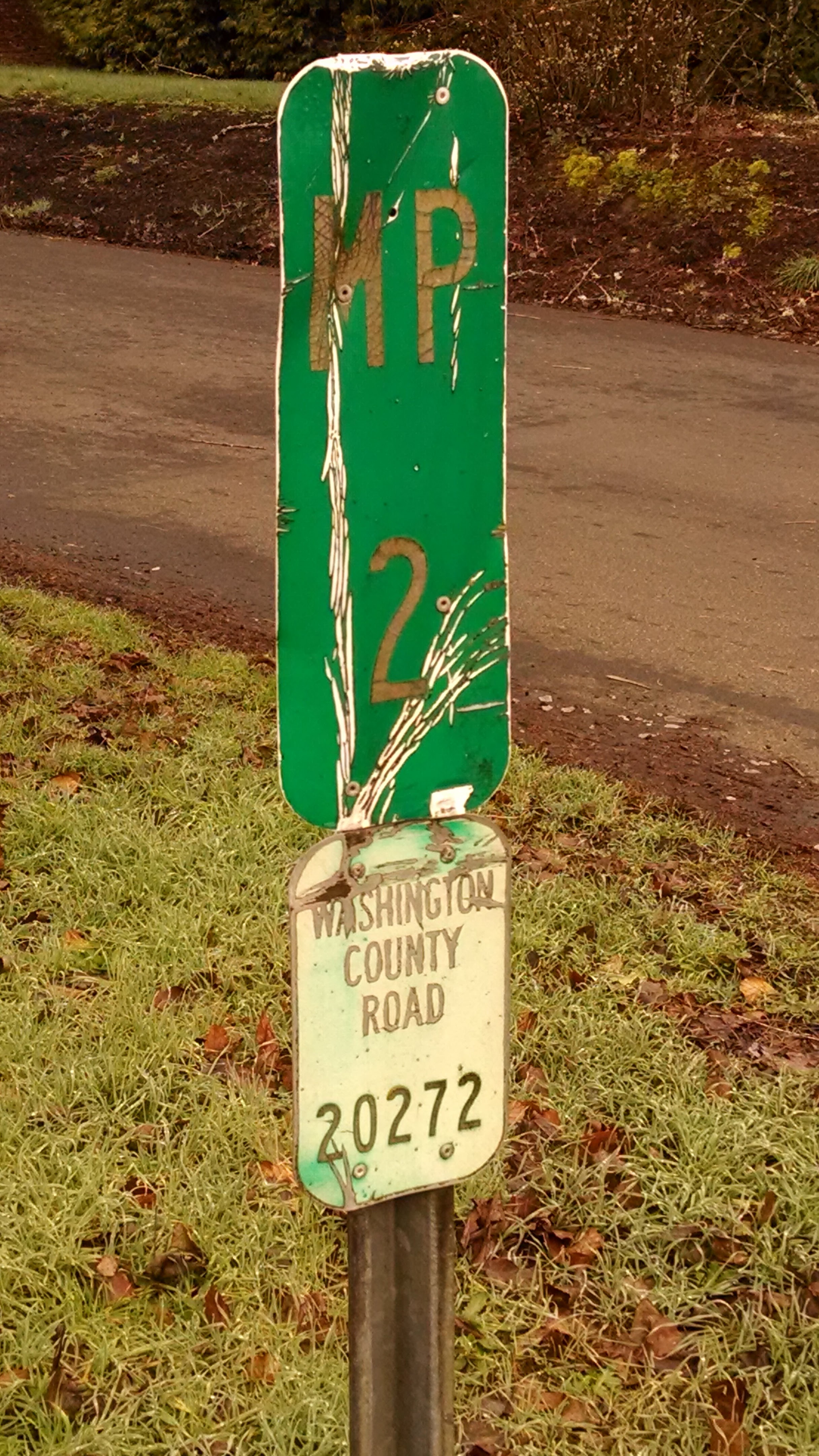
| 00:27, 15 June 2021 | 2015-02-11 washco-milepost 085216.jpg (file) |  |
1.52 MB | Jonathan | Milepost 2 sign on SW Bull Mountain Road (Washington County #20272) at the intersection of SW 150th Ave. in Tigard<br /> 📷 Jonathan Ledbetter<br /> 📆 11 February 2015 | 1 |
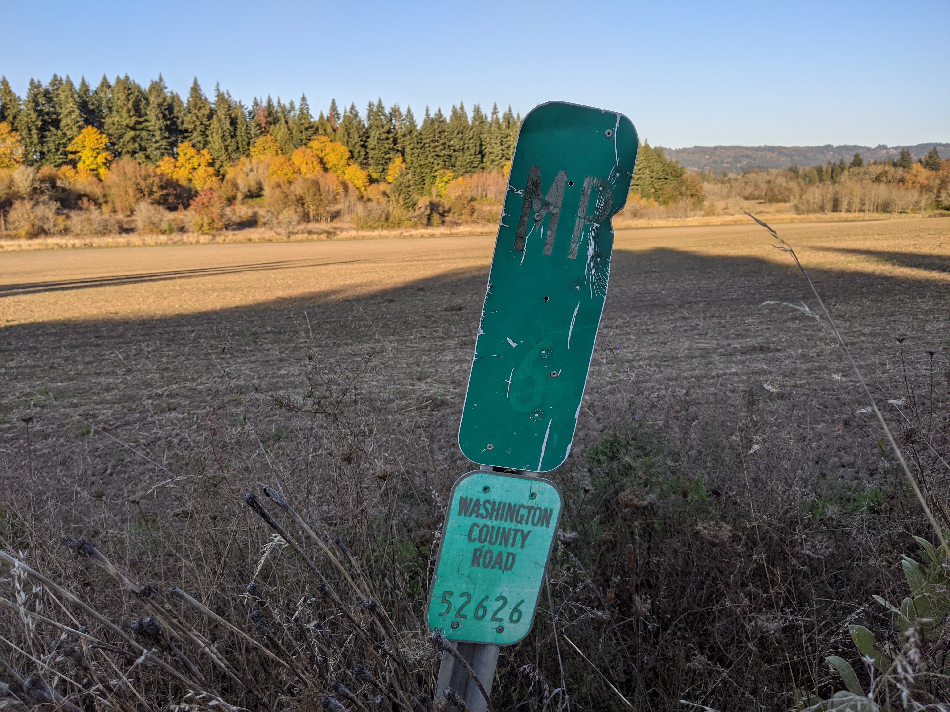
| 00:30, 15 June 2021 | 2020-10-29 washco-milepost 234721519.jpg (file) |  |
2.3 MB | Jonathan | Milepost 6 on NW West Union Rd. (Washington County #52626) near West Union.<br /> 📷 Jonathan Ledbetter<br /> 📆 29 October 2020 | 1 |
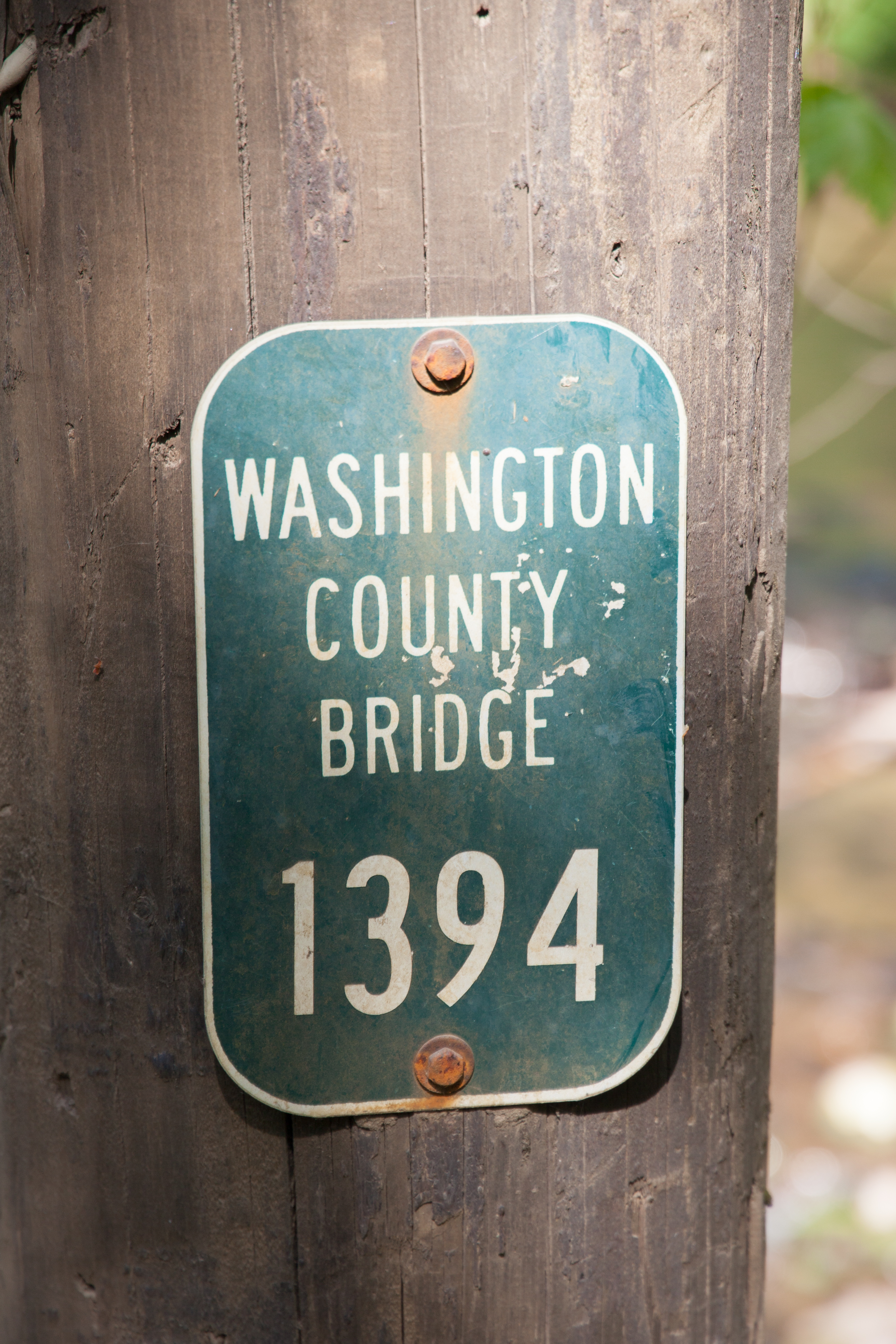
| 01:23, 15 June 2021 | 2019-05-08 washco-inventory-marker 0201.jpg (file) |  |
8.99 MB | Jonathan | A Washington County bridge inventory marker on Cochran Road near Reehers Camp.<br /> 📷 Jonathan Ledbetter<br /> 📆 8 May 2019 | 1 |
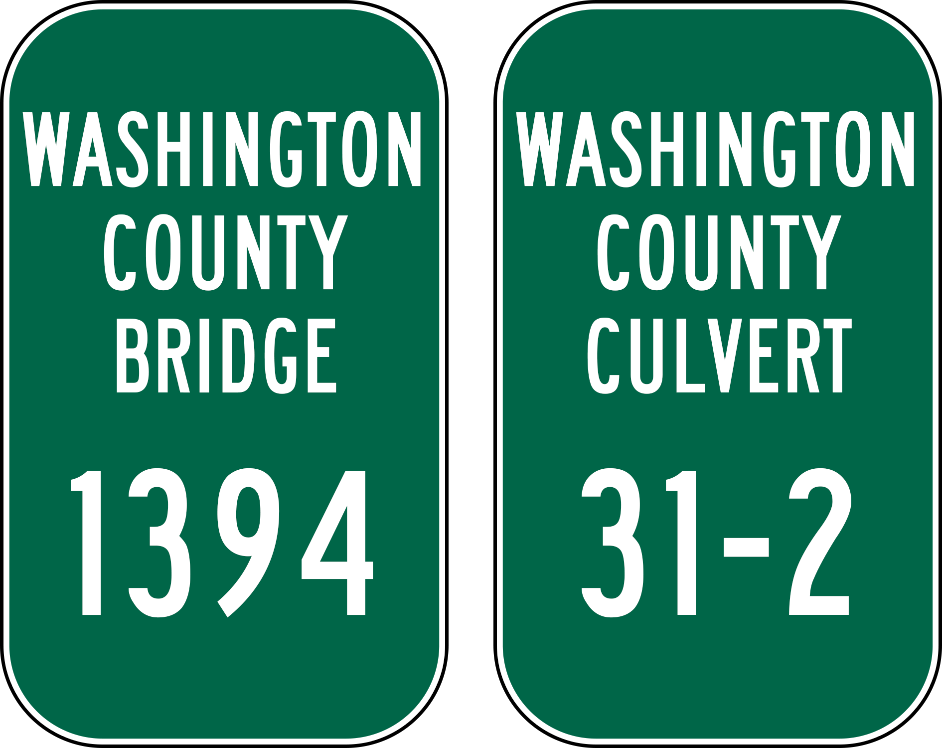
| 01:30, 15 June 2021 | Mp-county-washington-bridge-culvert.png (file) |  |
114 KB | Jonathan | Examples of bridge and culvert inventory markers found along Washington County roads.<br /> 📷 Jonathan Ledbetter<br /> 📆 15 June 2021 | 1 |
| 17:55, 15 June 2021 | Mp-county-linn-bridge.png (file) |  |
112 KB | Jonathan | Examples of bridge markers found along Linn County roads.<br /> 📷 Jonathan Ledbetter<br /> 📆 15 June 2021 | 1 |
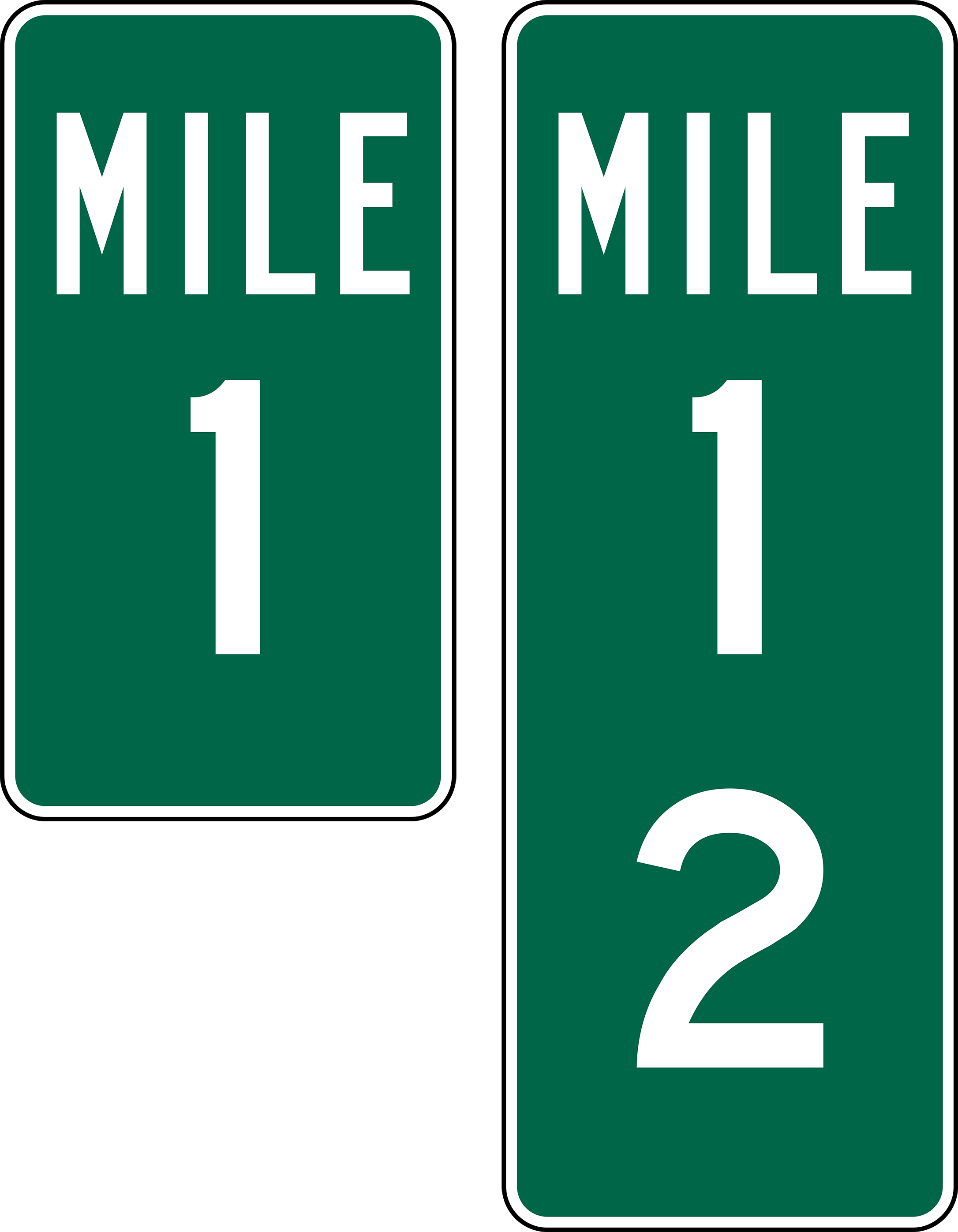
| 23:10, 15 June 2021 | 1971 MUTCD-OR-milepost-examples.png (file) |  |
172 KB | Jonathan | Added black border | 2 |
| 23:11, 15 June 2021 | 2003 MUTCD-OR-milepost-examples.png (file) |  |
167 KB | Jonathan | Added black border | 3 |
| 23:12, 15 June 2021 | 2009 MUTCD-OR-milepost-examples.png (file) |  |
295 KB | Jonathan | Added black border | 2 |
| 23:16, 15 June 2021 | Mp-county-clackamas-examples.png (file) |  |
324 KB | Jonathan | Added black border | 2 |
| 01:35, 17 June 2021 | 2021-06-01 orig-stone-milepost-18-destroyed 2520.jpg (file) |  |
20.85 MB | Jonathan | Presumably original concrete milepost 18 from The Dalles-California Highway, as found destroyed on the side of US-197 south of Dufur. If this is the milepost, it would have been placed about 200 feet behind the camera.<br /> 📷 Jonathan Ledbetter<br /> 📆 1 June 2021 | 1 |
| 20:14, 28 June 2021 | Mp-county-douglas-examples.png (file) |  |
363 KB | Jonathan | Examples of mileposts found along Douglas County Roads.<br /> 📷 Jonathan Ledbetter<br /> 📆 28 June 2021 | 1 |
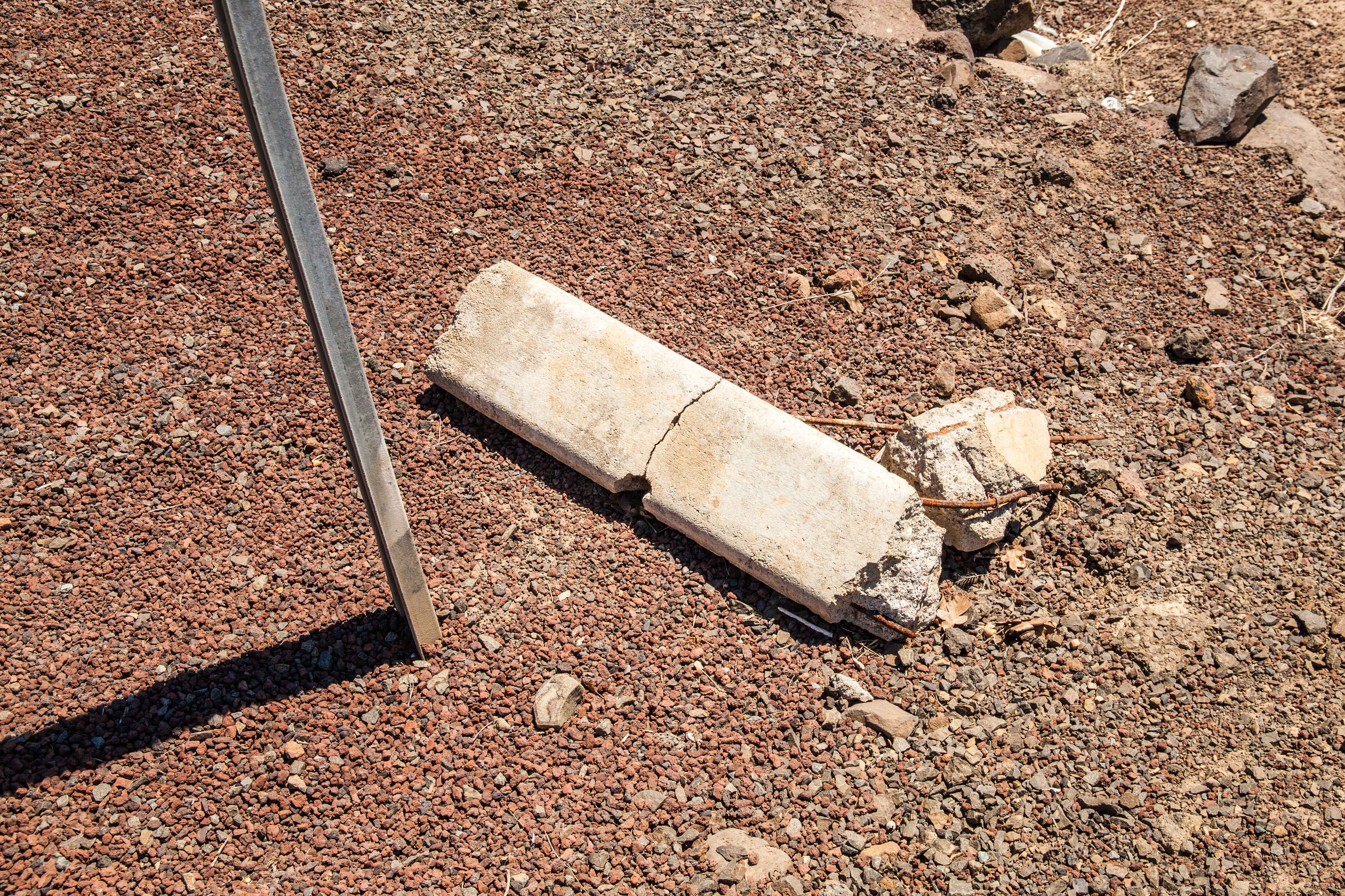
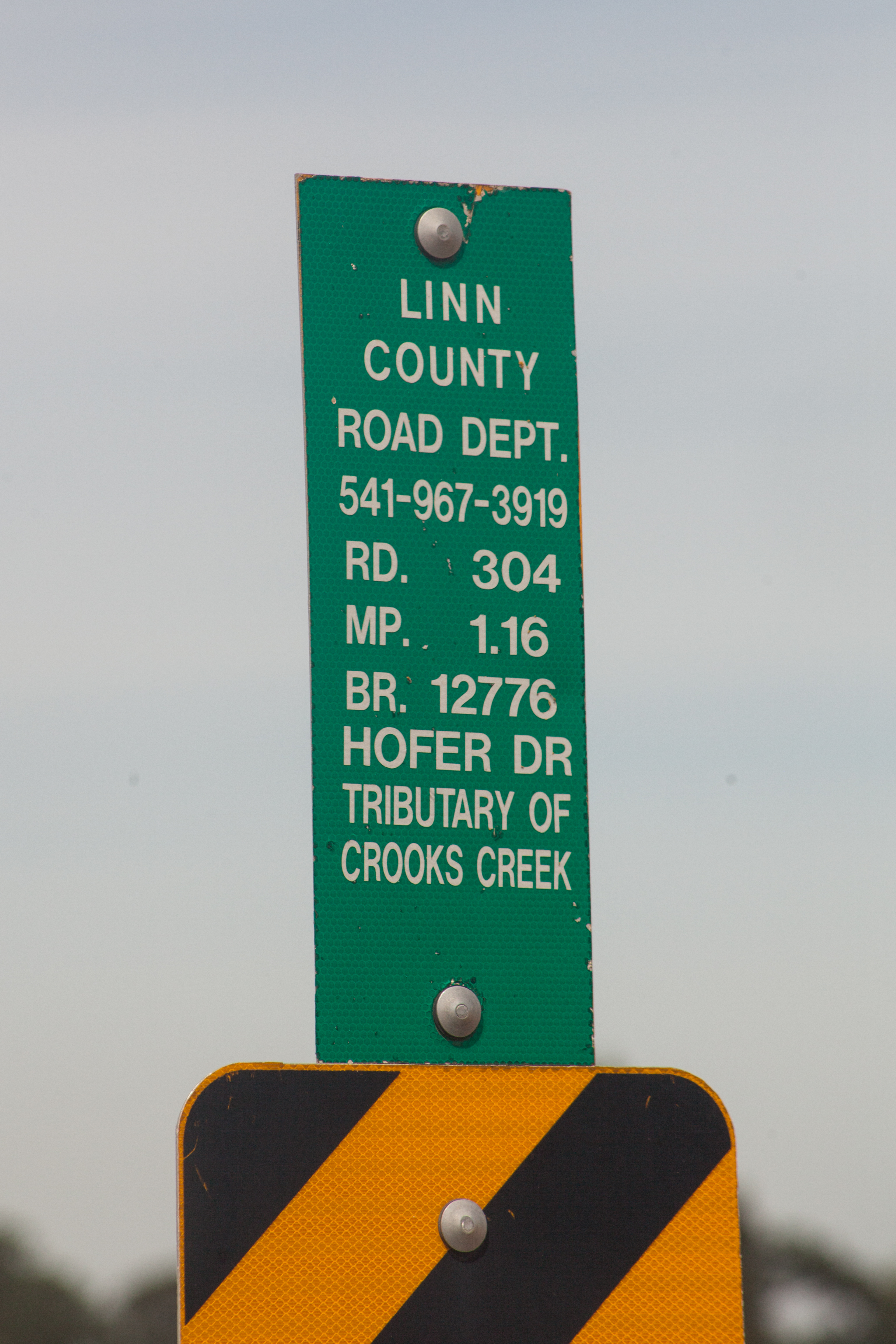
| 23:52, 30 June 2021 | 2016-08-13 linnco-inventory-marker 3258.jpg (file) |  |
7.34 MB | Jonathan | A Linn County bridge inventory marker at MP 1.16 on Hofer Road at the bridge over a tributary of Crooks Creek.<br /> 📷 Jonathan Ledbetter<br /> 📆 13 August 2016 | 1 |
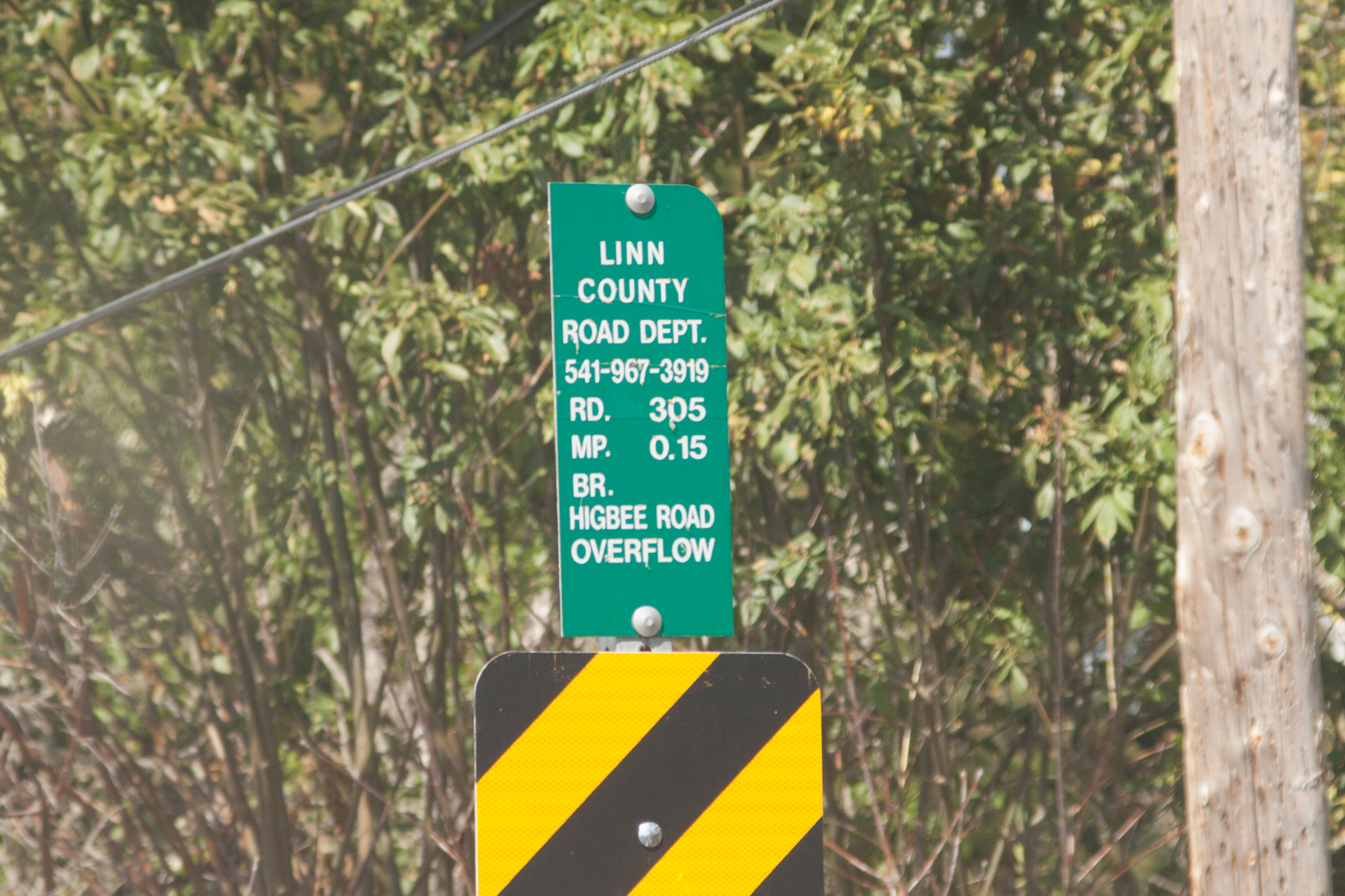
| 23:55, 30 June 2021 | 2016-08-13 linnco-inventory-marker 3330.jpg (file) |  |
3.17 MB | Jonathan | A Linn County bridge inventory marker at MP 0.15 on Higbee Road at an overflow channel.<br /> 📷 Jonathan Ledbetter<br /> 📆 13 August 2016 | 1 |
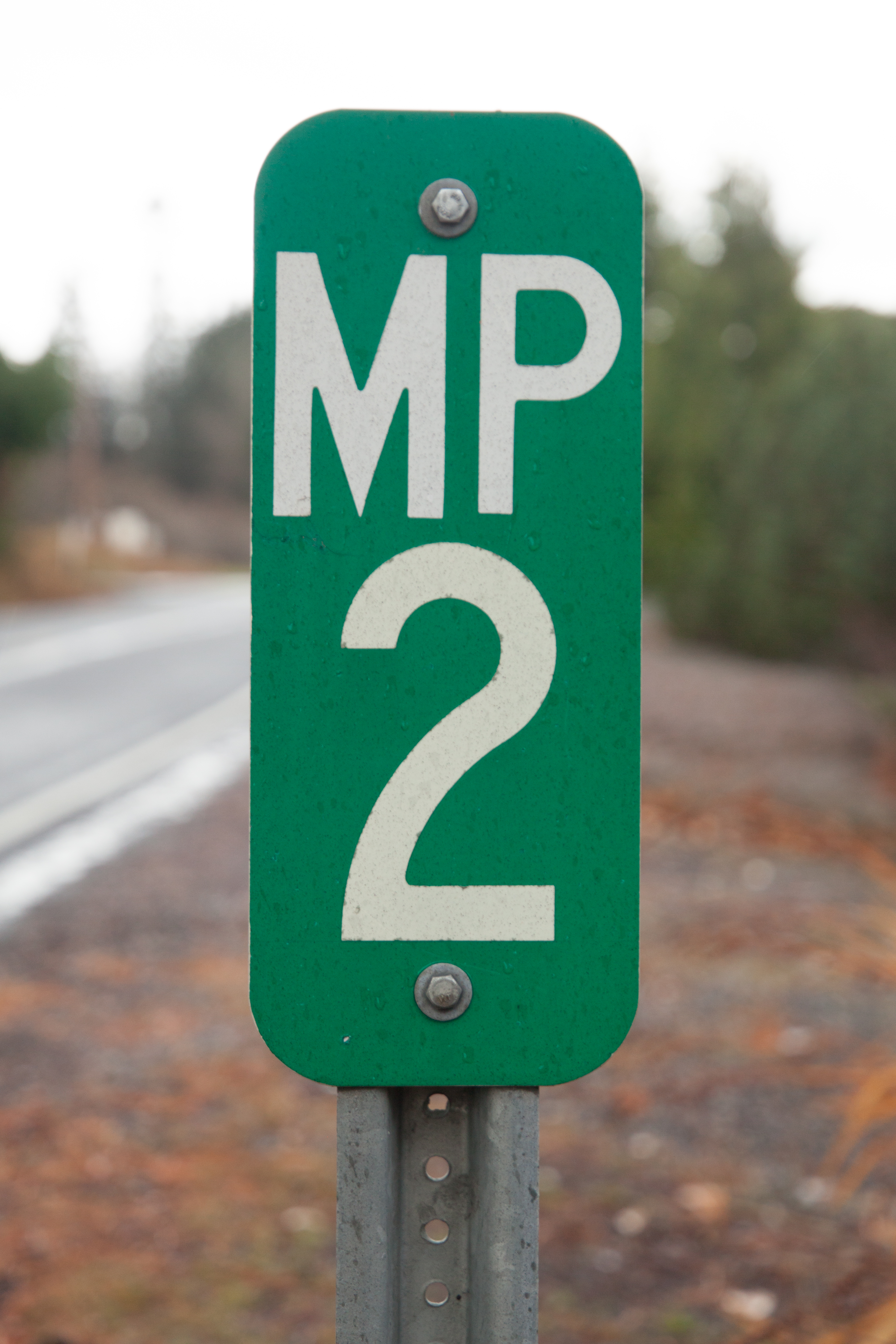
| 23:58, 30 June 2021 | 2019-11-15 hoodriverco-milepost 4106.jpg (file) |  |
9.13 MB | Jonathan | A Hood River County milepost at MP 2 on Cooper Spur Rd. near Parkdale.<br /> 📷 Jonathan Ledbetter<br /> 📆 15 November 2019 | 1 |
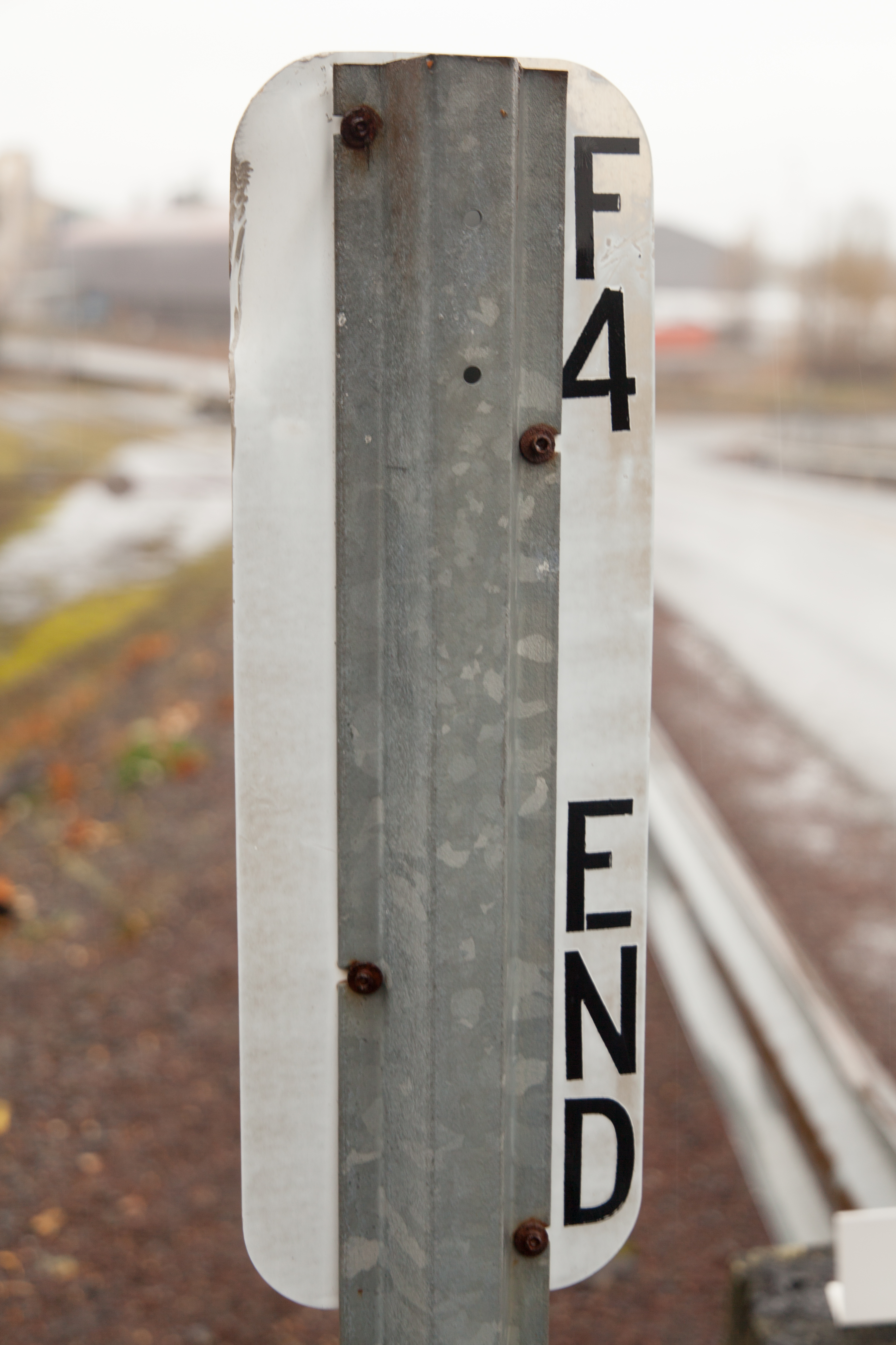
| 23:59, 30 June 2021 | 2019-11-15 hoodriverco-end-milepost 3029.jpg (file) |  |
10.09 MB | Jonathan | A Hood River County milepost at MP 1.18 on Forest Lane in Cascade Locks.<br /> 📷 Jonathan Ledbetter<br /> 📆 15 November 2019 | 1 |
| 00:04, 1 July 2021 | 2019-11-15 hoodriverco-end-milepost-back 3036.jpg (file) |  |
6.87 MB | Jonathan | The reverse side of MP 1.18 on Forest Lane in Cascade Locks.<br /> 📷 Jonathan Ledbetter<br /> 📆 15 November 2019 | 1 |
| 00:27, 1 July 2021 | 2021-06-20 washco-milepost 3559.jpg (file) |  |
13.04 MB | Jonathan | Milepost 4 on NW West Union Rd. (Washington County #52626) near Helvetia.<br /> 📷 Jonathan Ledbetter<br /> 📆 20 June 2021 | 1 |
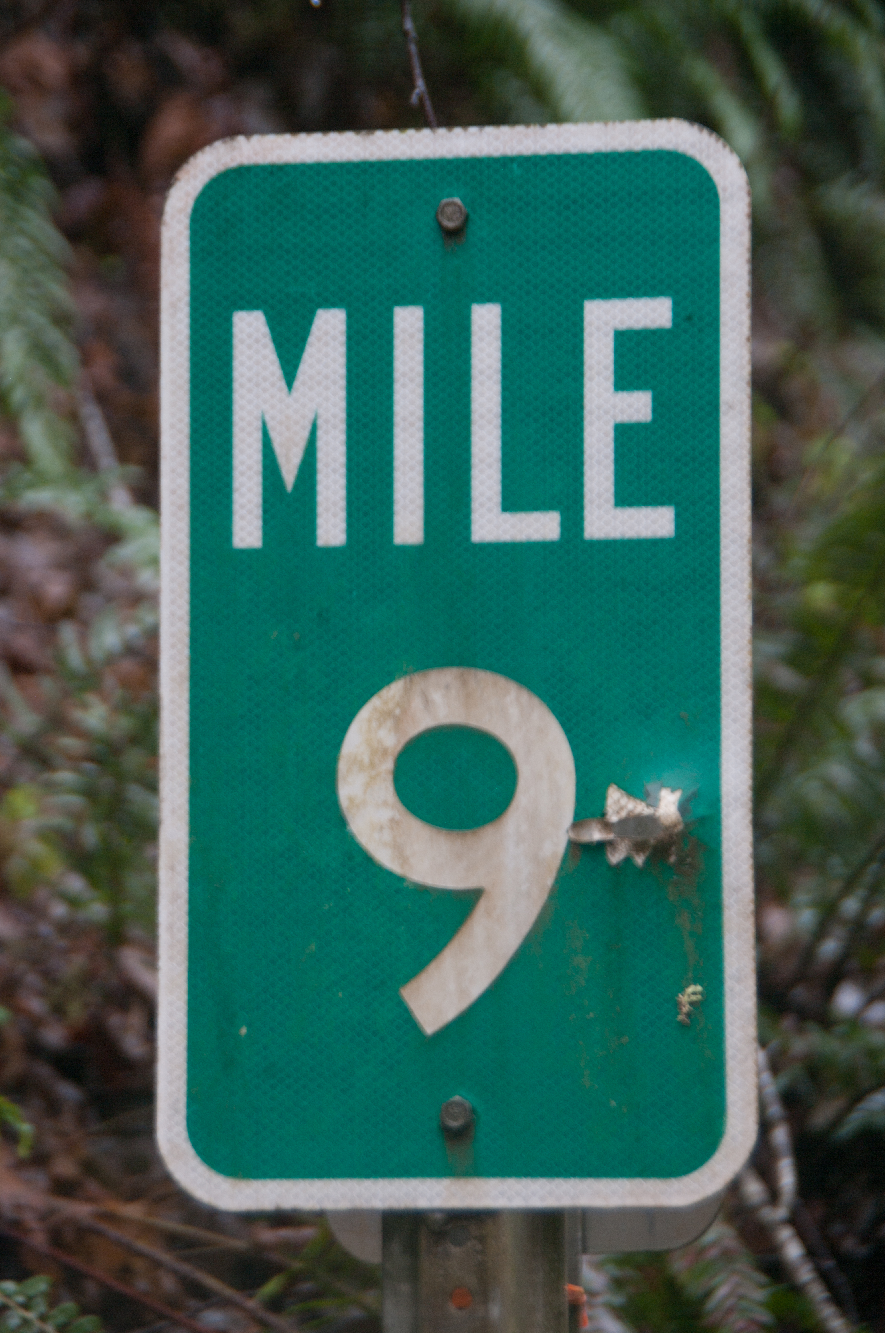
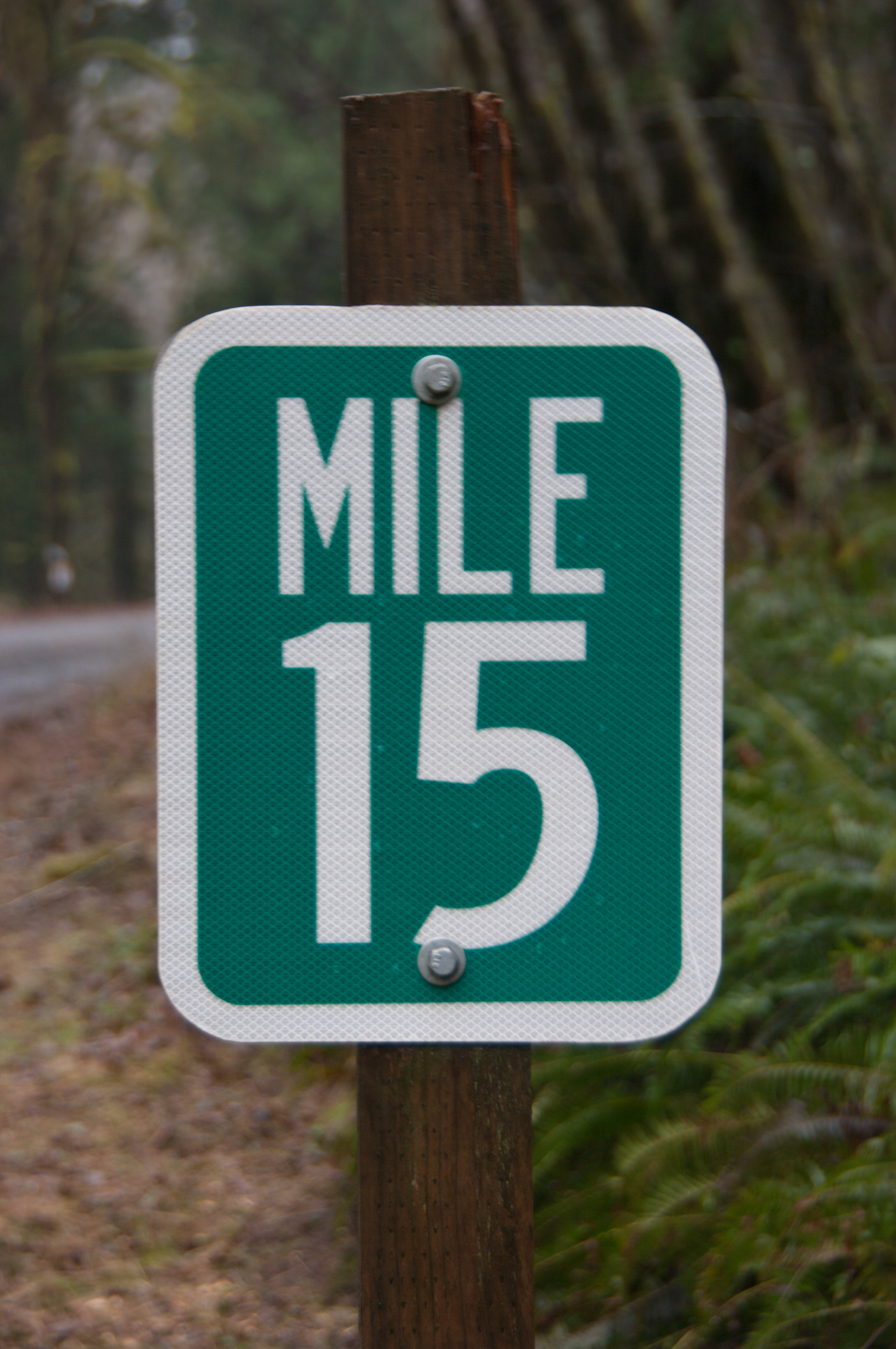
| 18:09, 2 July 2021 | 2021-01-02 tillamookco-milepost 6715.jpg (file) |  |
8.69 MB | Jonathan | A D10-1 milepost at MP 9 on Foss Road (Tillamook County #507).<br /> 📷 Jonathan Ledbetter<br /> 📆 2 January 2021 | 1 |
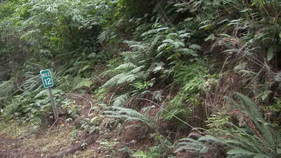
| 18:16, 2 July 2021 | 2018 tillamookco-vidlog Foss-Rd(507) MP12-NB(C2).jpg (file) | _MP12-NB(C2).jpg) |
147 KB | Jonathan | A D10-1 milepost, notable for containing a two-digit number in a space designed for one, at MP 12 of Foss Road (Tillamook County #507).<br /> 🖼 Tillamook County Video Log via [http://tillamook.streetpixweb.com/ StreetPix]<br /> 📆 2018 | 1 |
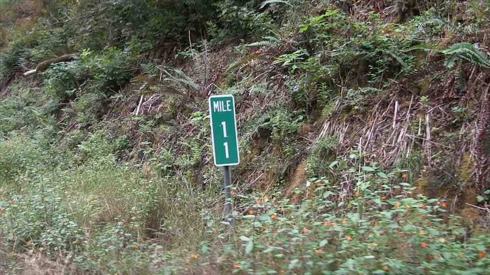
| 18:17, 2 July 2021 | 2014 tillamookco-vidlog Foss-Rd(507) MP11-NB(C2).jpg (file) | _MP11-NB(C2).jpg) |
211 KB | Jonathan | A D10-2 milepost at MP 11 of Foss Road (Tillamook County #507).<br /> 🖼 Tillamook County Video Log via [http://tillamook.streetpixweb.com/ StreetPix]<br /> 📆 2014 | 1 |
| 18:17, 2 July 2021 | 2014 tillamookco-vidlog Foss-Rd(507) MP14-NB(C2).jpg (file) | _MP14-NB(C2).jpg) |
170 KB | Jonathan | A D10-2 milepost at MP 14 of Foss Road (Tillamook County #507).<br /> 🖼 Tillamook County Video Log via [http://tillamook.streetpixweb.com/ StreetPix]<br /> 📆 2014 | 1 |
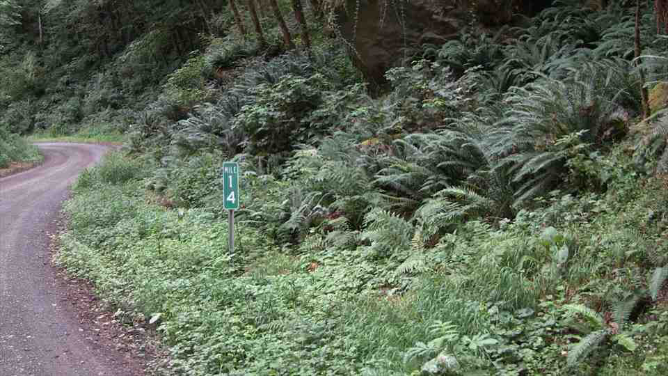
| 18:24, 2 July 2021 | 2021-01-02 tillamookco-milepost 6706.jpg (file) |  |
8.51 MB | Jonathan | A Tillamook County milepost at MP 15 on Foss Road (Tillamook County #507).<br /> 📷 Jonathan Ledbetter<br /> 📆 2 January 2021 | 1 |
| 00:21, 3 July 2021 | Mp-county-tillamook-bridge.png (file) |  |
146 KB | Jonathan | Changed octothorpe thickness and centered blue rounded rectangle vertically and horizontally | 1 |
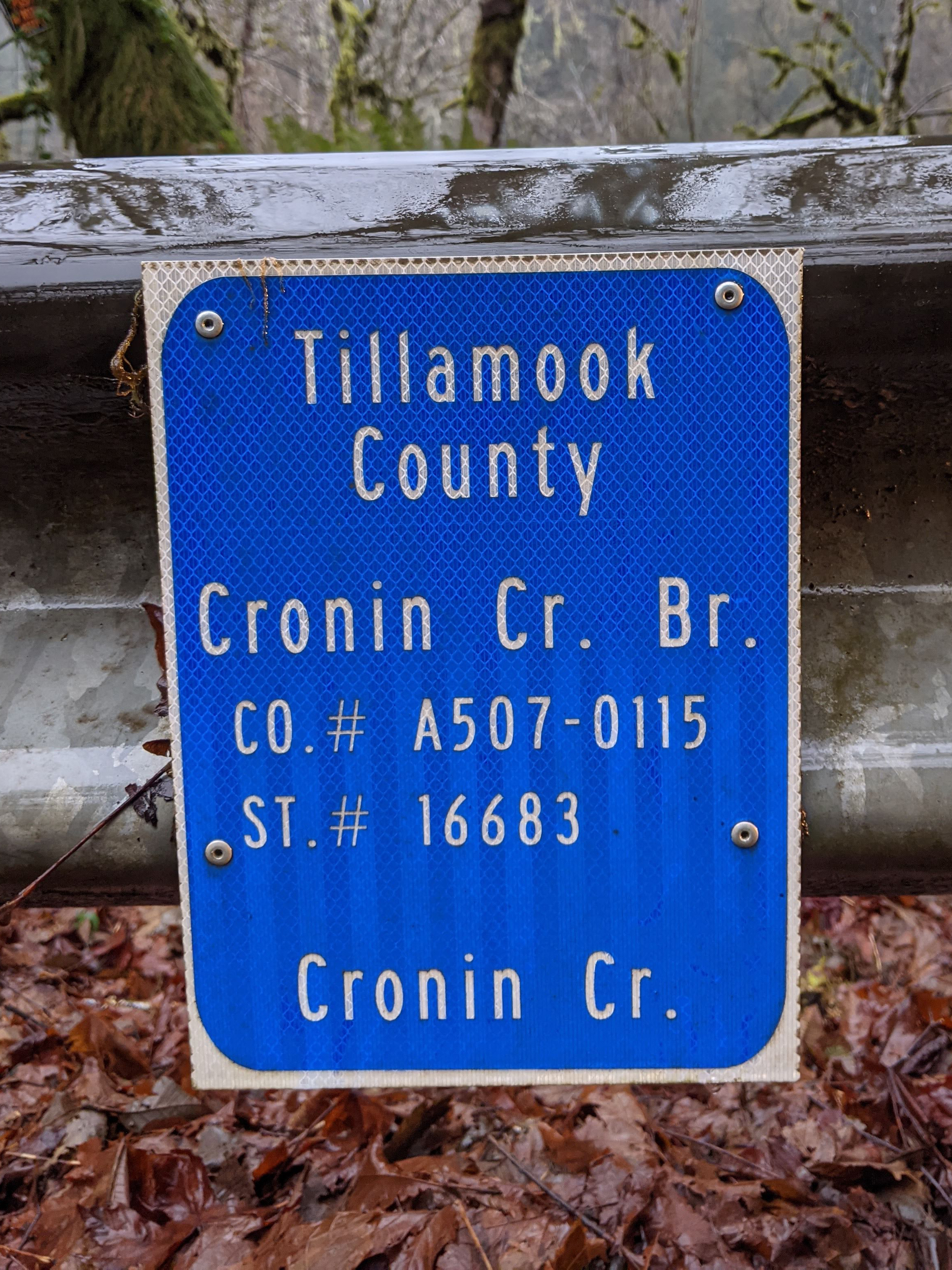
| 00:33, 3 July 2021 | 2021-01-02 tillamookco-inventory-marker 215922150.jpg (file) |  |
4.67 MB | Jonathan | A Tillamook County bridge inventory marker on Foss Road (Tillamook County #507) at the Cronin Creek Bridge over Cronin Creek.<br /> 📷 Jonathan Ledbetter<br /> 📆 2 January 2021 | 1 |
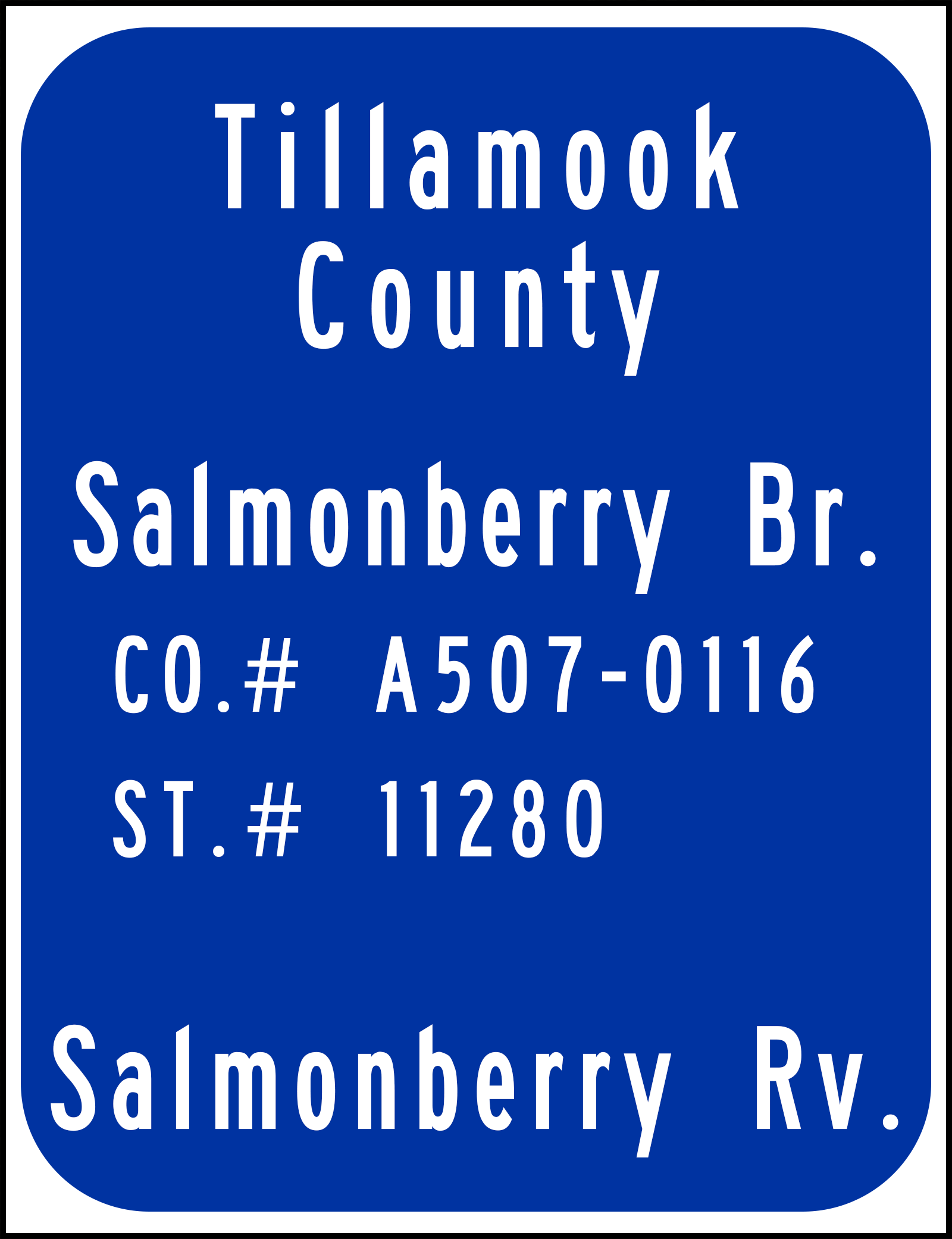
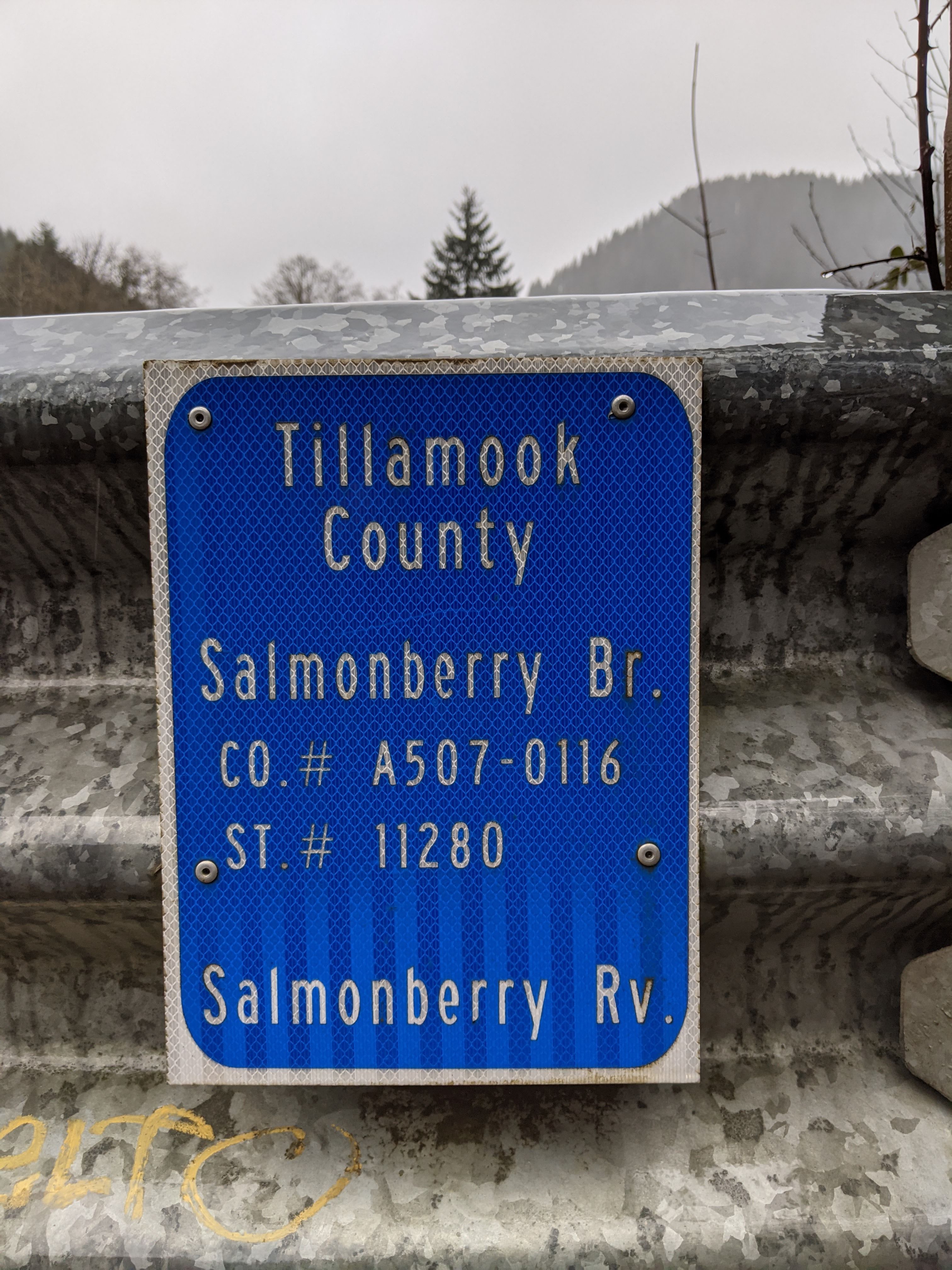
| 00:34, 3 July 2021 | 2021-01-02 tillamookco-inventory-marker 220959309.jpg (file) |  |
1.78 MB | Jonathan | A Tillamook County bridge inventory marker on Foss Road (Tillamook County #507) at the Salmonberry Bridge over the Salmonberry River.<br /> 📷 Jonathan Ledbetter<br /> 📆 2 January 2021 | 1 |
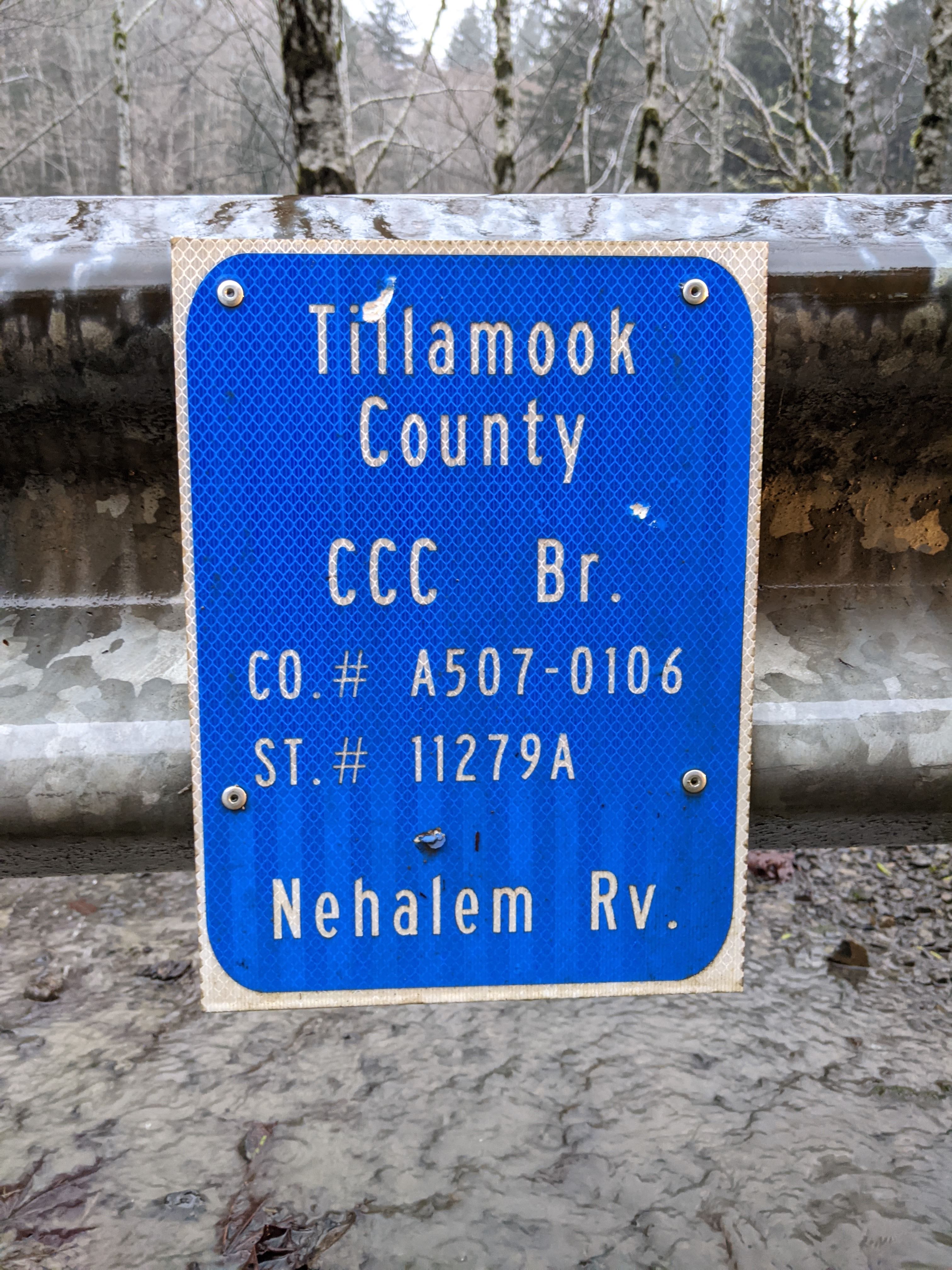
| 00:36, 3 July 2021 | 2021-01-02 tillamookco-inventory-marker 224230662.jpg (file) |  |
1.9 MB | Jonathan | A Tillamook County bridge inventory marker on Foss Road (Tillamook County #507) at the CCC Bridge over the Nehalem River.<br /> 📷 Jonathan Ledbetter<br /> 📆 2 January 2021 | 1 |
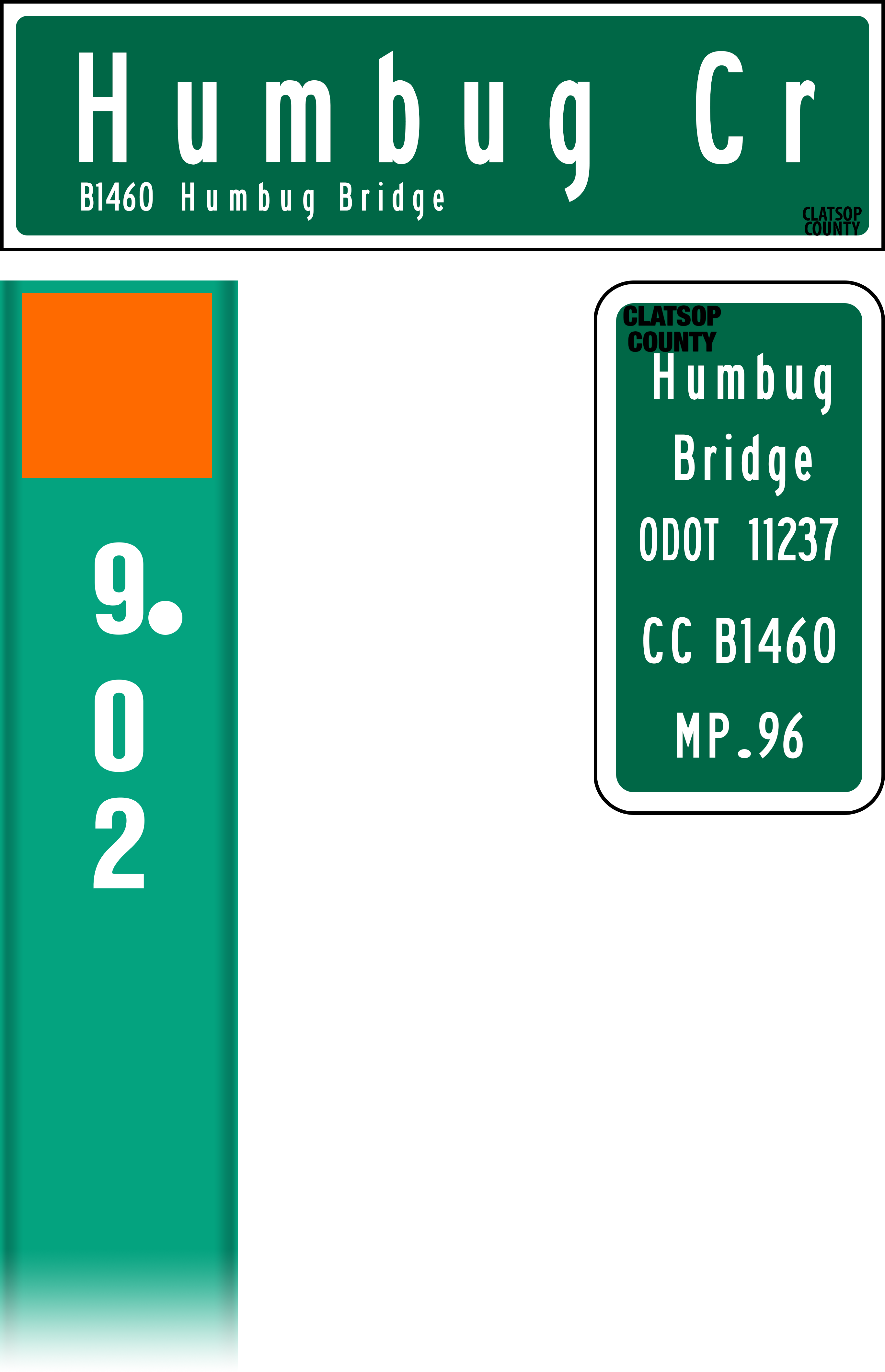
| 10:08, 3 July 2021 | Mp-county-clatsop-bridge-examples.png (file) |  |
336 KB | Jonathan | Added culvert marker flag, rearranged markers | 2 |
| 10:55, 3 July 2021 | 2021-01-02 clatsopco-inventory-marker 212350500.jpg (file) |  |
1.96 MB | Jonathan | A bridge inventory marker at MP 0.96 on Lower Nehalem Road (Clatsop County #1404) near Elsie.<br /> 📷 Jonathan Ledbetter<br /> 📆 1 January 2021 | 1 |
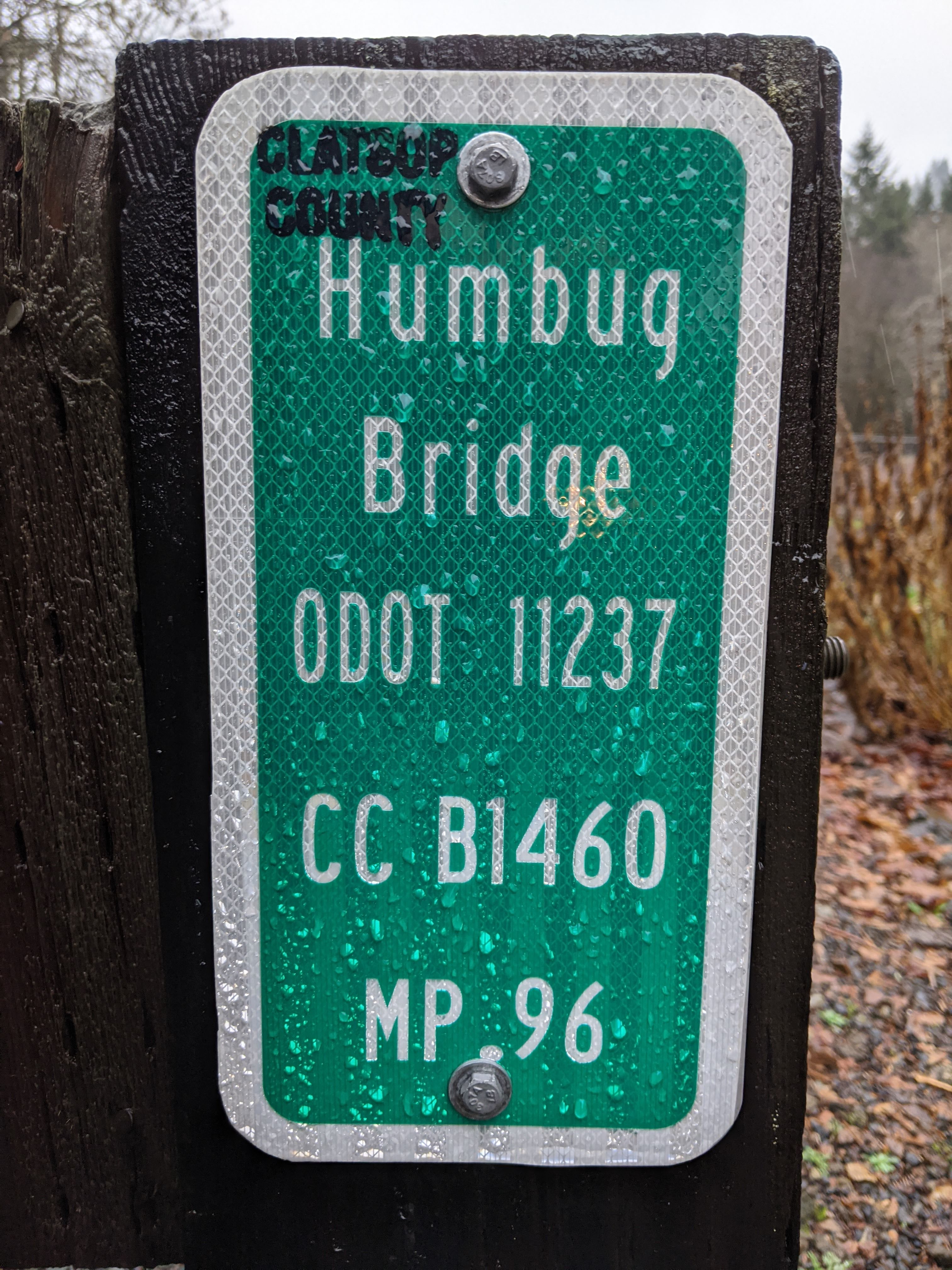
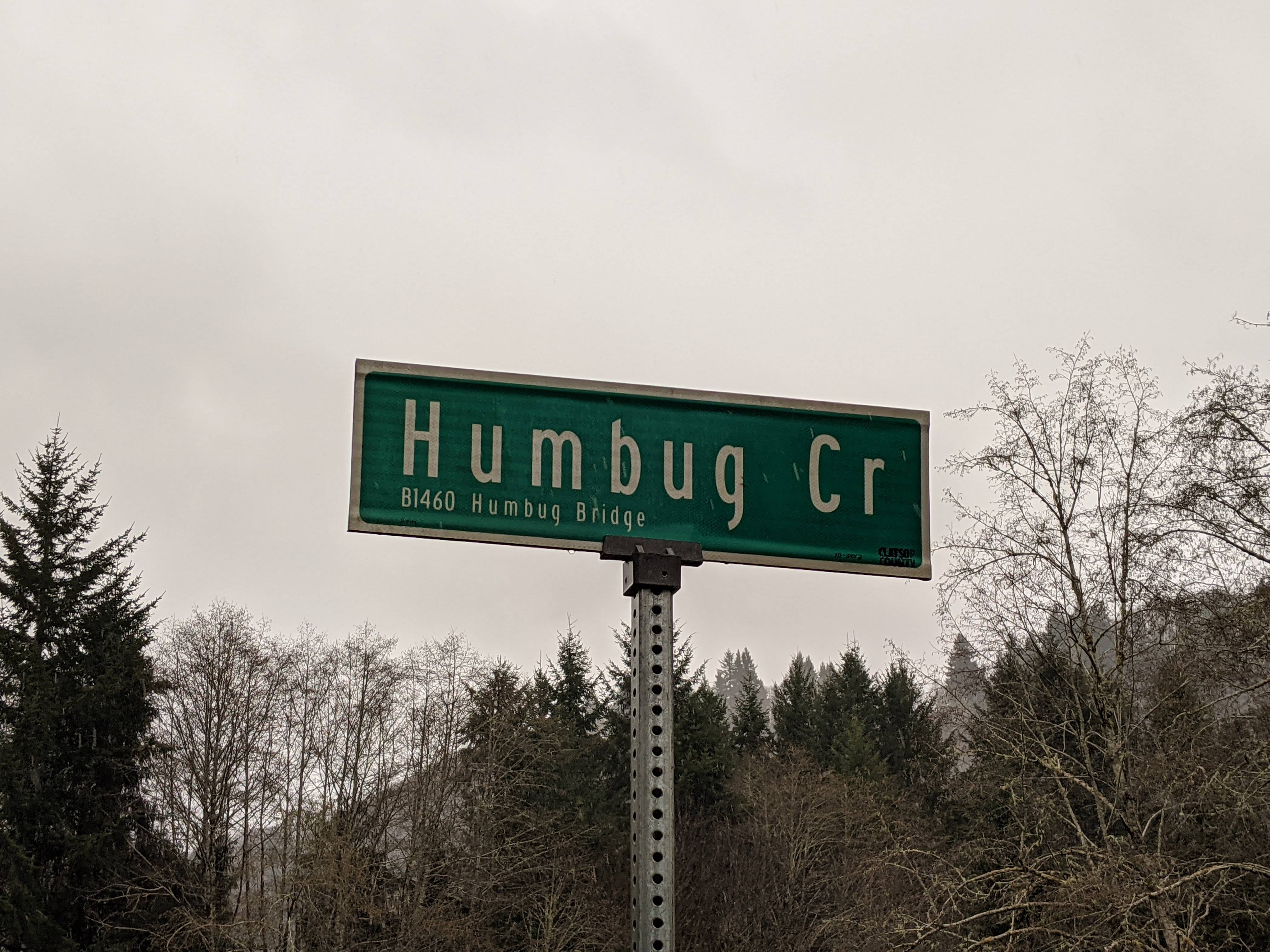
| 10:56, 3 July 2021 | 2021-01-02 clatsopco-bridge-sign 212359329.jpg (file) |  |
1.04 MB | Jonathan | A bridge sign for the Humbug Bridge over Humbug Creek on Lower Nehalem Road (Clatsop County #1404) near Elsie.<br /> 📷 Jonathan Ledbetter<br /> 📆 2 January 2021 | 1 |
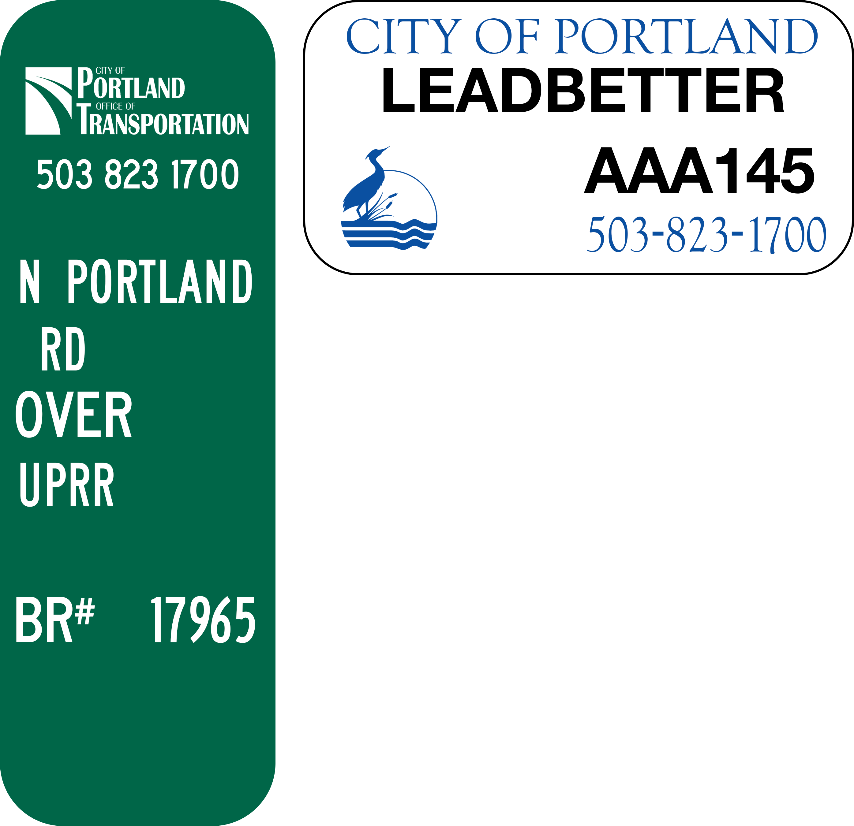
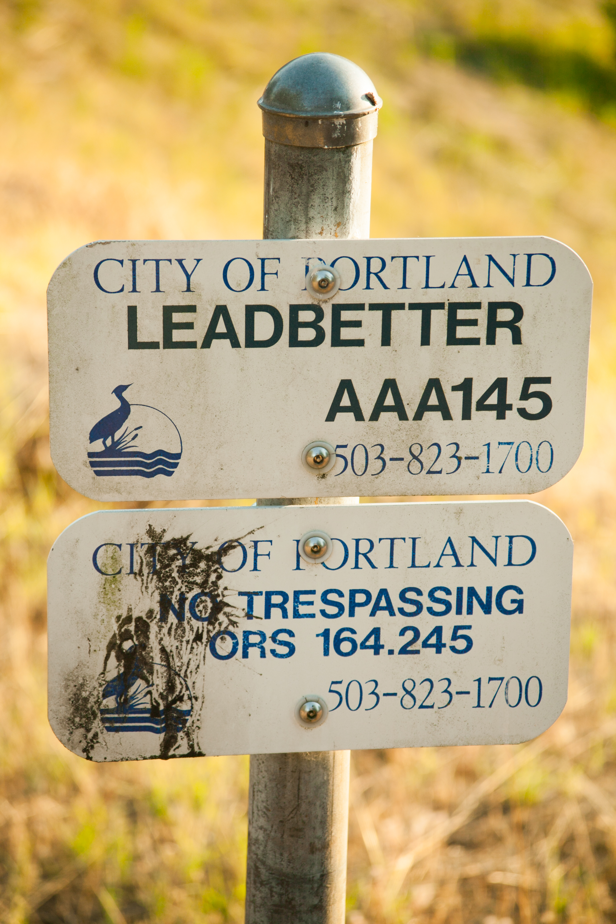
| 14:54, 3 July 2021 | Mp-city-portland-bridge.png (file) |  |
120 KB | Jonathan | An example of a bridge marker found along Portland city streets.<br /> 📷 Jonathan Ledbetter<br /> 📆 3 July 2021 | 1 |
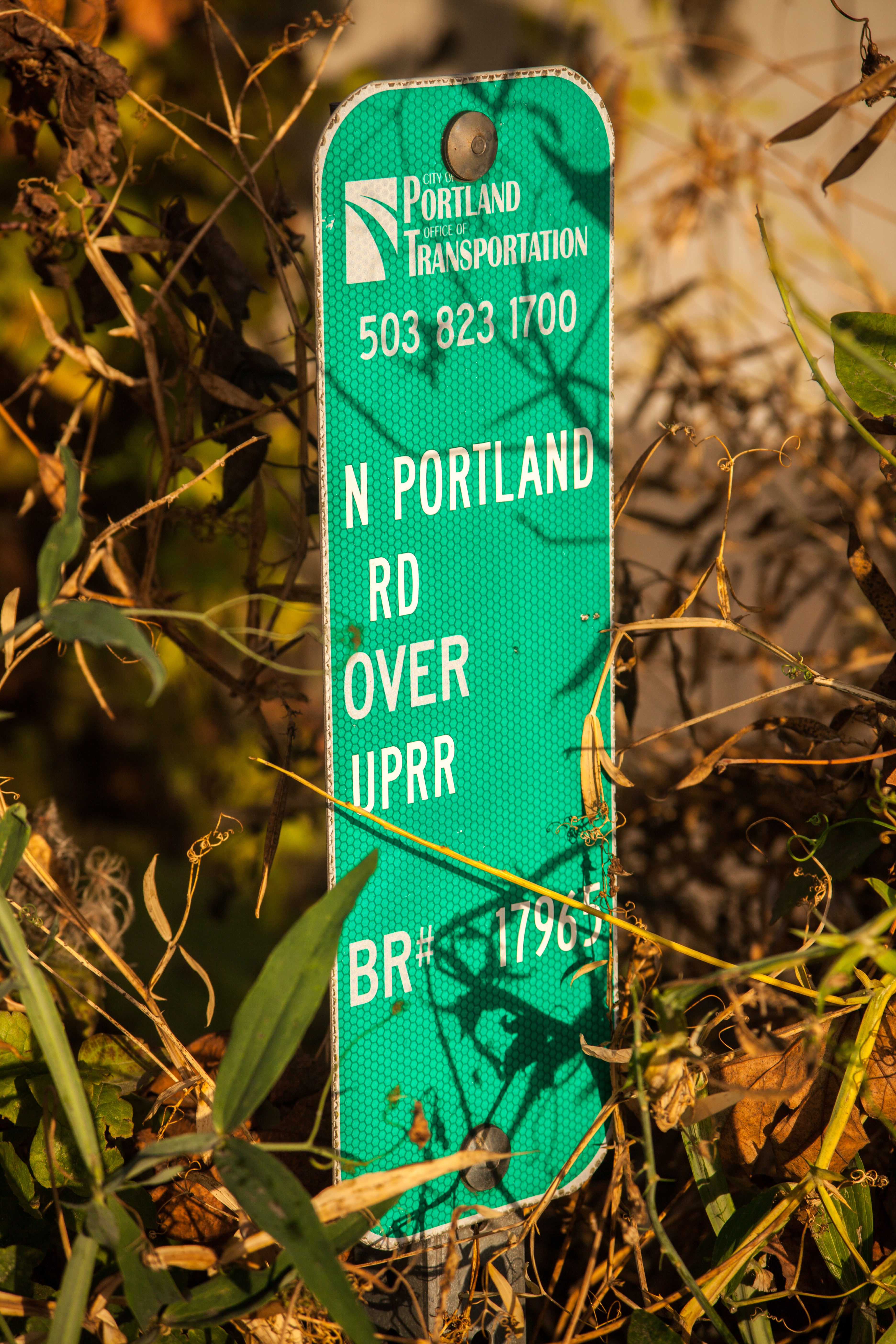
| 17:07, 3 July 2021 | 2015-10-18 portland-inventory-marker 8347.jpg (file) |  |
14.96 MB | Jonathan | A bridge inventory marker for the bridge over the Union Pacific Railroad tracks on N Portland Road near St. Johns.<br /> 📷 Jonathan Ledbetter<br /> 📆 18 October 2015 | 1 |
| 02:51, 4 July 2021 | Mp-city-portland-bridge-culvert-examples.png (file) |  |
267 KB | Jonathan | Examples of bridge and culvert markers found along Portland city streets.<br /> 📷 Jonathan Ledbetter<br /> 📆 4 July 2021 | 1 |
| 03:09, 4 July 2021 | 2014-08-01 portland-culvert-marker 5174.jpg (file) |  |
4.68 MB | Jonathan | A Portland Bureau of Environmental Services culvert marker near Kelley Point.<br /> 📷 Jonathan Ledbetter<br /> 📆 1 August 2014 | 1 |
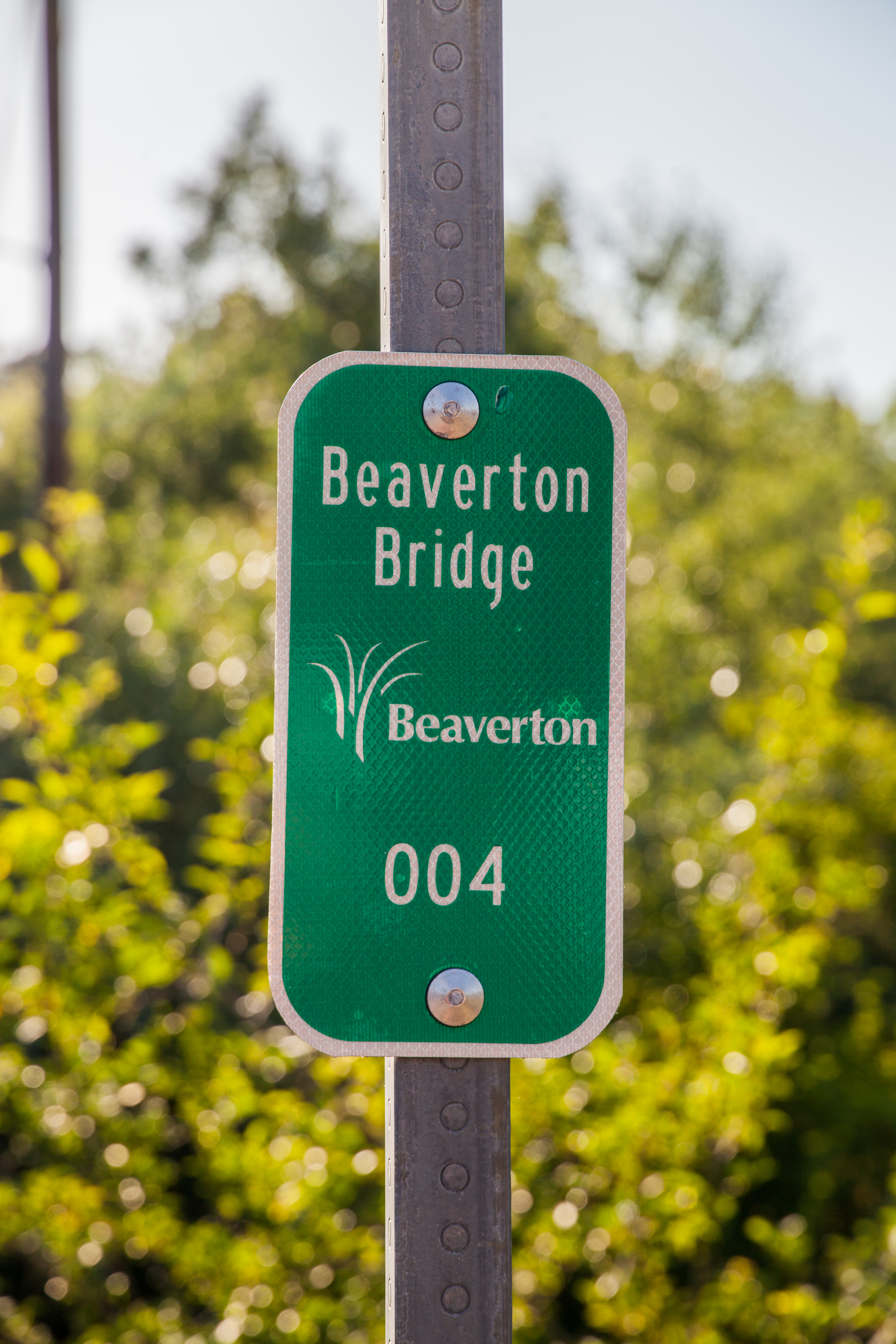
| 00:26, 5 July 2021 | 2021-07-04 beaverton-bridge-marker 3682.jpg (file) |  |
12.37 MB | Jonathan | A Beaverton bridge inventory marker on the bridge over Fanno Creek on Hall Blvd.<br /> 📷 Jonathan Ledbetter<br /> 📆 4 July 2021 | 1 |
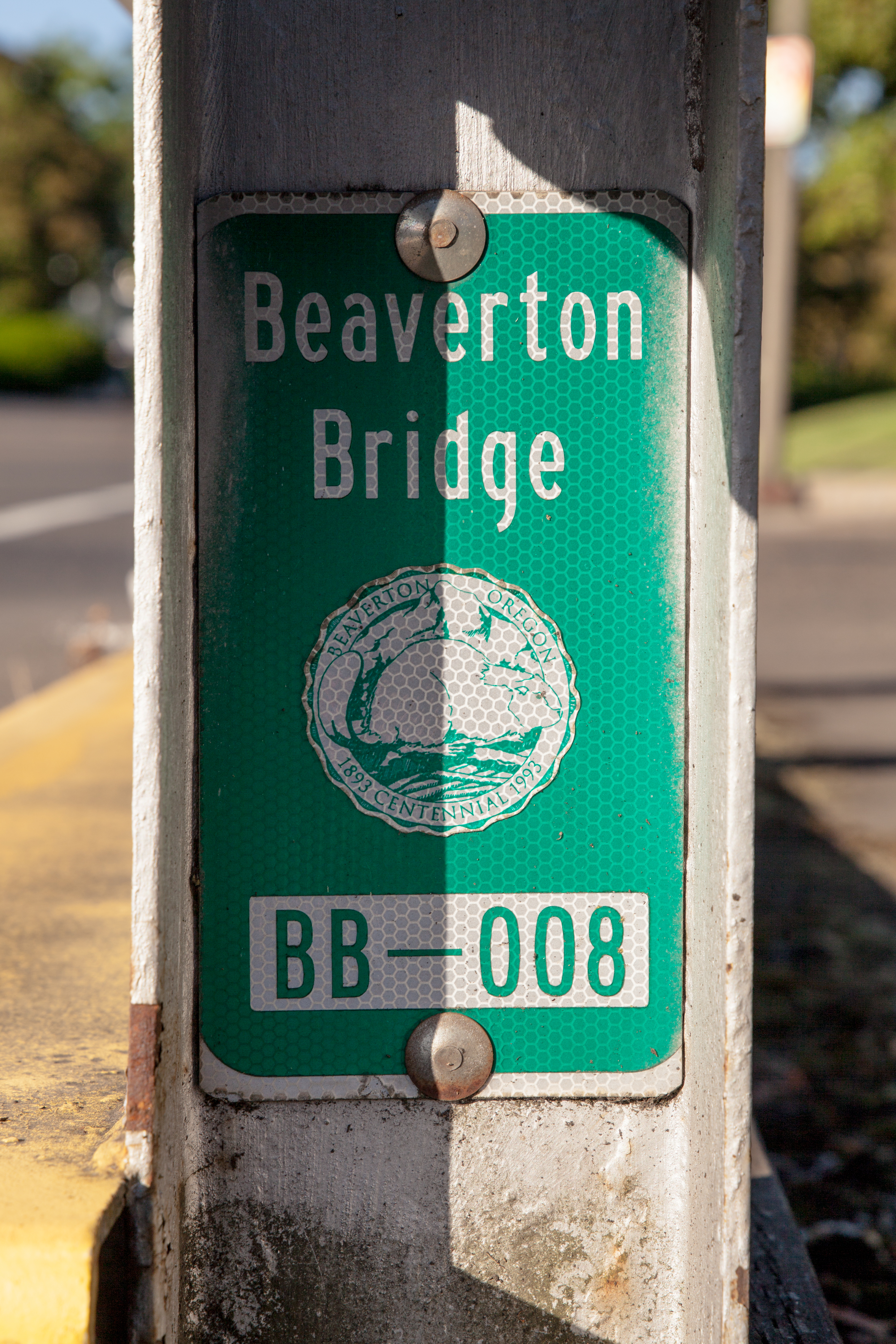
| 00:30, 5 July 2021 | 2021-07-04 beaverton-bridge-marker-seal 3703.jpg (file) |  |
13.6 MB | Jonathan | A Beaverton bridge inventory marker with the city logo on the bridge over Fanno Creek on Hall Blvd.<br /> 📷 Jonathan Ledbetter<br /> 📆 4 July 2021 | 1 |
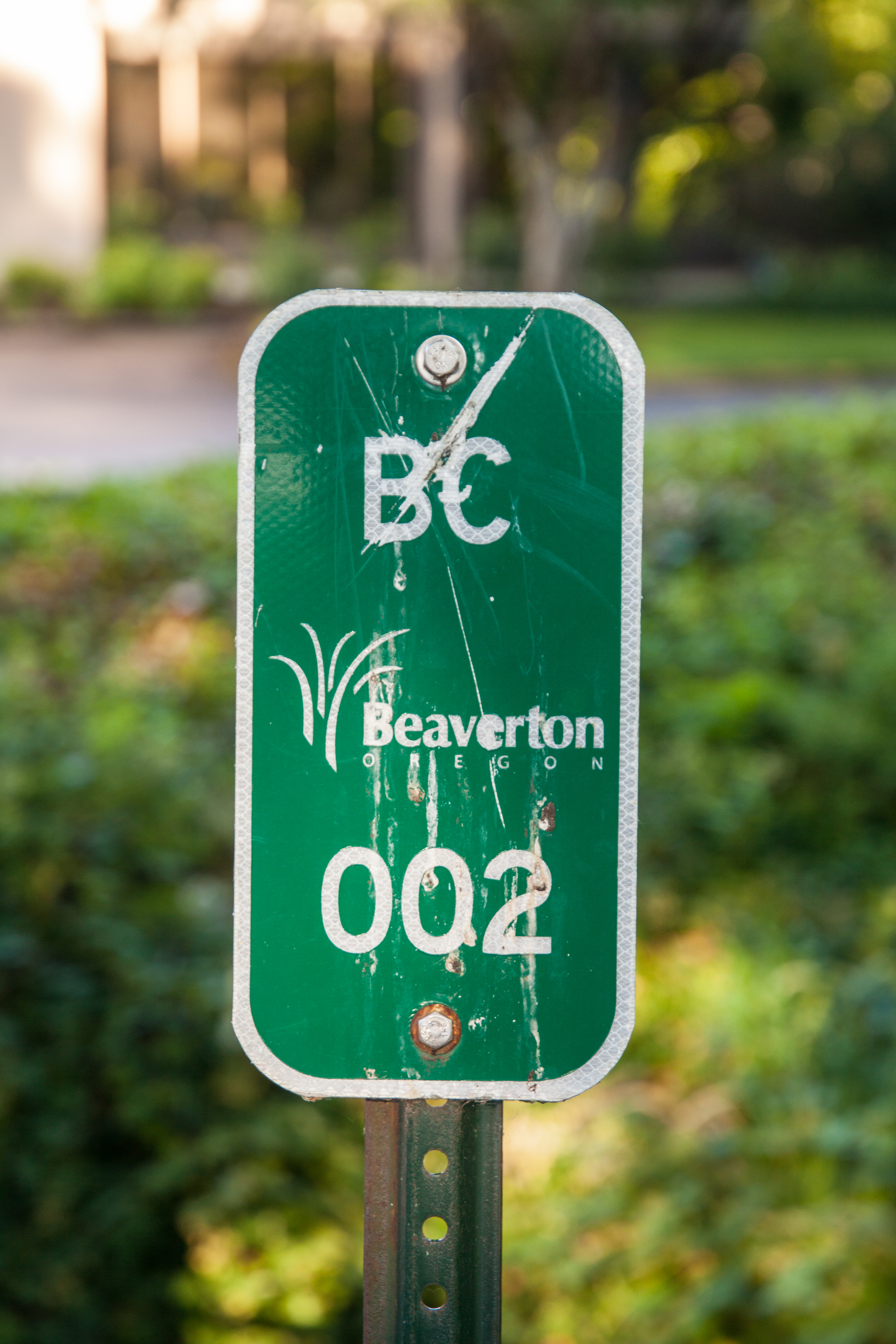
| 01:05, 5 July 2021 | 2021-07-04 beaverton-culvert-marker 3698.jpg (file) |  |
13.49 MB | Jonathan | A Beaverton culvert inventory marker with the city logo on SW Griffith Dr.<br /> 📷 Jonathan Ledbetter<br /> 📆 4 July 2021 | 1 |
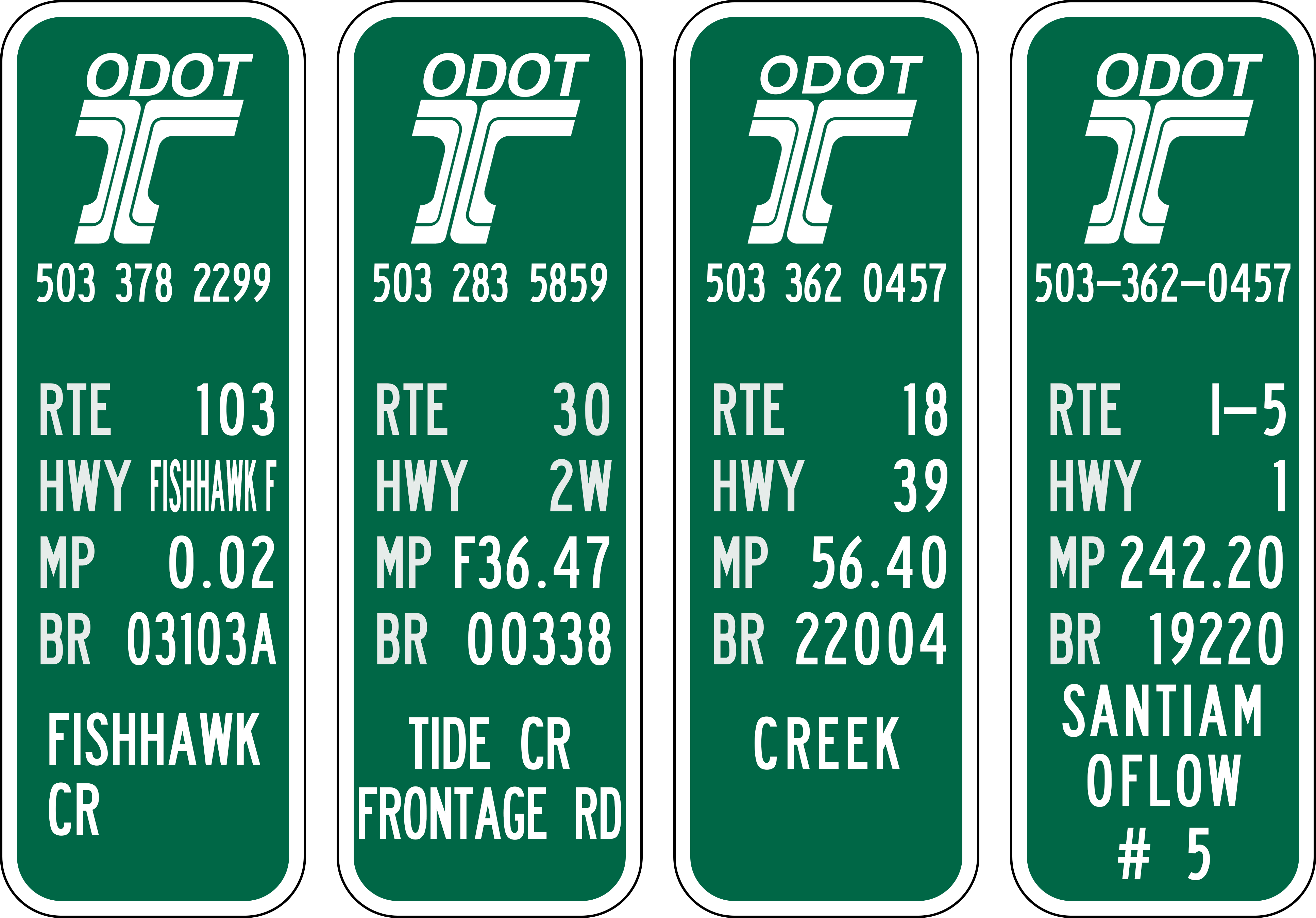
| 00:50, 12 July 2021 | Odot-bridge-inventory-marker-examples.png (file) |  |
367 KB | Jonathan | Examples of ODOT bridge inventory markers found along Oregon state highways.<br /> 📷 Jonathan Ledbetter<br /> 📆 12 July 2021 | 1 |