File list
Jump to navigation
Jump to search
This special page shows all uploaded files.
| Date | Name | Thumbnail | Size | User | Description | Versions |
|---|---|---|---|---|---|---|
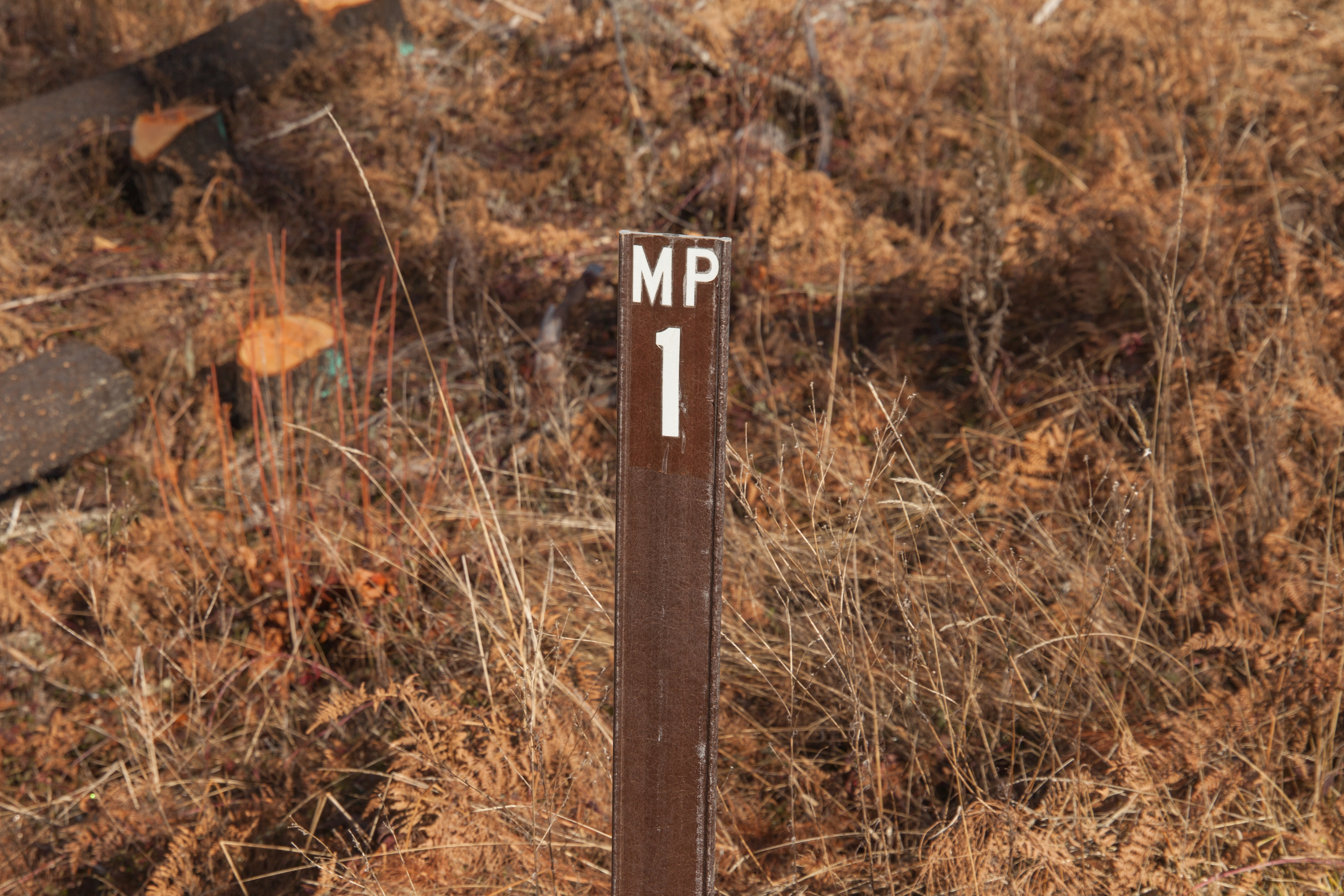
| 01:13, 9 April 2025 | 2025-01-22 hoodnf-milepost-nf46 9174.jpg (file) |  |
6.6 MB | Jonathan | MP 1 along National Forest 46 south of Ripplebrook.<br /> 📷 Jonathan Ledbetter<br /> 📆 22 January 2025 | 1 |
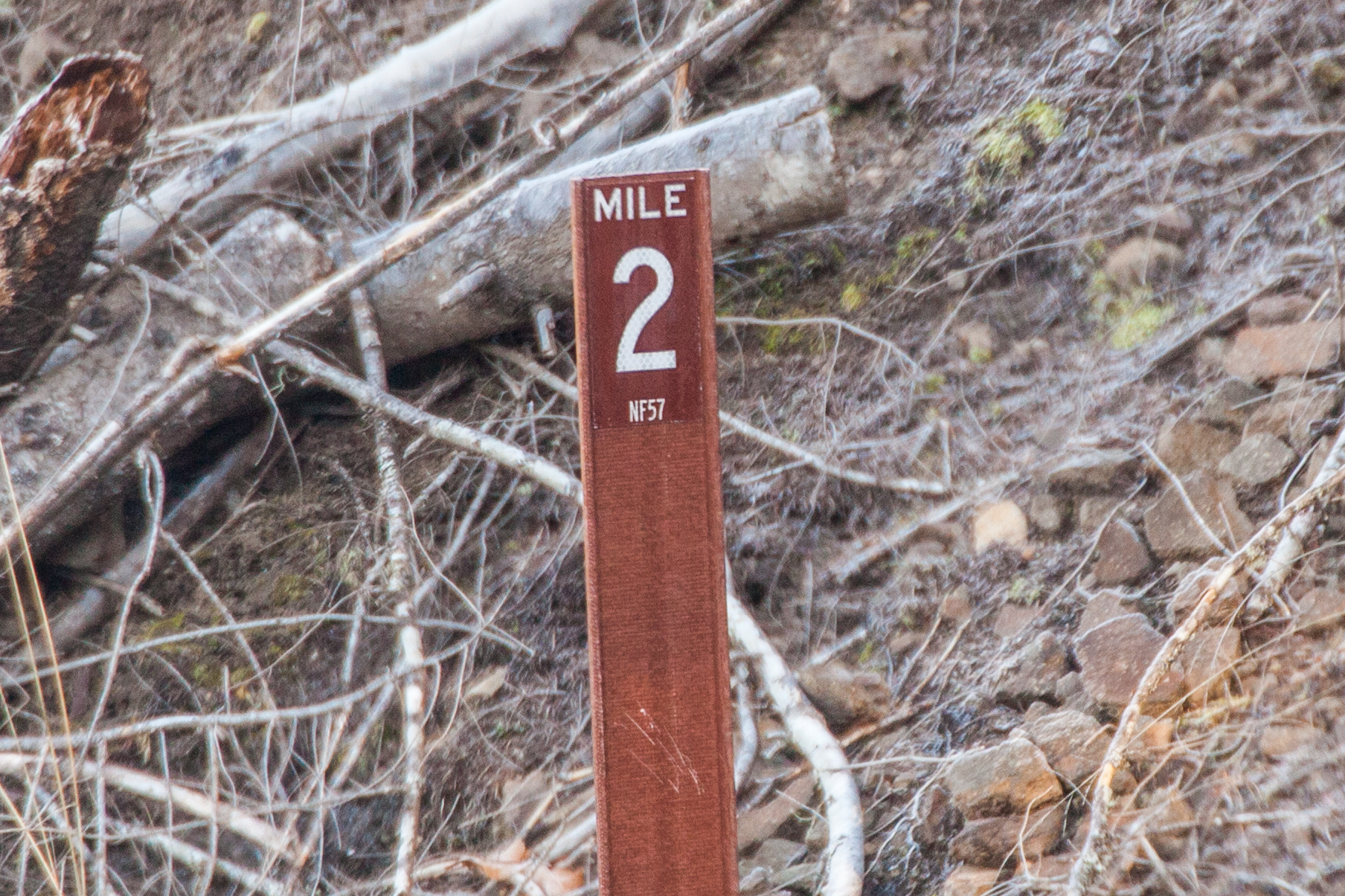
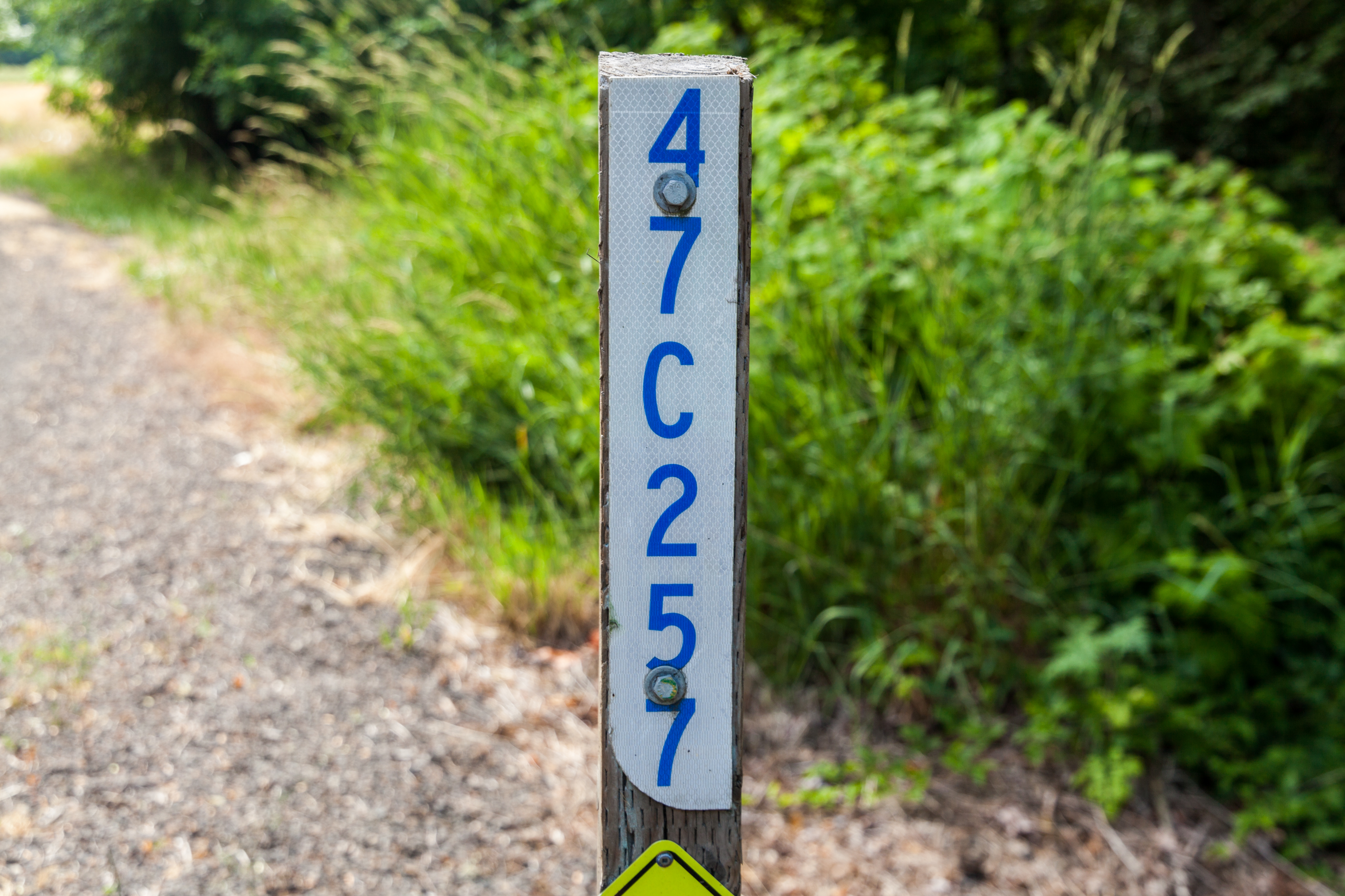
| 01:17, 9 April 2025 | 2025-01-22 hoodnf-milepost-nf57-new 9327.jpg (file) |  |
1.89 MB | Jonathan | New style MP 2 along National Forest 57 between Ripplebrook and Lake Harriet. It is theorized that these mileposts were added during repair/reconstruction efforts after the 2020 Riverside Fire.<br /> 📷 Jonathan Ledbetter<br /> 📆 22 January 2025 | 1 |
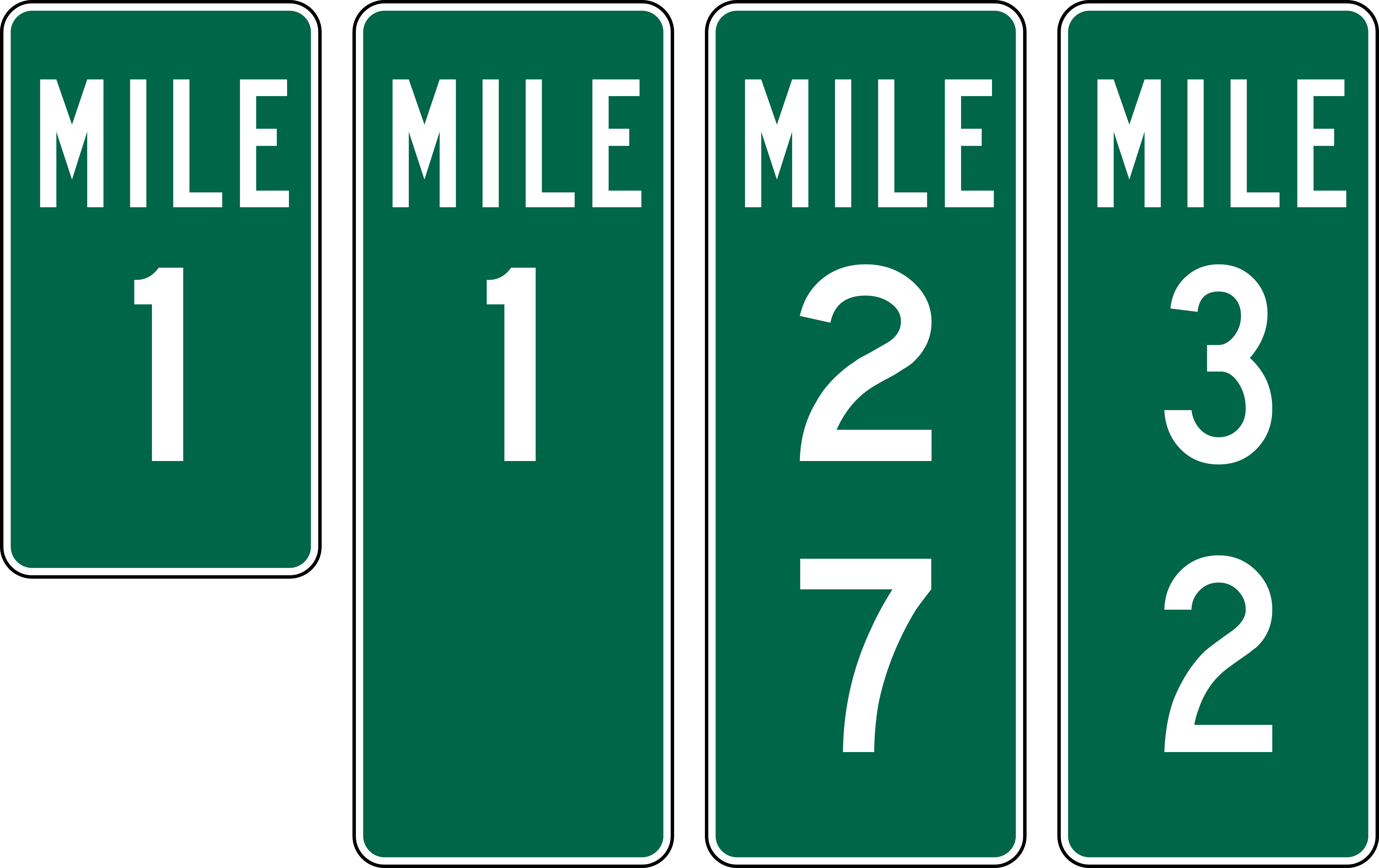
| 17:25, 9 April 2025 | Mp-sf-tillamook-examples.png (file) |  |
56 KB | Jonathan | Examples of mileposts found along roads in both Clatsop and Tillamook State Forests.<br /> 📷 Jonathan Ledbetter<br /> 📆 9 April 2025 | 1 |
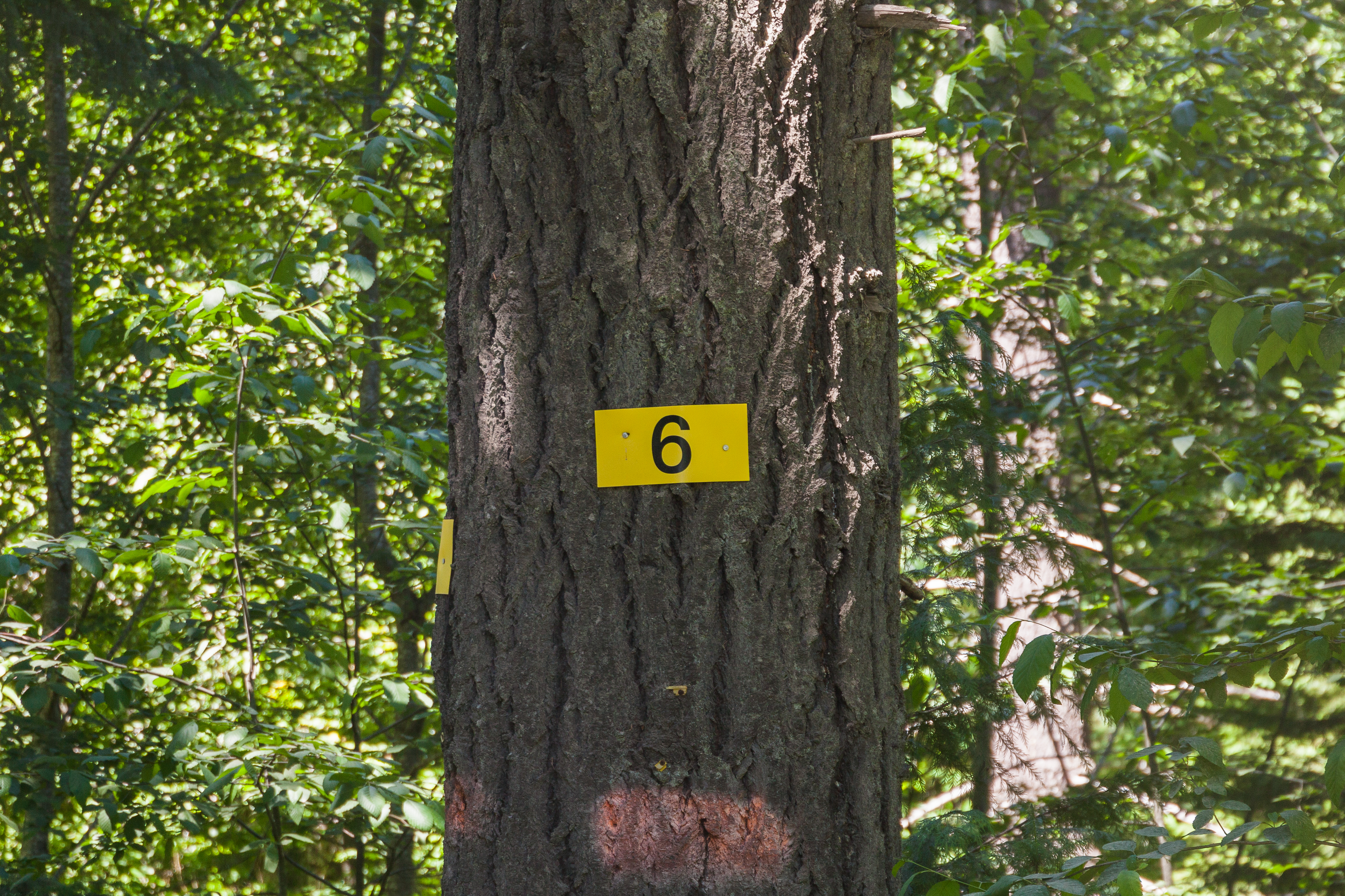
| 17:50, 9 April 2025 | 2024-07-09 cochran-rd-mp-6 6485.jpg (file) |  |
12.33 MB | Jonathan | MP 6 along Cochran Road near Cochran. The font used on the sign is Helvetica.<br /> 📷 Jonathan Ledbetter<br /> 📆 9 July 2024 | 1 |
| 17:51, 9 April 2025 | 2024-07-09 cochran-rd-mp-4.5 6601.jpg (file) |  |
6.43 MB | Jonathan | MP 4.5 along Cochran Road west of Reehers Camp. The font used on the sign is similar to Frutiger or Calibri.<br /> 📷 Jonathan Ledbetter<br /> 📆 9 July 2024 | 1 |
| 22:20, 9 April 2025 | Mp-sf-clatsop-examples.png (file) |  |
20 KB | Jonathan | Examples of mileposts found along roads in the Clatsop State Forest.<br /> 📷 Jonathan Ledbetter<br /> 📆 9 April 2025 | 1 |
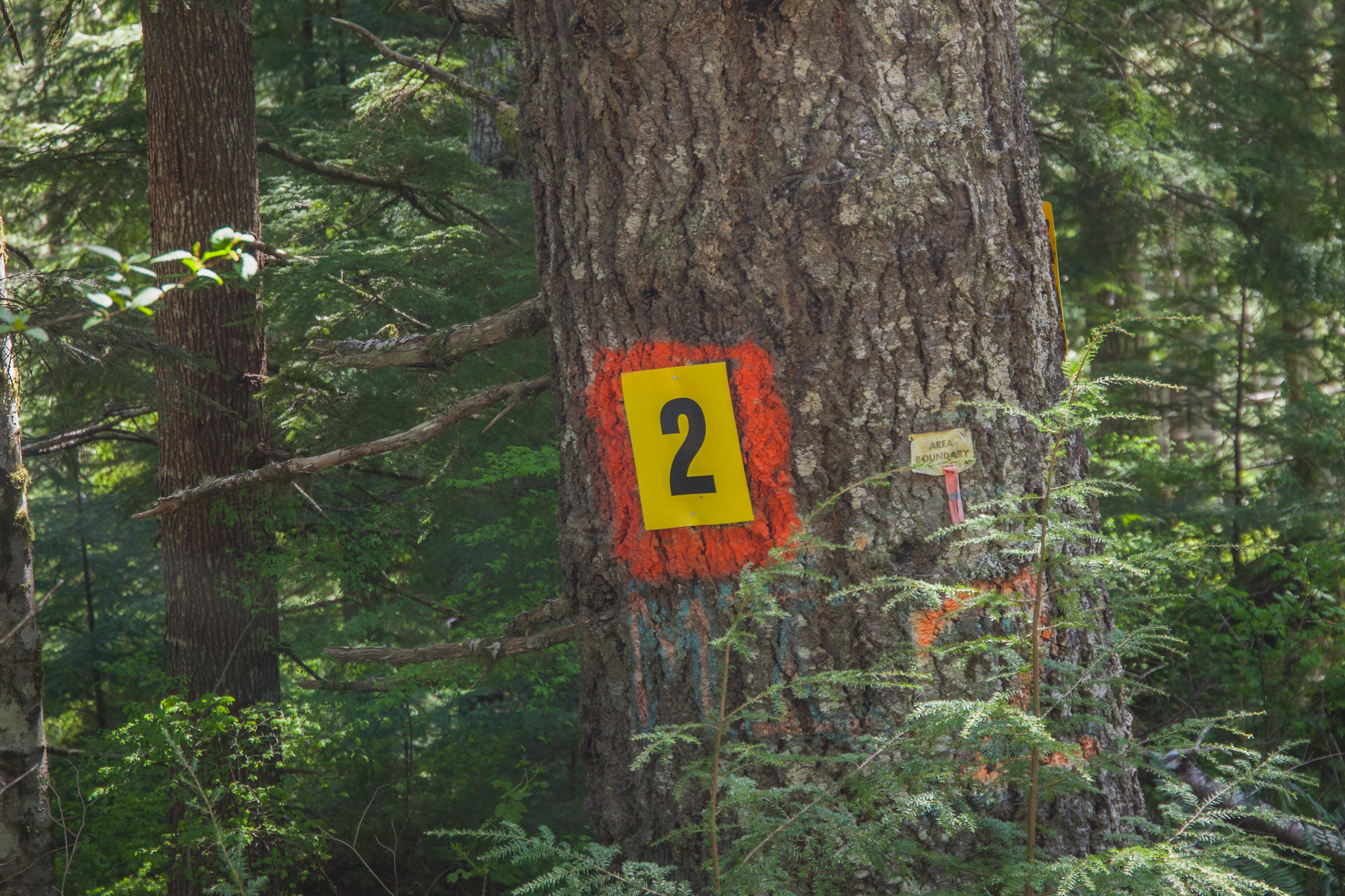
| 22:31, 9 April 2025 | 2019-05-08 quartz-cr-rd-mp-2 0555.jpg (file) |  |
10.32 MB | Jonathan | MP 2 along Quartz Creek Road near Flat Iron Mountain. The font used on the sign is Helvetica Inserat.<br /> 📷 Jonathan Ledbetter<br /> 📆 8 May 2019 | 1 |
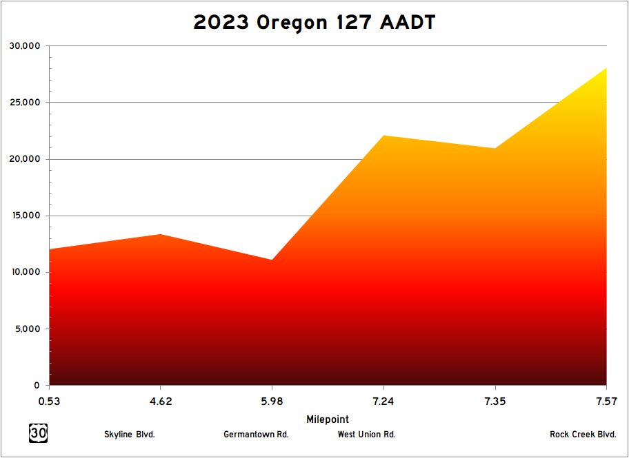
| 18:26, 7 May 2025 | 2023 or-127 aadt.png (file) |  |
20 KB | Jonathan | Graphical representation of ODOT annual average daily traffic (AADT) data for OR-127 from their 2023 Transportation Volume Tables. | 1 |
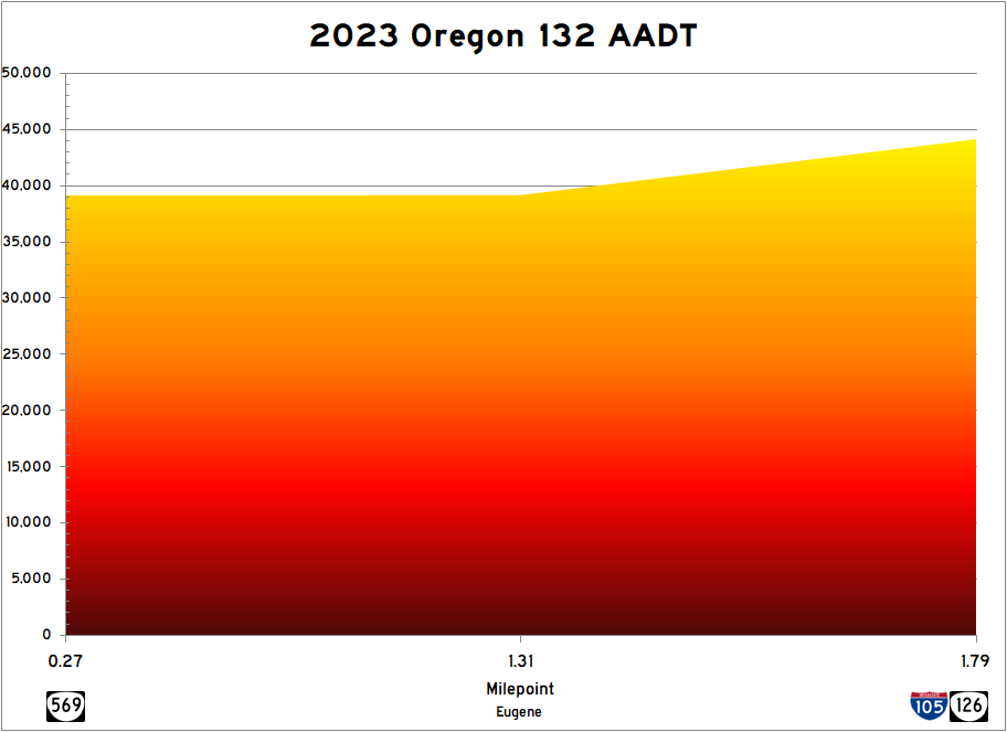
| 01:08, 8 May 2025 | 2023 or-132 aadt.png (file) |  |
20 KB | Jonathan | Graphical representation of ODOT annual average daily traffic (AADT) data for OR-132 from their 2023 Transportation Volume Tables. | 1 |
| 23:17, 14 May 2025 | OR 224.png (file) |  |
31 KB | Jonathan | Modern version of route shield for OR-224 | 1 |
| 23:19, 14 May 2025 | NF 46.png (file) |  |
75 KB | Jonathan | Modern version of route shield for NF-46 | 1 |
| 23:20, 14 May 2025 | OR 224 1932.png (file) |  |
88 KB | Jonathan | 1932 version of the route shield for OR-224 | 1 |
| 23:22, 14 May 2025 | OR 225 1932.png (file) |  |
87 KB | Jonathan | 1932 version of the route shield for OR-225 | 1 |
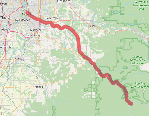
| 23:24, 14 May 2025 | OR 224-map.png (file) |  |
295 KB | Jonathan | Map of modern OR-224 alignment | 1 |
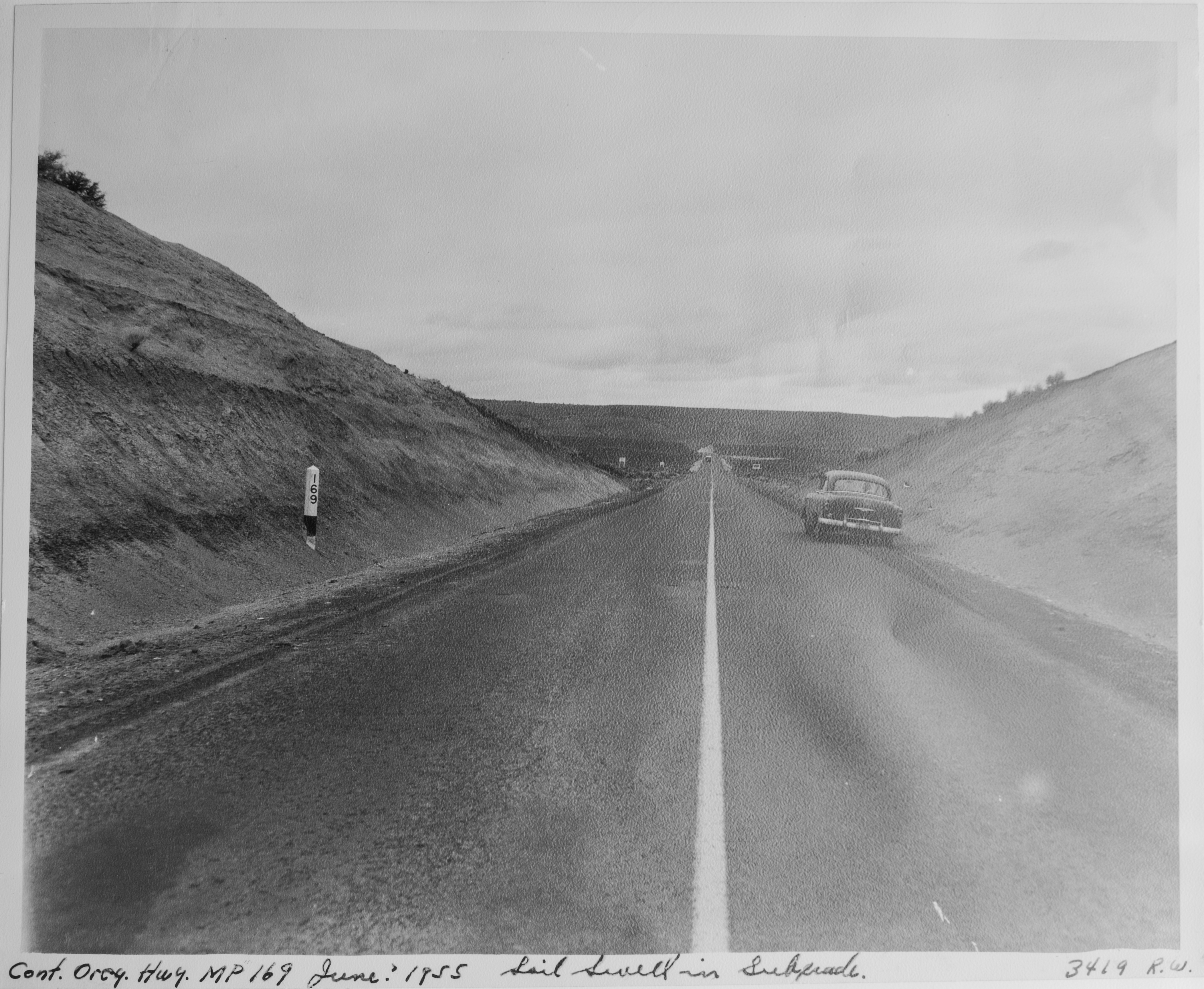
| 22:28, 18 June 2025 | 1955-06c - OSHD 3419 - Central Oregon Highway MP 169.jpg (file) |  |
6.06 MB | Jonathan | A desolate section of the Central Oregon Highway near Stinkingwater Creek. A wooden milepost reading "169" can be seen on the left.<br /> 📆 Unknown<br /> 🖼 Oregon State Highway Division via [https://www.oregon.gov/odot/about/pages/library.aspx ODOT Library]<br /> 🆔 3419 | 1 |
| 15:46, 28 June 2025 | 1936-02 oshd row 5B-2-14 1.jpg (file) |  |
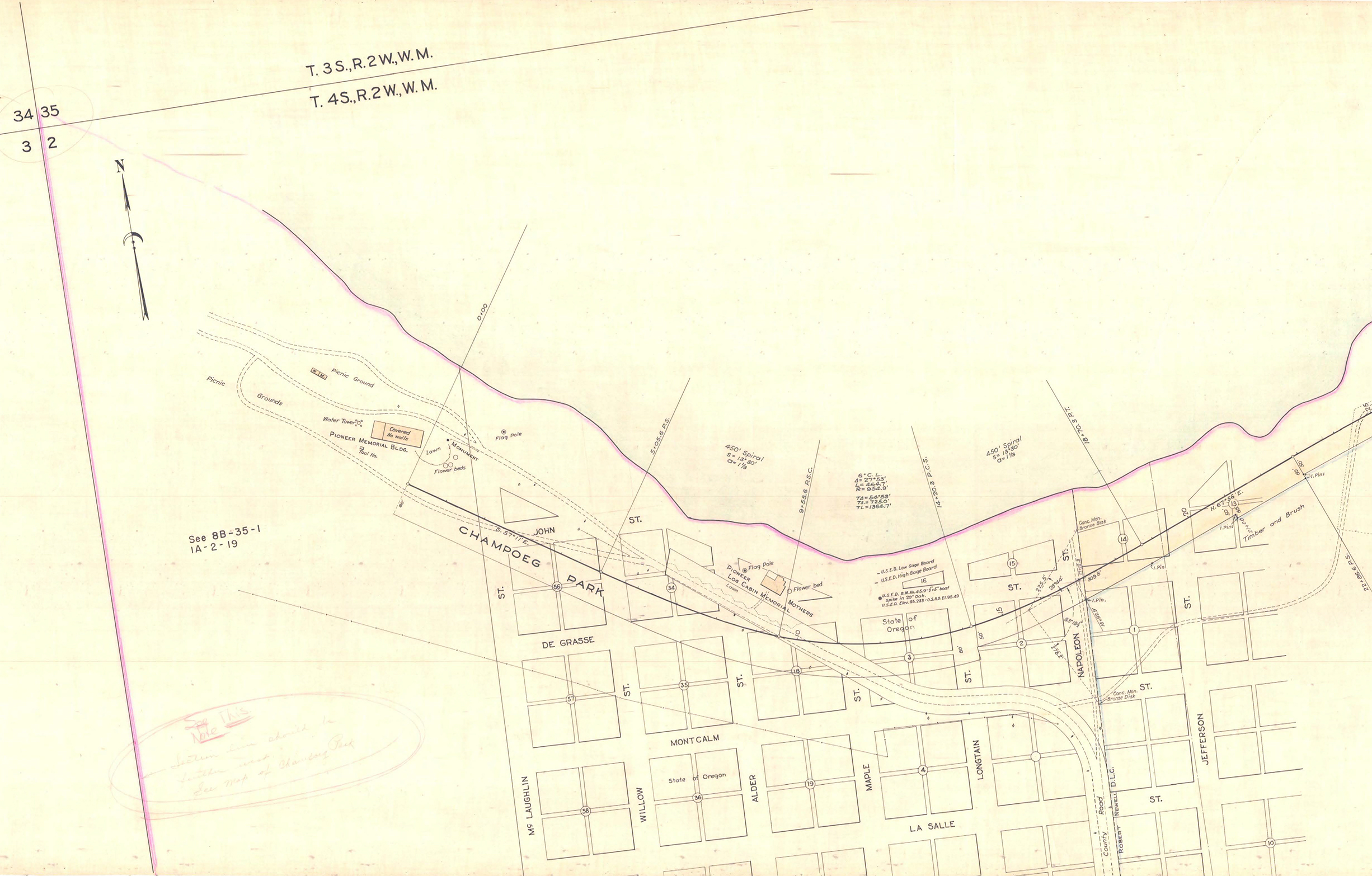
1.55 MB | Jonathan | Close-up of the Champoeg Memorial Highway located line ROW map showing the western terminus and routing through the Champoeg State Heritage Area.<br /> 📆 February 1936<br /> 🖼 Oregon State Highway Division<br /> 🆔 5B-2-14 | 1 |
| 15:47, 28 June 2025 | 1936-02 oshd row 5B-2-14 2.jpg (file) |  |
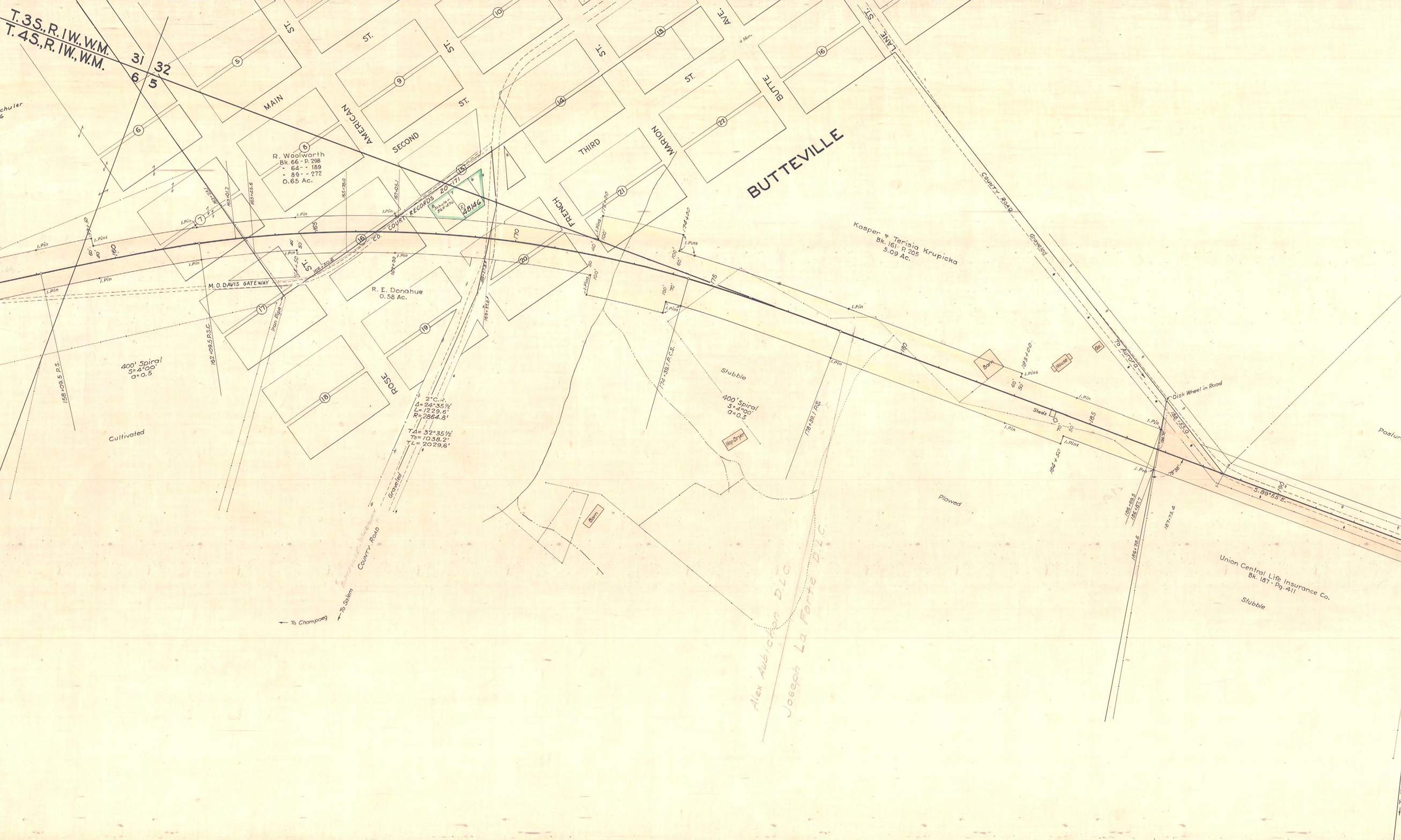
1.83 MB | Jonathan | Close-up of the Champoeg Memorial Highway located line ROW map showing the routing through Butteville.<br /> 📆 February 1936<br /> 🖼 Oregon State Highway Division<br /> 🆔 5B-2-14 | 1 |
| 15:50, 28 June 2025 | 1936-02 oshd row 5B-2-14 3.jpg (file) |  |
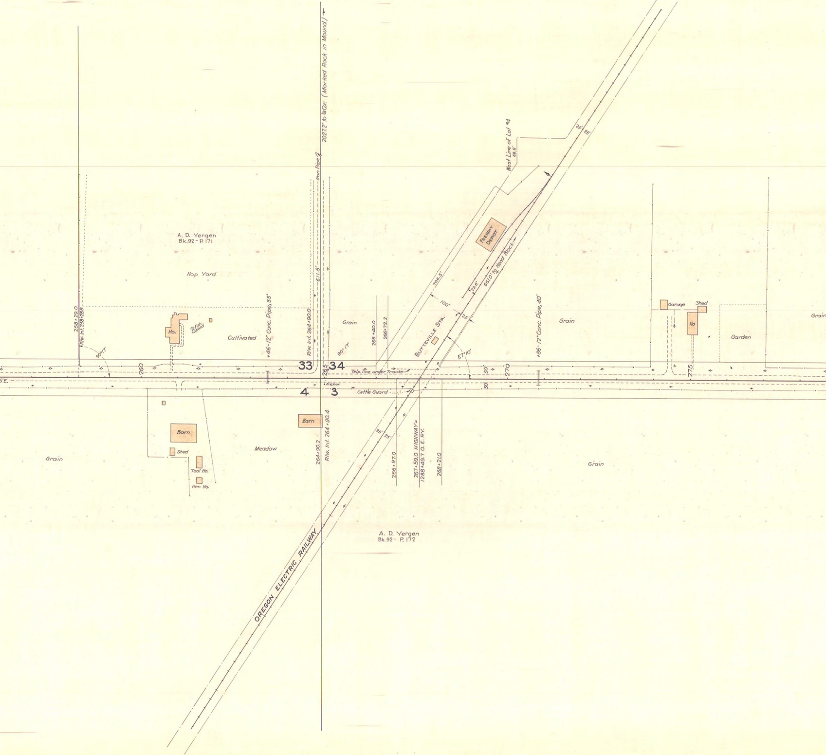
800 KB | Jonathan | Close-up of the Champoeg Memorial Highway located line ROW map showing the routing near Butteville Station.<br /> 📆 February 1936<br /> 🖼 Oregon State Highway Department<br /> 🆔 5B-2-14 | 1 |
| 15:52, 28 June 2025 | 1936-02 oshd row 5B-2-14 4.jpg (file) |  |
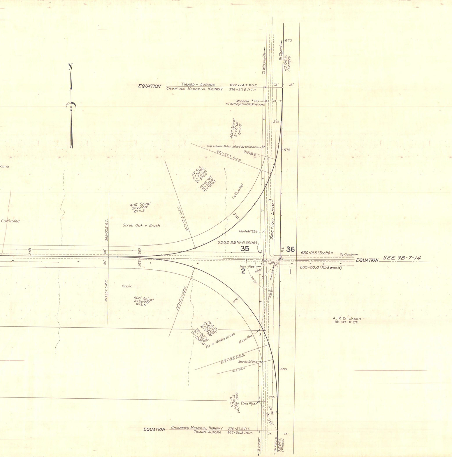
860 KB | Jonathan | Close-up of the Champoeg Memorial Highway located line ROW map showing the eastern terminus at the Beaverton-Aurora Highway (labeled "Tigard-Aurora Highway") near Aurora.<br /> 📆 February 1936<br /> 🖼 Oregon State Highway Department<br /> 🆔 5B-2-14 | 1 |
| 22:24, 2 July 2025 | Mp-bia-warmsprings-examples.png (file) |  |
121 KB | Jonathan | Examples of mileposts along Warm Springs Reservation roads which conform to the 1971 Edition of the MUTCD.<br /> 📷 Jonathan Ledbetter<br /> 📆 2 July 2025 | 1 |
| 20:13, 9 July 2025 | Mp-county-marion-culvert.png (file) |  |
33 KB | Jonathan | An example of a culvert marker found along Marion County roads.<br /> 📷 Jonathan Ledbetter<br /> 📆 9 July 2025 | 1 |
| 20:24, 9 July 2025 | 2025-06-22 marionco-inventory-marker 1025.jpg (file) |  |
10.17 MB | Jonathan | A Marion County culvert inventory marker at on Champoeg Road NE over Ryan Creek.<br /> 📷 Jonathan Ledbetter<br /> 📆 22 June 2025 | 1 |
| 00:28, 17 July 2025 | 2025-07-12 wooden-milepost-43 184449846.jpg (file) |  |
6.76 MB | Jonathan | Wooden milepost 43 along a 1952 realignment of the Historic Columbia River Highway, as found on US-30/Historic US-30/Wa Na Pa Street in Cascade Locks.<br /> 📷 Jonathan Ledbetter<br /> 📆 12 July 2025 | 1 |
| 19:32, 18 July 2025 | 2025-07-13 warmsprings-milepost 1495.jpg (file) |  |
9.67 MB | Jonathan | A photo of a standard D10-2 milepost on BIA-3 between Wapinitia and Simnasho inside the Warm Springs Reservation.<br /> 📷 Jonathan Ledbetter<br /> 📆 13 July 2025 | 1 |
| 22:31, 18 July 2025 | 2025-07-13 hoodnf-nf43-mp-5 1534.jpg (file) |  |
14.11 MB | Jonathan | MP 5 along National Forest 43 north of US-26.<br /> 📷 Jonathan Ledbetter<br /> 📆 13 July 2025 | 1 |
| 20:20, 7 August 2025 | Ohs milton-miller.jpg (file) |  |
263 KB | Jonathan | A photo of Milton A. Miller, a controversial politician who played a pivotal role in his attempts to route a highway to Champoeg Park.<br /> 📆 Unknown<br /> 🖼 Oregon Historical Society via J.A. Hussey's ''Champoeg: Place of Transition'' (1967) p. 283 | 1 |
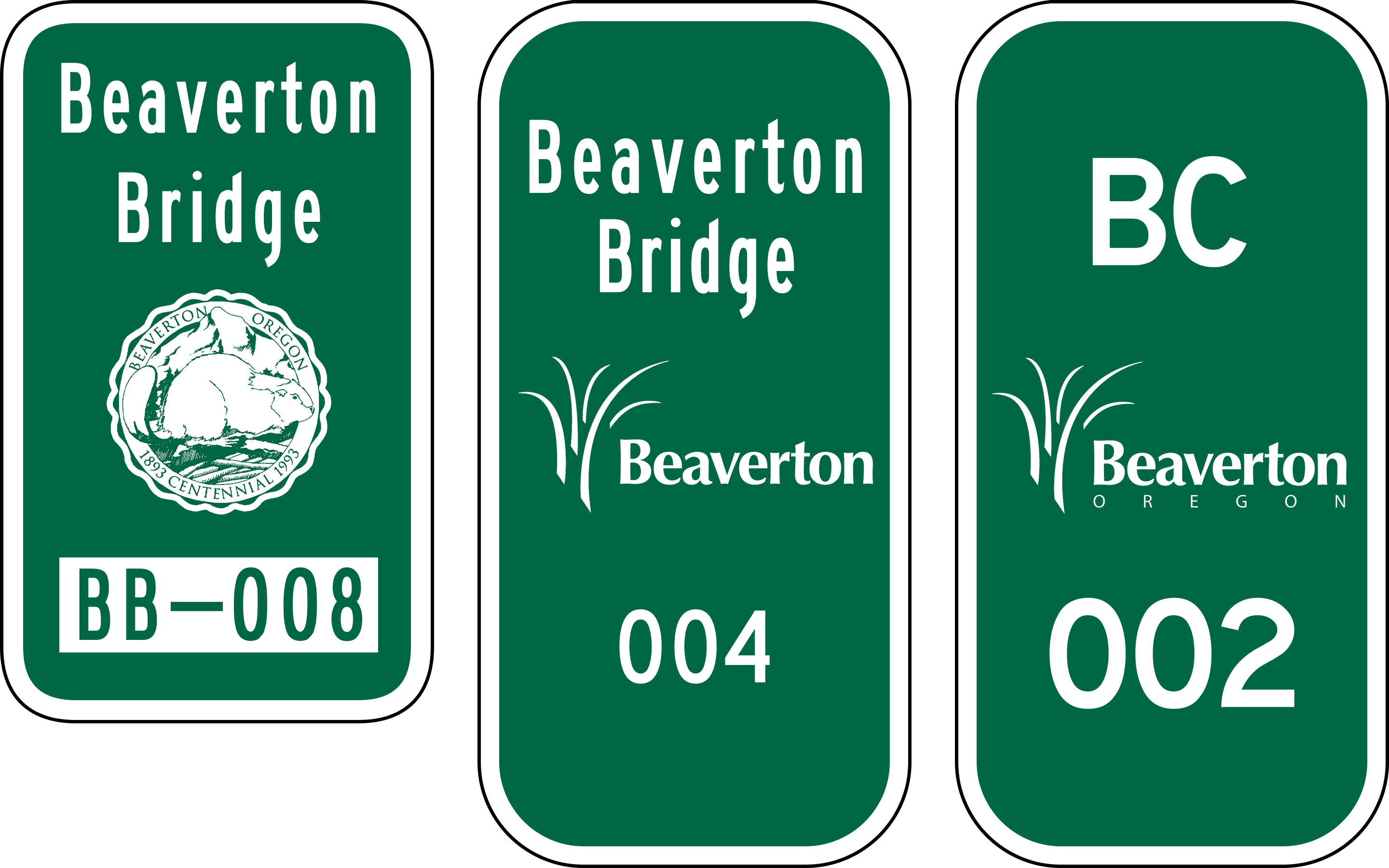
| 23:25, 17 November 2025 | Mp-city-beaverton-bridge-culvert-examples.png (file) |  |
495 KB | Jonathan | Examples of bridge and culvert markers found along Beaverton city roads and footpaths.<br /> 📷 Jonathan Ledbetter<br /> 📆 17 November 2025 | 3 |
| 16:23, 18 November 2025 | 2025-11-17 beaverton-bridge-marker-bb-19051 4.jpg (file) |  |
3.88 MB | Jonathan | A Beaverton bridge inventory marker with the city logo and "BB" on SW Hart Rd. over Johnson Creek.<br /> 📷 Jonathan Ledbetter<br /> 📆 17 November 2025 | 1 |
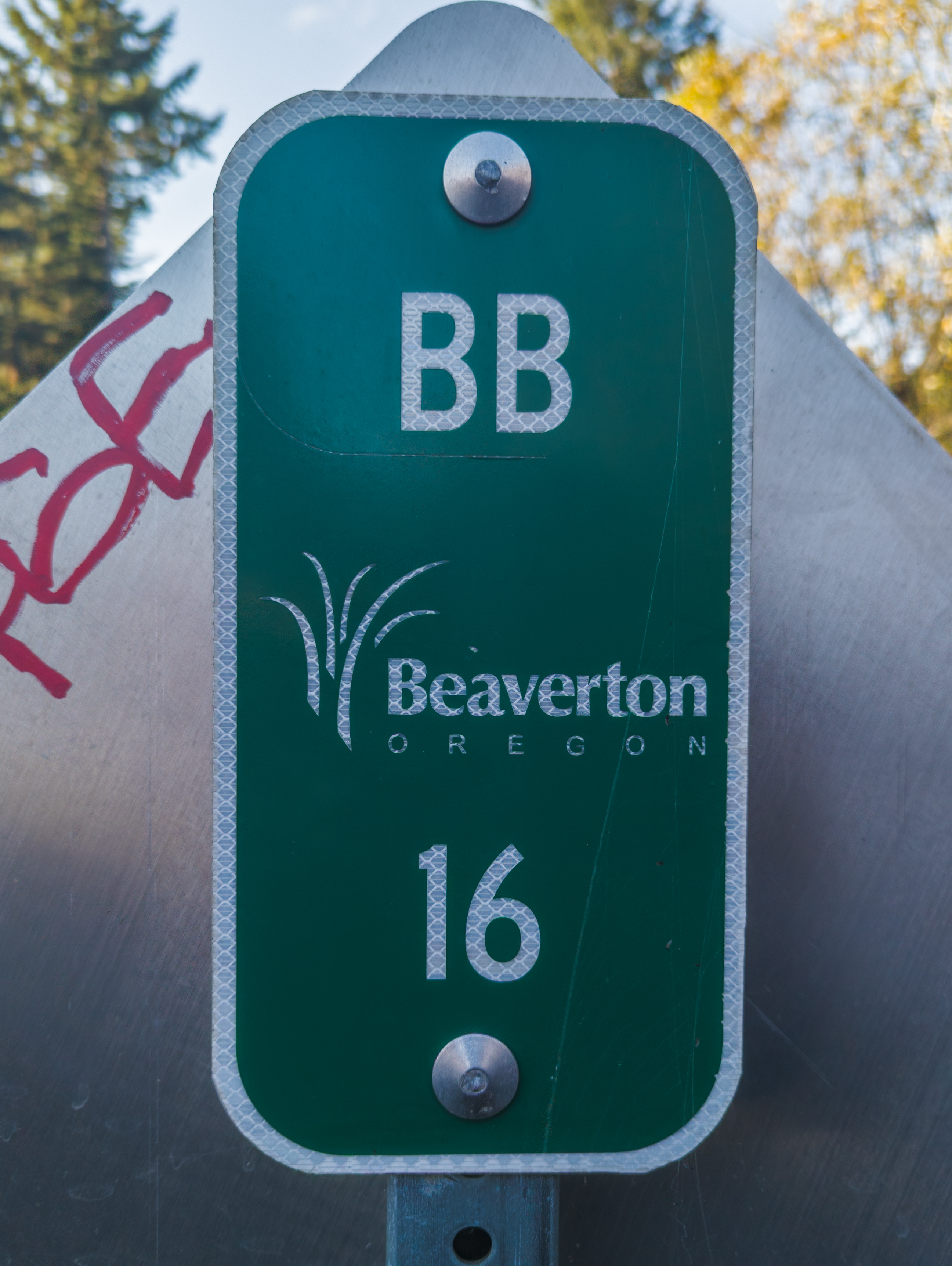
| 16:29, 18 November 2025 | 2025-11-18 beaverton-bridge-marker-bb-16 02.jpg (file) |  |
4 MB | Jonathan | A Beaverton bridge inventory marker with the city logo and "BB" on SW Davis Rd. over Johnson Creek.<br /> 📷 Jonathan Ledbetter<br /> 📆 18 November 2025 | 1 |
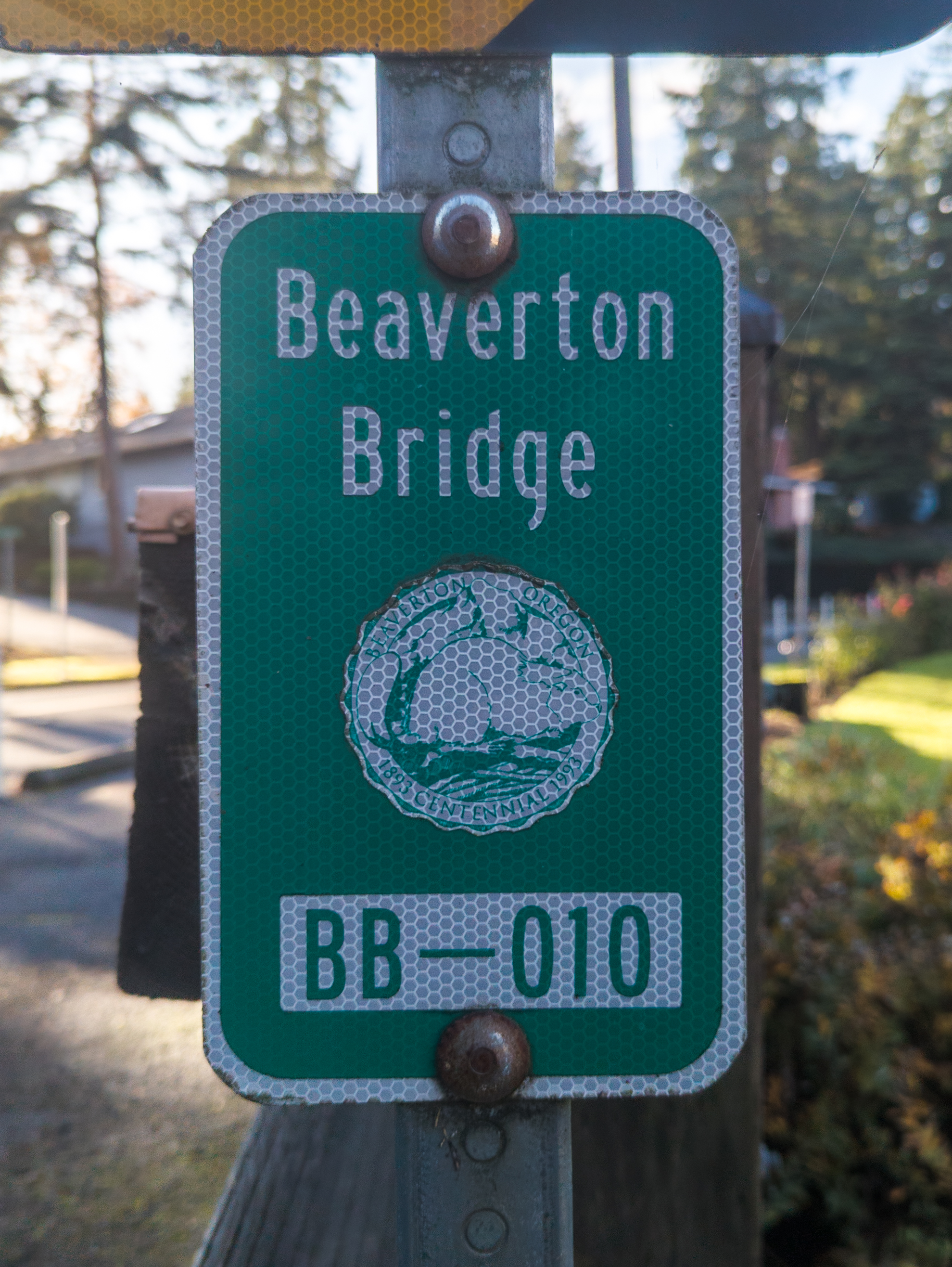
| 16:31, 18 November 2025 | 2025-11-18 beaverton-bridge-marker-seal 6.jpg (file) |  |
3.2 MB | Jonathan | A Beaverton bridge inventory marker with the city seal on the bridge over Johnson Creek on SW Village Ln. 📷 Jonathan Ledbetter<br /> 📆 18 November 2025 | 1 |