File list
Jump to navigation
Jump to search
This special page shows all uploaded files.
| Date | Name | Thumbnail | Size | Description | Versions |
|---|---|---|---|---|---|
| 15:43, 6 February 2021 | OR 8.png (file) |  |
49 KB | Modern version of route shield for OR-8 | 1 |
| 15:05, 6 February 2021 | OR 7.png (file) |  |
37 KB | Modern version of route shield for OR-7 | 1 |
| 15:02, 6 February 2021 | OR 6.png (file) |  |
46 KB | Modern version of route shield for OR-6 | 1 |
| 14:59, 6 February 2021 | I 5.png (file) |  |
80 KB | Modern version of route shield for I-5 (smaller "5") | 1 |
| 02:28, 6 February 2021 | US 730.png (file) |  |
36 KB | Modern version of route shield for US-730 | 1 |
| 02:27, 6 February 2021 | OR 3.png (file) |  |
46 KB | Modern version of route shield for OR-3 | 1 |
| 02:20, 6 February 2021 | OR 244 1932.png (file) |  |
87 KB | 1932 version of route shield for OR-244 | 1 |
| 01:53, 6 February 2021 | OR 2 1932.png (file) |  |
85 KB | 1932 version of the route shield of OR-2 | 1 |
| 01:48, 6 February 2021 | OR 2 1948.png (file) |  |
96 KB | 1948 version of route shield for OR-2 | 1 |
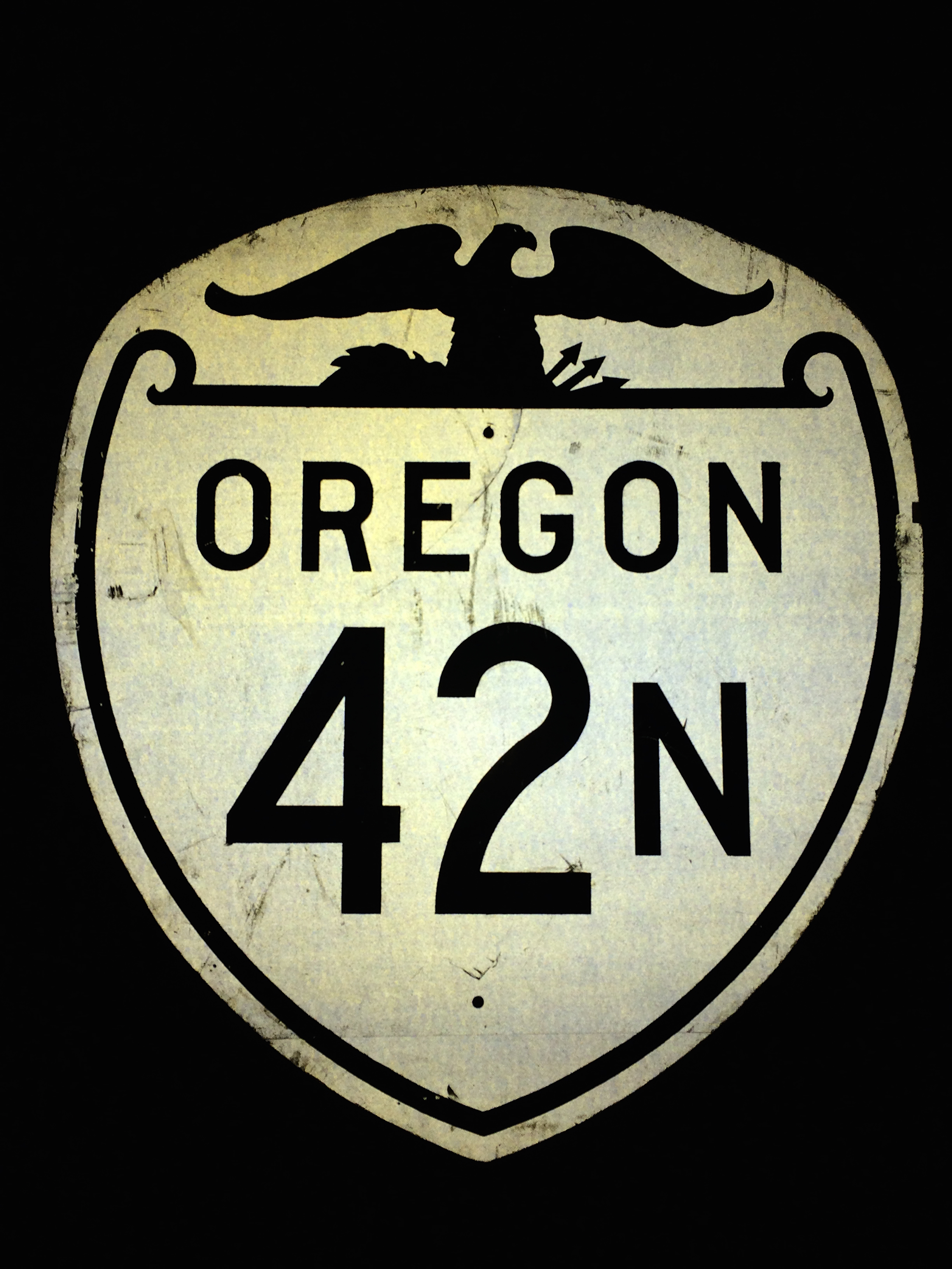
| 23:18, 5 February 2021 | Cgperry OR 42N shield.jpg (file) |  |
2.96 MB | Photo taken September 30, 2016 by Curtis Gregory Perry, Flickr https://www.flickr.com/photos/curtisperry/29986303946/, used with permission and shared under Creative Commons Attribution-NonCommercial-ShareAlike 2.0 Generic (CC BY-NC-SA 2.0) | 1 |
| 01:21, 5 February 2021 | 1956 OfficialMap Roseburg Inset.jpg (file) |  |
678 KB | 1 | |
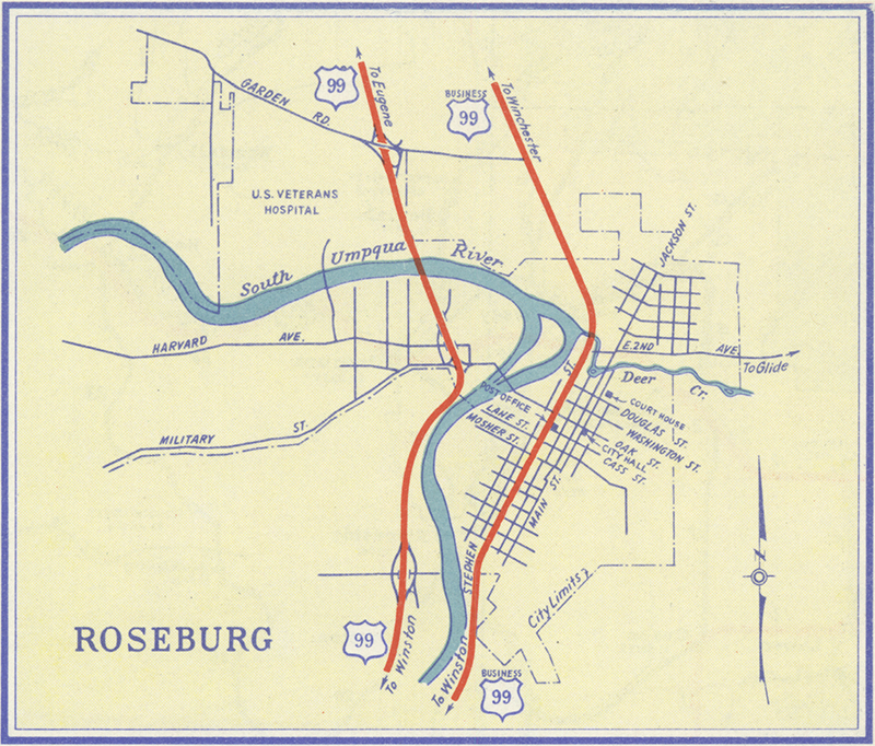
| 01:19, 5 February 2021 | 1955 OfficialMap Roseburg.jpg (file) |  |
502 KB | 1 | |
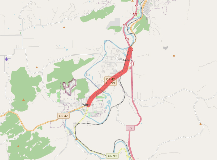
| 01:17, 5 February 2021 | OR 42N-map.jpg (file) |  |
159 KB | Map showing route of former OR-42N | 1 |
| 23:10, 4 February 2021 | US 99 1948.png (file) |  |
116 KB | 1948 version of route shield for US-99 | 1 |
| 19:08, 4 February 2021 | OR 42 1948.png (file) |  |
96 KB | 1948 version of route shield for OR-42 | 1 |
| 18:40, 4 February 2021 | OR 231 1948.png (file) |  |
97 KB | Increased dimensions to 1024x1024 | 2 |
| 18:20, 4 February 2021 | US 97.png (file) |  |
30 KB | Increased dimensions to 1024x1024 | 2 |
| 18:10, 4 February 2021 | US 99 1926.png (file) |  |
89 KB | Increased dimensions to 1024x1024 | 2 |
| 17:39, 4 February 2021 | OR 230.png (file) |  |
68 KB | Increased dimensions to 1024x1024 | 2 |
| 17:38, 4 February 2021 | OR 231 1932.png (file) |  |
87 KB | Increased dimensions to 1024x1024 | 2 |
| 17:37, 4 February 2021 | OR 217 1932.png (file) |  |
88 KB | Increased dimensions to 1024x1024 | 2 |
| 17:30, 4 February 2021 | OR 42S.png (file) |  |
63 KB | Modern shield for OR-42S | 1 |
| 17:30, 4 February 2021 | OR 42.png (file) |  |
47 KB | Modern shield for OR-42 | 1 |
| 17:29, 4 February 2021 | OR 66.png (file) |  |
58 KB | Increased dimensions to 1024x1024 | 2 |
| 16:42, 4 February 2021 | OR 64 1948.png (file) |  |
111 KB | Increased dimensions to 1024x1024 | 2 |
| 16:36, 4 February 2021 | OR 42N 1948.png (file) |  |
97 KB | 1948 version of route shield for OR-42N | 1 |
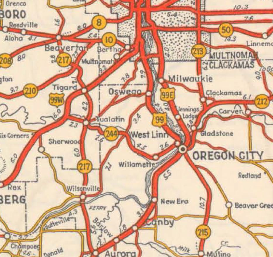
| 01:06, 4 February 2021 | 1936 OfficialMap OregonCity-Wilsonville.png (file) |  |
1.31 MB | A section of the 1936 official Oregon State Highway Map, showing a close-up view of SW/SE Portland, Oregon City, Wilsonville, Beaverton, Oswego, Canby, Tigard, Milwaukie, and other small cities and towns. | 1 |
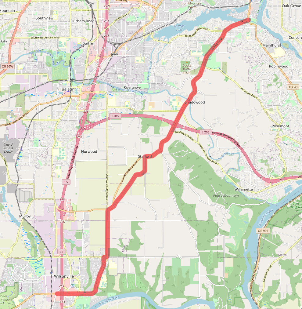
| 17:30, 2 February 2021 | OR 231 1934-map.jpg (file) |  |
924 KB | Map of the alignment of former OR-231 in 1934. | 1 |
| 23:38, 1 February 2021 | OR 62.png (file) |  |
54 KB | Modern route shield for Oregon Route 62 | 1 |
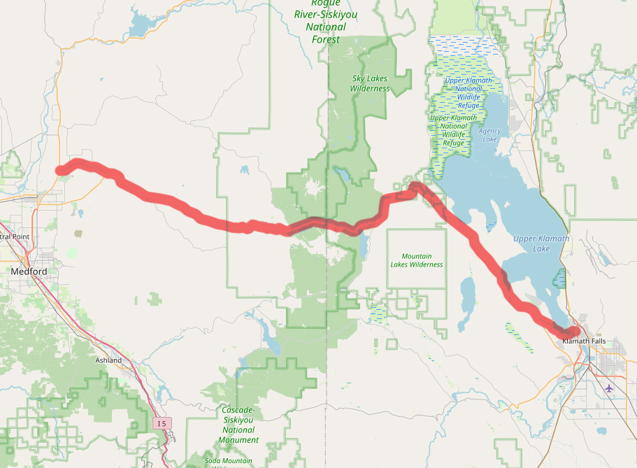
| 01:30, 1 February 2021 | OR 64-map.jpg (file) |  |
369 KB | Map of the alignment of former OR-64 in 1965. | 1 |