File list
Jump to navigation
Jump to search
This special page shows all uploaded files.
| Date | Name | Thumbnail | Size | Description | Versions |
|---|---|---|---|---|---|
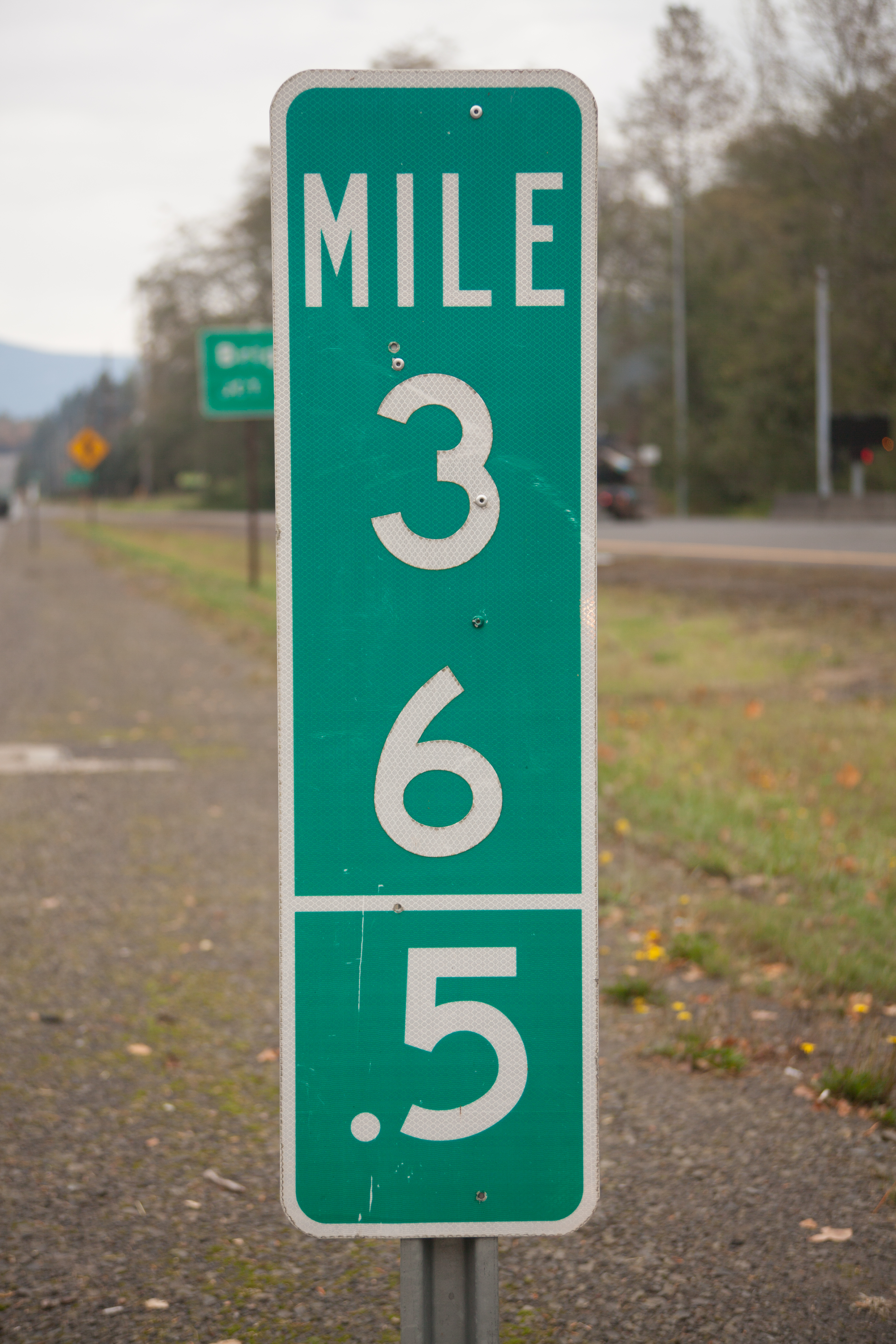
| 01:59, 23 May 2021 | 2017-10-25 state-half-milepost 4197.jpg (file) |  |
11.74 MB | A photo of a standard D10-2a milepost on US-26 west of Mt. Hood Village, placed during the summer of 2011 as part of an ODOT pilot project to better locate motorists, incidents and hazards.<br /> 📷 Jonathan Ledbetter<br /> 📆 25 October 2017 | 1 |
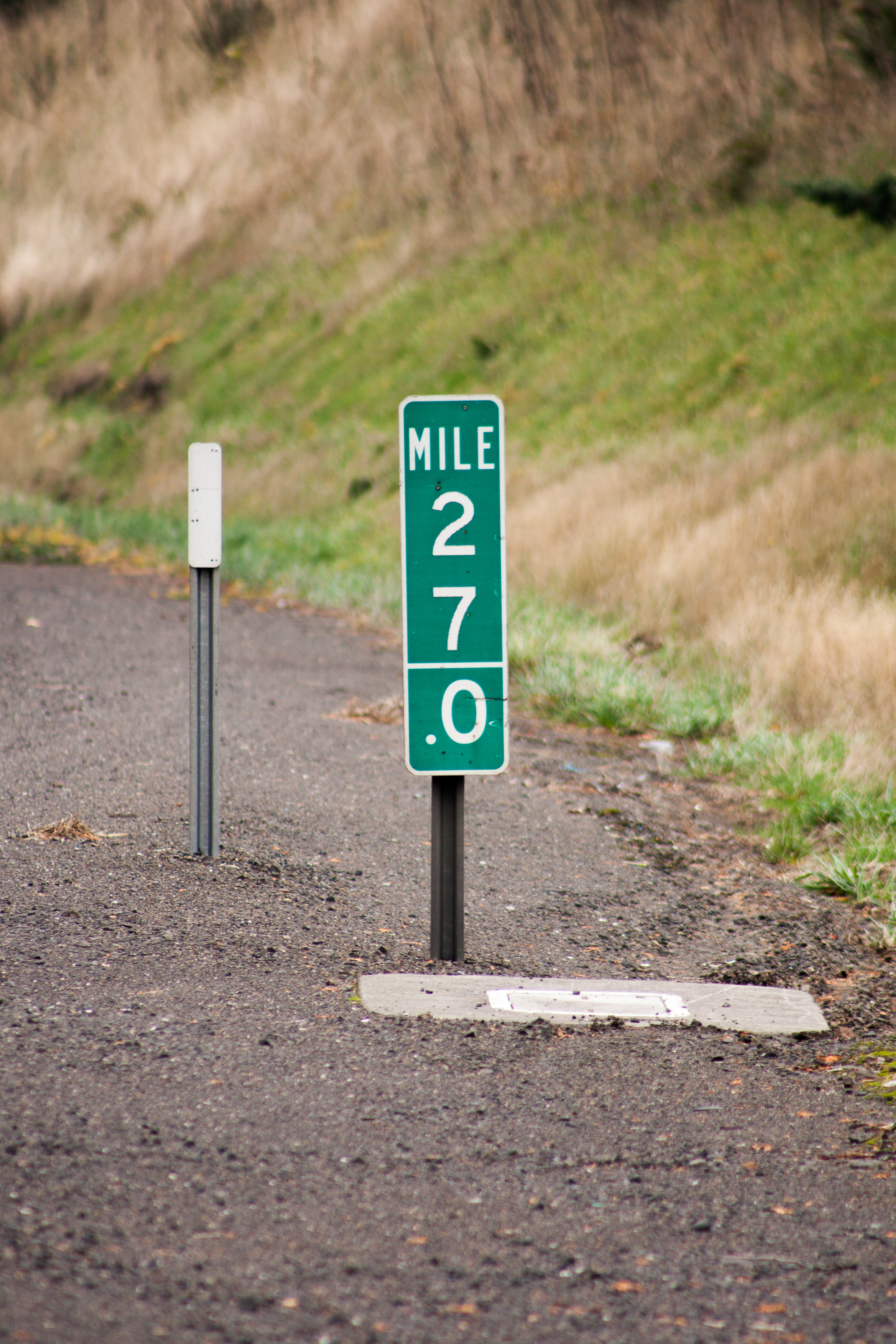
| 01:52, 23 May 2021 | 2017-10-25 state-half-milepost 4010.jpg (file) |  |
9.66 MB | A photo of a standard D10-2a milepost on US-26 east of Sandy, placed during the summer of 2011 as part of an ODOT pilot project to better locate motorists, incidents and hazards.<br /> 📷 Jonathan Ledbetter<br /> 📆 25 October 2017 | 1 |
| 21:33, 16 May 2021 | 1961 MUTCD-OR-milepost-examples.png (file) |  |
152 KB | Standardized size to match 1971 examples | 2 |
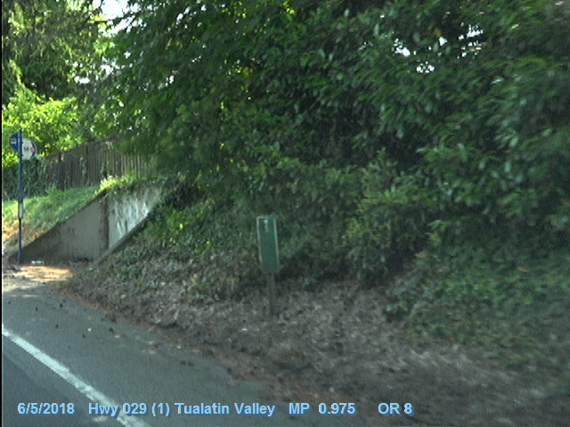
| 15:46, 15 May 2021 | 2018-06-05 odot-vidlog OR-8 MP0.975-EB.jpg (file) |  |
141 KB | A still frame of the ODOT Digital Video Log for OR-8/Tualatin Valley Highway #29, MP 0.975 eastbound. This frame features a (mostly) 1961 MUTCD specification milepost, which has since been removed.<br /> 🖼 [https://dvlprod-ordot.msappproxy.net/cf/dvl/index.cfm?&fuseaction=entry ODOT Digital Video Log]<br /> 📆 5 June 2018 | 1 |
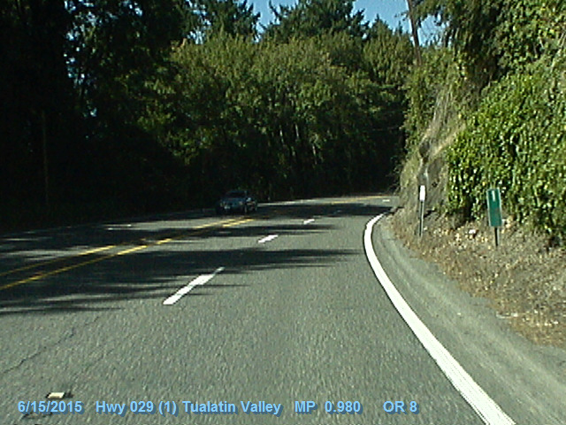
| 15:43, 15 May 2021 | 2015-06-15 odot-vidlog OR-8 MP0.98-WB.jpg (file) |  |
159 KB | A still frame of the ODOT Digital Video Log for OR-8/Tualatin Valley Highway #29, MP 0.980. This frame features a (mostly) 1961 MUTCD specification milepost, which has since been removed.<br /> 🖼 [https://dvlprod-ordot.msappproxy.net/cf/dvl/index.cfm?&fuseaction=entry ODOT Digital Video Log]<br /> 📆 15 June 2015 | 1 |
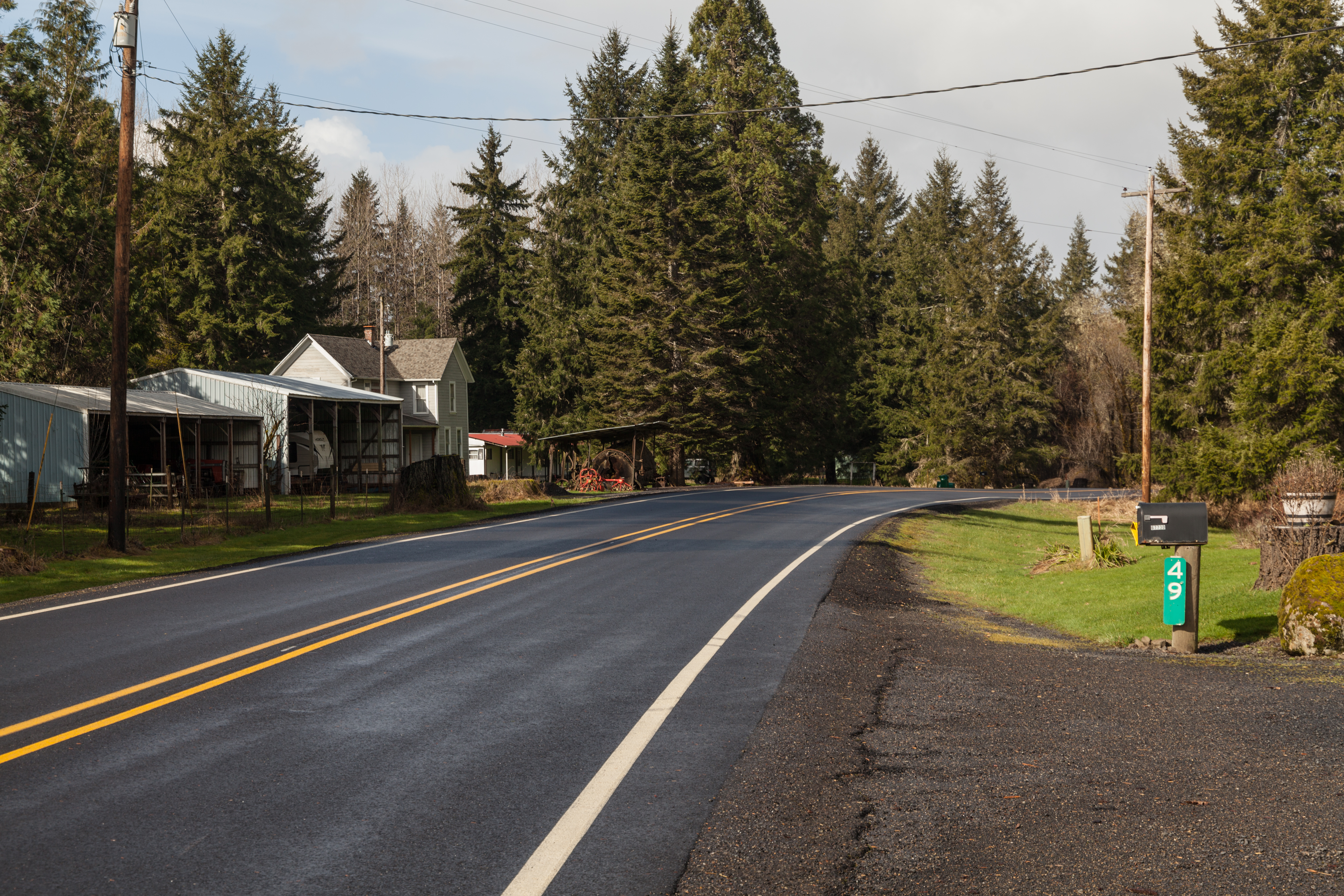
| 13:08, 15 May 2021 | 2021-02-26 state-1961-milepost 9285.jpg (file) |  |
13.57 MB | Milepost 49 as seen along OR-47 a couple miles outside of Mist. The milepost is designed to the 1961 MUTCD specification and is in excellent condition for its supposed age. 📷 Jonathan Ledbetter<br /> 📆 26 February 2021 | 1 |
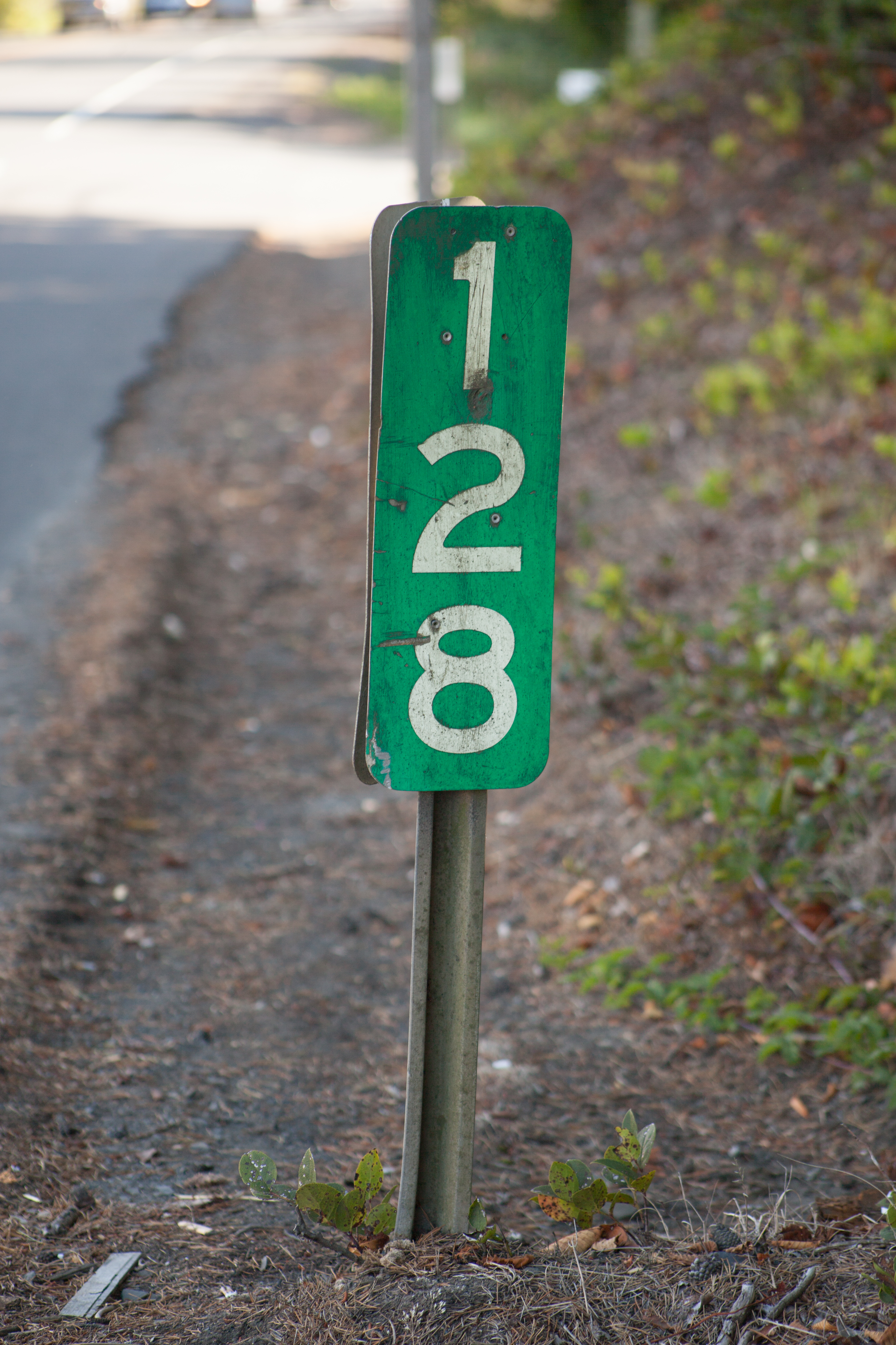
| 13:03, 15 May 2021 | 2016-08-02 state-1961-milepost 2311.jpg (file) |  |
10.49 MB | Milepost 128 along US-101 in Depoe Bay. The mileposts are designed to the 1961 MUTCD specifications. 📷 Jonathan Ledbetter<br /> 📆 2 August 2016 | 1 |
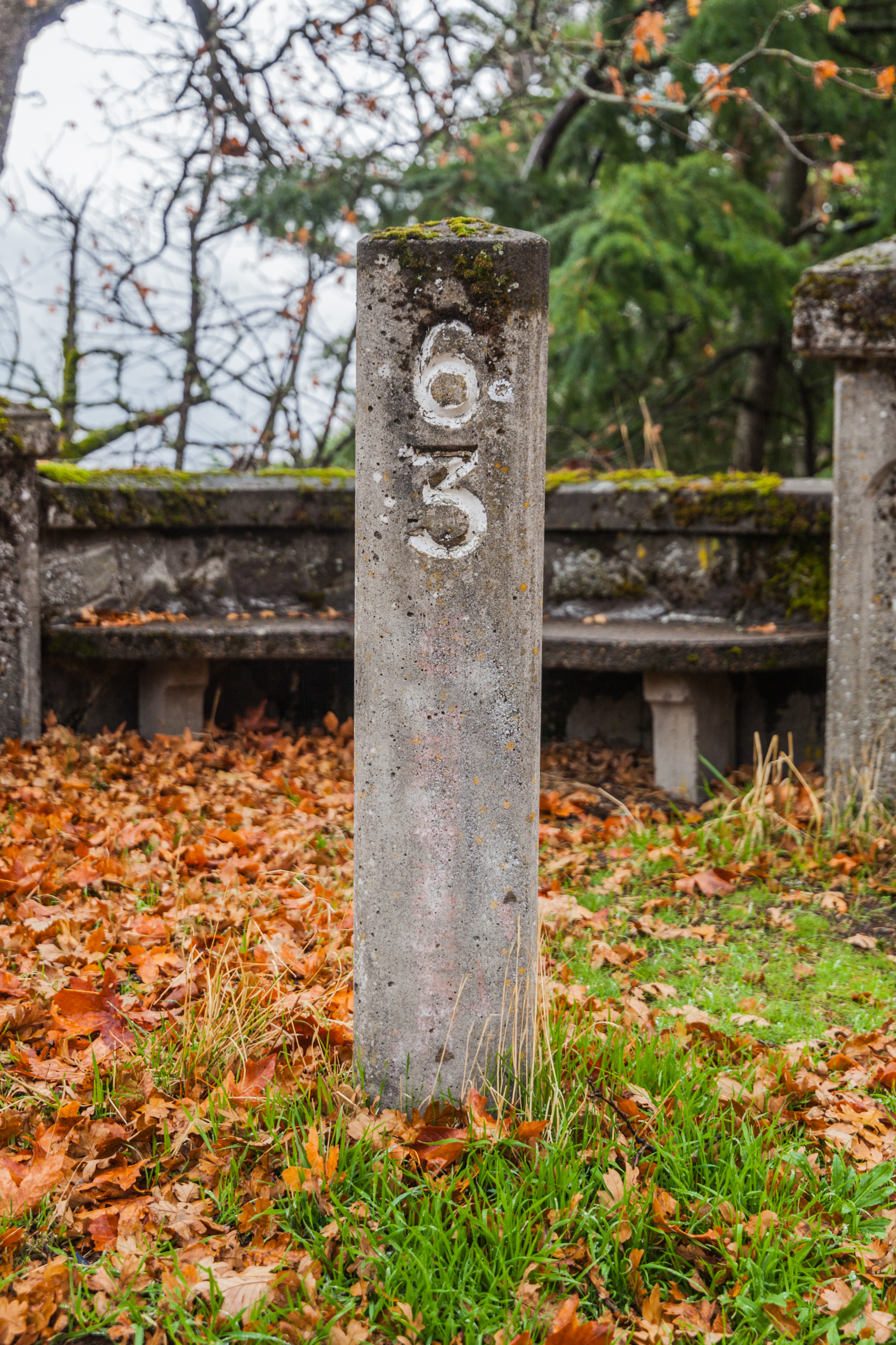
| 17:26, 12 May 2021 | 2019-11-15 concrete-milepost-63 3754.jpg (file) |  |
13.09 MB | The restored concrete milepost 63 on the Historic Columbia River Highway at Ruthton Point, just west of Hood River. It was placed in the Summer of 1992 as part of a rehabilitation of the Ruthton Point viaduct.<br /> 📷 Jonathan Ledbetter<br /> 📆 15 November 2019 | 1 |
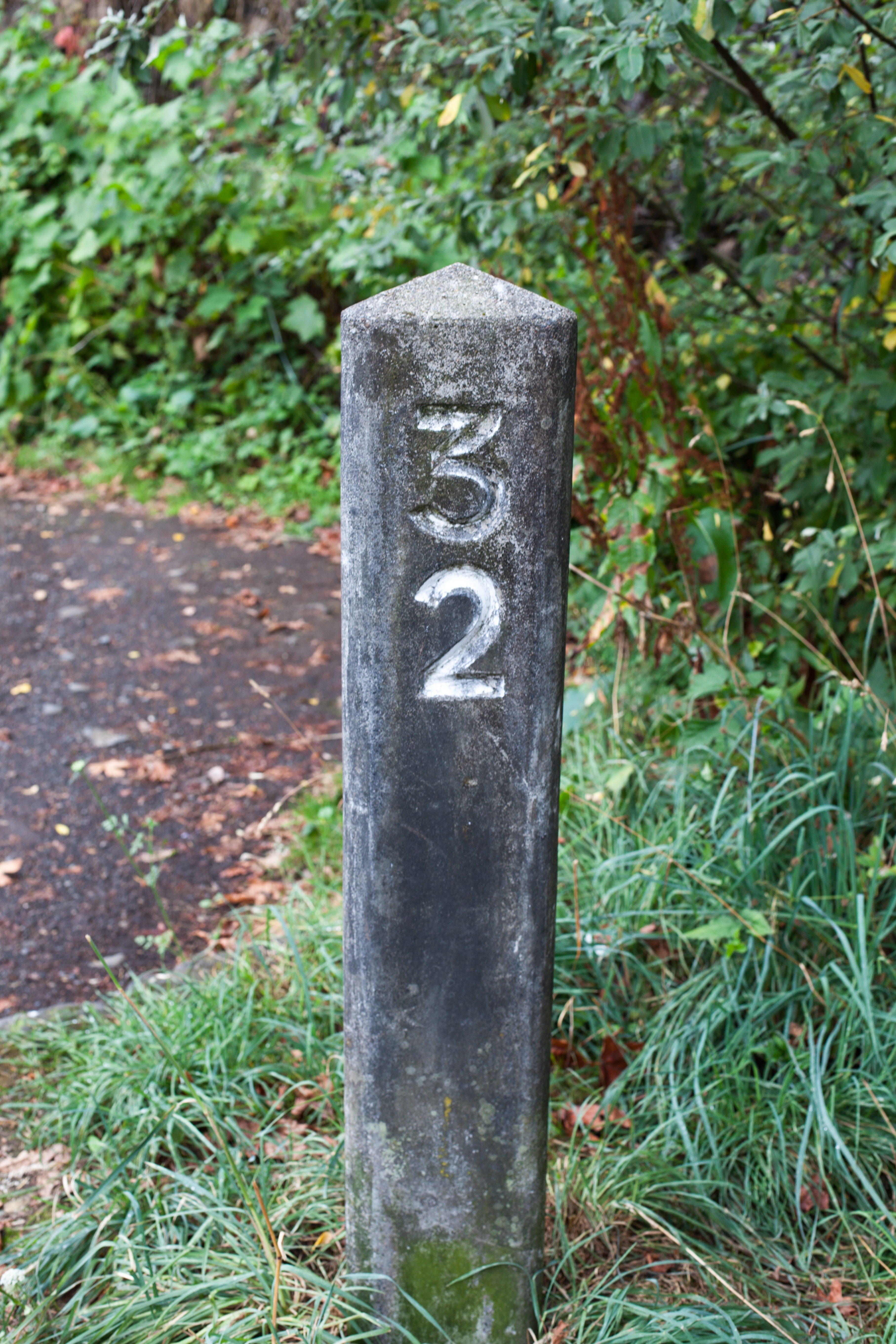
| 17:08, 12 May 2021 | 2013-08-28 concrete-milepost-32 7109.jpg (file) |  |
11.49 MB | The restored concrete milepost 32 on the Historic Columbia River Highway just west of Multnomah Falls.<br /> 📷 Jonathan Ledbetter<br /> 📆 28 August 2013 | 1 |
| 12:48, 11 May 2021 | 1981 ochi-report crh-mileposts pp87&89.png (file) |  |
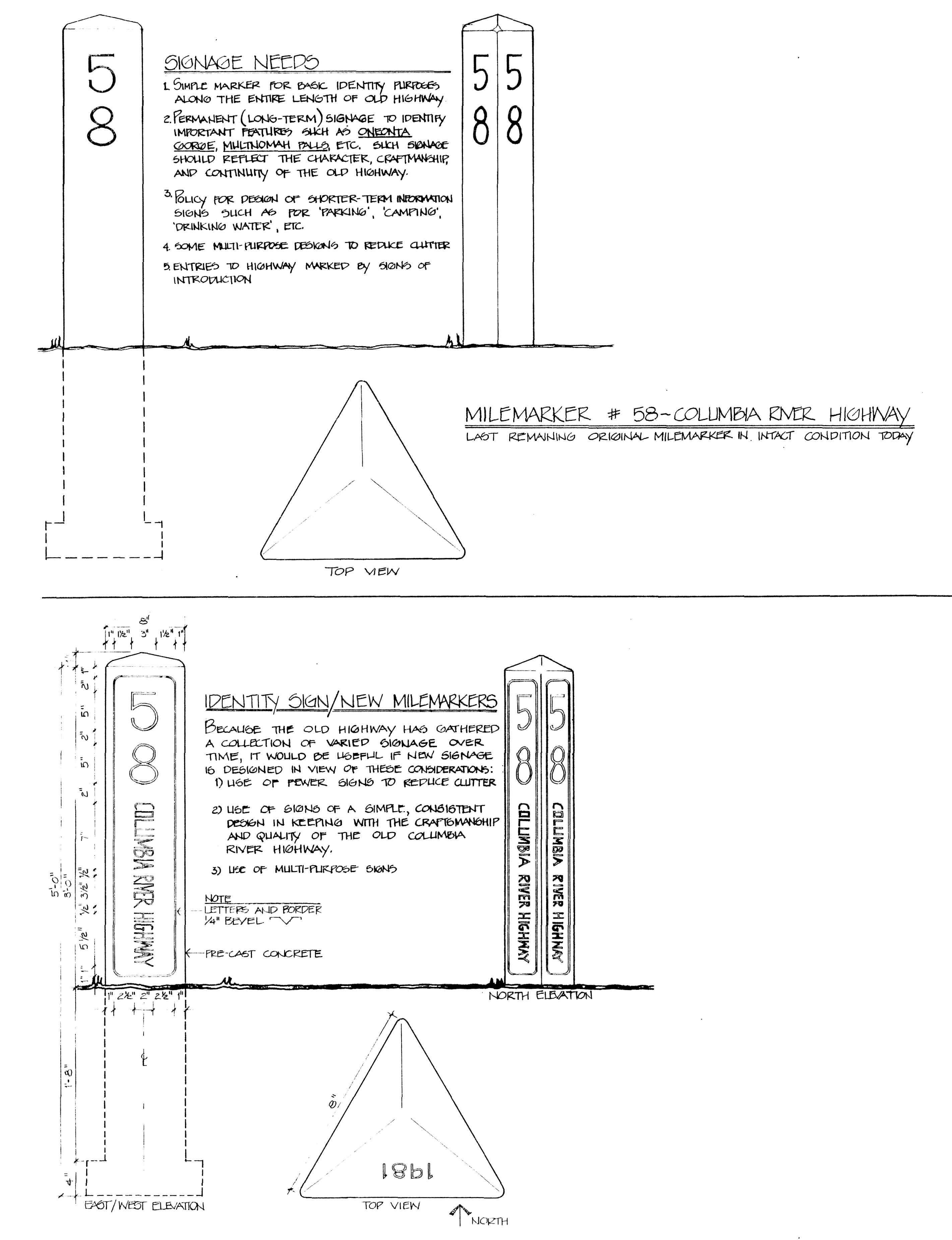
916 KB | A comparison of the original Columbia River Highway concrete mileposts and the ones proposed by Diane Ochi in her 1981 report. The ones reconstructed for the highway in the 1990s did not incorporate Ochi's enhancements.<br /> 🖼 Ochi, Diane. [http://npshistory.com/publications/columbia-river-highway.pdf ''Columbia River Highway: Options for Conservation and Reuse''], National Park Service, pp. 87 & 89<br /> 📆 1981 | 1 |
| 23:13, 9 May 2021 | 2020-02-07 orig-stone-milepost-58 4637.jpg (file) |  |
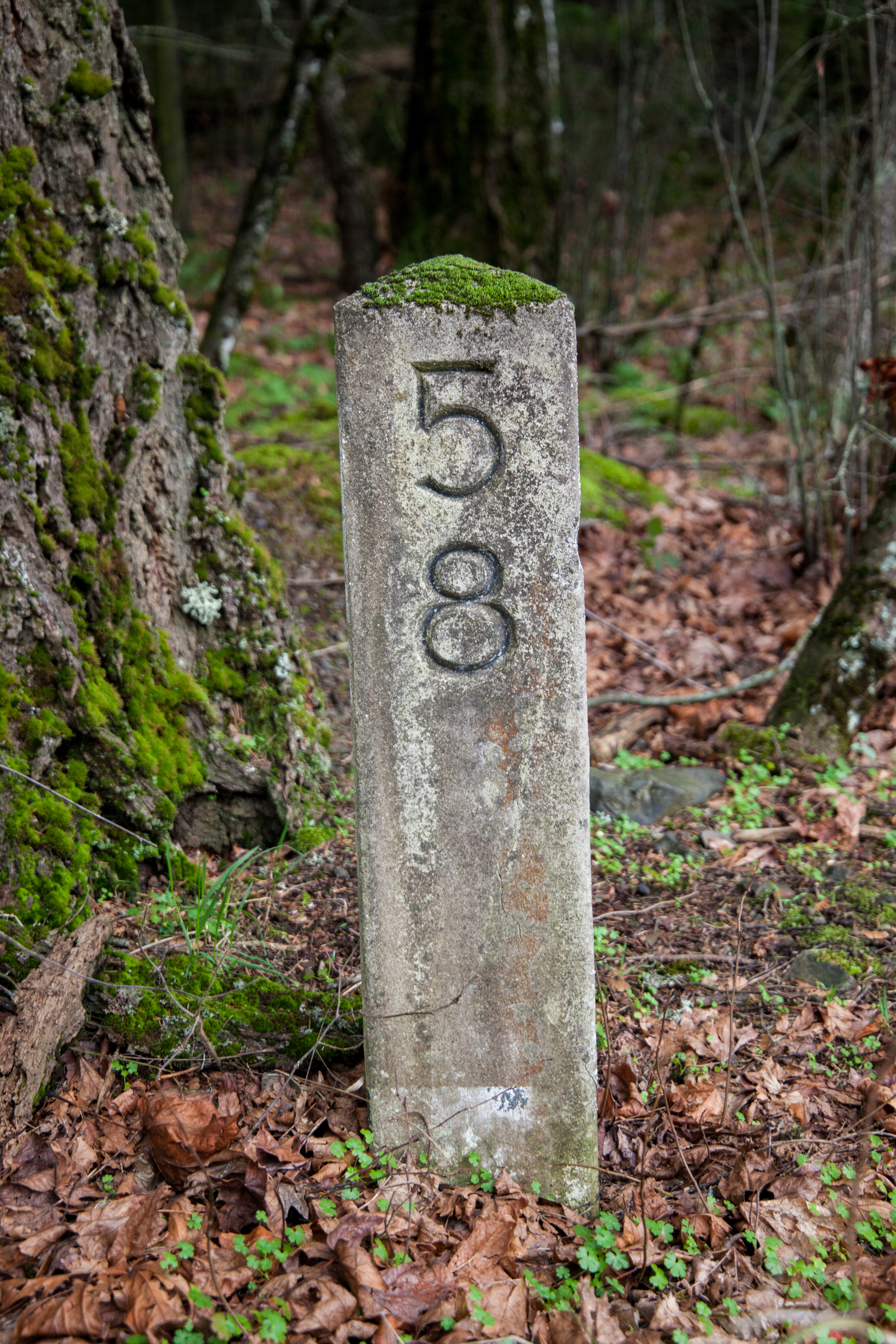
15.13 MB | Original concrete milepost 58 along the Historic Columbia River Highway Trail just west of Viento State Park.<br /> 📷 Jonathan Ledbetter<br /> 📆 7 February 2020 | 1 |
| 23:11, 9 May 2021 | 2020-02-07 orig-stone-milepost-14 4322.jpg (file) |  |
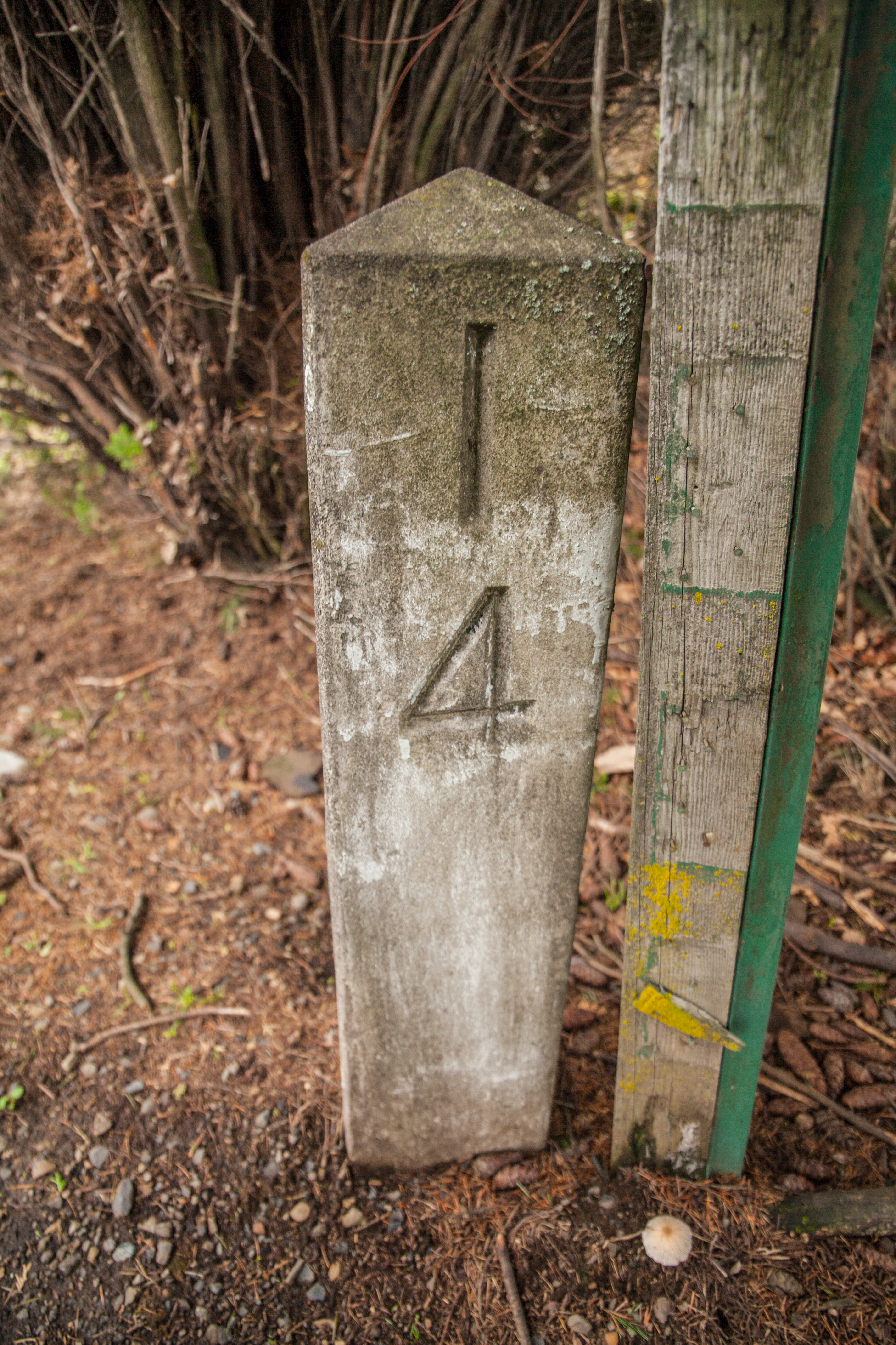
14.58 MB | Original concrete milepost 14 from the Historic Columbia River Highway, as found in the 24400 block of Sandy Blvd. in Wood Village.<br /> 📷 Jonathan Ledbetter<br /> 📆 7 February 2020 | 1 |
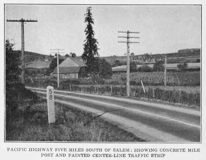
| 00:20, 9 May 2021 | 1924 OSHC-6th-Biennial-Report p78.jpg (file) |  |
184 KB | 1 | |
| 12:17, 8 May 2021 | 2013-11-11 portland-p7-post 115842.jpg (file) |  |
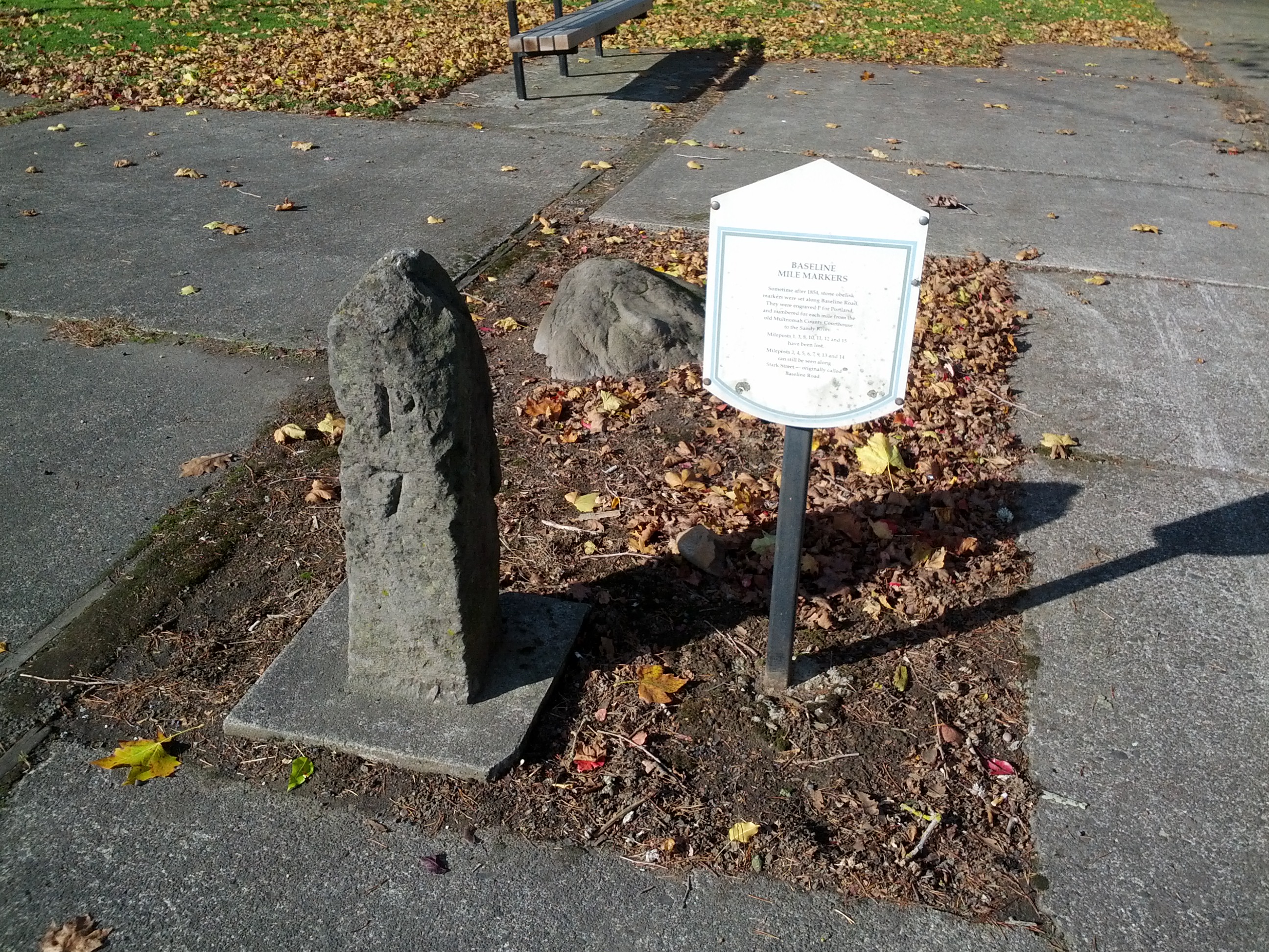
1.97 MB | Baseline mile marker 7, numbered "P7", next to a plaque describing the markers' history in Ventura Park at the corner of SE Stark Street and 117th Avenue, Portland.<br /> 📷 Jonathan Ledbetter<br /> 📆 11 November 2013 | 1 |
| 11:52, 8 May 2021 | 2013-01-02 portland-p7-post-south 00570018.jpg (file) |  |
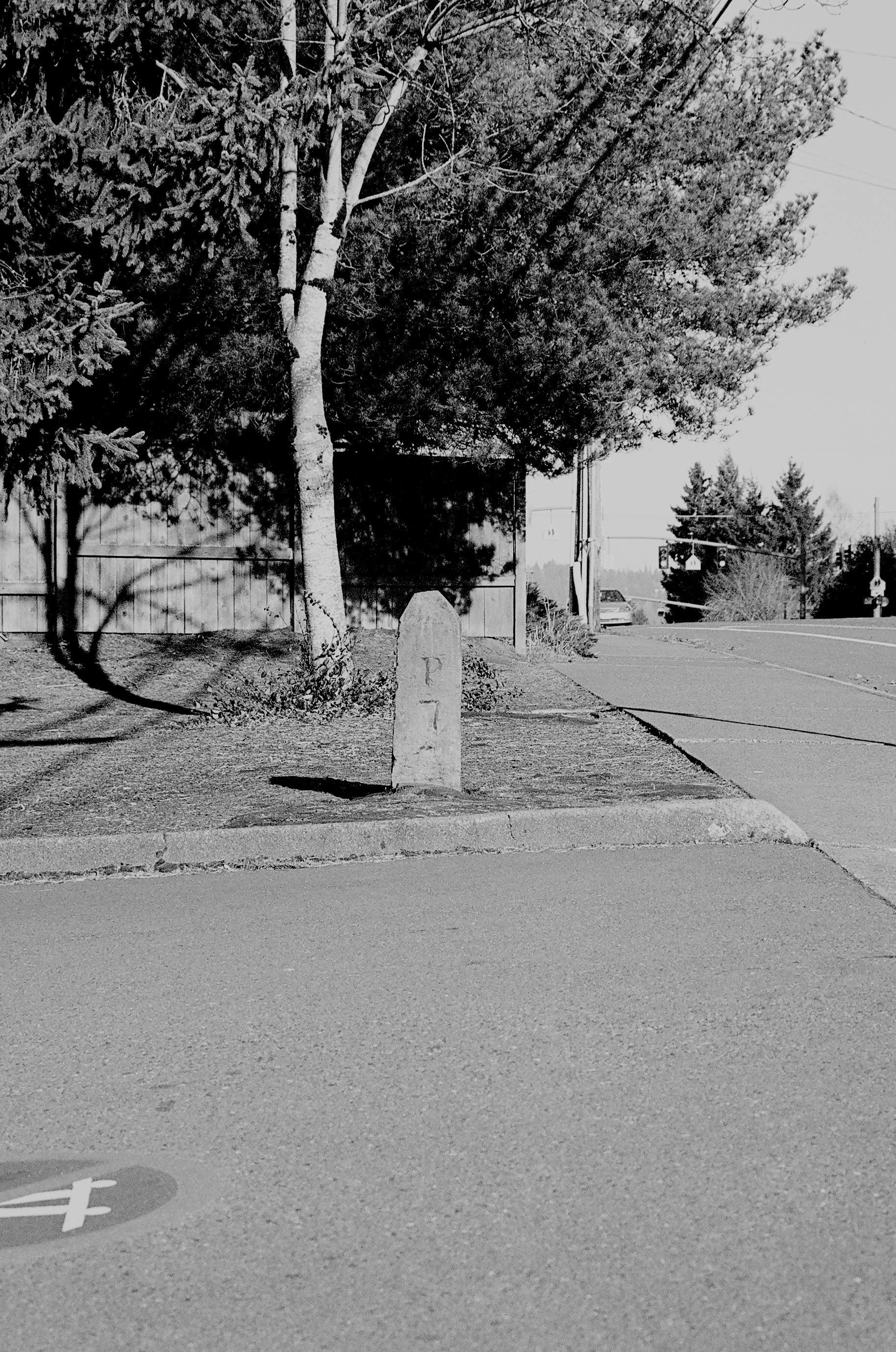
3.42 MB | Southern baseline mile marker 7, numbered "P7", as seen outside the Capitol Hill branch of the Multnomah County Library, Portland.<br /> 📷 Jonathan Ledbetter<br /> 📆 2 January 2013 | 1 |
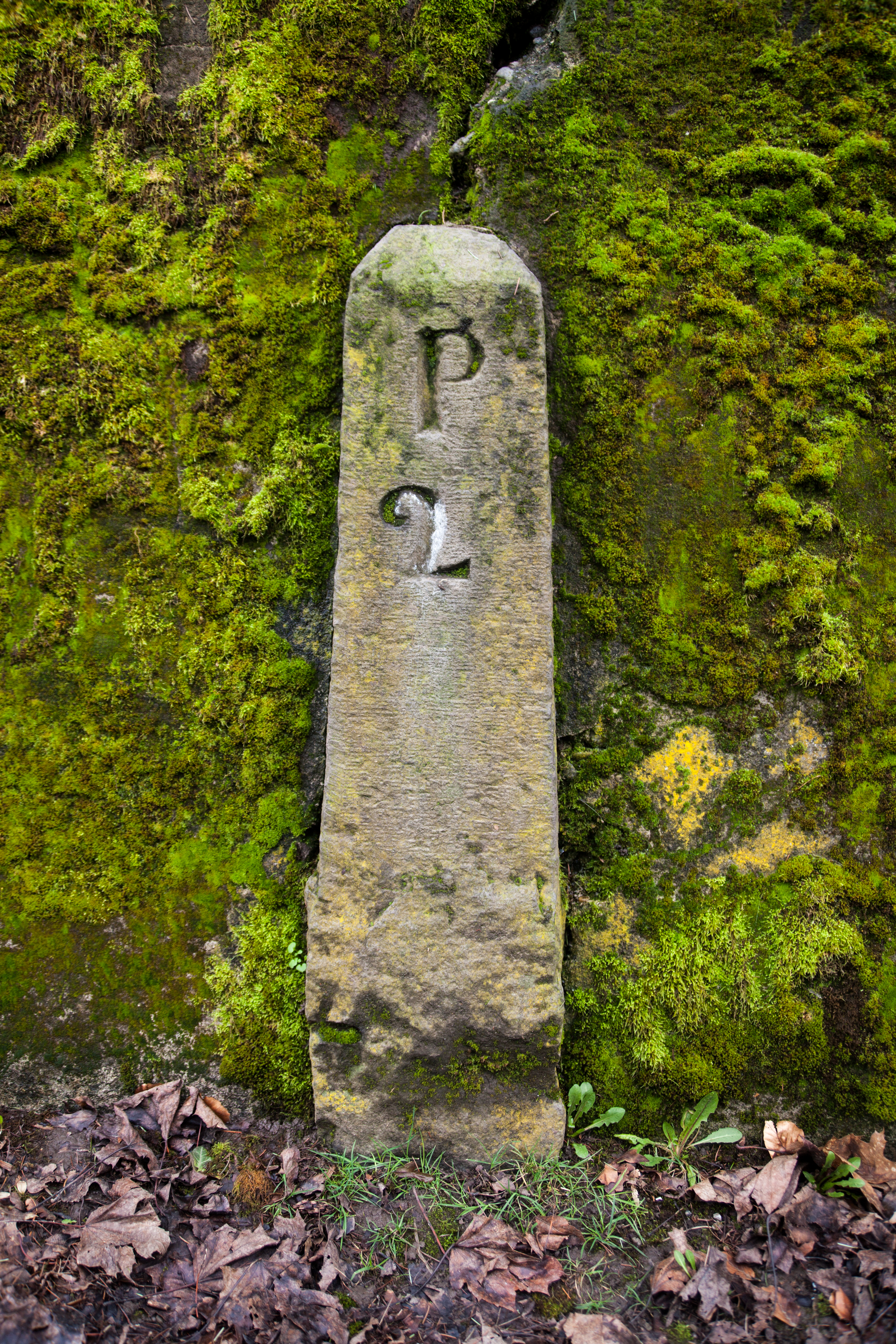
| 10:22, 8 May 2021 | 2016-02-20 portland-p2-post 1065.jpg (file) |  |
20.22 MB | Added GPS data | 2 |
| 07:50, 8 May 2021 | Undated - OSHD 181 - John Day Highway With Fossil Mountain Mile Post 116 (Wheeler County).jpg (file) | .jpg) |
610 KB | 1 | |
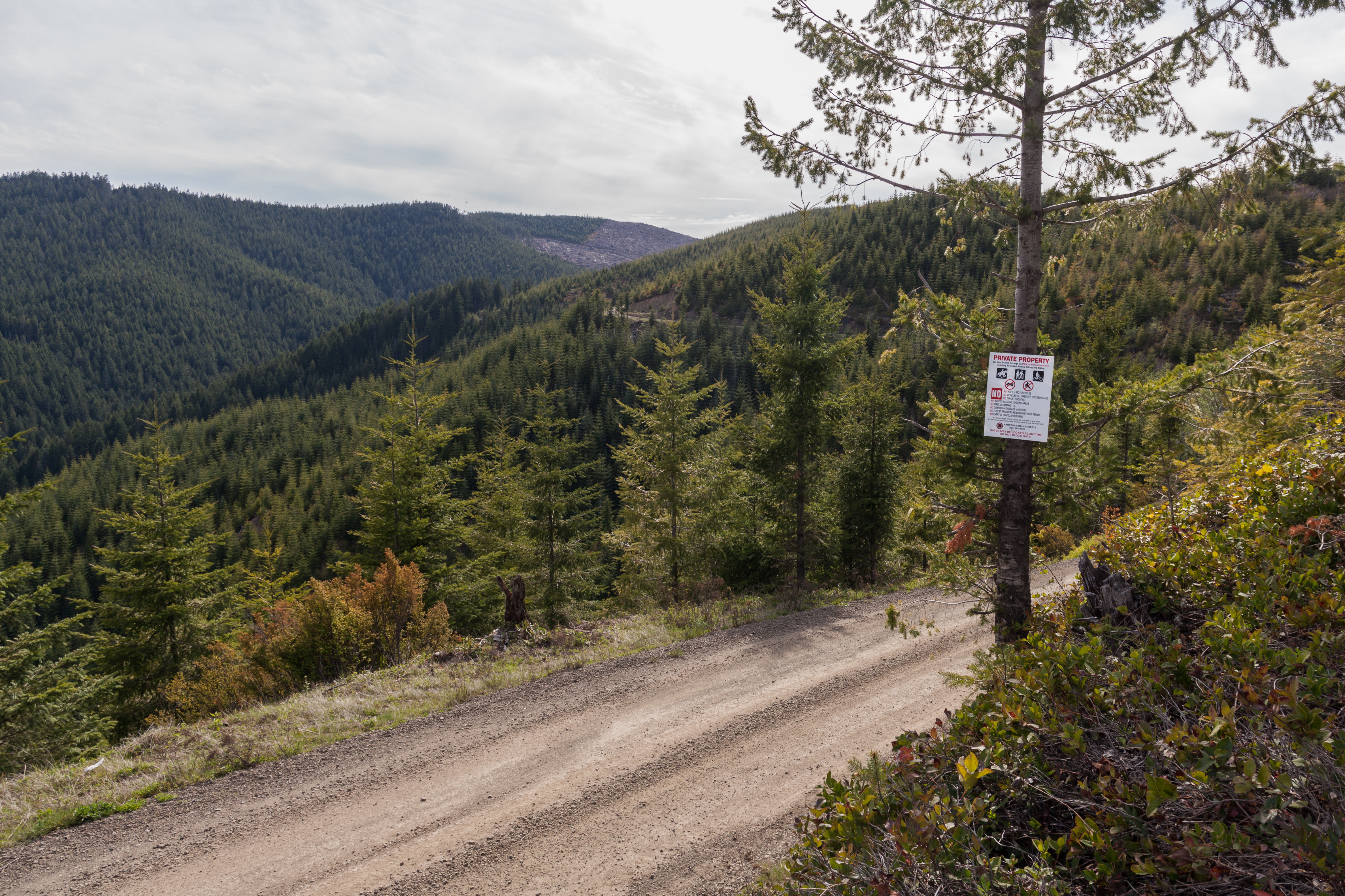
| 00:25, 13 April 2021 | 2020-05-09 ridge-route-8548.jpg (file) |  |
10.99 MB | Storey Burn Road looking west towards Larch Mountain and Blue Lake, Tillamook County.<br /> 📷 Jonathan Ledbetter<br /> 📆 9 May 2020 | 1 |
| 20:08, 11 March 2021 | Under construction.gif (file) |  |
413 bytes | Shrunk size | 2 |
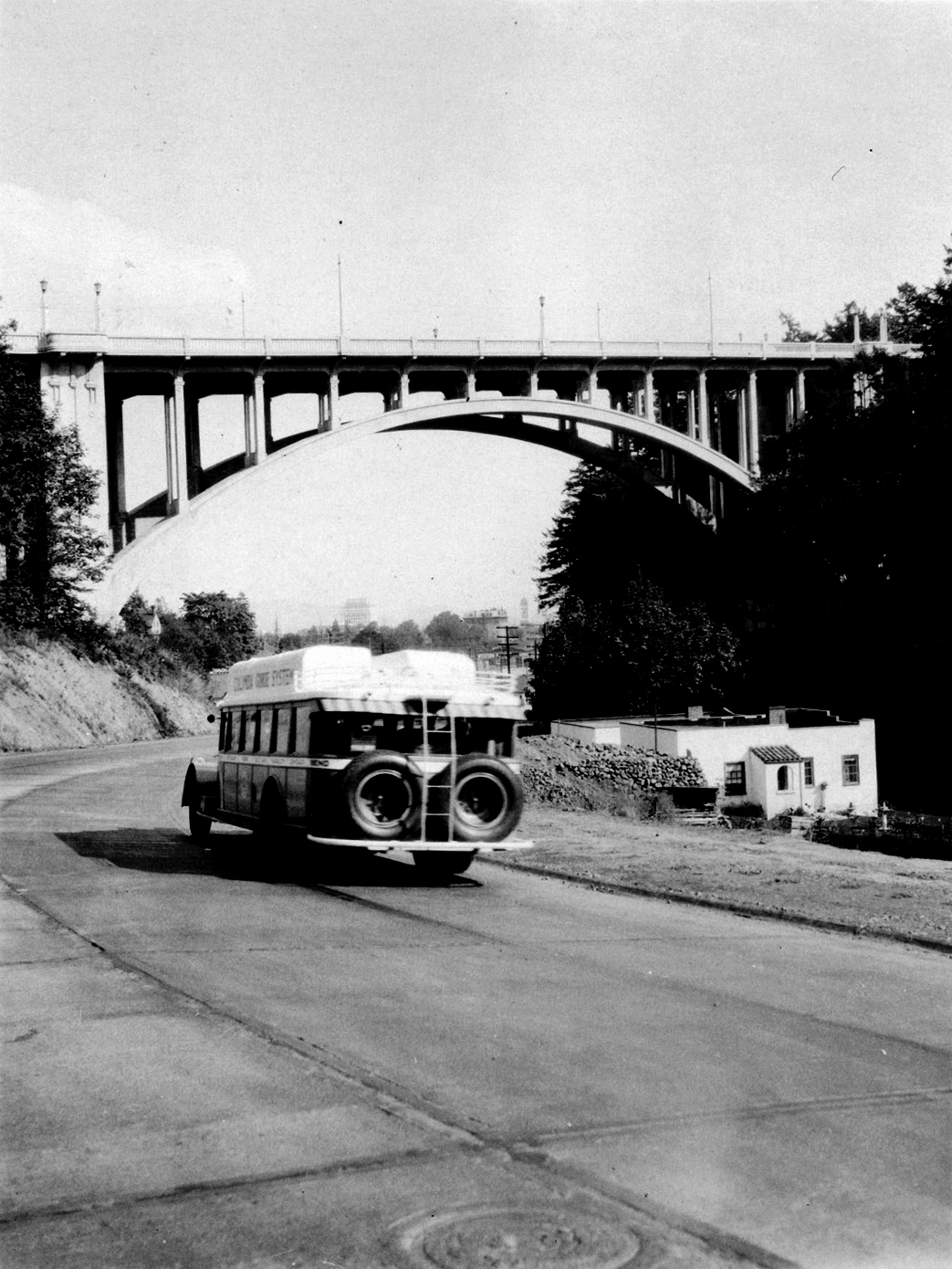
| 02:09, 10 March 2021 | Multco-image-2.jpg (file) |  |
740 KB | A bus heading eastbound on the newly-paved Canyon Road entering Portland. 📆 1930 🖼 Multnomah County Archives via [https://vintageportland.wordpress.com/2015/03/04/vista-avenue-viaduct-1930/ Vintage Portland] | 1 |
| 17:25, 24 February 2021 | US 99E 1948.png (file) |  |
116 KB | 1948 version of the route shield for US-99E | 1 |
| 17:14, 24 February 2021 | US 99W 1948.png (file) |  |
118 KB | 1948 version of route shield for US-99W | 1 |
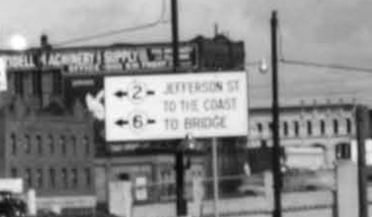
| 01:35, 15 February 2021 | Harbor-dr-south-of-hawthorne-bridge-looking-north-1949-sign.jpg (file) |  |
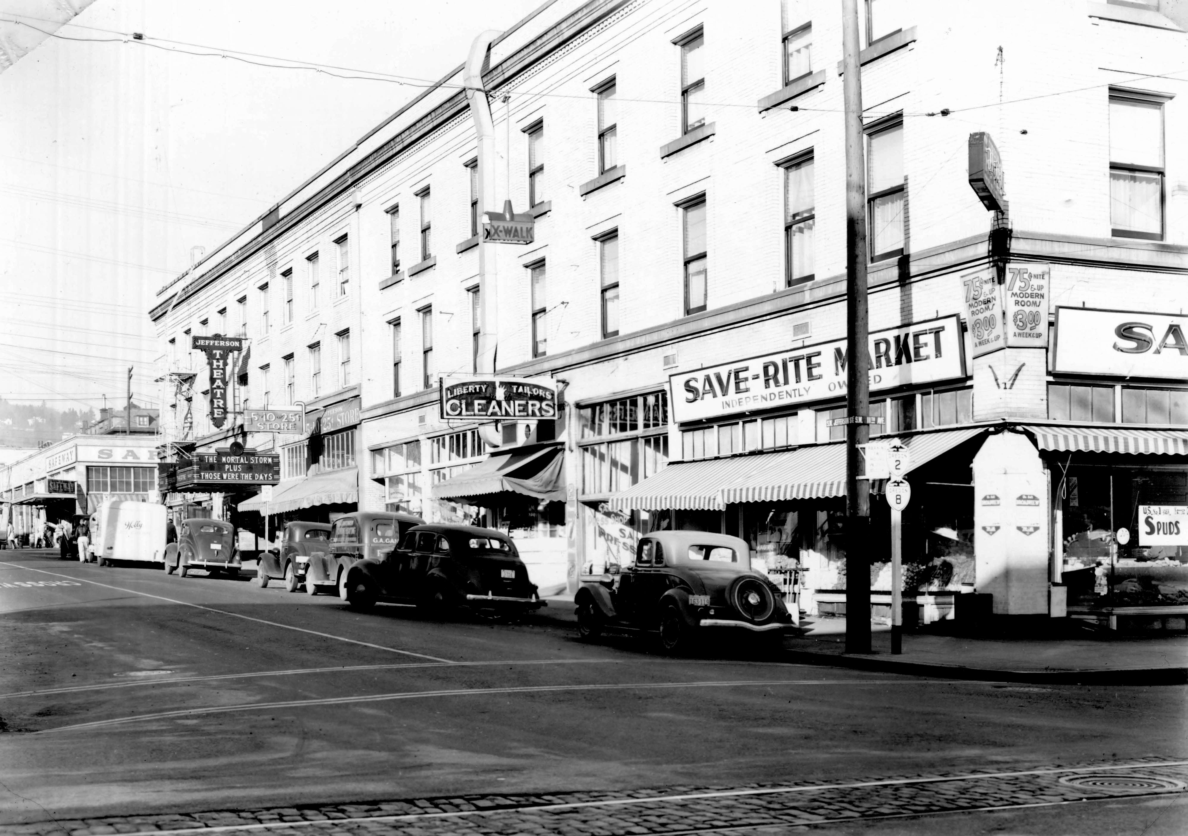
86 KB | A close-up of the sign in this photo of SW Harbor Drive & Jefferson in Portland.<br /> 📆 1949<br /> 🖼 City of Portland Archives via [https://vintageportland.wordpress.com/2011/04/14/harbor-drive-sw-jefferson-1949/ Vintage Portland] | 1 |
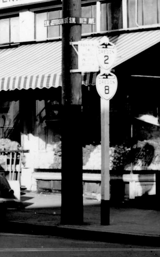
| 01:29, 15 February 2021 | A2005-001-796-sw-jefferson-west-from-11th-1940-shields.jpg (file) |  |
188 KB | A close-up of the shields in this photo of SW Jefferson & 11th in Portland.<br /> 📆 1940<br /> 🖼 City of Portland Archives via [https://vintageportland.wordpress.com/2011/04/25/jefferson-west-apartments-1940/ Vintage Portland]<br /> 🆔 A2005-001.796 | 1 |
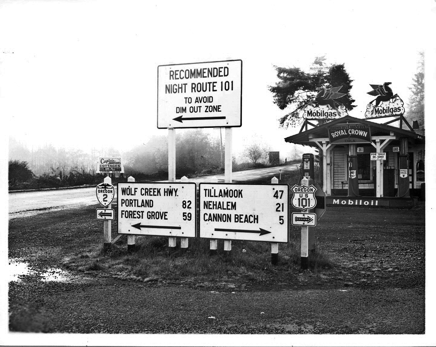
| 01:25, 15 February 2021 | 1942c - OSHD - Cannon Beach Jct with 101 Night Route.jpg (file) |  |
813 KB | A photo of the signs at Cannon Beach Junction, the junction of OR-2 and US-101. A recommended 101 night route sign indicates how motorists can avoid the World War II dim-out zone.<br /> 📆 c. 1942<br /> 🖼 Oregon State Highway Department | 1 |
| 22:36, 14 February 2021 | 1944 - Gerald W. Williams Collection 207 - Quartz Creek Bridge, Clatsop County, Oregon.jpg (file) |  |
2.25 MB | The completed Quartz Creek Bridge along the Wolf Creek Highway after a fire.<br /> 📆 1944<br /> 🖼 [https://www.flickr.com/photos/osucommons/8113540767/ OSU Special Collections & Archives] - Gerald W. Williams Collection<br /> 🆔 207 | 1 |
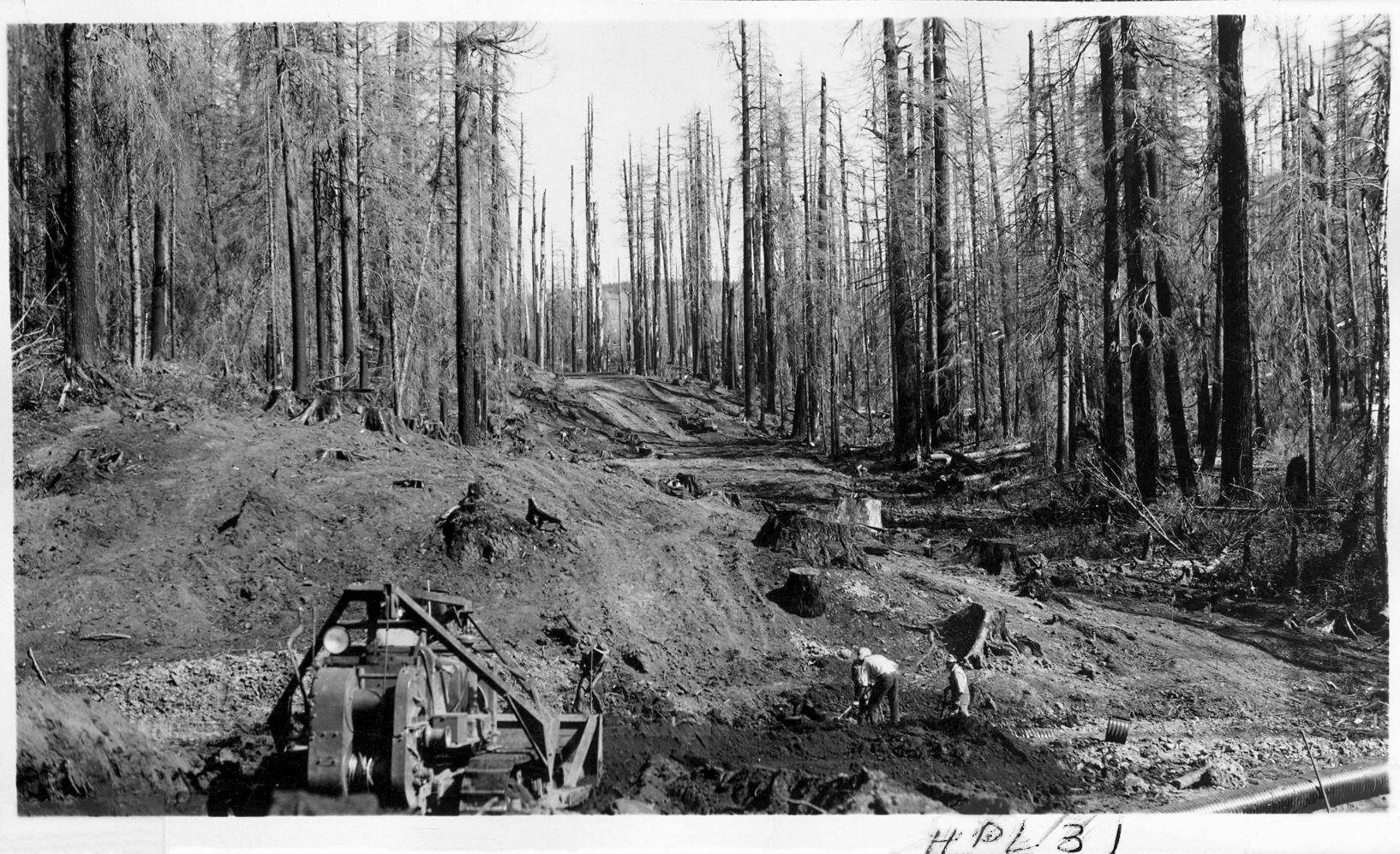
| 21:57, 14 February 2021 | Undated - OSHD HPL 31 - Wolf Creek Hwy.jpg (file) |  |
1.1 MB | Clearing trees and grading along the Wolf Creek Highway.<br /> 🖼 Oregon State Highway Department<br /> 🆔 HPL 31 | 1 |
| 21:49, 14 February 2021 | Undated - OSHD HPL 22 - Wolf Creek Hwy @ North Fork Ranger Station Summit.jpg (file) |  |
1.09 MB | Cutting through the mountain along the North Fork-Ranger Station Summit section of the Wolf Creek Highway.<br /> 🖼 Oregon State Highway Department<br /> 🆔 HPL 22 | 1 |
| 19:30, 14 February 2021 | Undated - OSHD G-513 - Wolf Creek showing close up of shovel on cut.jpg (file) |  |
1.43 MB | Close-up shot of shovel on cut along Wolf Creek Highway.<br /> 🖼 Oregon State Highway Department via [http://records.sos.state.or.us/ORSOSWebDrawer/RecordHtml/6398266 Oregon State Archives]<br /> 🆔 G-513 | 1 |
| 19:16, 14 February 2021 | Undated - OSHD G-512 - Wolf Creek showing long shot of shovel on cut.jpg (file) |  |
444 KB | Long shot of shovel on cut along Wolf Creek Highway.<br /> 🖼 Oregon State Highway Department via [http://records.sos.state.or.us/ORSOSWebDrawer/RecordHtml/6398265 Oregon State Archives]<br /> 🆔 G-512 | 1 |
| 18:38, 14 February 2021 | Undated - OSHD G-510 - Wolf Creek construction showing Quartz Creek Bridge from below.jpg (file) |  |
665 KB | Construction of the Quartz Creek Bridge on the Wolf Creek Highway as seen from below.<br /> 📆 c. 1938<br /> 🖼 Oregon State Highway Department via [http://records.sos.state.or.us/ORSOSWebDrawer/RecordHtml/6398263 Oregon State Archives]<br /> 🆔 G-510 | 1 |
| 17:38, 14 February 2021 | Undated - OSHD G-509 - Wolf Creek construction showing Quartz Bridge from below.jpg (file) |  |
607 KB | Construction of the Quartz Creek Bridge on the Wolf Creek Highway as seen from below.<br /> 📆 c. 1938<br /> 🖼 Oregon State Highway Department via [http://records.sos.state.or.us/ORSOSWebDrawer/RecordHtml/6398262 Oregon State Archives]<br /> 🆔 G-509 | 1 |
| 17:34, 14 February 2021 | Undated - OSHD G-508 - Wolf Creek construction showing Quartz Creek Bridge from east end.jpg (file) |  |
1.26 MB | Quartz Creek Bridge construction on Wolf Creek Highway as seen from east end.<br /> 📆 c. 1938<br /> 🖼 Oregon State Highway Department via [http://records.sos.state.or.us/ORSOSWebDrawer/RecordHtml/6398261 Oregon State Archives]<br /> 🆔 G-508 | 1 |
| 17:30, 14 February 2021 | Undated - OSHD G-507 - Wolf Creek construction showing Quartz Creek Bridge.jpg (file) |  |
486 KB | Construction of the Quartz Creek Bridge along the Wolf Creek Highway.<br /> 📆 c. 1938<br /> 🖼 Oregon State Highway Department via [http://records.sos.state.or.us/ORSOSWebDrawer/RecordHtml/6398260 Oregon State Archives]<br /> 🆔 G-507 | 1 |
| 17:22, 14 February 2021 | Undated - OSHD 3, 4, 10 - Wolf Creek Hwy. Coast Range Summit MP 13.33-13.62.jpg (file) |  |
2.55 MB | Log clearing operations on the Wolf Creek Highway near the Coast Range Summit between Necanicum Junction and Elsie, looking easterly towards Portland. Location is near present-day US-26 mileposts 13.33-13.62 (engineering stations 221+27.5, 222+25 and 227+25 respectively).<br /><!-- 📆 Unknown<br />--> 🖼 Oregon State Highway Department | 1 |
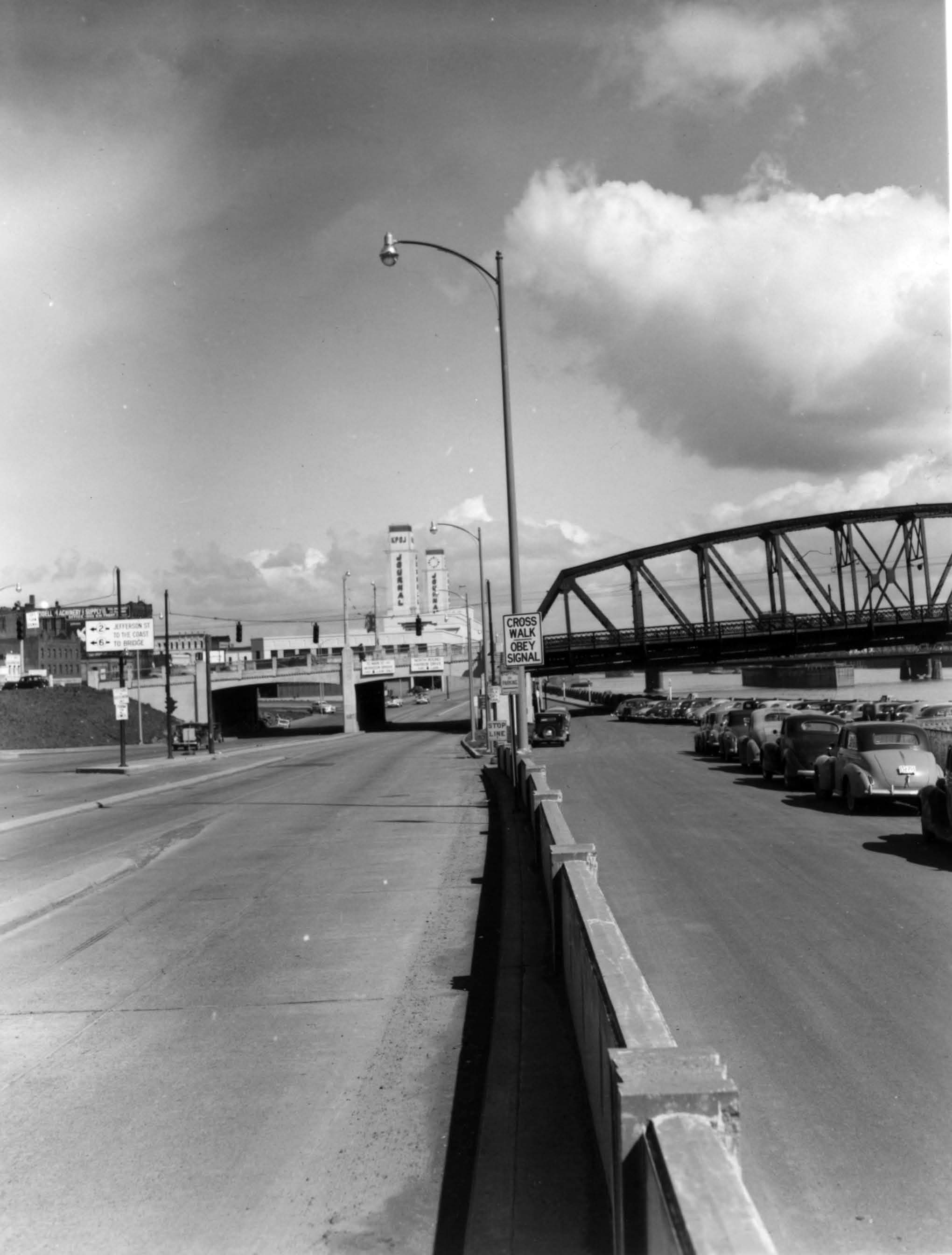
| 17:08, 14 February 2021 | Harbor-dr-south-of-hawthorne-bridge-looking-north-1949.jpg (file) |  |
233 KB | Harbor Drive south of the Hawthorne Bridge looking north.<br /> 📆 1949<br /> 🖼 City of Portland Archives via [https://vintageportland.wordpress.com/2011/04/14/harbor-drive-sw-jefferson-1949/ Vintage Portland] | 1 |
| 13:47, 14 February 2021 | A2005-001-796-sw-jefferson-west-from-11th-1940.jpg (file) |  |
949 KB | The corner of SW Jefferson St. (Oregon Routes 2 and 8) and SW 11th Ave. in Portland.<br /> 📆 1940<br /> 🖼 City of Portland Archives via [https://vintageportland.wordpress.com/2011/04/25/jefferson-west-apartments-1940/ Vintage Portland]<br /> 🆔 A2005-001.796 | 1 |
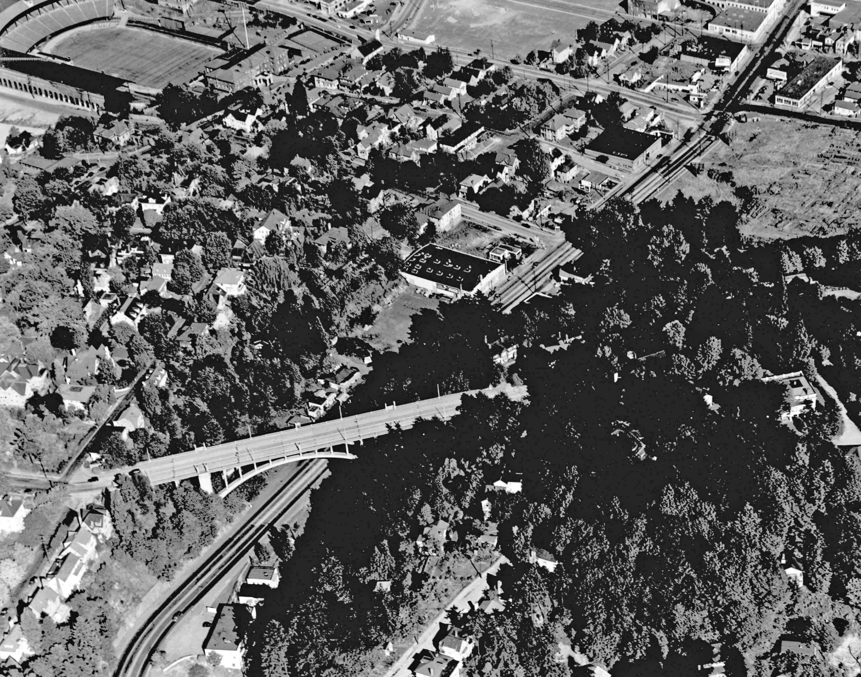
| 13:40, 14 February 2021 | A2005-001-792-sw-jefferson-northeast-1947-2.jpg (file) |  |
865 KB | Aerial photo of SW Jefferson Street (Sunset Highway) near the Vista Bridge.<br /> 📆 1947<br /> 🖼 City of Portland Archives via [https://vintageportland.wordpress.com/2012/08/24/aerial-view-goose-hollow-1947/ Vintage Portland]<br /> 🆔 A2005-001.792 | 1 |
| 01:52, 14 February 2021 | Undated - 288 - I-5 at Bonita Road.jpg (file) |  |
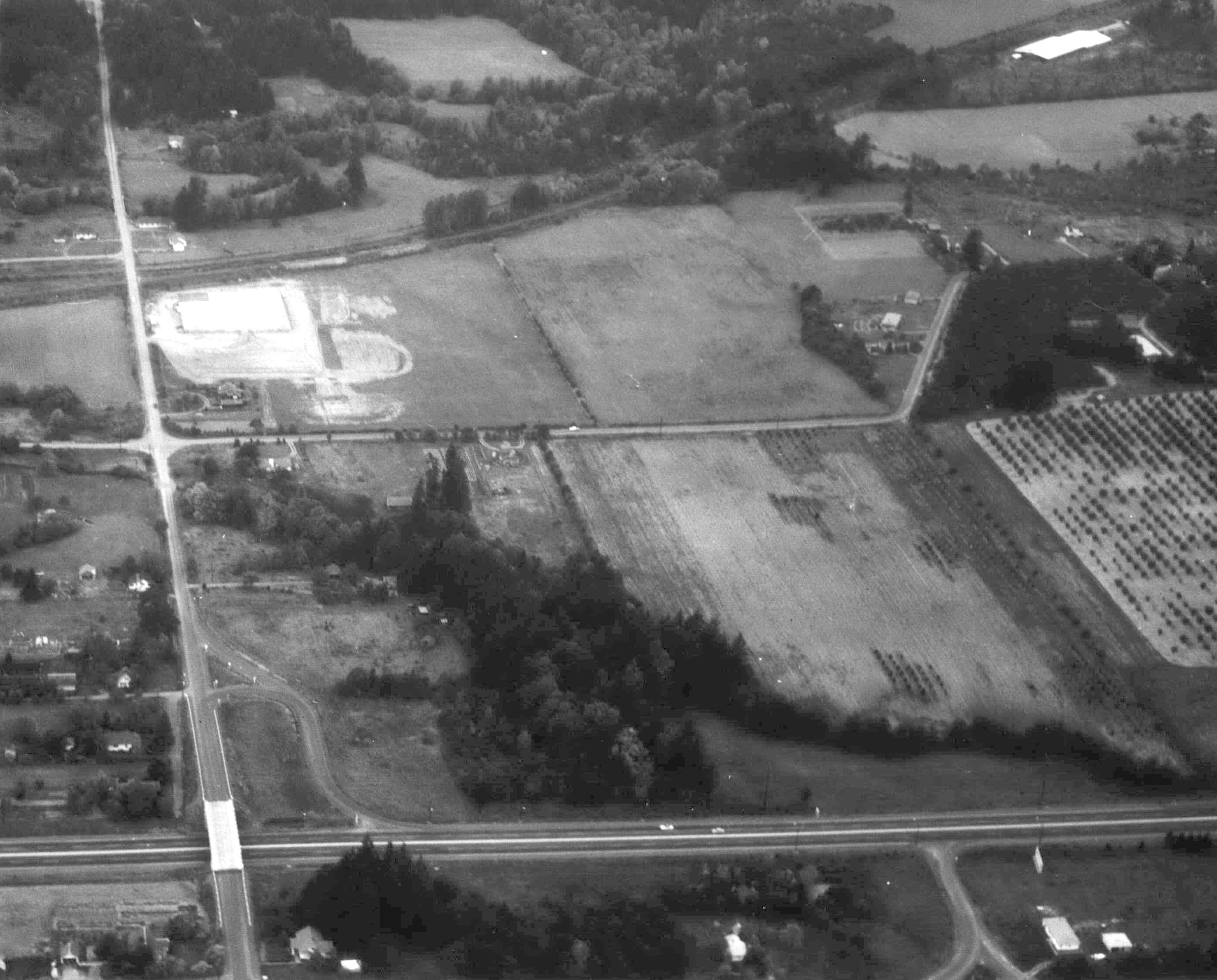
847 KB | Aerial photo of Interstate 5 at Bonita Road.<br /> 🖼 City of Beaverton ([https://web.archive.org/web/20160304065358if_/http://apps.beavertonoregon.gov/HistoricPhotos/photos/aerial_09_p.jpg archived])<br /> 🆔 288 | 1 |
| 01:44, 14 February 2021 | 1950s-sunset-hwy-barnes-road.jpg (file) |  |
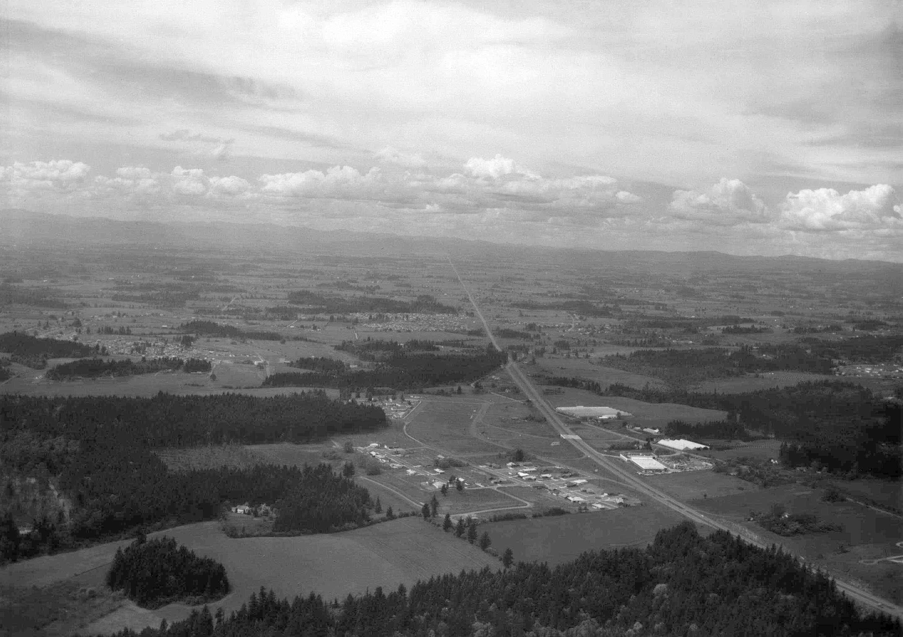
471 KB | Looking west near the recently completed Barnes Road interchange along the Sunset Highway.<br /> 📆 1950s<br /> 🖼 City of Beaverton ([https://web.archive.org/web/20160304082933if_/http://apps.beavertonoregon.gov/HistoricPhotos/photos/aerial_02_p.jpg archived])<!--<br /> 🆔 xxx--> | 1 |
| 01:40, 14 February 2021 | A2004-002-6716-aerial-view-sw-barnes-rd-highway-26-1949.jpg (file) |  |
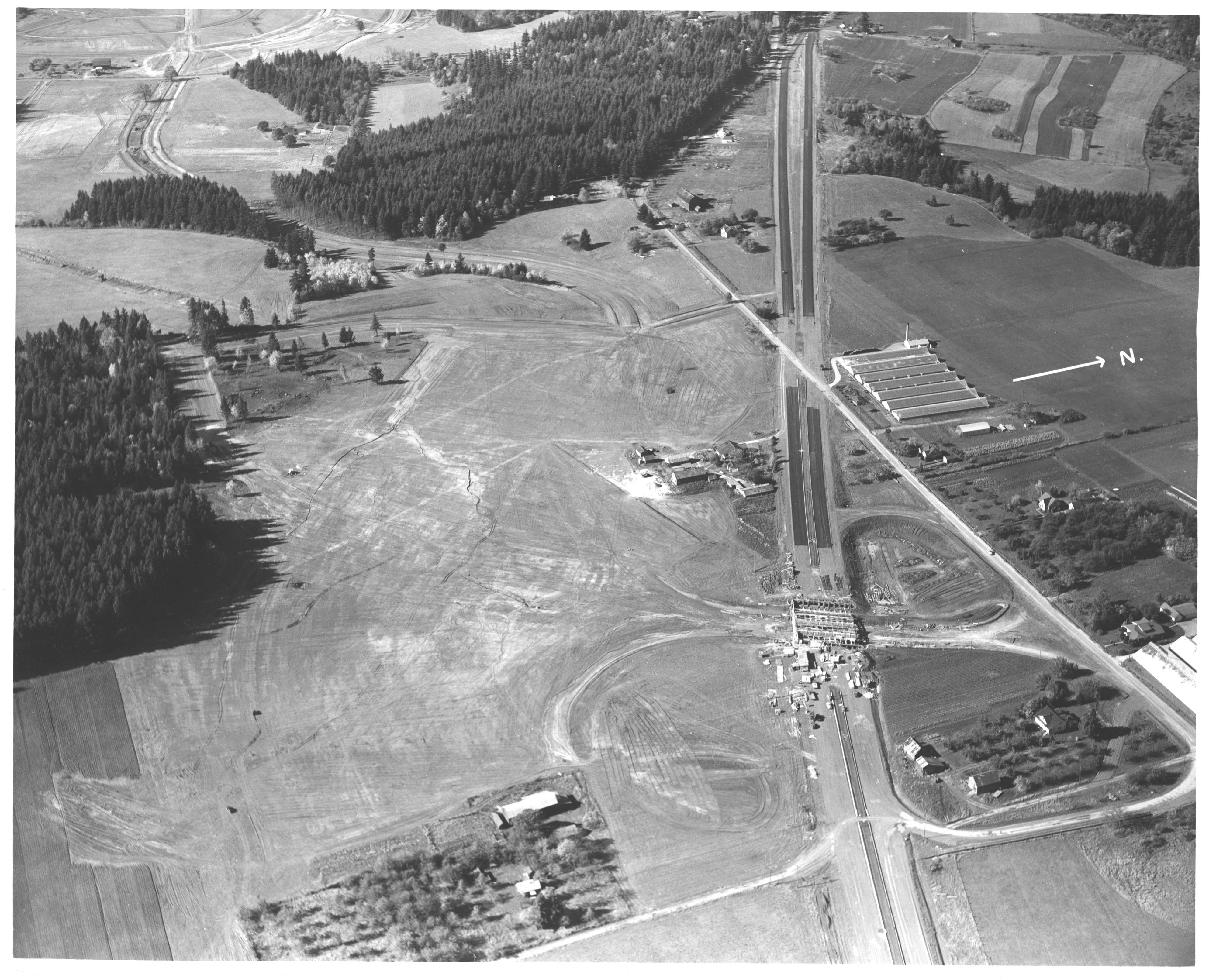
1.26 MB | Aerial view of the construction of the Barnes Road interchange on the Sunset Highway.<br /> 📆 1949<br /> 🖼 City of Portland Archives via [https://vintageportland.wordpress.com/2011/12/19/sunset-highway-1949/ Vintage Portland]<br /> 🆔 A2004-002.6716<br /> | 1 |
| 01:00, 14 February 2021 | A2004-002-864-view-from-city-washington-park-1935.jpg (file) |  |
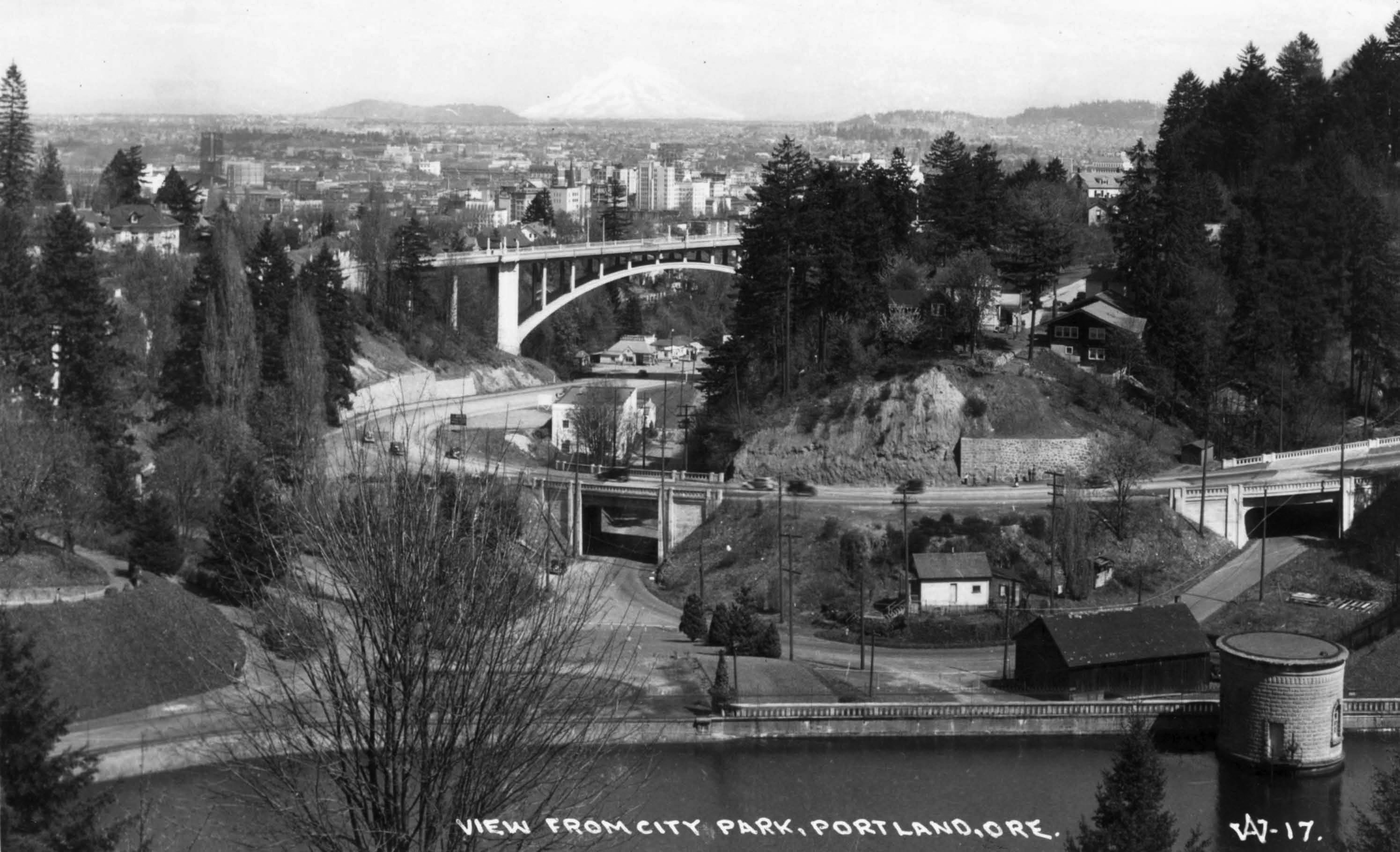
584 KB | View of the eastern end of Canyon Road and the Vista Bridge from Washington Park.<br /> 📆 1935<br /> 🖼 City of Portland Archives via [https://vintageportland.wordpress.com/2010/07/08/view-from-washington-park-1935/ Vintage Portland]<br /> 🆔 A2004-002.864<br /> | 1 |
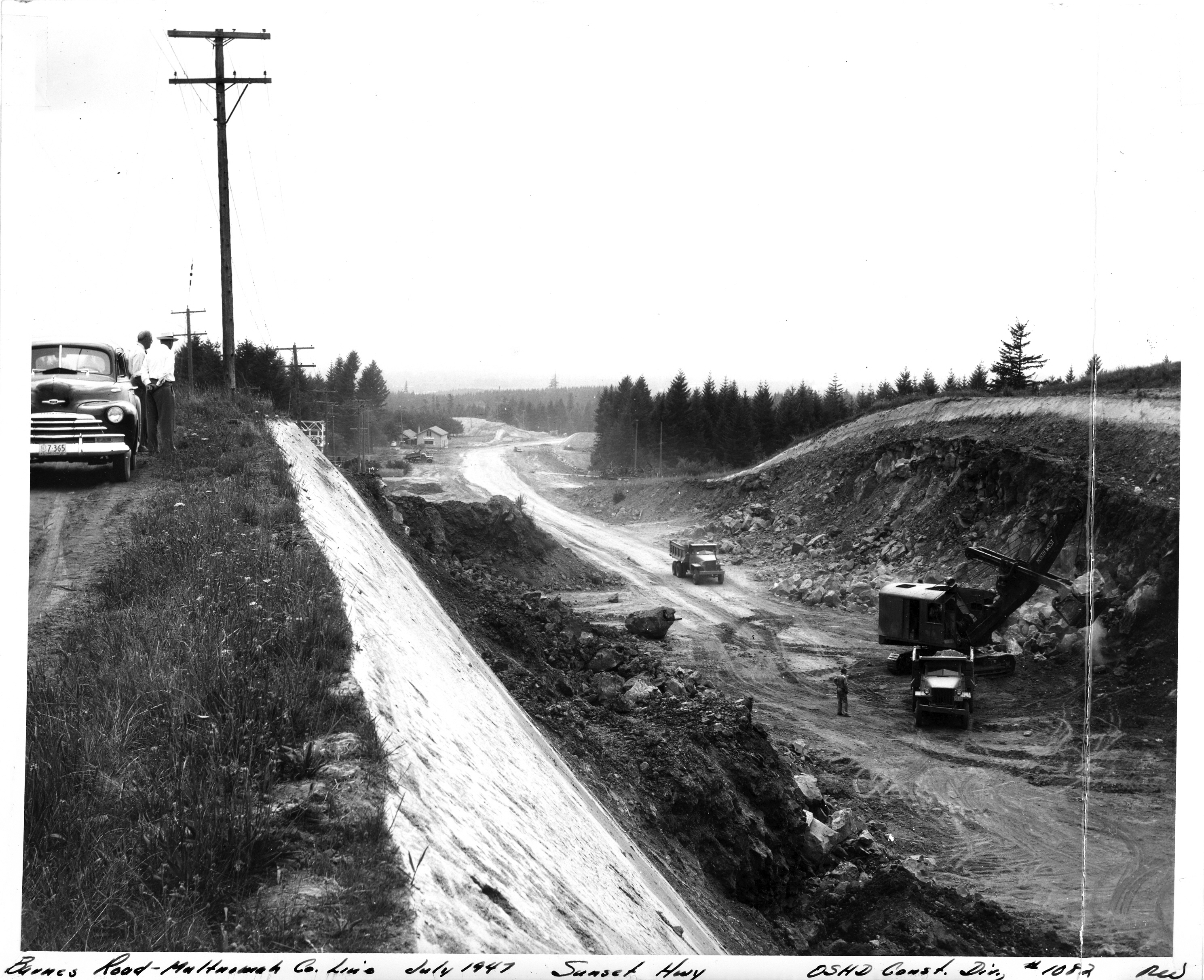
| 00:50, 14 February 2021 | 1947-07 - OSHD 1082 - Barnes Road-Multnomah Co Line.jpg (file) |  |
2.86 MB | Constructing the Barnes Road-Multnomah County Line section of the Sunset Highway.<br /> 📆 July 1947<br /> 🖼 Oregon State Highway Department, Construction Division<br /> 🆔 1082 | 1 |
| 00:44, 14 February 2021 | 1937-03-18 - OSHD HPL 37 - Wolf Creek Hwy. Sunset Logging Co's Operations South of Highway, Looking North.jpg (file) |  |
950 KB | Looking north at the Sunset Logging Company's operations south of the Wolf Creek Highway, looking north.<br /> 📆 18 March 1937<br /> 🖼 Oregon State Highway Department<br /> 🆔 HPL 37<br /> | 1 |
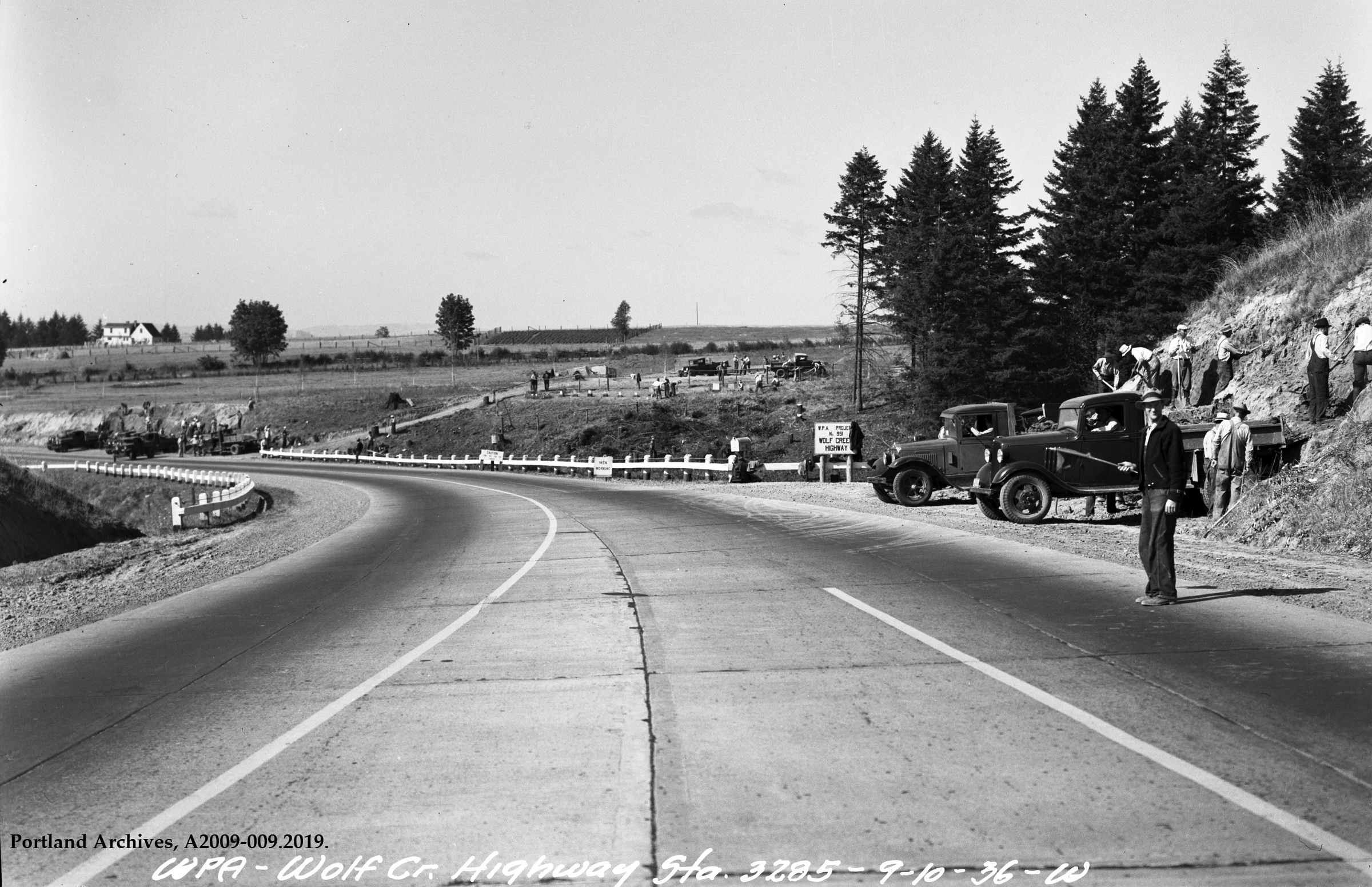
| 00:34, 14 February 2021 | 1936-sep-10 wolf-creek-highway-construction a2009-009.2019.jpg (file) |  |
1.88 MB | Construction of the Wolf Creek Highway (WPA Project #951) near Sylvan (engineering station 3285) looking west.<br /> 📆 10 September 1936<br /> 🔗 [https://efiles.portlandoregon.gov/record/3900699 City of Portland Archives] via [https://vintageportland.wordpress.com/2020/06/15/wolf-creek-highway-1936-4/ Vintage Portland]<br /> 🆔 A2009-009.2029<br /> | 1 |
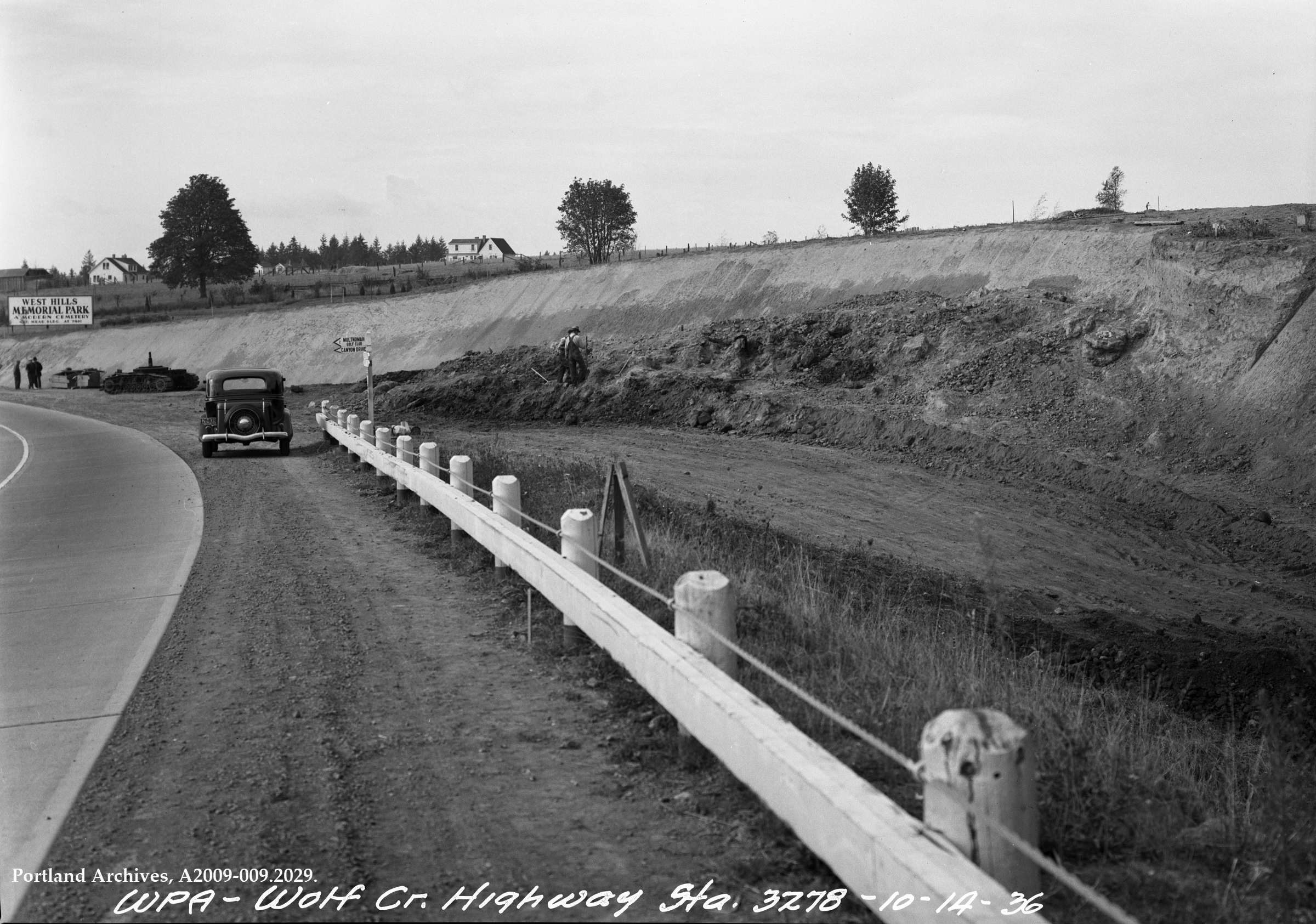
| 00:25, 14 February 2021 | 1936-oct-14 wolf-creek-highway-sylvan-looking-west a2009-009.2029-1.jpg (file) |  |
1.99 MB | The Wolf Creek Highway at Sylvan (engineering station 3278) looking west. 📆 14 October 1936 🖼 City of Portland Archives 🆔 A2009-009.2029 🔗 https://efiles.portlandoregon.gov/record/3901401 via https://vintageportland.wordpress.com/2020/03/23/wolf-creek-highway-1936-2/ | 1 |
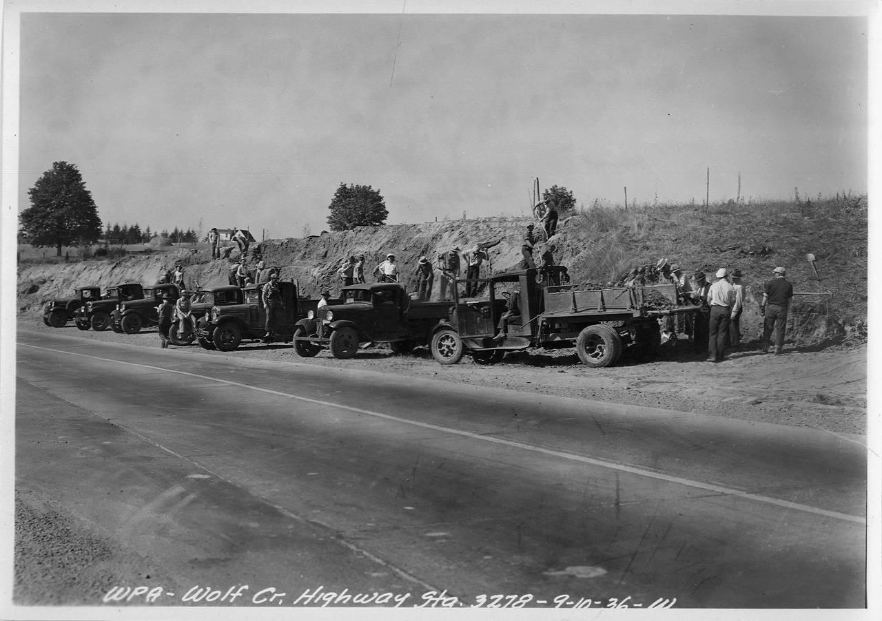
| 00:20, 14 February 2021 | 1936-09-10 - WPA - Wolf Creek Highway Station 3278 W.jpg (file) |  |
328 KB | WPA vehicles and personnel constructing the Wolf Creek Highway near Sylvan (engineering station 3278). 📆 10 September 1936 | 1 |
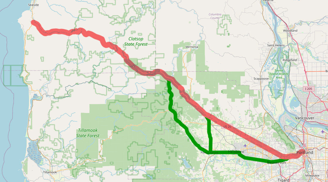
| 02:32, 12 February 2021 | OR 2-map.jpg (file) |  |
529 KB | Map showing old alignments of OR-2 | 1 |
| 02:12, 12 February 2021 | OR 53 1948.png (file) |  |
98 KB | 1948 version of route shield for OR-53 | 1 |
| 02:12, 12 February 2021 | OR 47 1948.png (file) |  |
93 KB | 1948 version of route shield for OR-47 | 1 |