File list
Jump to navigation
Jump to search
This special page shows all uploaded files.
| Date | Name | Thumbnail | Size | User | Description | Versions |
|---|---|---|---|---|---|---|
| 10:37, 13 June 2021 | Mp-county-multnomah-examples.png (file) |  |
119 KB | Jonathan | Examples of mileposts found along Multnomah County Roads.<br /> 📷 Jonathan Ledbetter<br /> 📆 13 June 2021 | 1 |
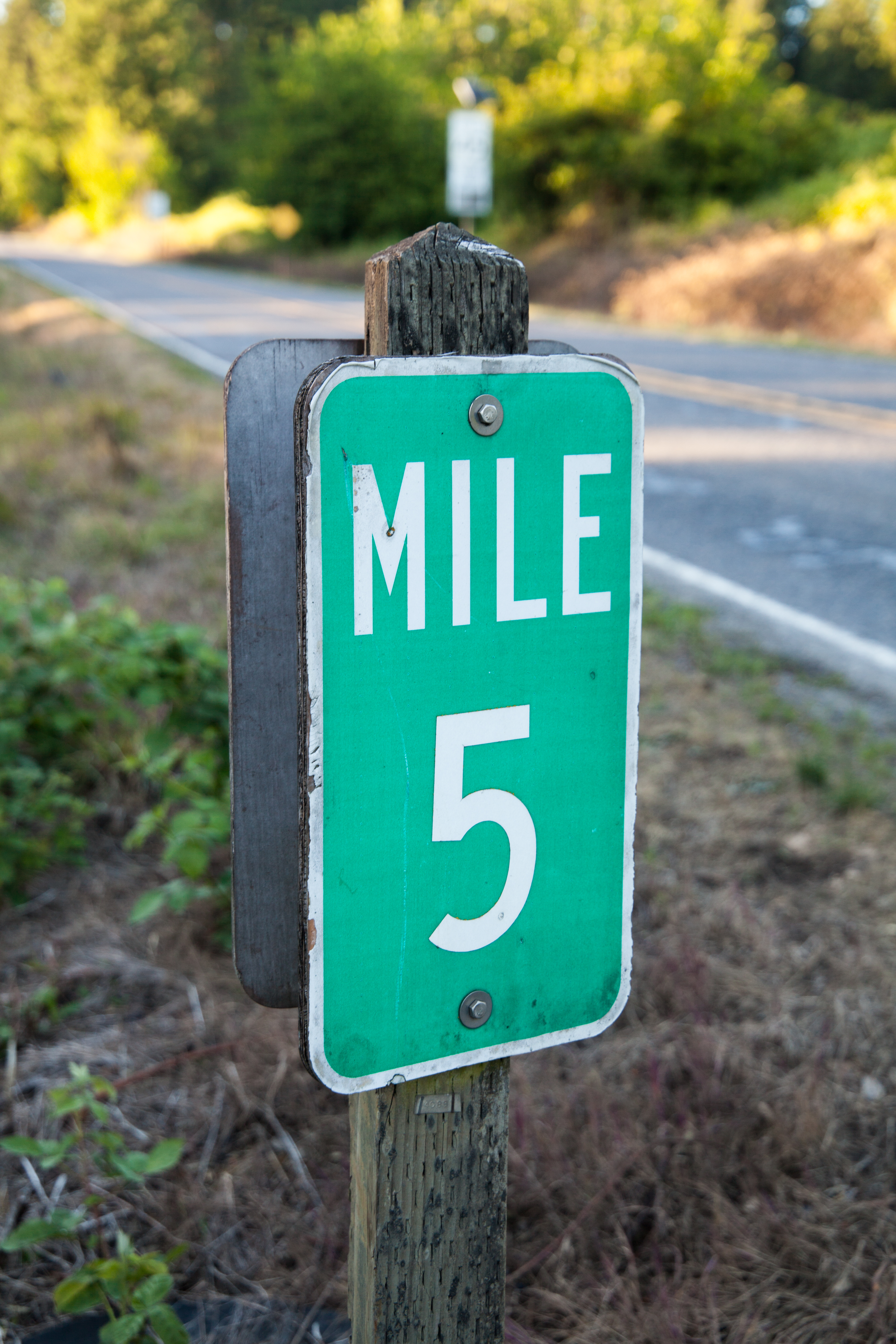
| 09:42, 13 June 2021 | 2021-05-28 multco-milepost-5 1536.jpg (file) |  |
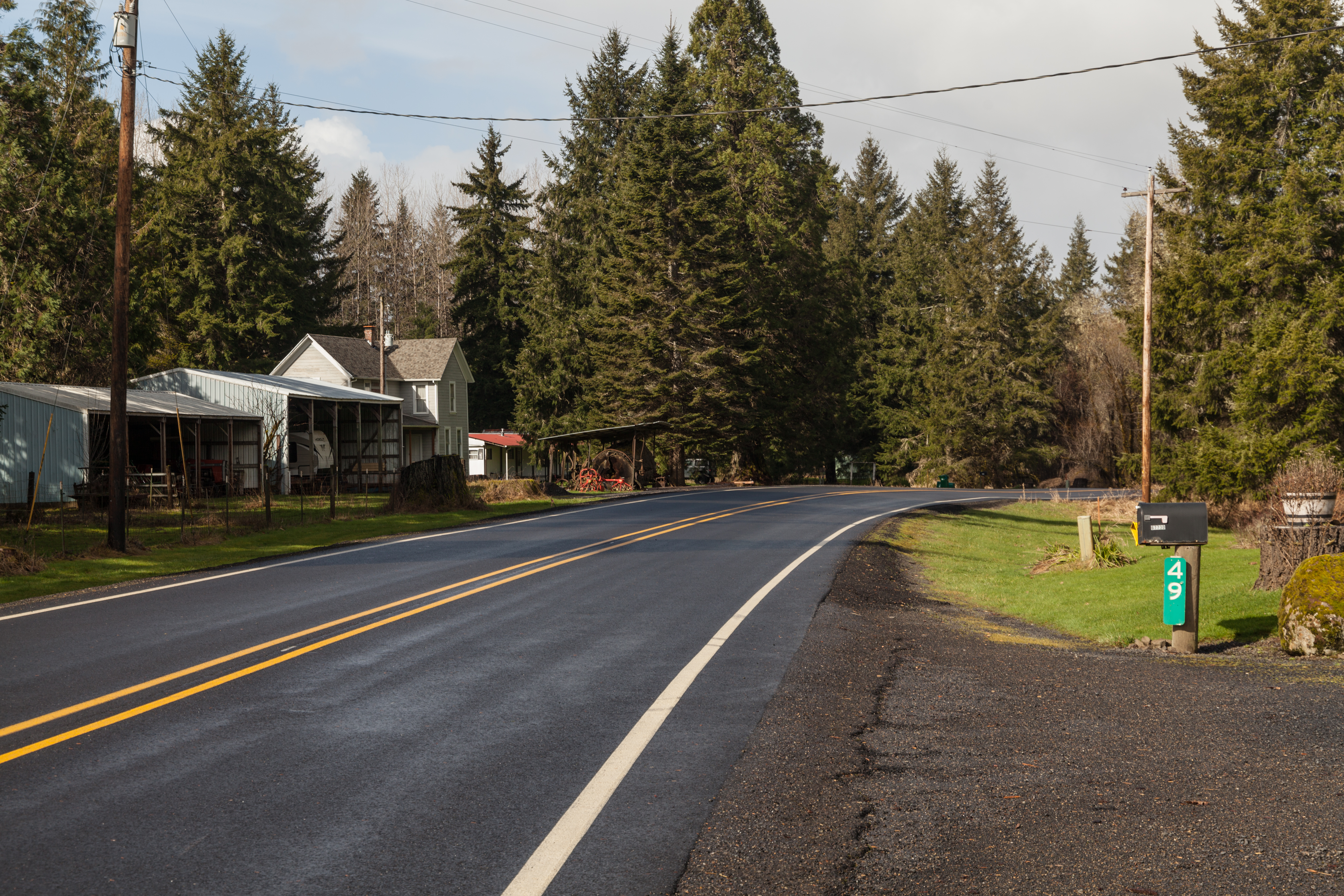
12.16 MB | Jonathan | Milepost 5 along Cornelius Pass Road (OR-127) north at the Multnomah-Washington County Line.<br /> 📷 Jonathan Ledbetter<br /> 📆 28 May 2021 | 1 |
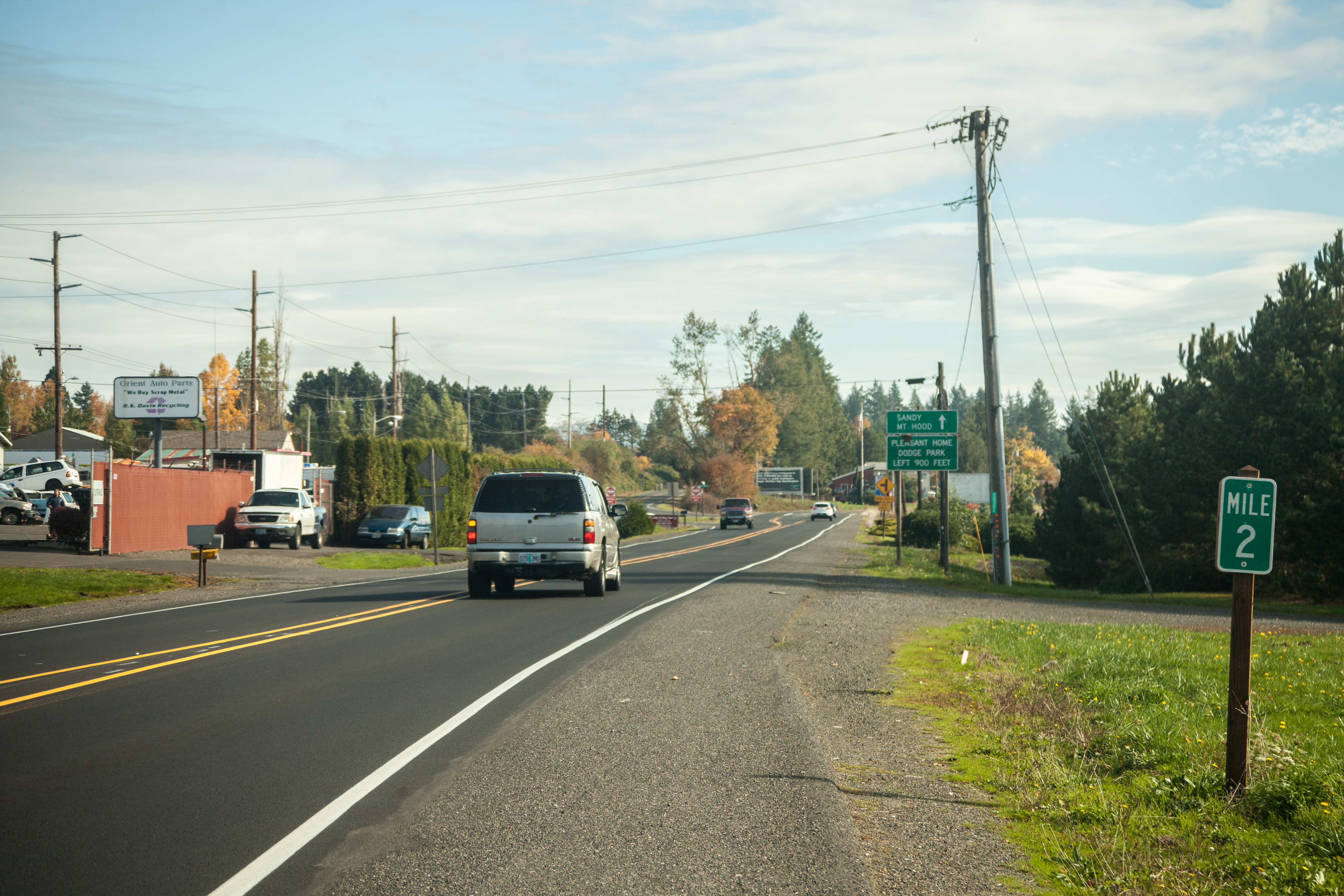
| 09:38, 13 June 2021 | 2017-10-25 multco-milepost 3928.jpg (file) |  |
11.26 MB | Jonathan | Milepost 2 along SE Orient Drive (former OR-50/US-26) in Orient.<br /> 📷 Jonathan Ledbetter<br /> 📆 25 October 2017 | 1 |
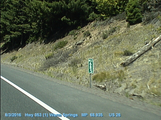
| 00:21, 10 June 2021 | 2016-08-03 odot-vidlog US-26(53) MP68.935-WB.jpg (file) | _MP68.935-WB.jpg) |
147 KB | Jonathan | An oddly-numbered and oddly-placed "Mile 68.5" marker at MP 68.935 on US-26 near Clear Creek in the Mount Hood National Forest.<br /> 🖼 [https://dvlprod-ordot.msappproxy.net/cf/dvl/index.cfm?&fuseaction=entry ODOT Digital Video Log]<br /> 📆 3 August 2016 | 1 |
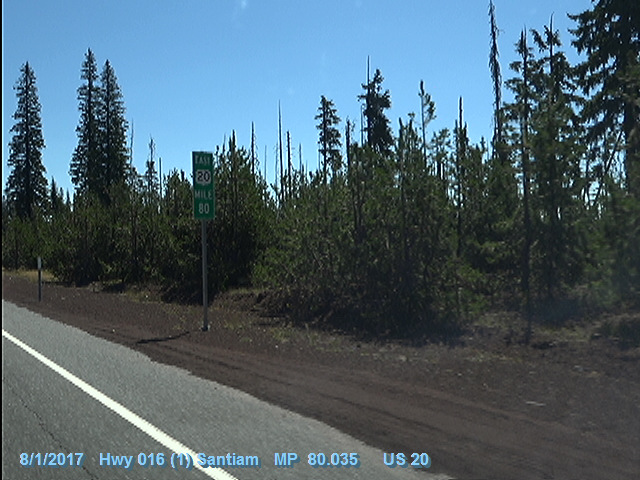
| 23:36, 9 June 2021 | 2017-08-01 odot-vidlog US-20(16) MP80.035-EB.jpg (file) | _MP80.035-EB.jpg) |
136 KB | Jonathan | An enhanced milepost at MP 80 on US-20 eastbound in the Cascades.<br /> 🖼 [https://dvlprod-ordot.msappproxy.net/cf/dvl/index.cfm?&fuseaction=entry ODOT Digital Video Log]<br /> 📆 1 August 2017 | 1 |
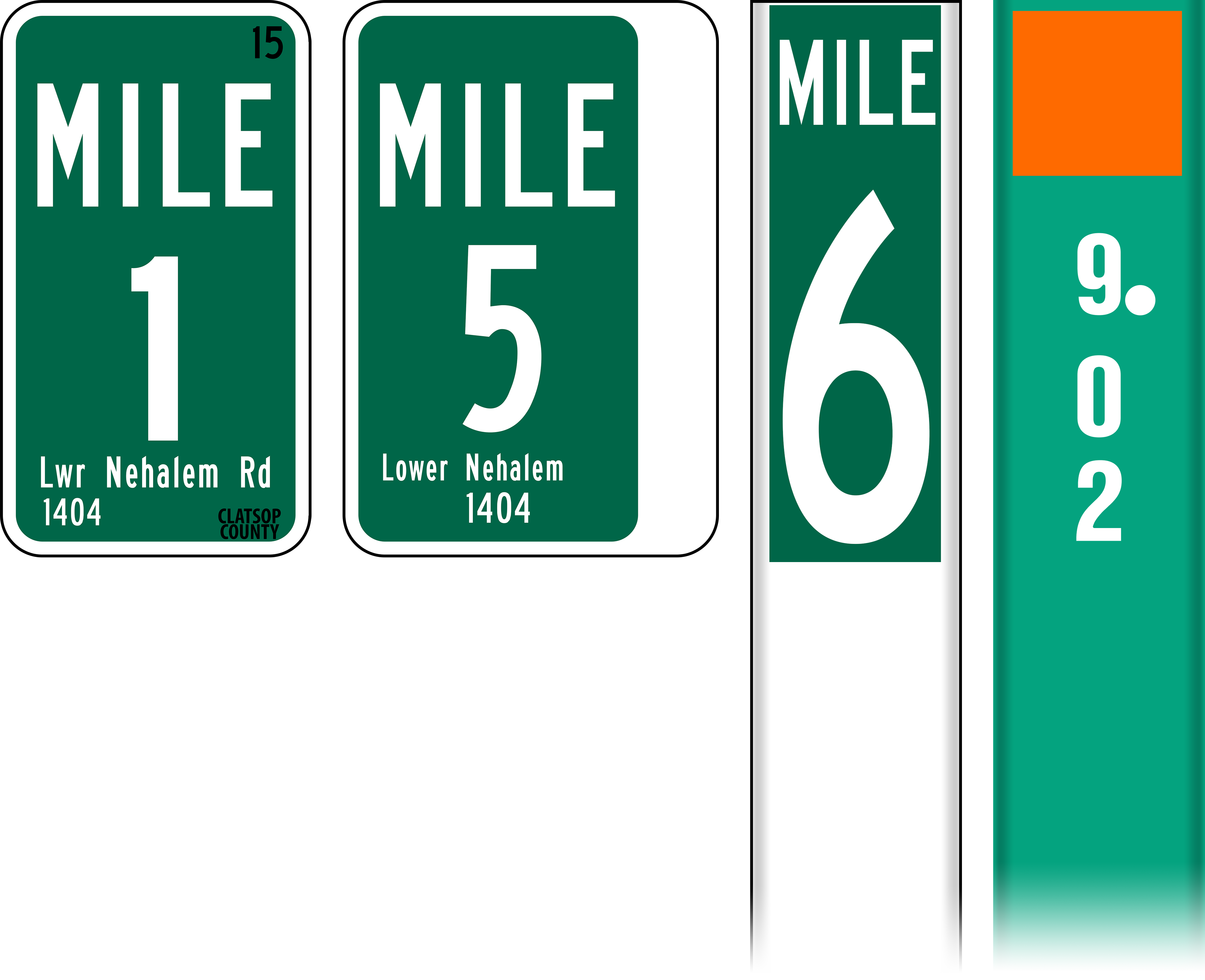
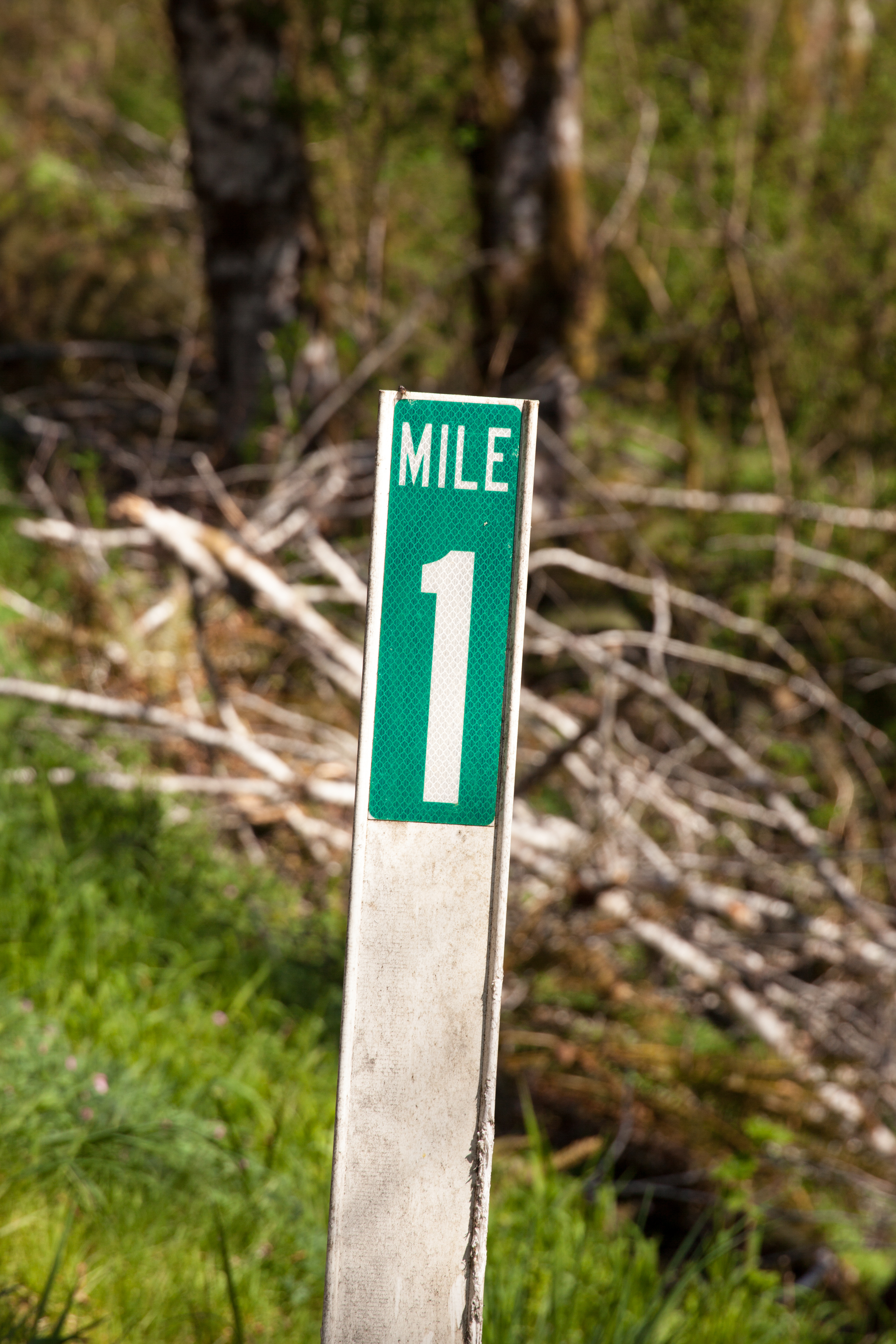
| 22:36, 9 June 2021 | Mp-county-clatsop-examples.png (file) |  |
587 KB | Jonathan | Fixed dimensions of MILE sticker on white wicket milepost | 1 |
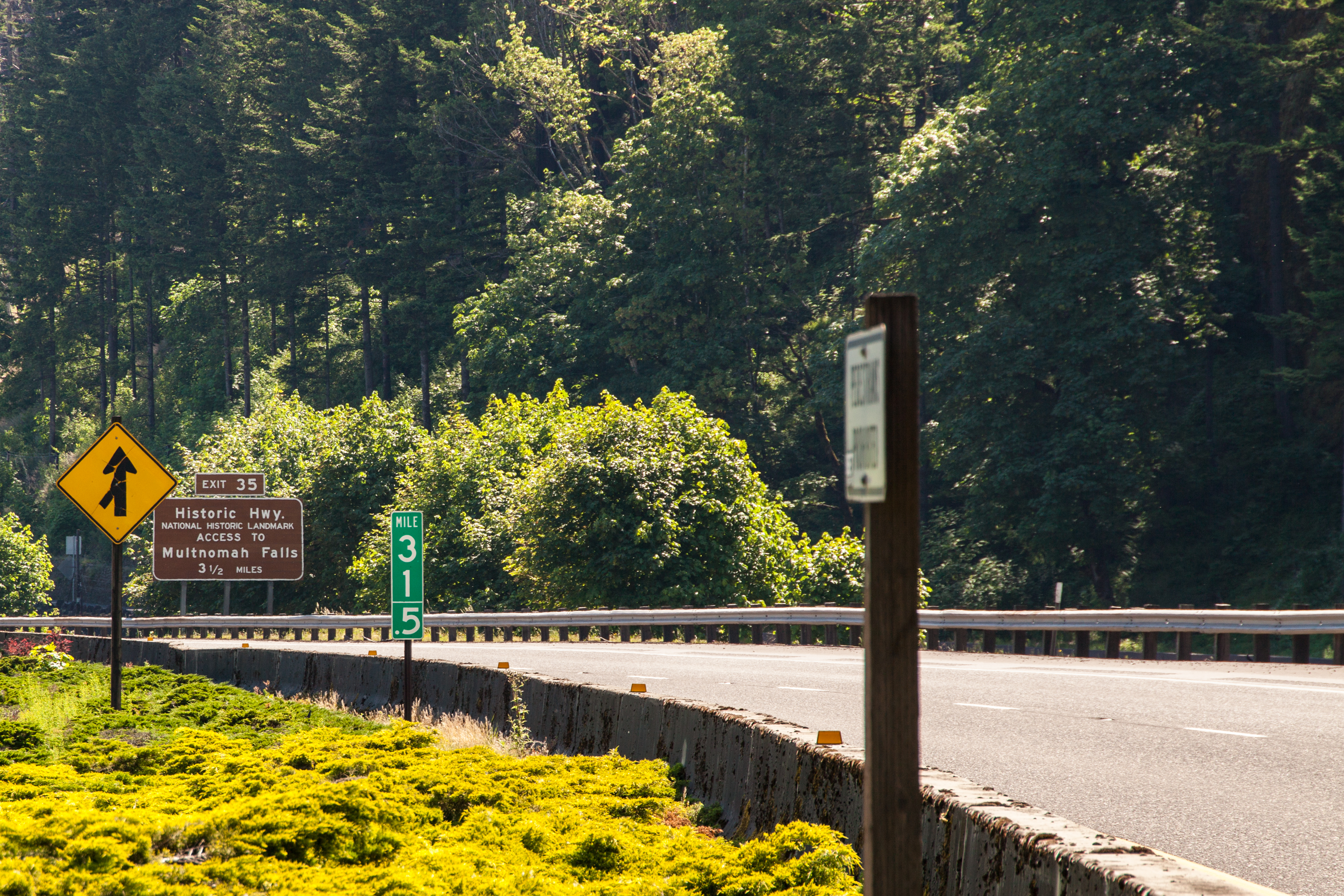
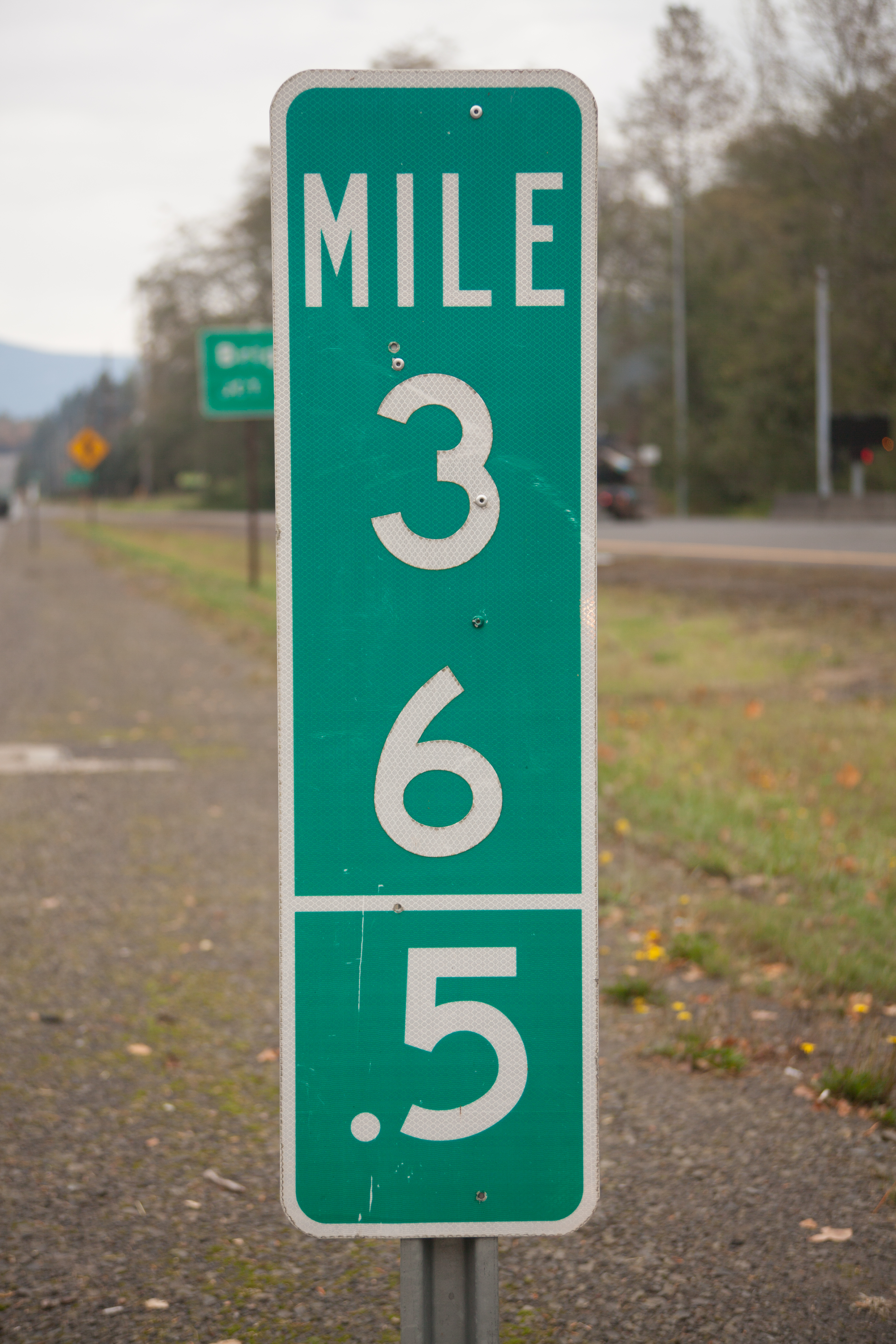
| 00:22, 8 June 2021 | 2021-06-01 milepost 31.5 1659.jpg (file) |  |
9.06 MB | Jonathan | A freeway-sized fractional mile marker at MP 31.5 along I-84/US-30 at Multnomah Falls.<br /> 📷 Jonathan Ledbetter<br /> 📆 1 June 2021 | 1 |
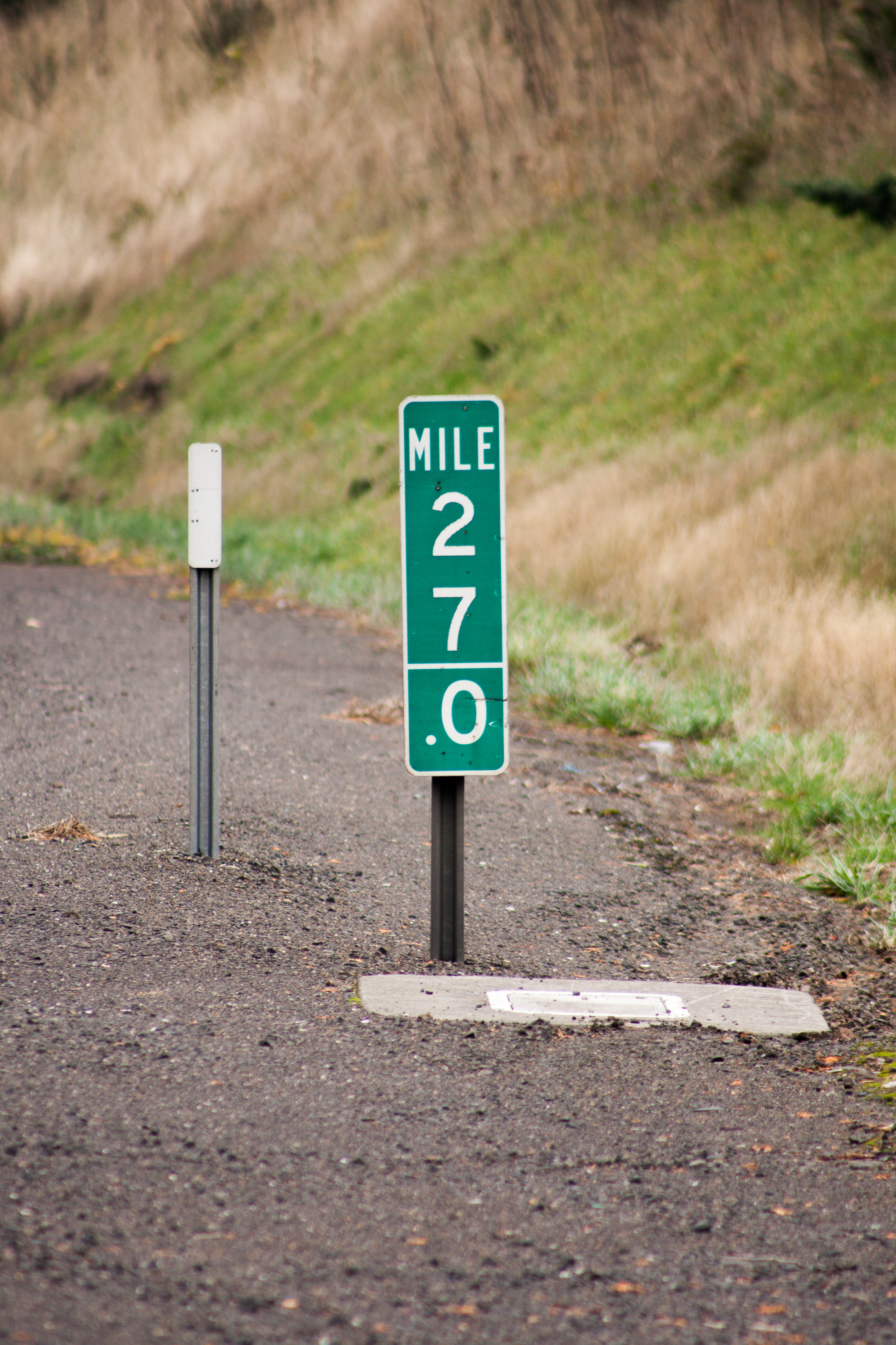
| 22:32, 7 June 2021 | 2021-06-01 milepost 68.9 3005.jpg (file) |  |
7.31 MB | Jonathan | A photo of milepost 68.9 along US-26 near Clear Creek in the Mount Hood National Forest. This shows an example of how Oregon avoids the "mile 69 problem."<br /> 📷 Jonathan Ledbetter<br /> 📆 1 June 2021 | 1 |
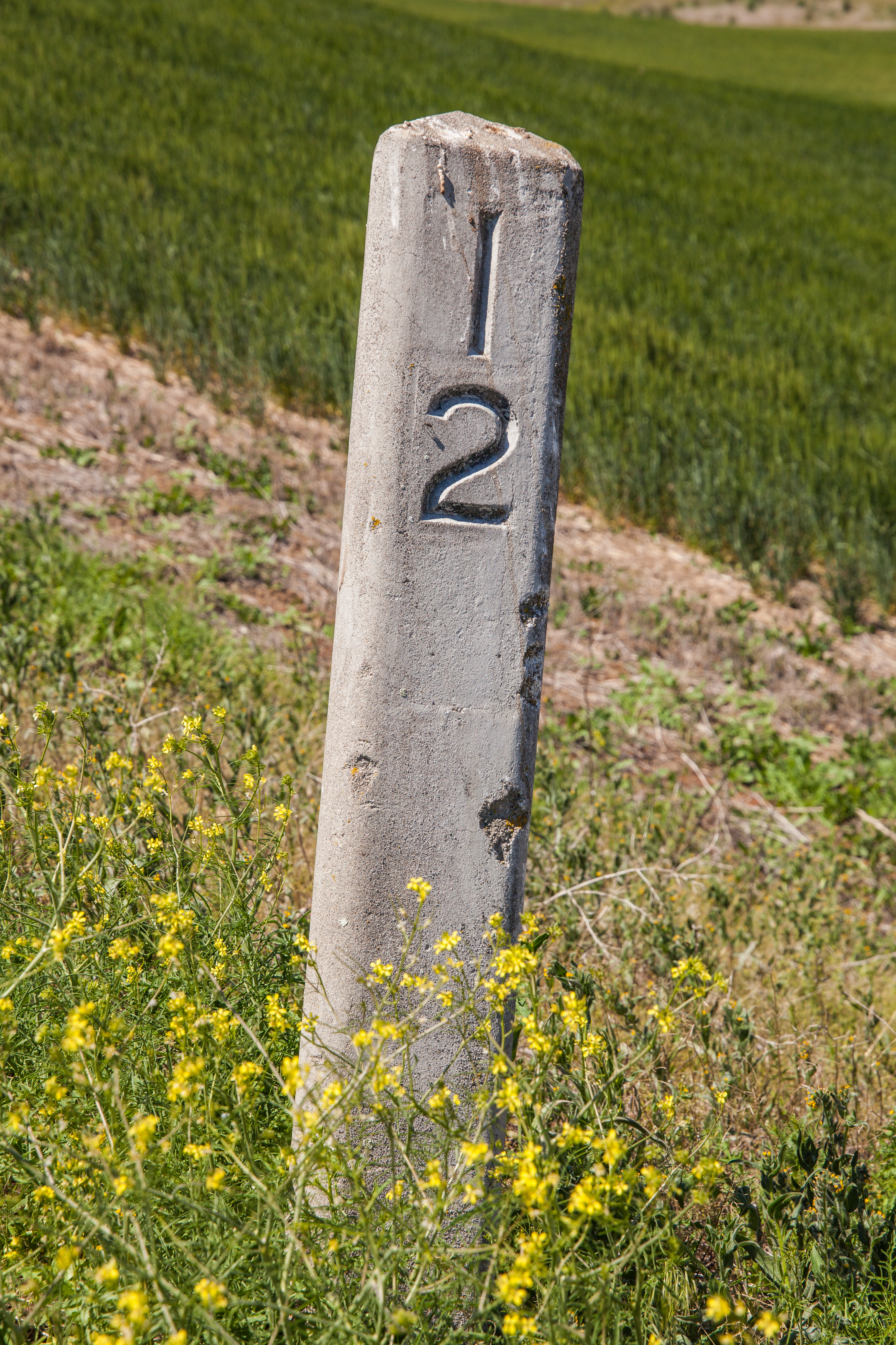
| 17:33, 3 June 2021 | 2021-06-01 orig-stone-milepost-12 2432.jpg (file) |  |
15.64 MB | Jonathan | Original concrete milepost 12 from The Dalles-California Highway, as found on an abandoned section of former OR-23/US-197 near Boyd, north of Dufur.<br /> 📷 Jonathan Ledbetter<br /> 📆 1 June 2021 | 1 |
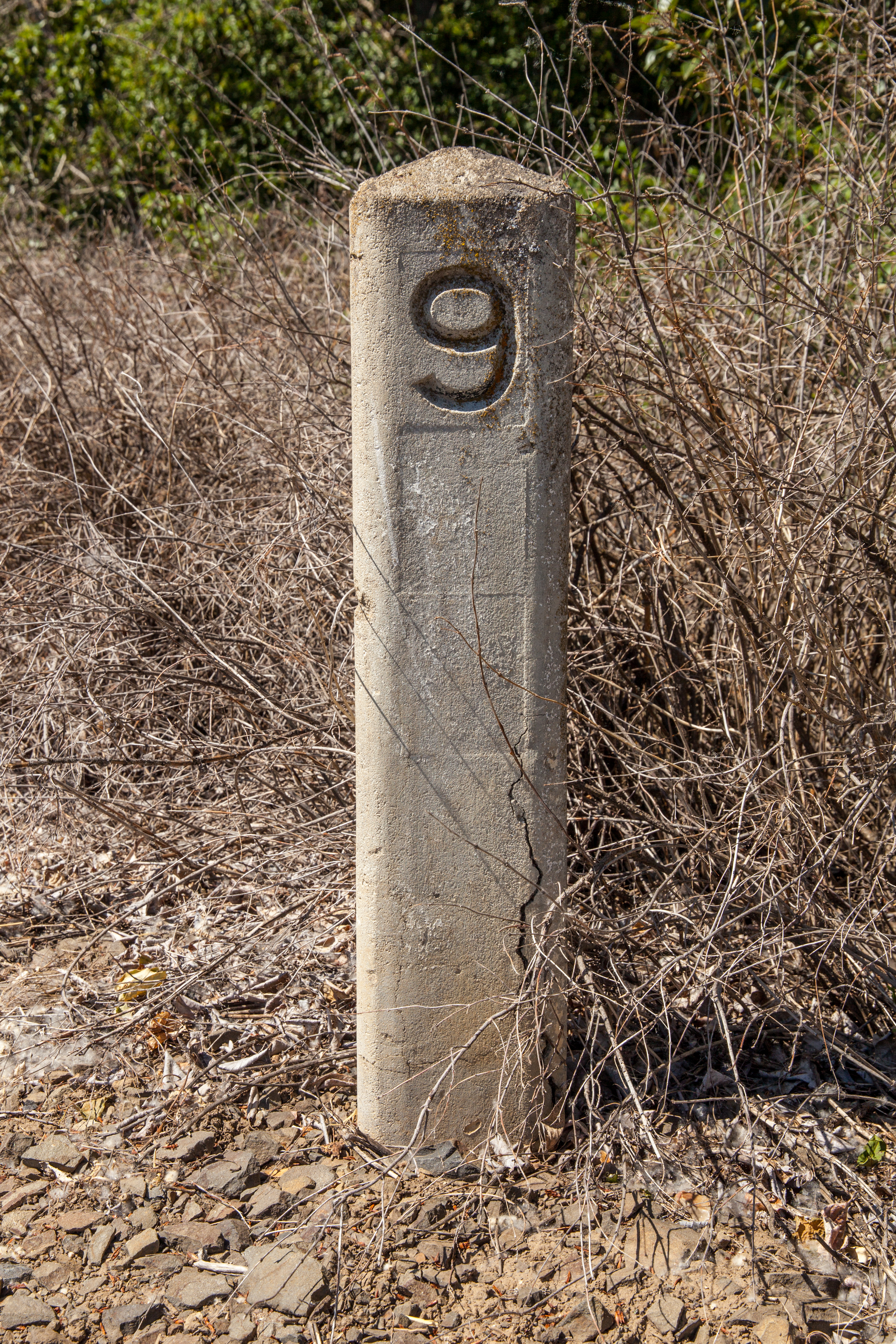
| 17:28, 3 June 2021 | 2021-06-01 orig-stone-milepost-9 2336.jpg (file) |  |
15.27 MB | Jonathan | Original concrete milepost 9 from The Dalles-California Highway, as found on Eightmile Rd. about halfway between The Dalles and Dufur.<br /> 📷 Jonathan Ledbetter<br /> 📆 1 June 2021 | 1 |
| 17:22, 3 June 2021 | 2021-06-01 orig-stone-milepost-3 2220.jpg (file) |  |
10.5 MB | Jonathan | Original concrete milepost 3 from The Dalles-California Highway, as found along Eightmile Rd. (former OR-23/US-197) near Petersburg.<br /> 📷 Jonathan Ledbetter<br /> 📆 1 June 2021 | 1 |
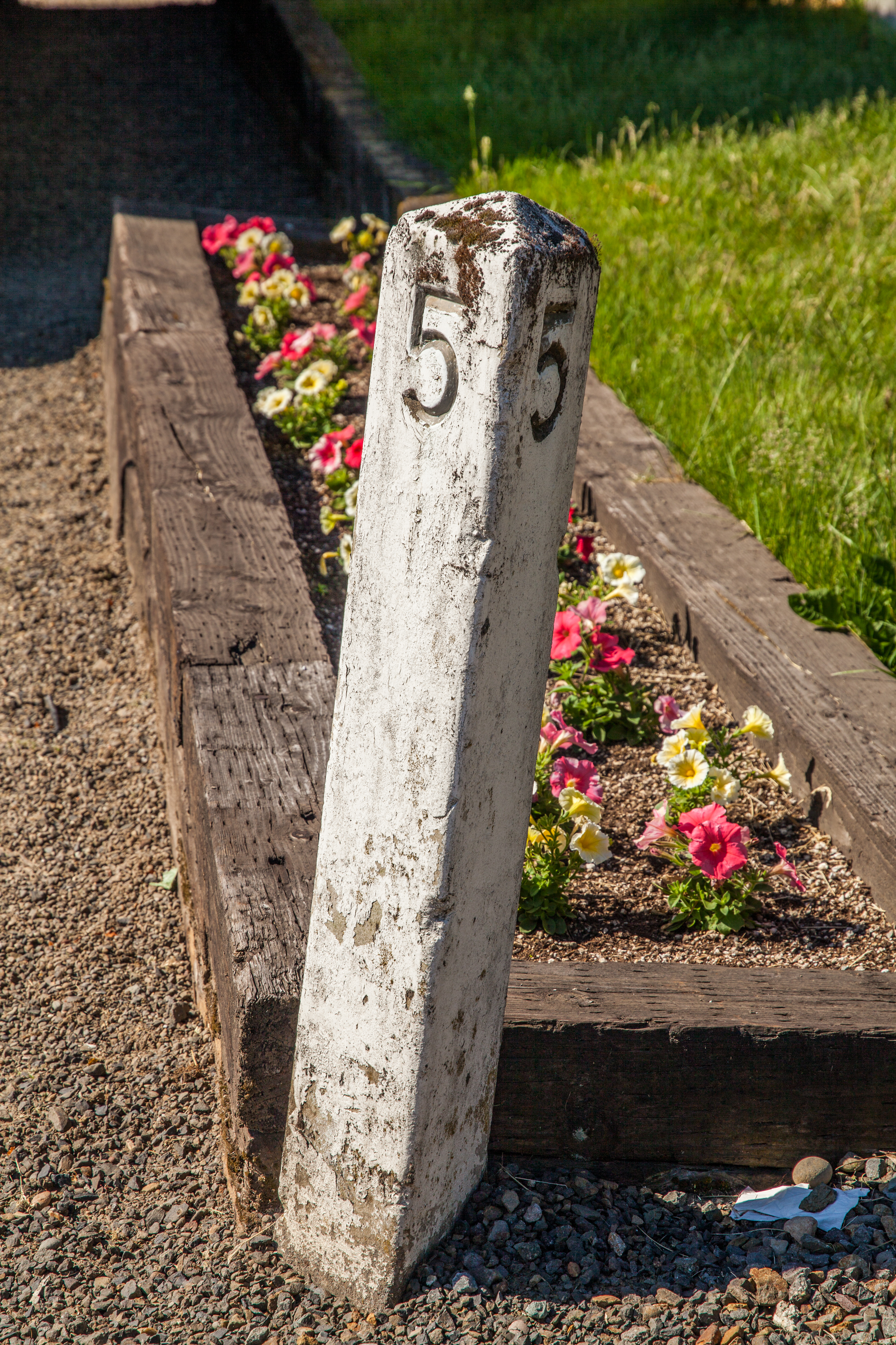
| 17:14, 3 June 2021 | 2021-06-01 orig-stone-milepost-5 1630.jpg (file) |  |
16.7 MB | Jonathan | Original concrete milepost 5 from (presumably) the West Side Pacific Highway, as found in the 1900 block of SW Spring Garden St. in Portland. (Note that the West Side Pacific Highway was never routed down SW Spring Garden St.)<br /> 📷 Jonathan Ledbetter<br /> 📆 1 June 2021 | 1 |
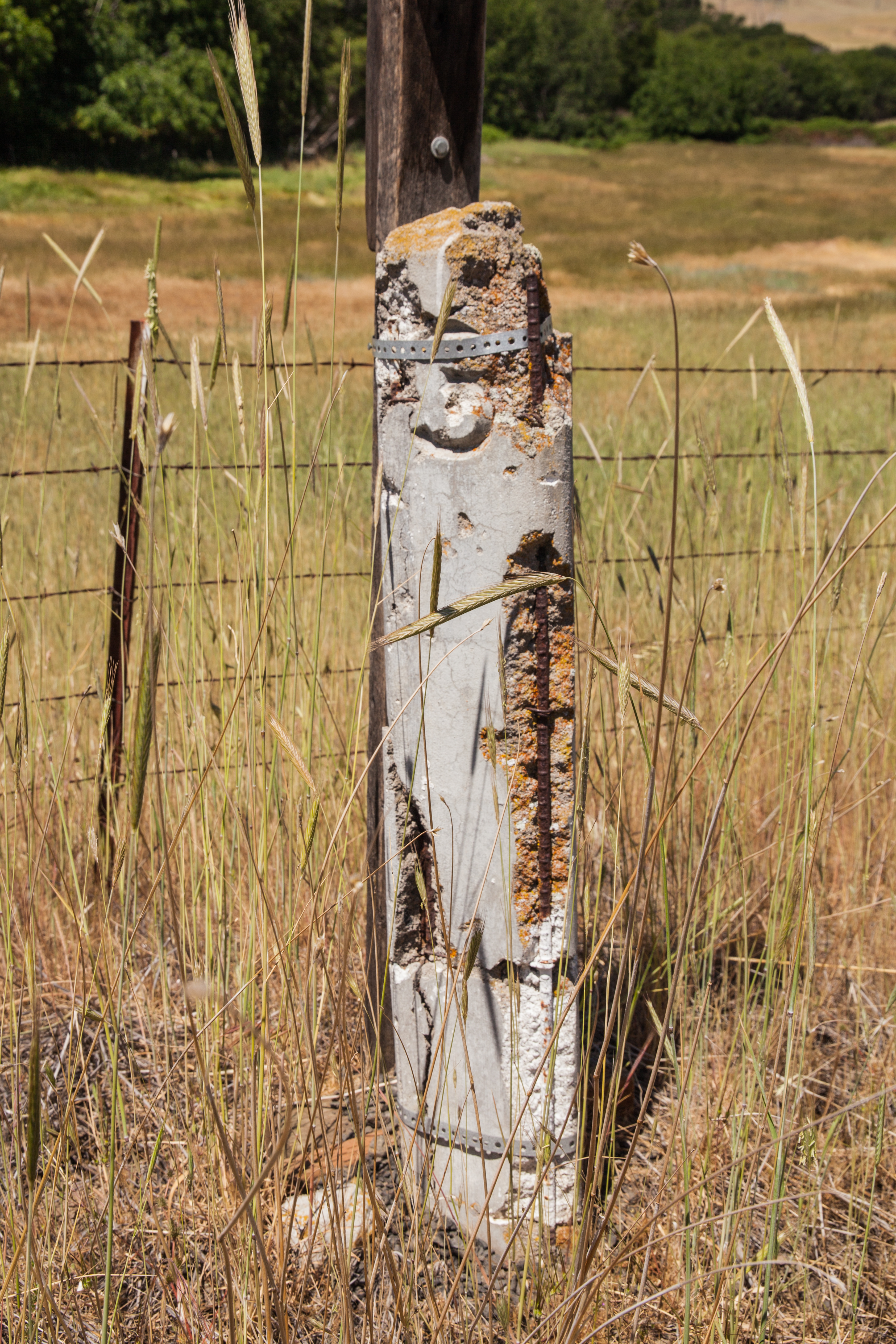
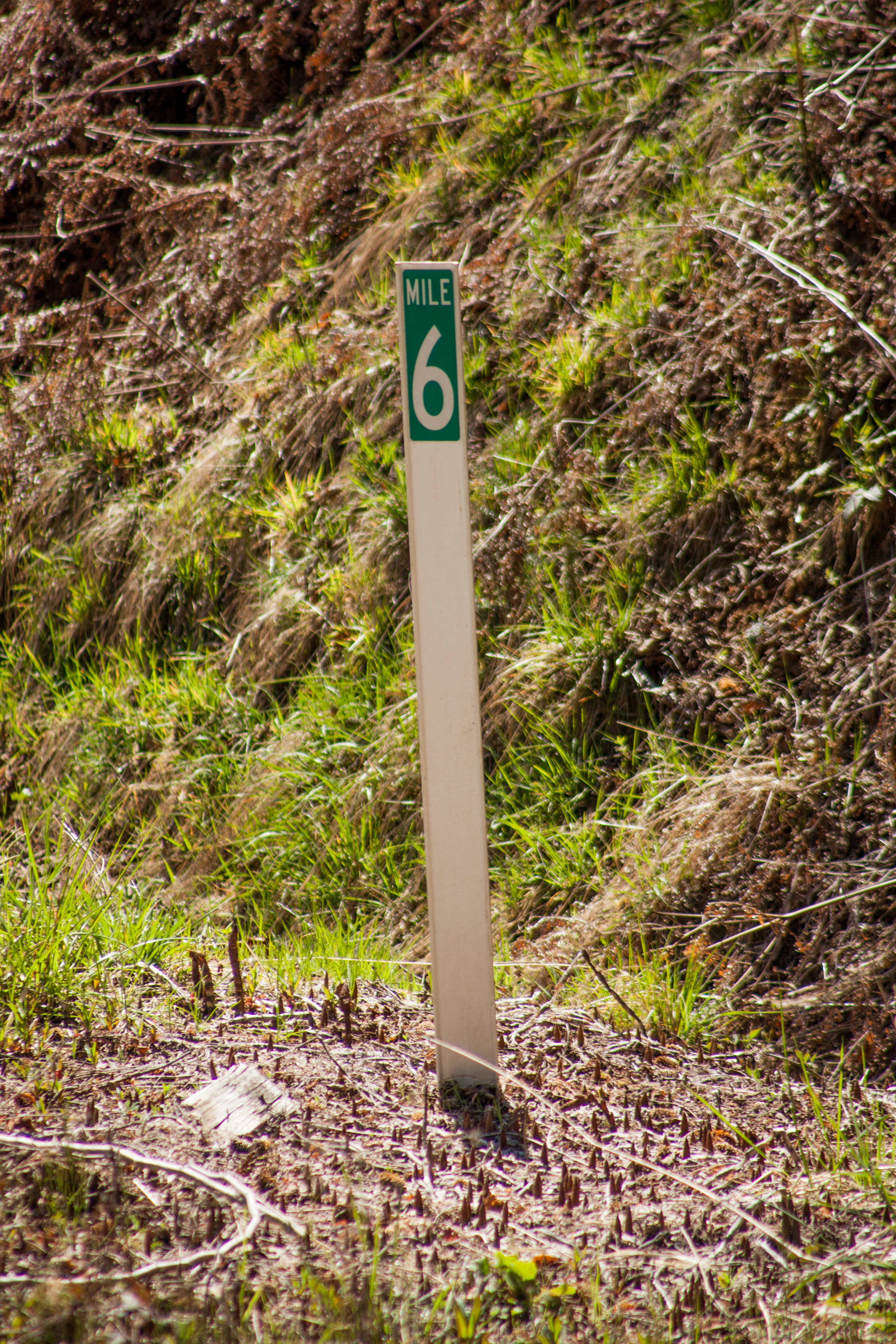
| 17:08, 26 May 2021 | 2021-04-18 clatsopco-milepost-flag 0932.jpg (file) |  |
14.97 MB | Jonathan | MP 6 on Hamlet Rd. near Hamlet.<br /> 📷 Jonathan Ledbetter<br /> 📆 18 April 2021 | 1 |
| 17:06, 26 May 2021 | 2021-04-18 clatsopco-milepost-flag 0707.jpg (file) |  |
8.54 MB | Jonathan | MP 1 on Red Bluff Rd. near Elsie.<br /> 📷 Jonathan Ledbetter<br /> 📆 18 April 2021 | 1 |
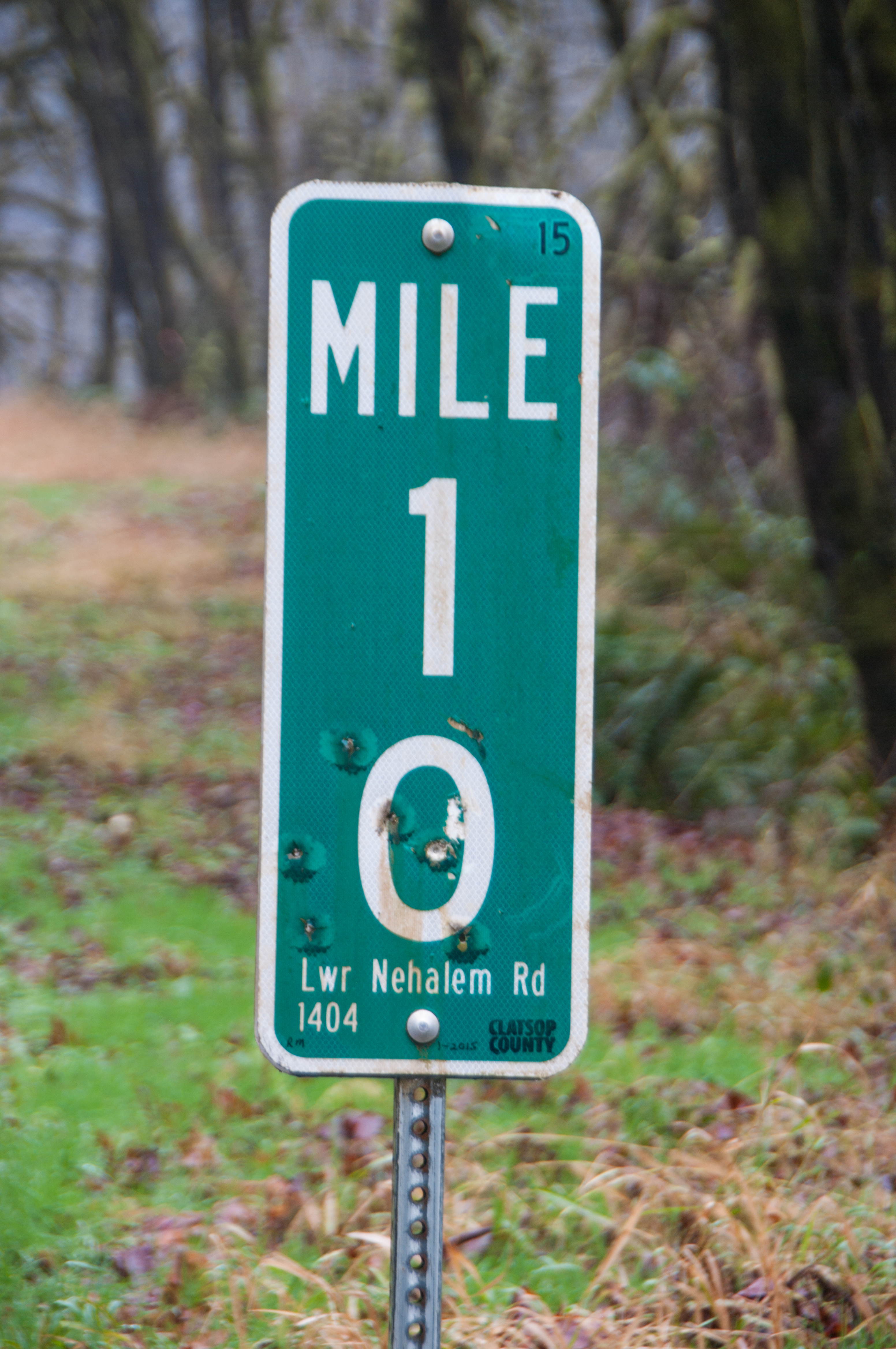
| 16:56, 26 May 2021 | 2021-01-02 clatsopco-milepost 6697.jpg (file) |  |
8.74 MB | Jonathan | MP 1 along Lower Nehalem Road (Clatsop County #1404) near the Tillamook County line. According to the "15" in the upper righthand corner and the hand-written date at the bottom, this marker was placed in January 2015.<br /> 📷 Jonathan Ledbetter<br /> 📆 2 January 2021 | 1 |
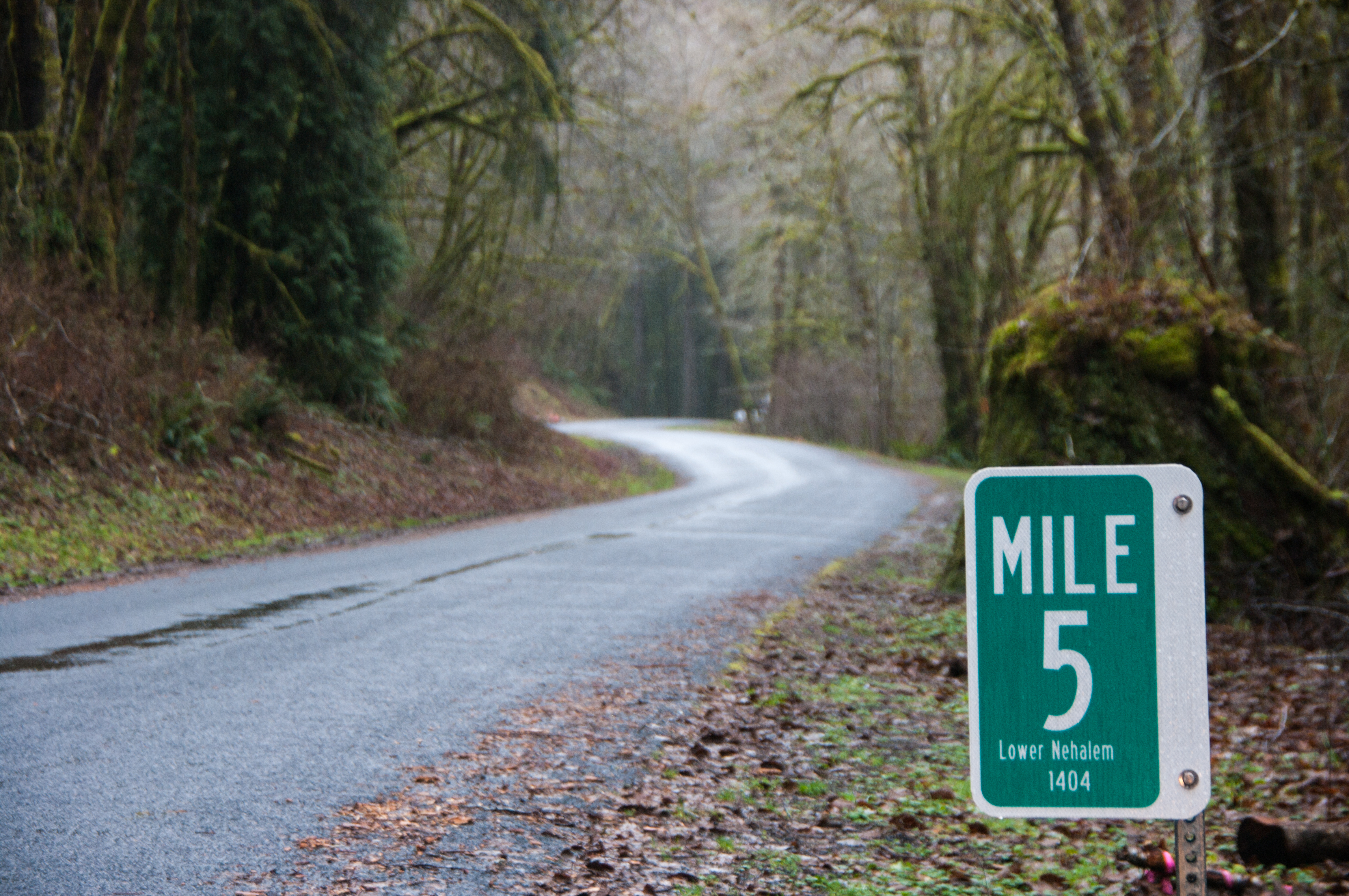
| 16:46, 26 May 2021 | 2021-01-02 clatsopco-milepost 6687.jpg (file) |  |
9.69 MB | Jonathan | MP 5 on Lower Nehalem Rd. (Clatsop County #1404) south of Elsie.<br /> 📷 Jonathan Ledbetter<br /> 📆 2 January 2021 | 1 |
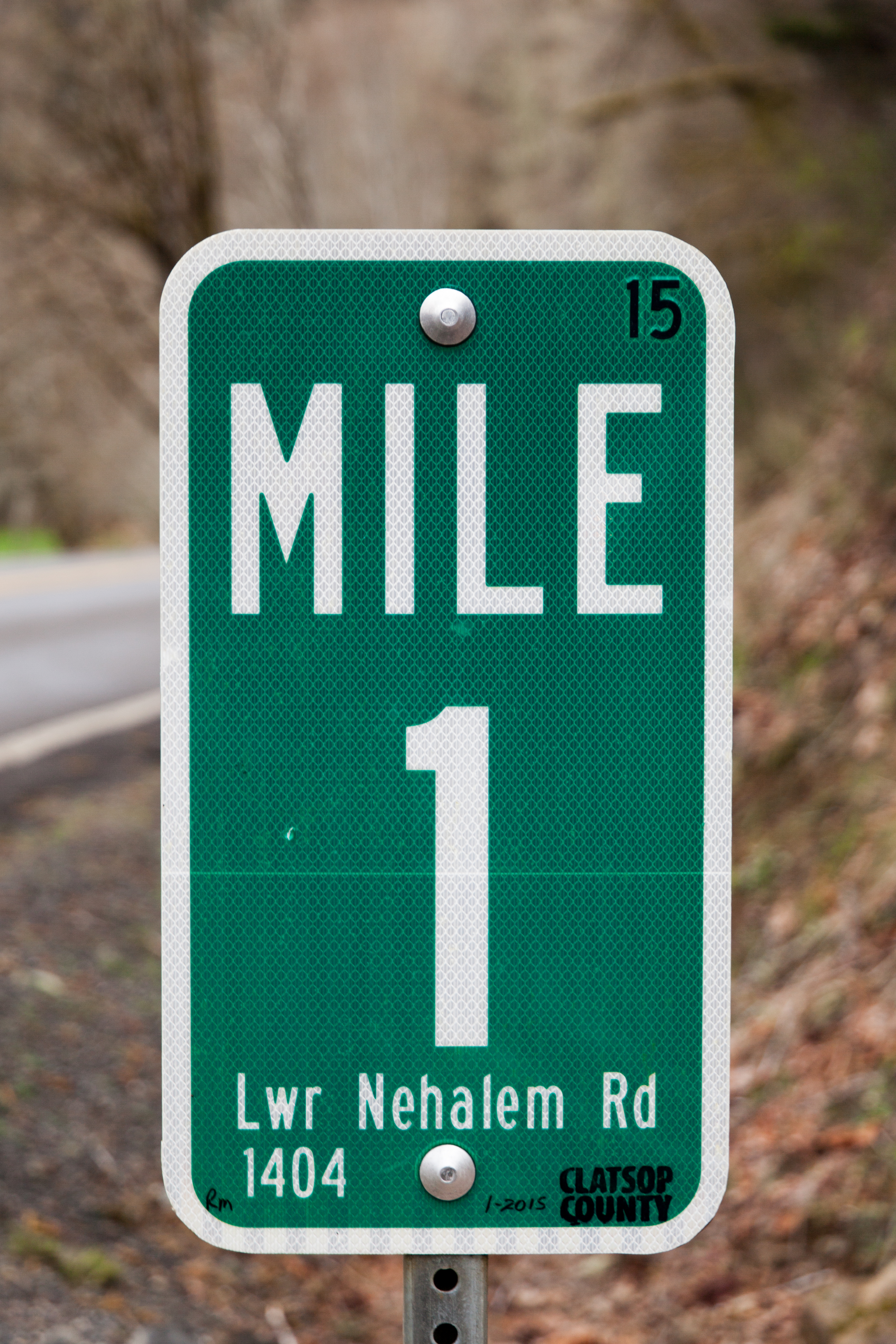
| 16:42, 26 May 2021 | 2018-04-03 clatsopco-milepost 0195.jpg (file) |  |
11.12 MB | Jonathan | MP 1 along Lower Nehalem Road (Clatsop County #1404) south of Elsie. According to the "15" in the upper righthand corner and the hand-written date at the bottom, this marker was placed in January 2015.<br /> 📷 Jonathan Ledbetter<br /> 📆 3 April 2018 | 1 |
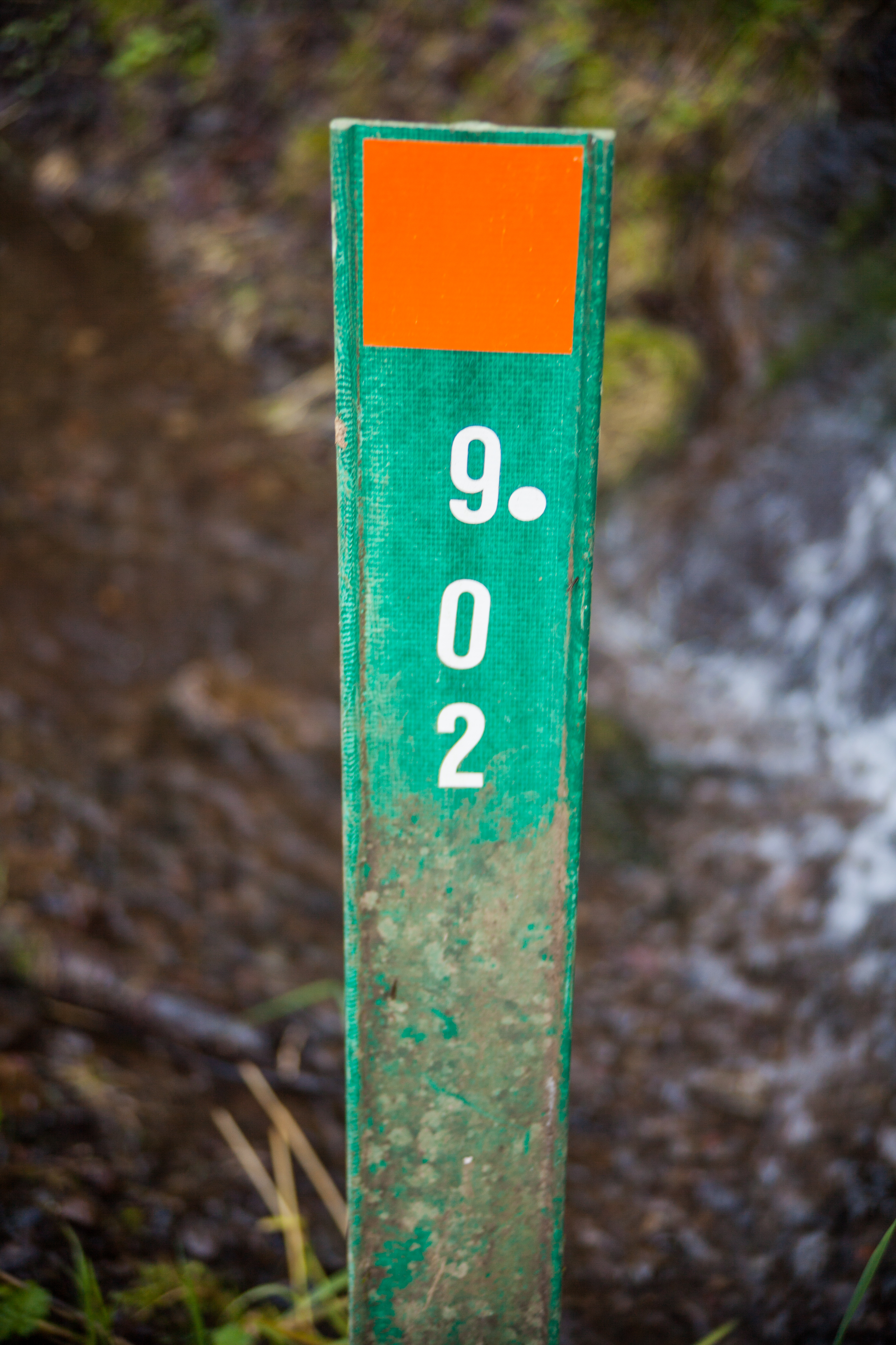
| 23:52, 25 May 2021 | 2014-03-23 clatsopco-milepost-flag 1129.jpg (file) |  |
12.92 MB | Jonathan | A green milepost wicket at a culvert at MP 9.02 on Lower Nehalem Road (#1404) in Clatsop County.<br /> 📷 Jonathan Ledbetter<br /> 📆 23 March 2013 | 1 |
| 17:51, 25 May 2021 | 2021-05-23 clackco-begin-county-maint-marker 1028.jpg (file) |  |
9.98 MB | Jonathan | A white "begin county maintenance" wicket along SW Carman Dr. (Clackamas County #21329) as it leaves Lake Oswego.<br /> 📷 Jonathan Ledbetter<br /> 📆 23 May 2021 | 1 |
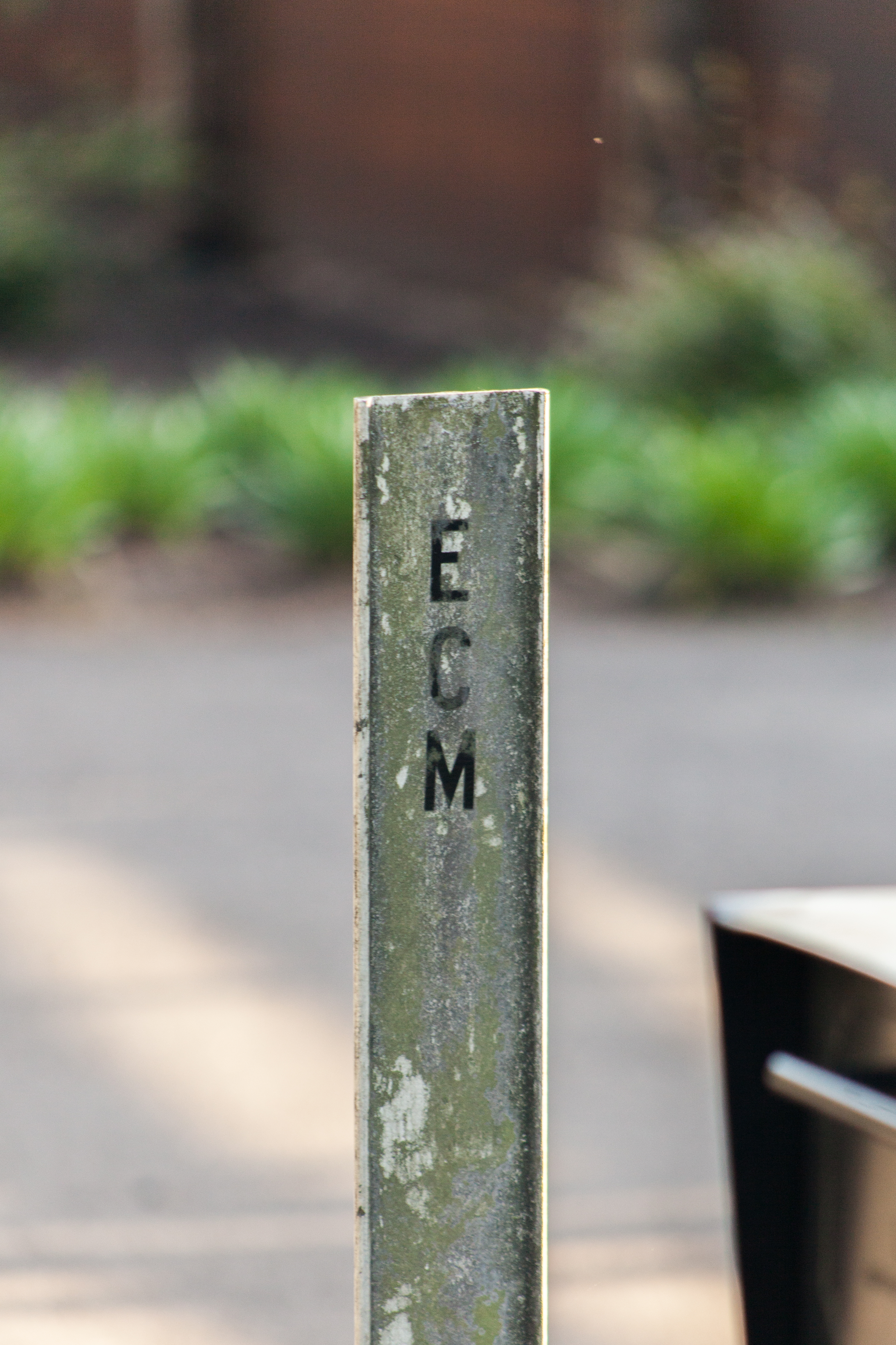
| 17:47, 25 May 2021 | 2021-05-23 clackco-end-county-maint-marker 1014.jpg (file) |  |
8.76 MB | Jonathan | A white "end county maintenance" wicket on SW Carman Rd. (Clackamas County #21329) as it enters Lake Oswego.<br /> 📷 Jonathan Ledbetter<br /> 📆 23 May 2021 | 1 |
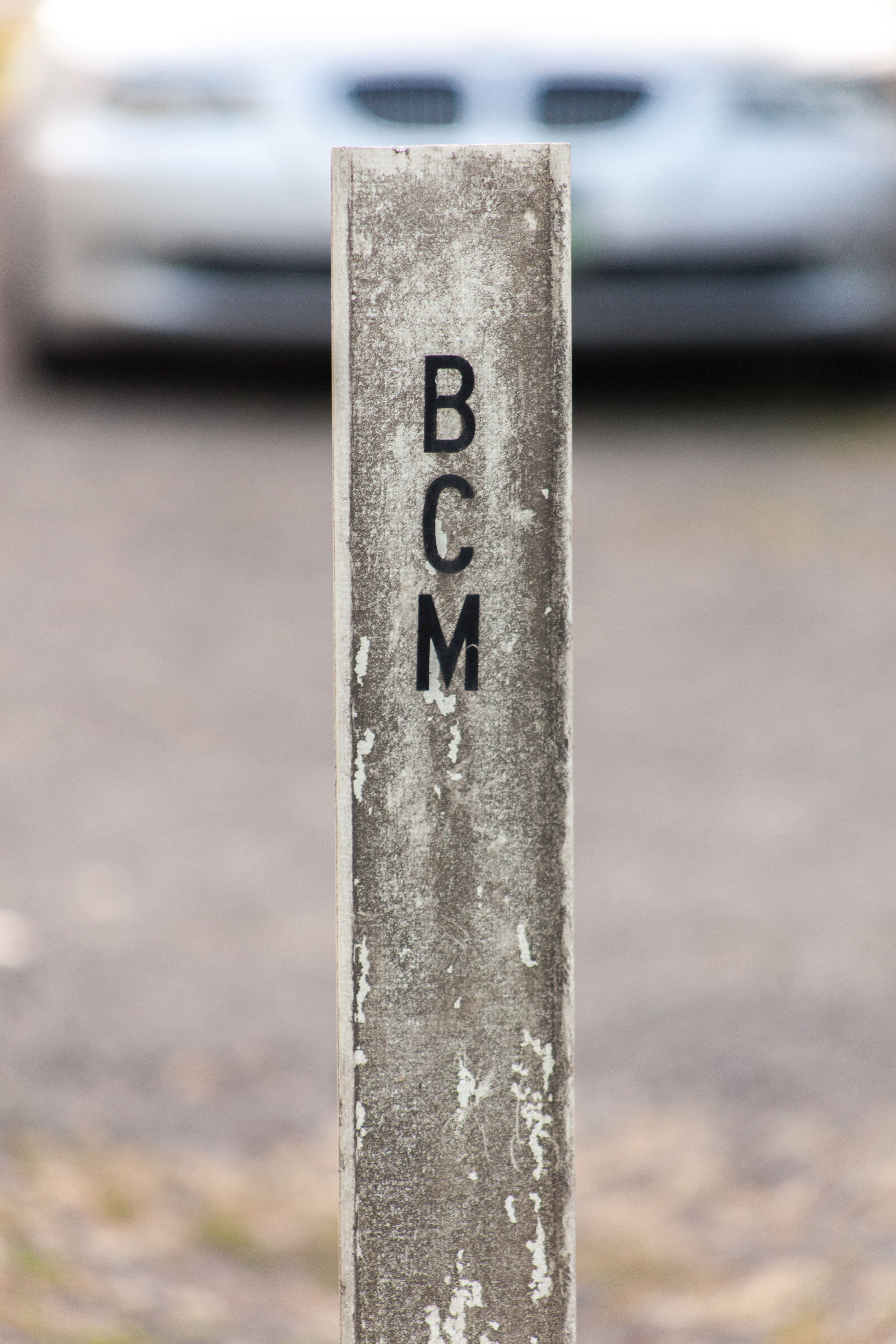
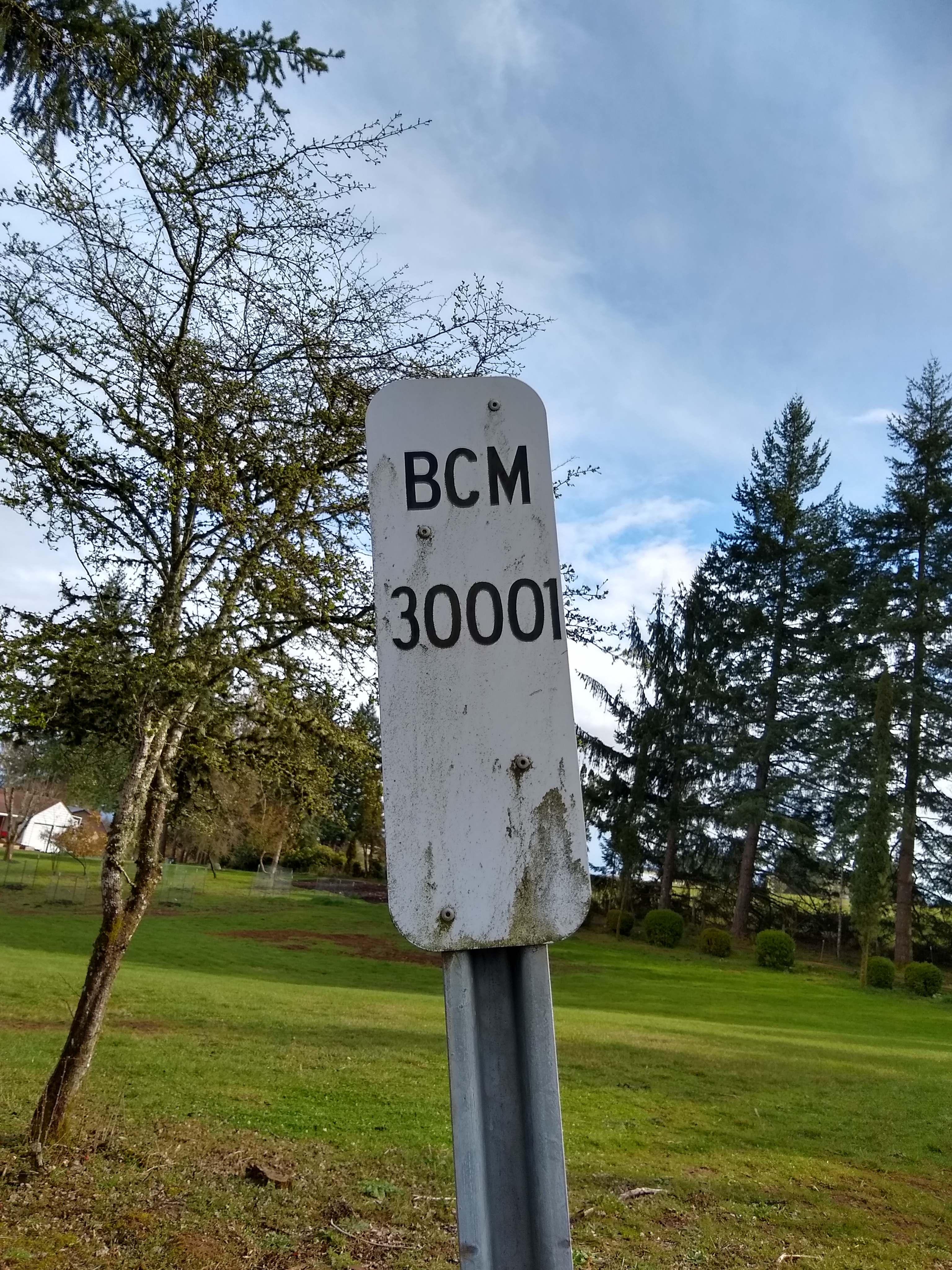
| 17:43, 25 May 2021 | 2020-02-29 clackco-begin-co-maint-marker 141904426.jpg (file) |  |
4.44 MB | Jonathan | A white rectangular "begin county maintenance" marker on SW Ladd Hill Rd. (Clackamas County #30001) as it leaves Washington County near Sherwood.<br /> 📷 Jonathan Ledbetter<br /> 📆 29 February 2020 | 1 |
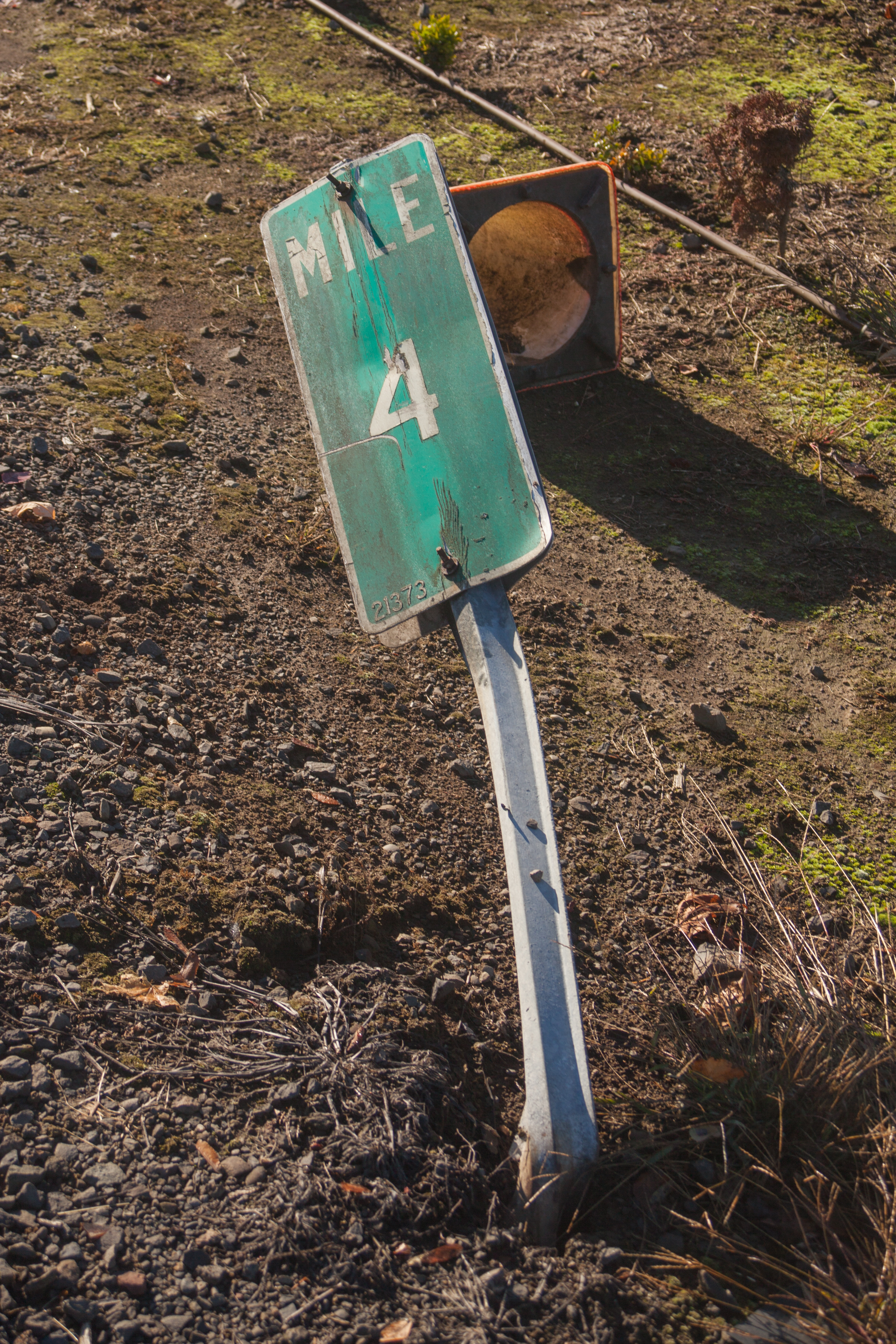
| 17:30, 25 May 2021 | 2017-10-25 clackco-milepost-damaged 3437.jpg (file) |  |
9.67 MB | Jonathan | A damaged green milepost at MP 4 on SW Borland Rd. (Clackamas County #21373) near West Linn. This milepost has since been removed.<br /> 📷 Jonathan Ledbetter<br /> 📆 25 October 2017 | 1 |
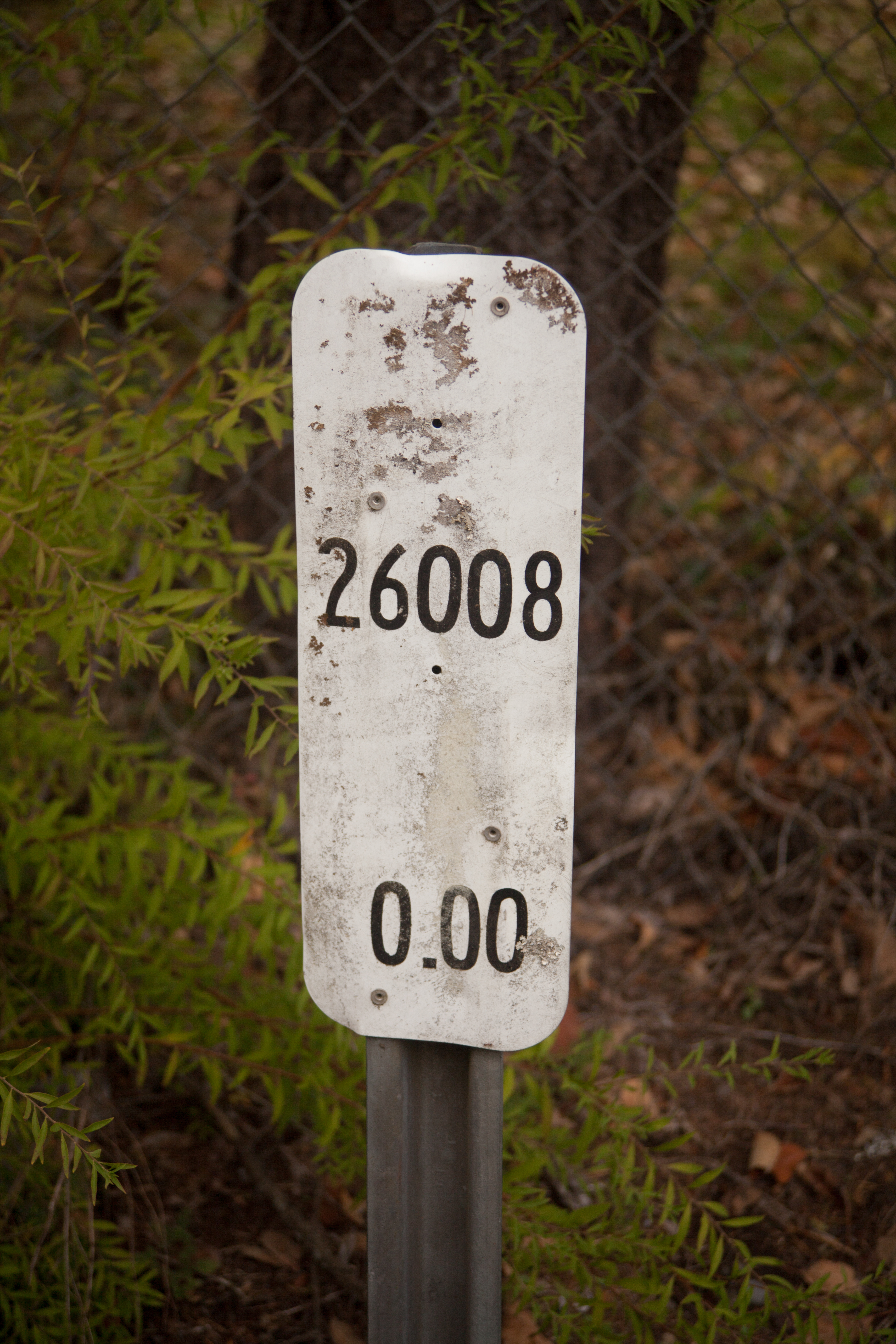
| 17:27, 25 May 2021 | 2017-10-25 clackco-100ths-milepost 4230.jpg (file) |  |
12.17 MB | Jonathan | A white rectangular milepost at MP 0.00 at the corner of E Salmon St. (Clackamas County #26008) and E Brightwood Loop Rd. (Clackamas County #26010) near Brightwood.<br /> 📷 Jonathan Ledbetter<br /> 📆 25 October 2017 | 1 |
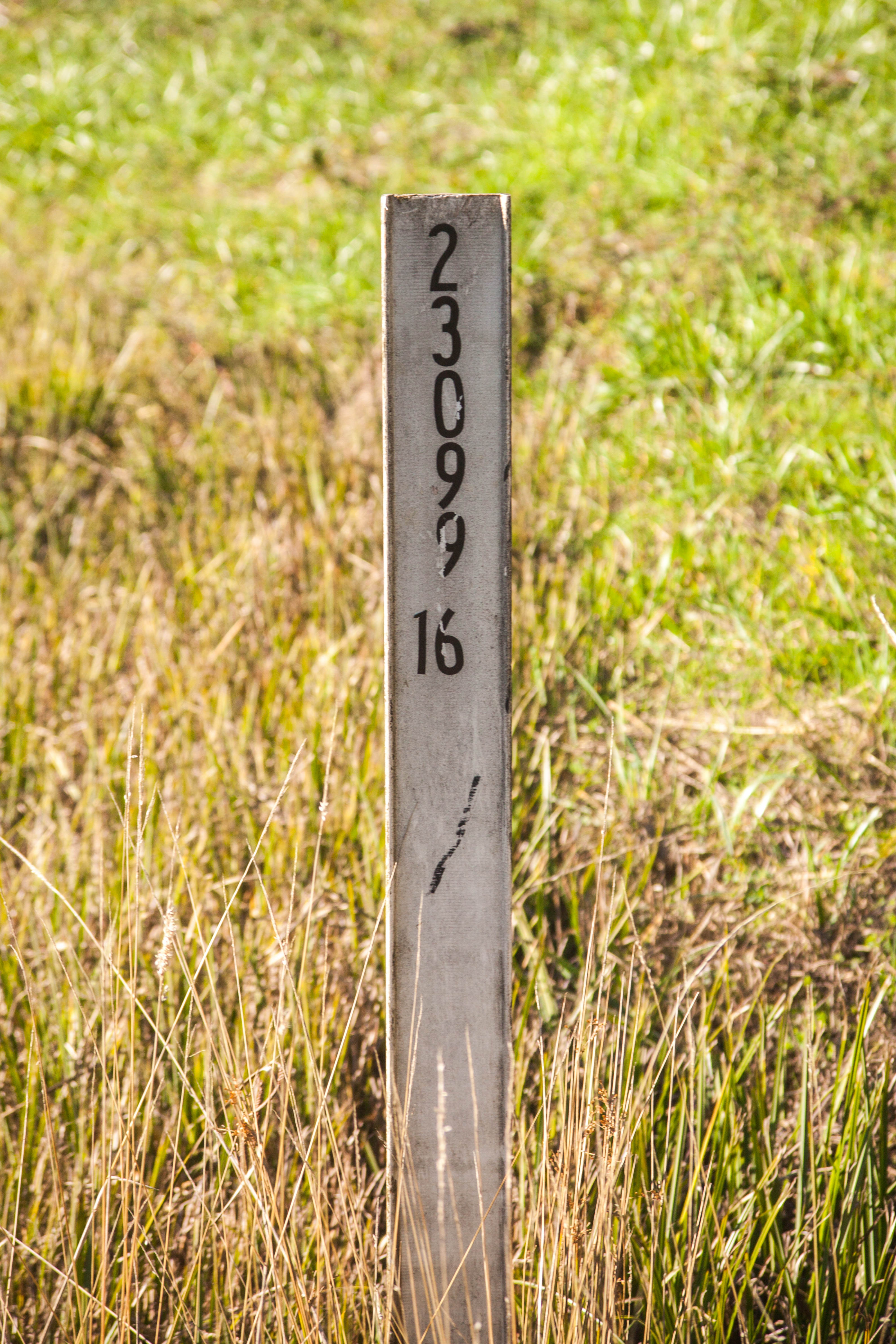
| 16:49, 25 May 2021 | 2017-10-25 clackco-100ths-flag-milepost 3748.jpg (file) |  |
10.93 MB | Jonathan | A white wicket milepost at MP 0.16 on SE Fireman Way (Clackamas County #23099) at the corner of SE 272nd Ave. in Boring.<br /> 📷 Jonathan Ledbetter<br /> 📆 25 October 2017 | 1 |
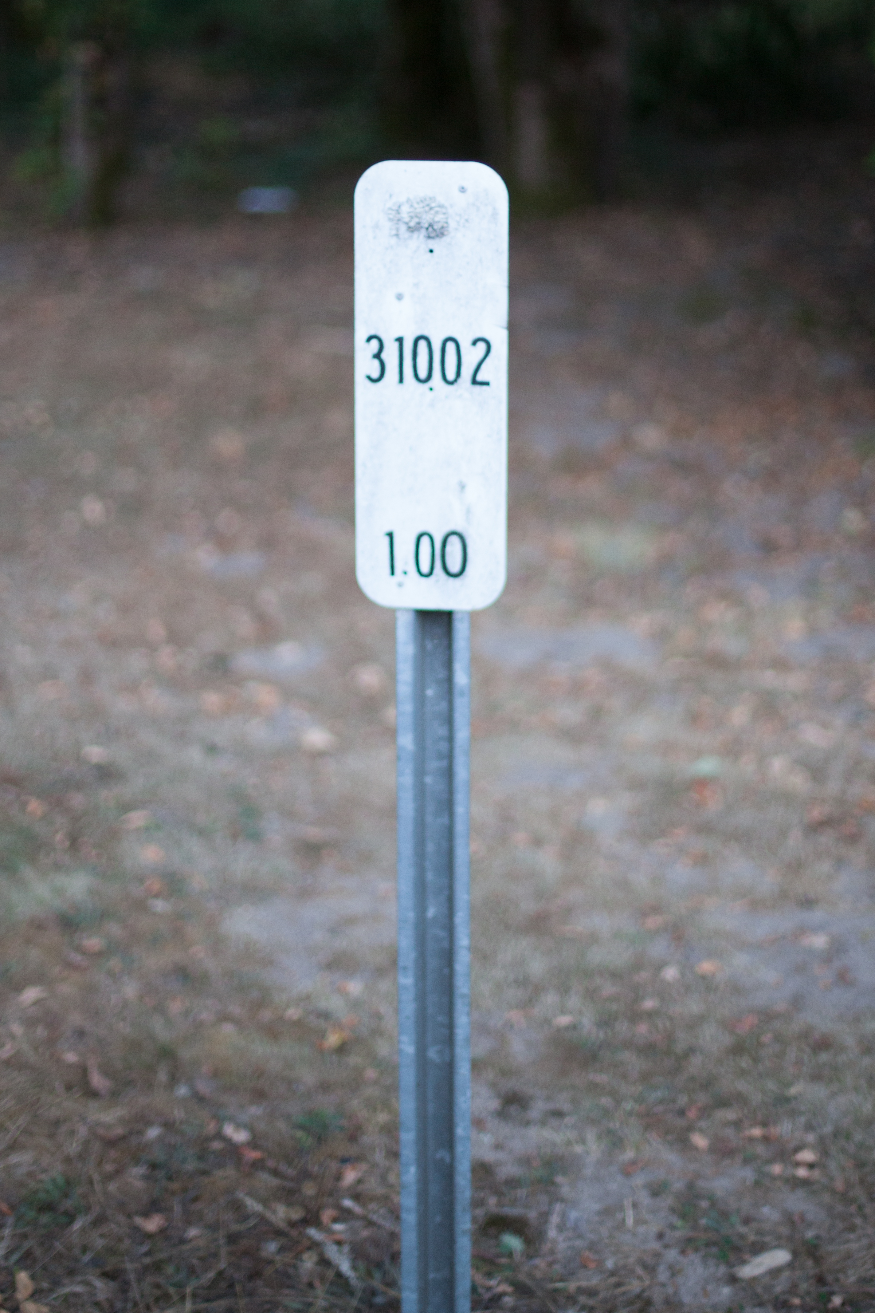
| 00:29, 25 May 2021 | 2013-09-02 clackco-100ths-milepost 7354.jpg (file) |  |
6.49 MB | Jonathan | A white rectangular milepost at MP 1.00 along SW Homesteader Rd. (Clackamas County #31002) near Stafford.<br /> 📷 Jonathan Ledbetter<br /> 📆 2 September 2013 | 1 |
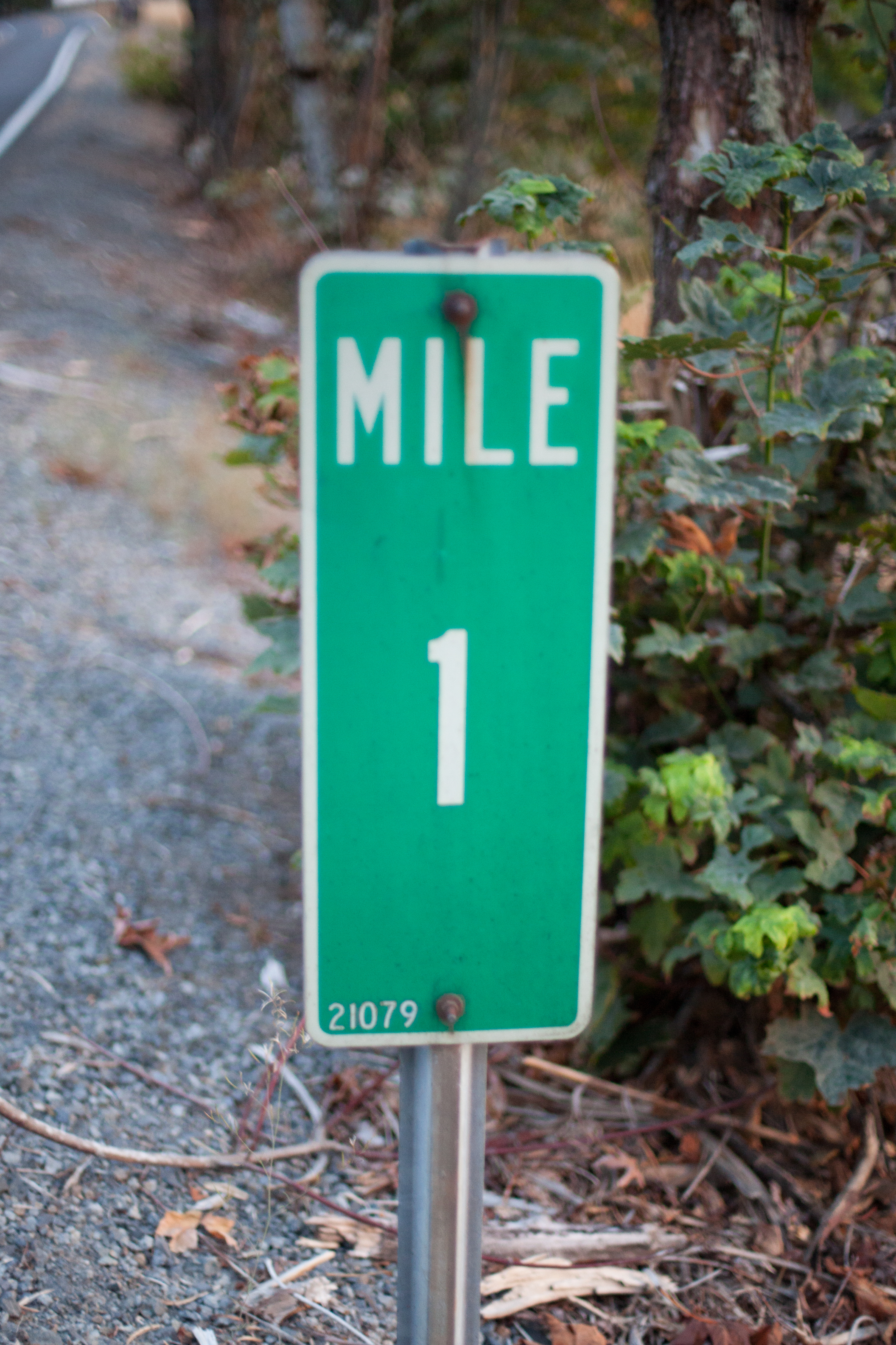
| 00:25, 25 May 2021 | 2013-09-02 clackco-milepost 7357.jpg (file) |  |
11.83 MB | Jonathan | MP 1 along SW Mountain Rd. (Clackamas County #21079) near Stafford in Clackamas County.<br /> 📷 Jonathan Ledbetter<br /> 📆 2 September 2013 | 1 |
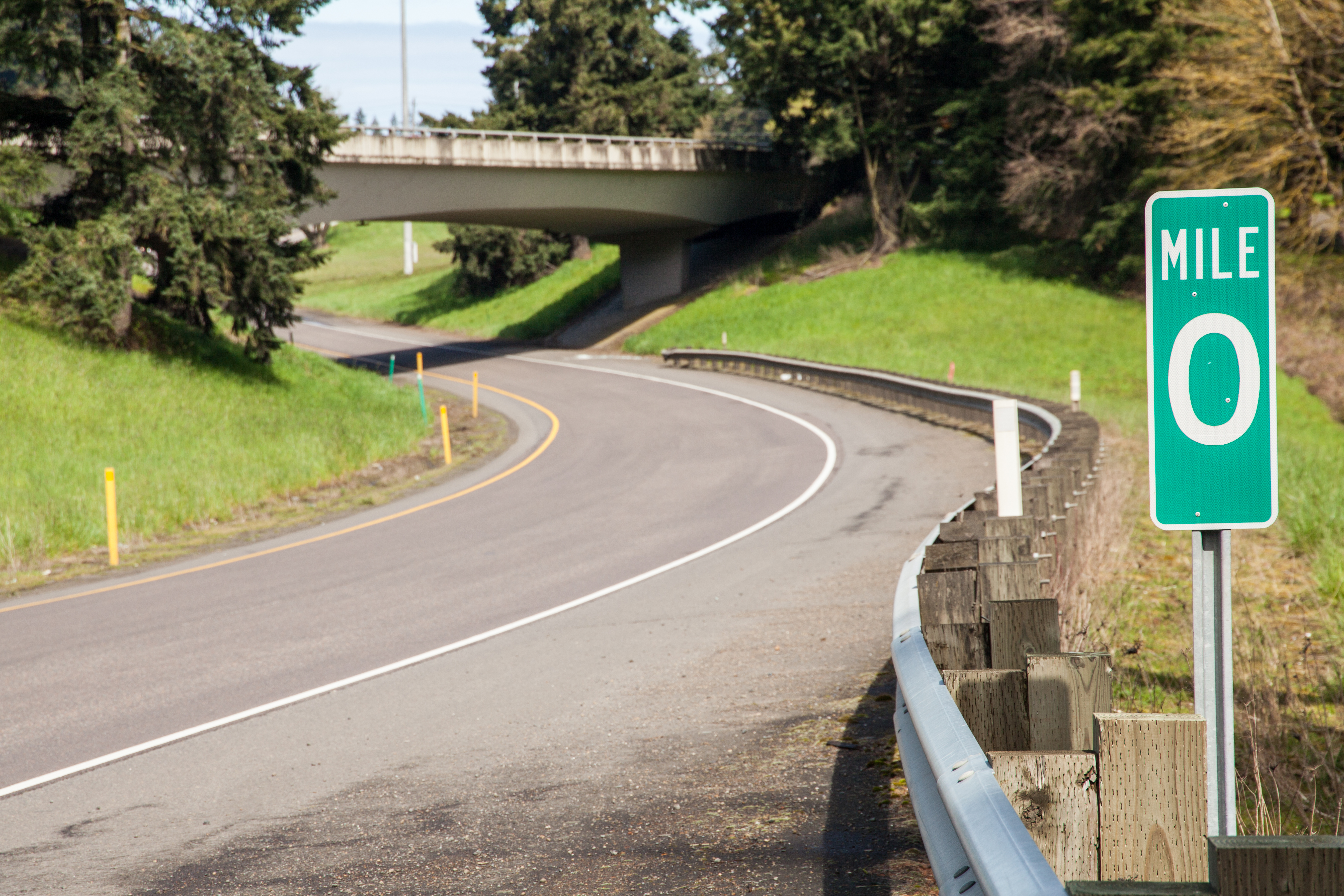
| 17:52, 24 May 2021 | 2020-04-05 state-milepost-0 6871.jpg (file) |  |
11.19 MB | Jonathan | A zero milepost at the northern terminus of OR-551, just before it merges onto I-5 north in the Charbonneau District near Wilsonville.<br /> 📷 Jonathan Ledbetter<br /> 📆 5 April 2020 | 1 |
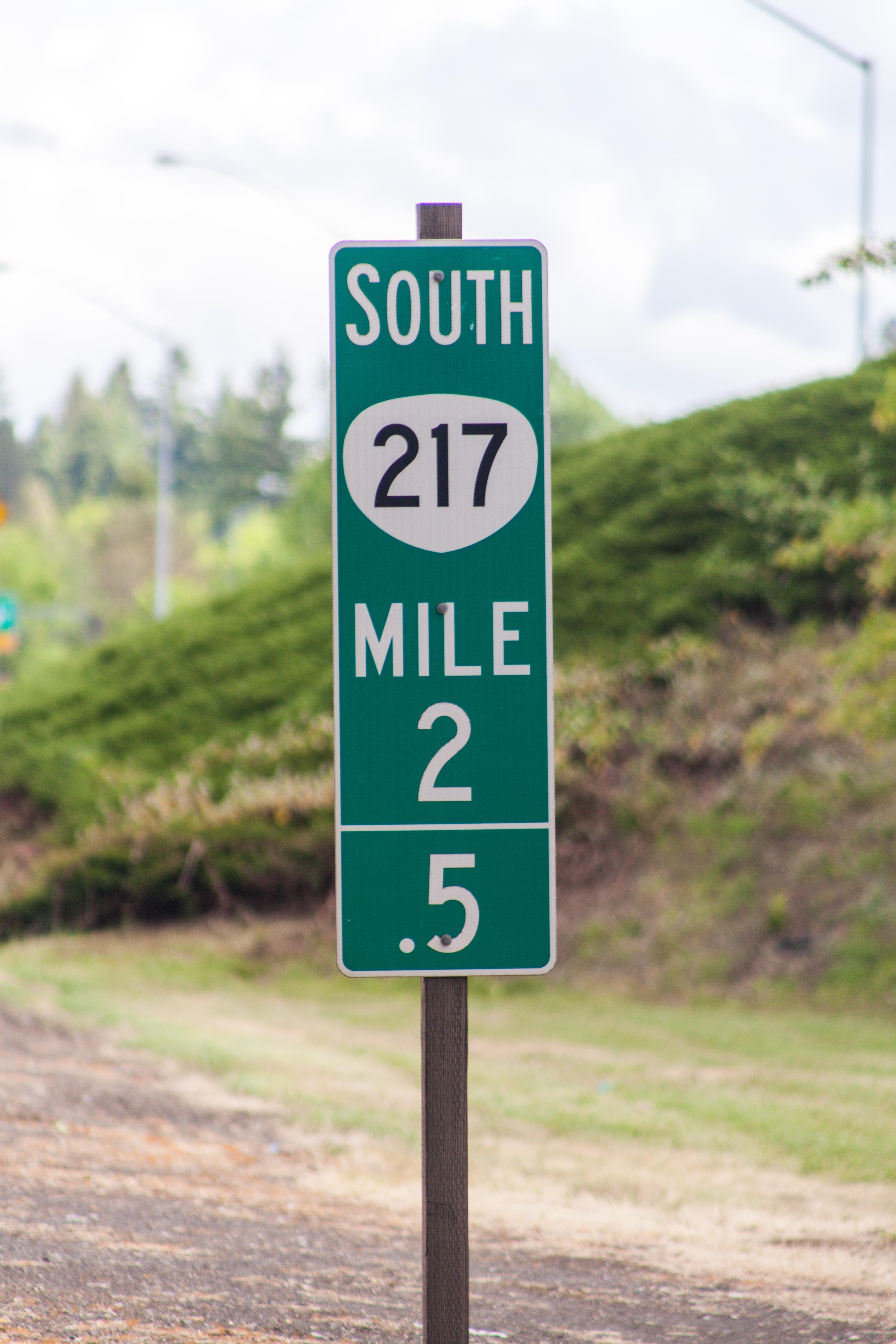
| 00:12, 24 May 2021 | 2021-05-23 or217-enhanced-milepost 1001.jpg (file) |  |
10.13 MB | Jonathan | A photo of an intermediate enhanced reference location sign (D10-5) along OR-217 in Beaverton. These were placed as part of a pilot project in the summer of 2011.<br /> 📷 Jonathan Ledbetter<br /> 📆 23 May 2021 | 1 |
| 02:10, 23 May 2021 | 2021-04-18 or-207-near-hardman.jpg (file) |  |
743 KB | Jonathan | An example of a D10-1a milepost on OR-207 near Hardman, but with a letter suffix to distinguish between three separate segments of the highway.<br /> 📷 Walter Haight<br /> 📆 18 April 2021 | 1 |
| 01:59, 23 May 2021 | 2017-10-25 state-half-milepost 4197.jpg (file) |  |
11.74 MB | Jonathan | A photo of a standard D10-2a milepost on US-26 west of Mt. Hood Village, placed during the summer of 2011 as part of an ODOT pilot project to better locate motorists, incidents and hazards.<br /> 📷 Jonathan Ledbetter<br /> 📆 25 October 2017 | 1 |
| 01:52, 23 May 2021 | 2017-10-25 state-half-milepost 4010.jpg (file) |  |
9.66 MB | Jonathan | A photo of a standard D10-2a milepost on US-26 east of Sandy, placed during the summer of 2011 as part of an ODOT pilot project to better locate motorists, incidents and hazards.<br /> 📷 Jonathan Ledbetter<br /> 📆 25 October 2017 | 1 |
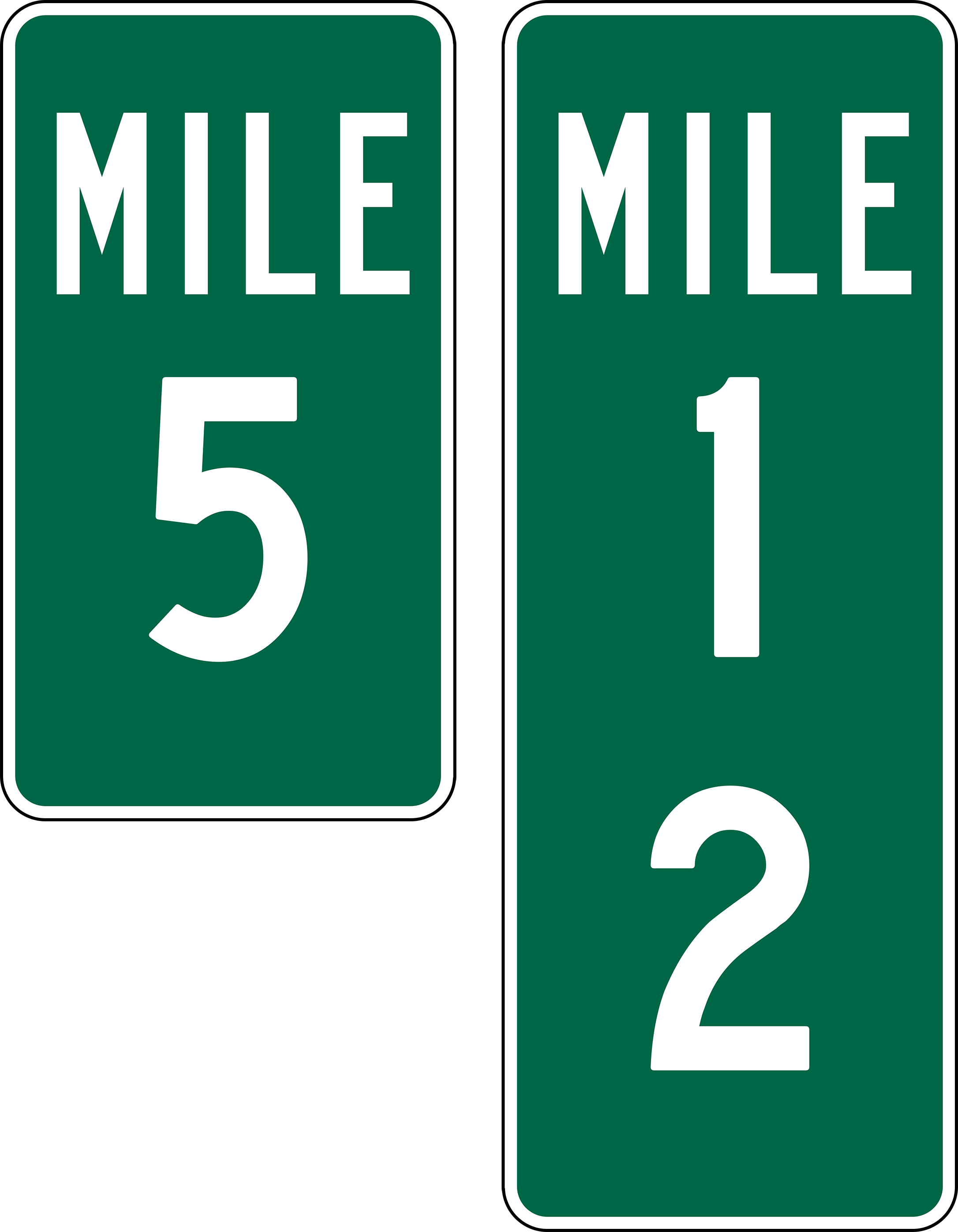
| 21:33, 16 May 2021 | 1961 MUTCD-OR-milepost-examples.png (file) |  |
152 KB | Jonathan | Standardized size to match 1971 examples | 2 |
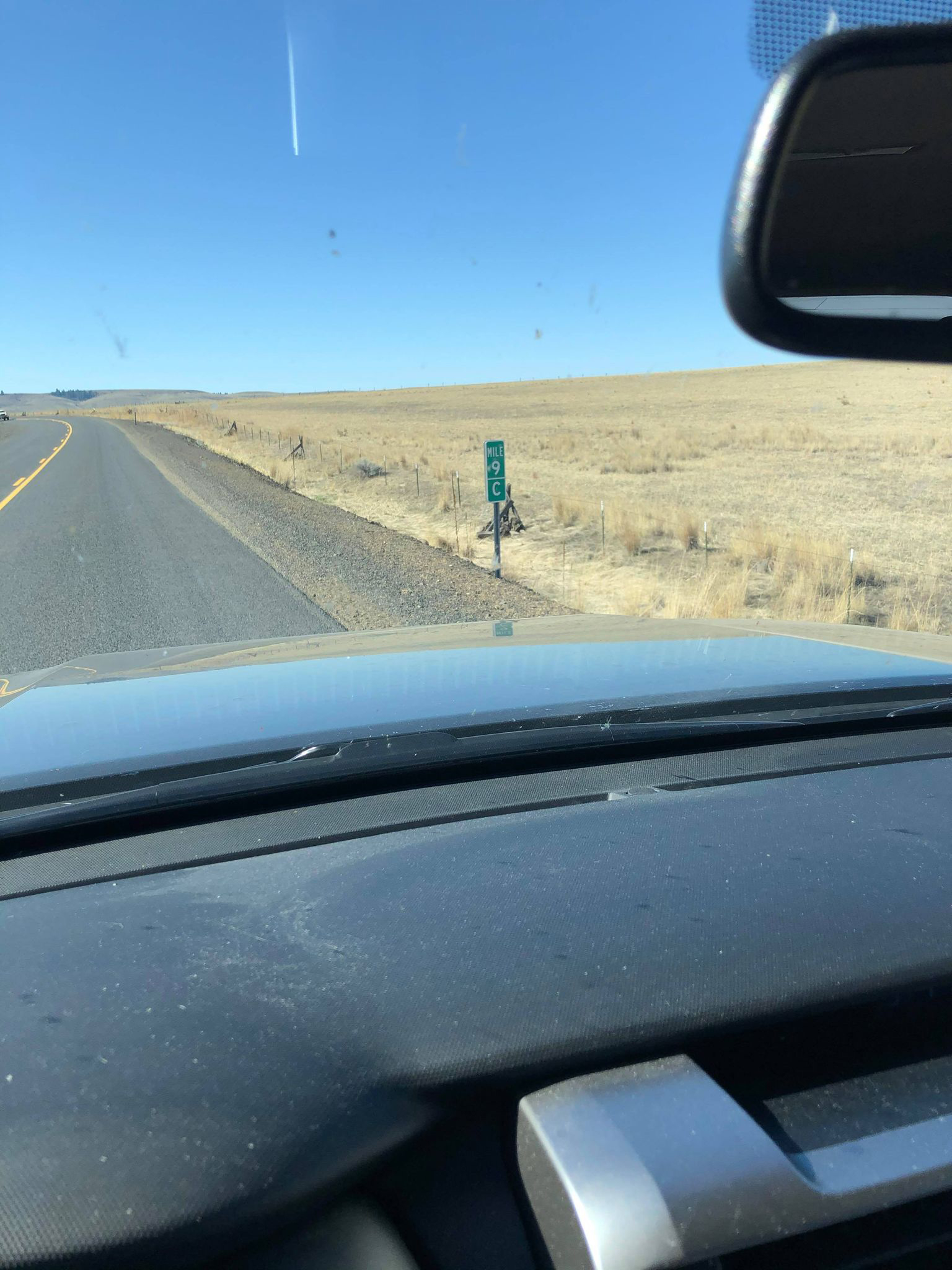
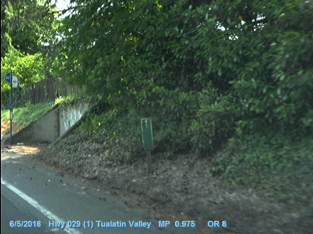
| 15:46, 15 May 2021 | 2018-06-05 odot-vidlog OR-8 MP0.975-EB.jpg (file) |  |
141 KB | Jonathan | A still frame of the ODOT Digital Video Log for OR-8/Tualatin Valley Highway #29, MP 0.975 eastbound. This frame features a (mostly) 1961 MUTCD specification milepost, which has since been removed.<br /> 🖼 [https://dvlprod-ordot.msappproxy.net/cf/dvl/index.cfm?&fuseaction=entry ODOT Digital Video Log]<br /> 📆 5 June 2018 | 1 |
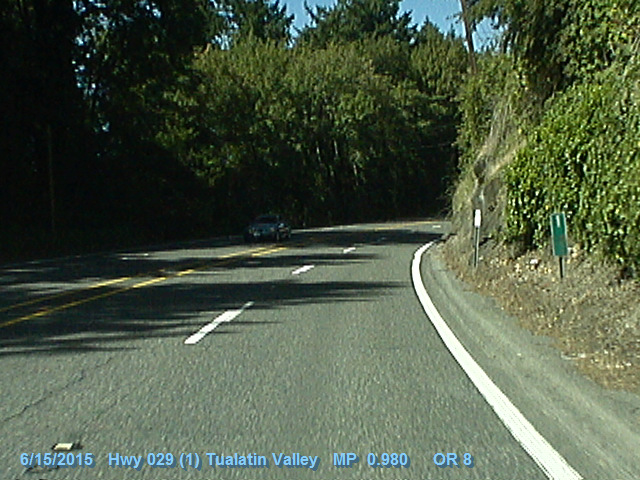
| 15:43, 15 May 2021 | 2015-06-15 odot-vidlog OR-8 MP0.98-WB.jpg (file) |  |
159 KB | Jonathan | A still frame of the ODOT Digital Video Log for OR-8/Tualatin Valley Highway #29, MP 0.980. This frame features a (mostly) 1961 MUTCD specification milepost, which has since been removed.<br /> 🖼 [https://dvlprod-ordot.msappproxy.net/cf/dvl/index.cfm?&fuseaction=entry ODOT Digital Video Log]<br /> 📆 15 June 2015 | 1 |
| 13:08, 15 May 2021 | 2021-02-26 state-1961-milepost 9285.jpg (file) |  |
13.57 MB | Jonathan | Milepost 49 as seen along OR-47 a couple miles outside of Mist. The milepost is designed to the 1961 MUTCD specification and is in excellent condition for its supposed age. 📷 Jonathan Ledbetter<br /> 📆 26 February 2021 | 1 |
| 13:03, 15 May 2021 | 2016-08-02 state-1961-milepost 2311.jpg (file) |  |
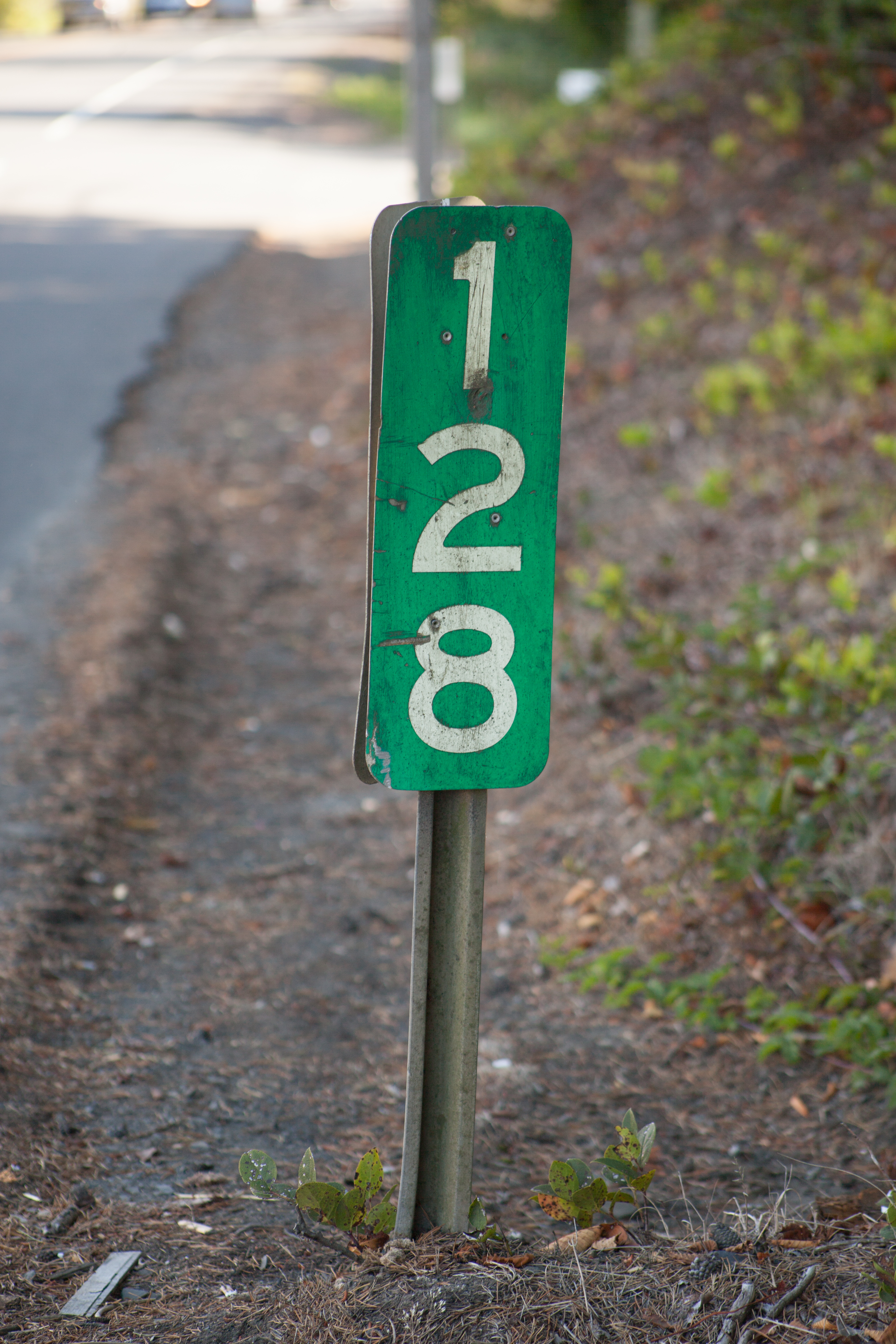
10.49 MB | Jonathan | Milepost 128 along US-101 in Depoe Bay. The mileposts are designed to the 1961 MUTCD specifications. 📷 Jonathan Ledbetter<br /> 📆 2 August 2016 | 1 |
| 17:26, 12 May 2021 | 2019-11-15 concrete-milepost-63 3754.jpg (file) |  |
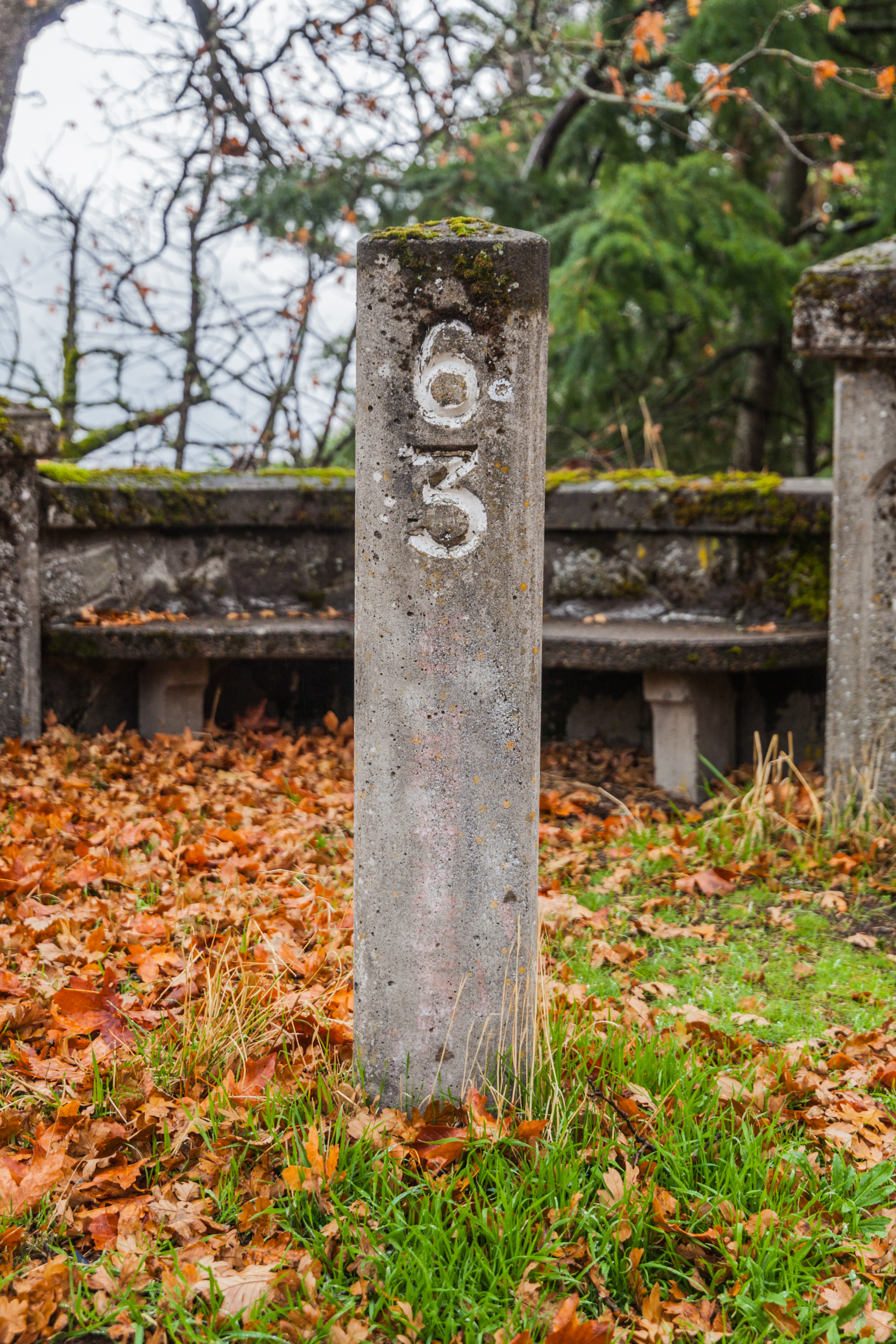
13.09 MB | Jonathan | The restored concrete milepost 63 on the Historic Columbia River Highway at Ruthton Point, just west of Hood River. It was placed in the Summer of 1992 as part of a rehabilitation of the Ruthton Point viaduct.<br /> 📷 Jonathan Ledbetter<br /> 📆 15 November 2019 | 1 |
| 17:08, 12 May 2021 | 2013-08-28 concrete-milepost-32 7109.jpg (file) |  |
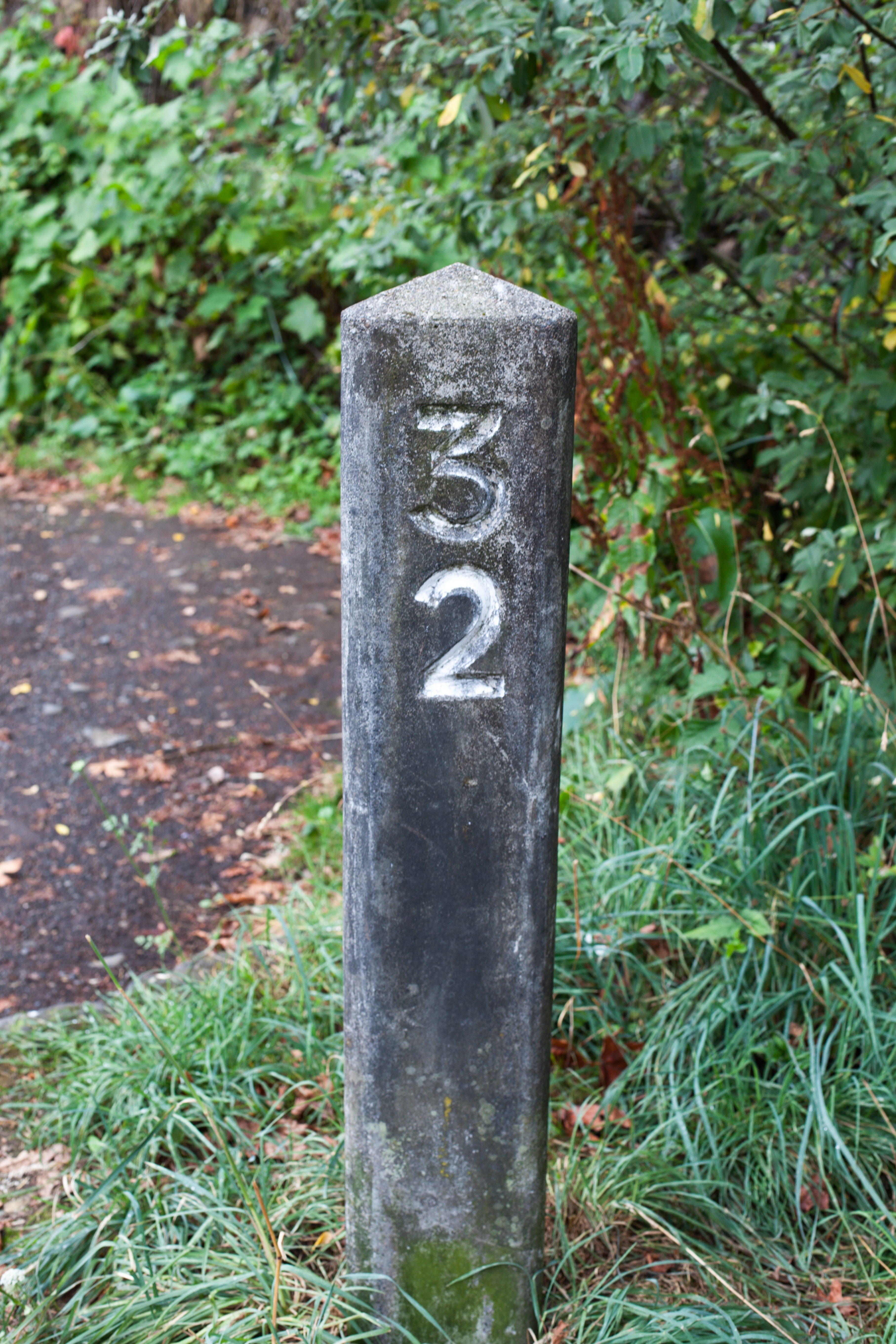
11.49 MB | Jonathan | The restored concrete milepost 32 on the Historic Columbia River Highway just west of Multnomah Falls.<br /> 📷 Jonathan Ledbetter<br /> 📆 28 August 2013 | 1 |
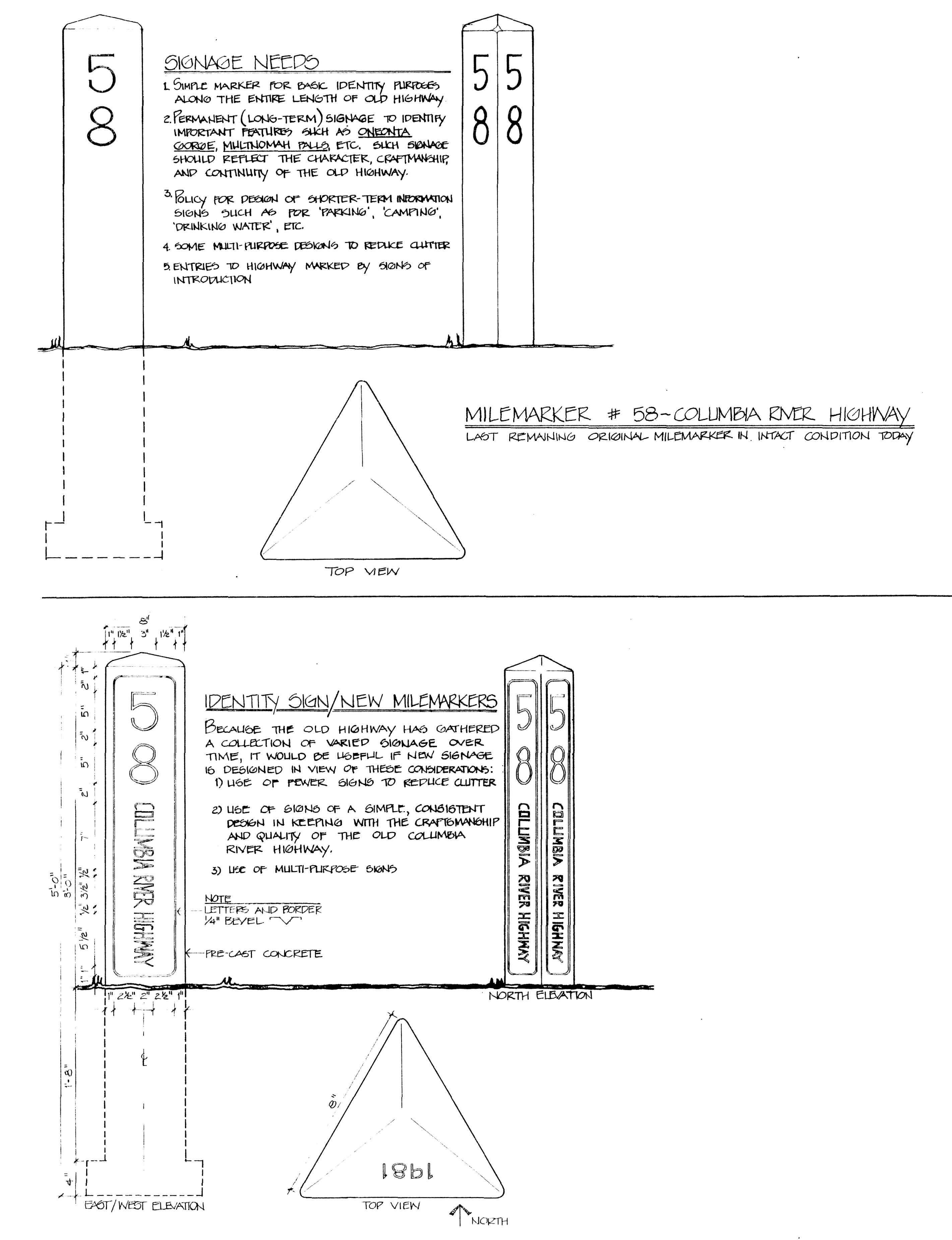
| 12:48, 11 May 2021 | 1981 ochi-report crh-mileposts pp87&89.png (file) |  |
916 KB | Jonathan | A comparison of the original Columbia River Highway concrete mileposts and the ones proposed by Diane Ochi in her 1981 report. The ones reconstructed for the highway in the 1990s did not incorporate Ochi's enhancements.<br /> 🖼 Ochi, Diane. [http://npshistory.com/publications/columbia-river-highway.pdf ''Columbia River Highway: Options for Conservation and Reuse''], National Park Service, pp. 87 & 89<br /> 📆 1981 | 1 |
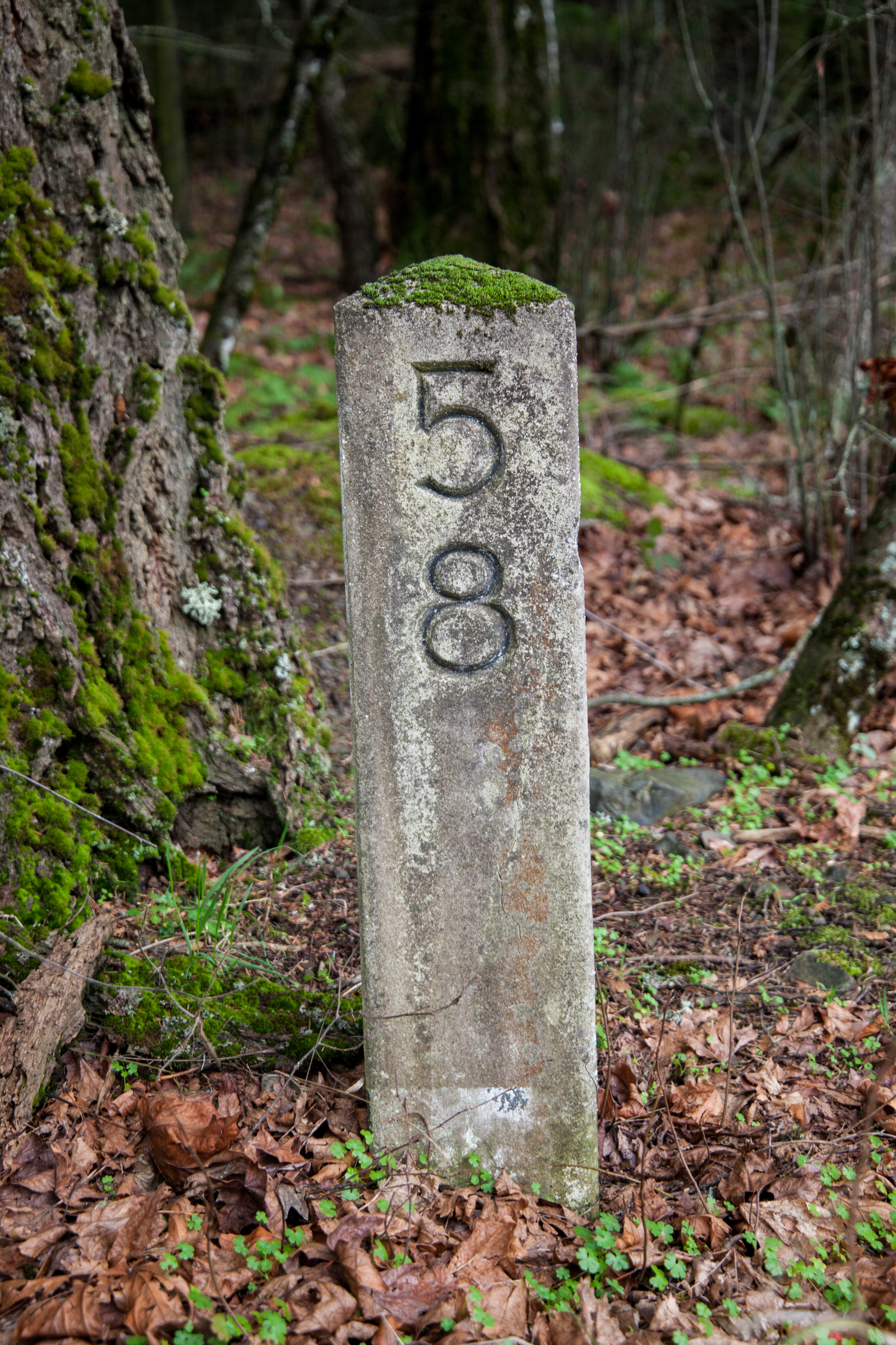
| 23:13, 9 May 2021 | 2020-02-07 orig-stone-milepost-58 4637.jpg (file) |  |
15.13 MB | Jonathan | Original concrete milepost 58 along the Historic Columbia River Highway Trail just west of Viento State Park.<br /> 📷 Jonathan Ledbetter<br /> 📆 7 February 2020 | 1 |
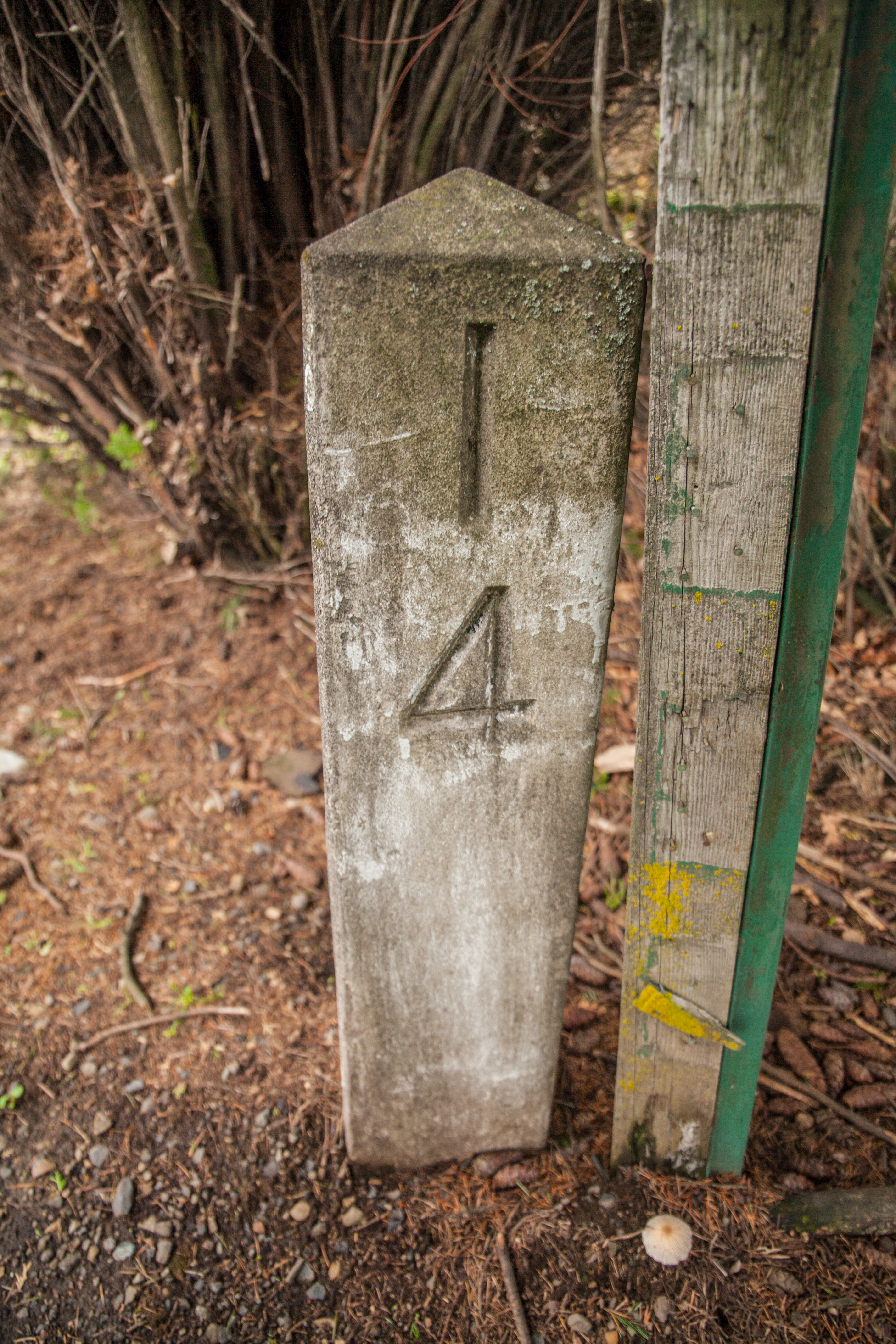
| 23:11, 9 May 2021 | 2020-02-07 orig-stone-milepost-14 4322.jpg (file) |  |
14.58 MB | Jonathan | Original concrete milepost 14 from the Historic Columbia River Highway, as found in the 24400 block of Sandy Blvd. in Wood Village.<br /> 📷 Jonathan Ledbetter<br /> 📆 7 February 2020 | 1 |
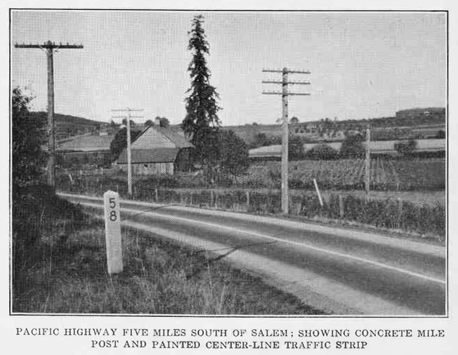
| 00:20, 9 May 2021 | 1924 OSHC-6th-Biennial-Report p78.jpg (file) |  |
184 KB | Jonathan | 1 | |
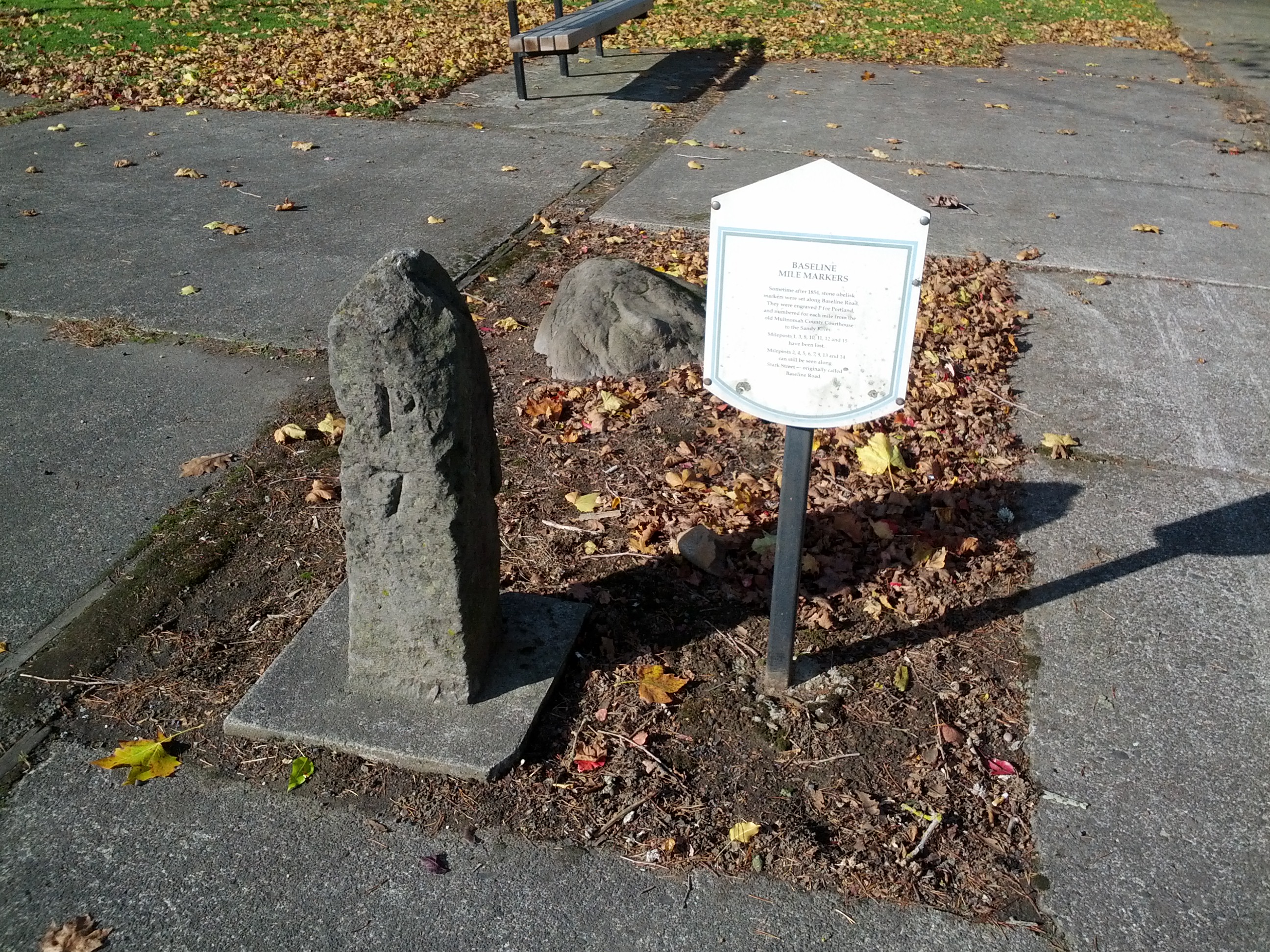
| 12:17, 8 May 2021 | 2013-11-11 portland-p7-post 115842.jpg (file) |  |
1.97 MB | Jonathan | Baseline mile marker 7, numbered "P7", next to a plaque describing the markers' history in Ventura Park at the corner of SE Stark Street and 117th Avenue, Portland.<br /> 📷 Jonathan Ledbetter<br /> 📆 11 November 2013 | 1 |
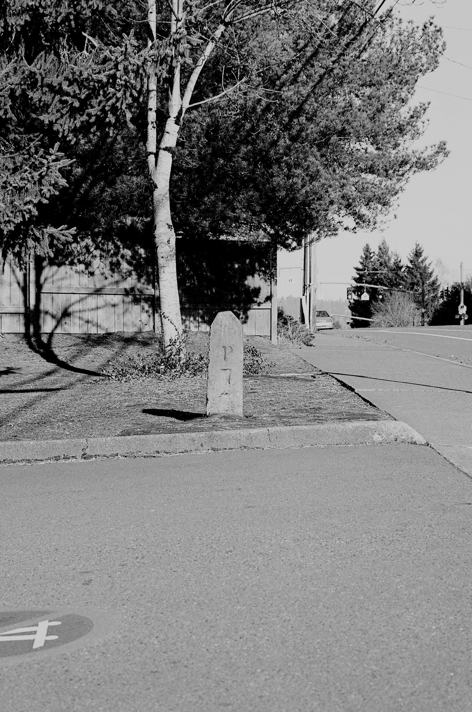
| 11:52, 8 May 2021 | 2013-01-02 portland-p7-post-south 00570018.jpg (file) |  |
3.42 MB | Jonathan | Southern baseline mile marker 7, numbered "P7", as seen outside the Capitol Hill branch of the Multnomah County Library, Portland.<br /> 📷 Jonathan Ledbetter<br /> 📆 2 January 2013 | 1 |
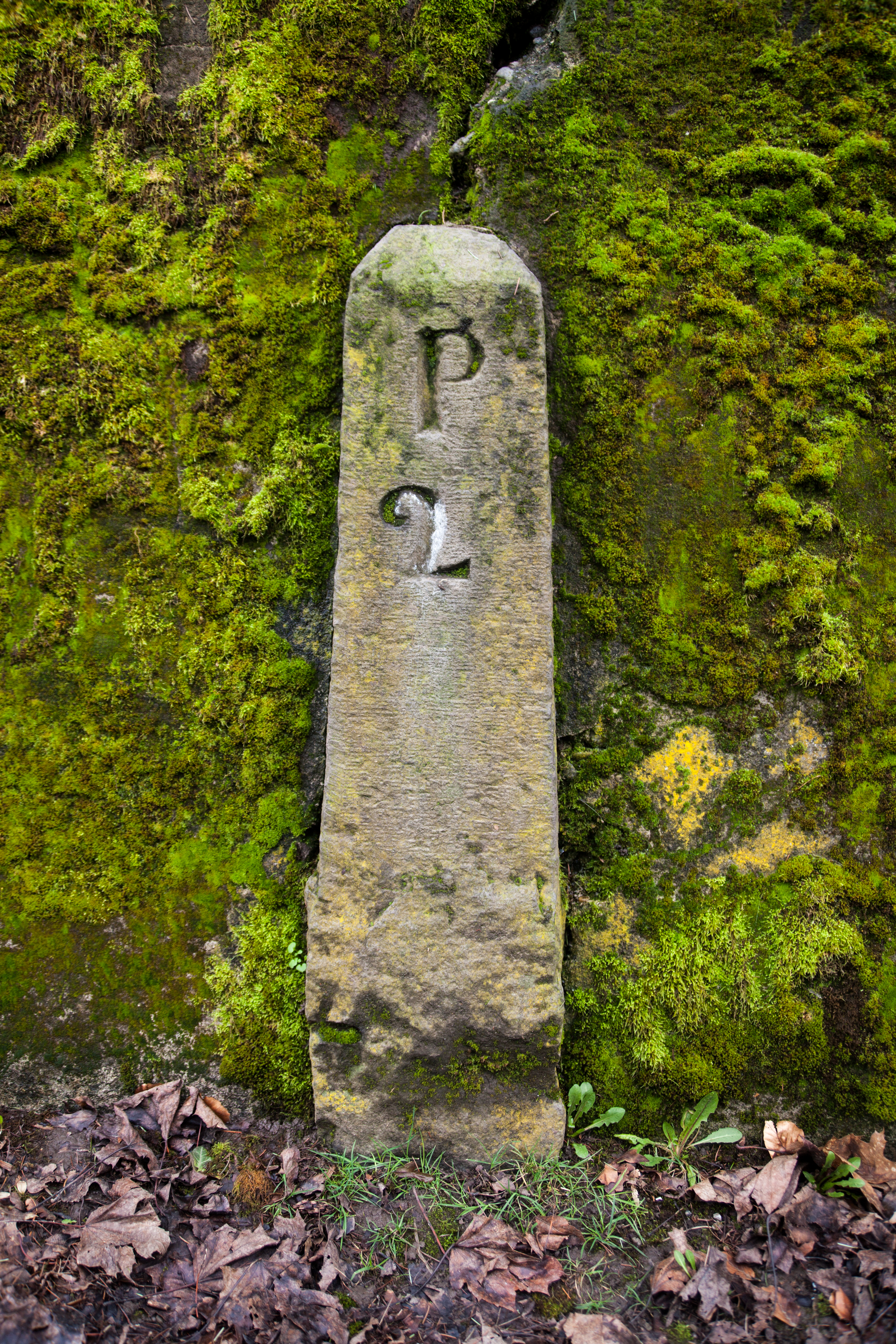
| 10:22, 8 May 2021 | 2016-02-20 portland-p2-post 1065.jpg (file) |  |
20.22 MB | Jonathan | Added GPS data | 2 |
| 07:50, 8 May 2021 | Undated - OSHD 181 - John Day Highway With Fossil Mountain Mile Post 116 (Wheeler County).jpg (file) | .jpg) |
610 KB | Jonathan | 1 | |
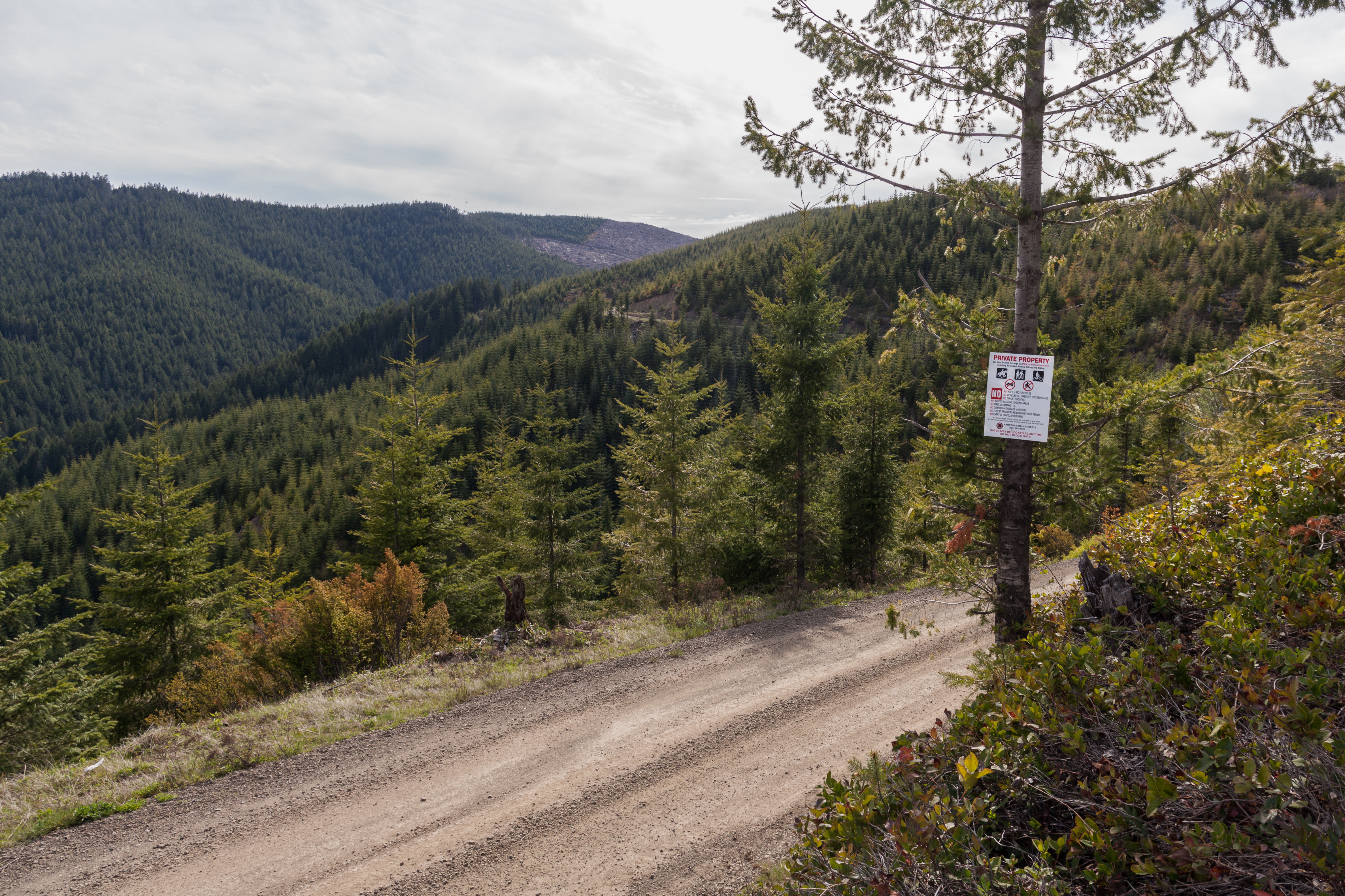
| 00:25, 13 April 2021 | 2020-05-09 ridge-route-8548.jpg (file) |  |
10.99 MB | Jonathan | Storey Burn Road looking west towards Larch Mountain and Blue Lake, Tillamook County.<br /> 📷 Jonathan Ledbetter<br /> 📆 9 May 2020 | 1 |
| 20:08, 11 March 2021 | Under construction.gif (file) |  |
413 bytes | Jonathan | Shrunk size | 2 |
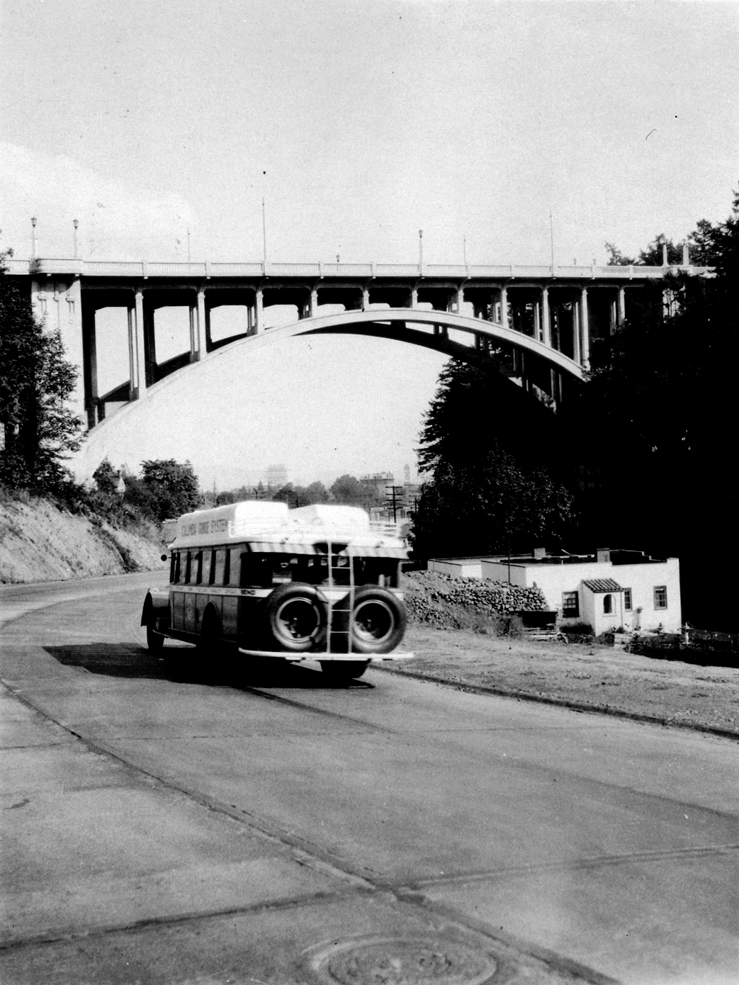
| 02:09, 10 March 2021 | Multco-image-2.jpg (file) |  |
740 KB | Jonathan | A bus heading eastbound on the newly-paved Canyon Road entering Portland. 📆 1930 🖼 Multnomah County Archives via [https://vintageportland.wordpress.com/2015/03/04/vista-avenue-viaduct-1930/ Vintage Portland] | 1 |
| 17:25, 24 February 2021 | US 99E 1948.png (file) |  |
116 KB | Jonathan | 1948 version of the route shield for US-99E | 1 |