File list
Jump to navigation
Jump to search
This special page shows all uploaded files.
| Date | Name | Thumbnail | Size | Description | Versions |
|---|---|---|---|---|---|
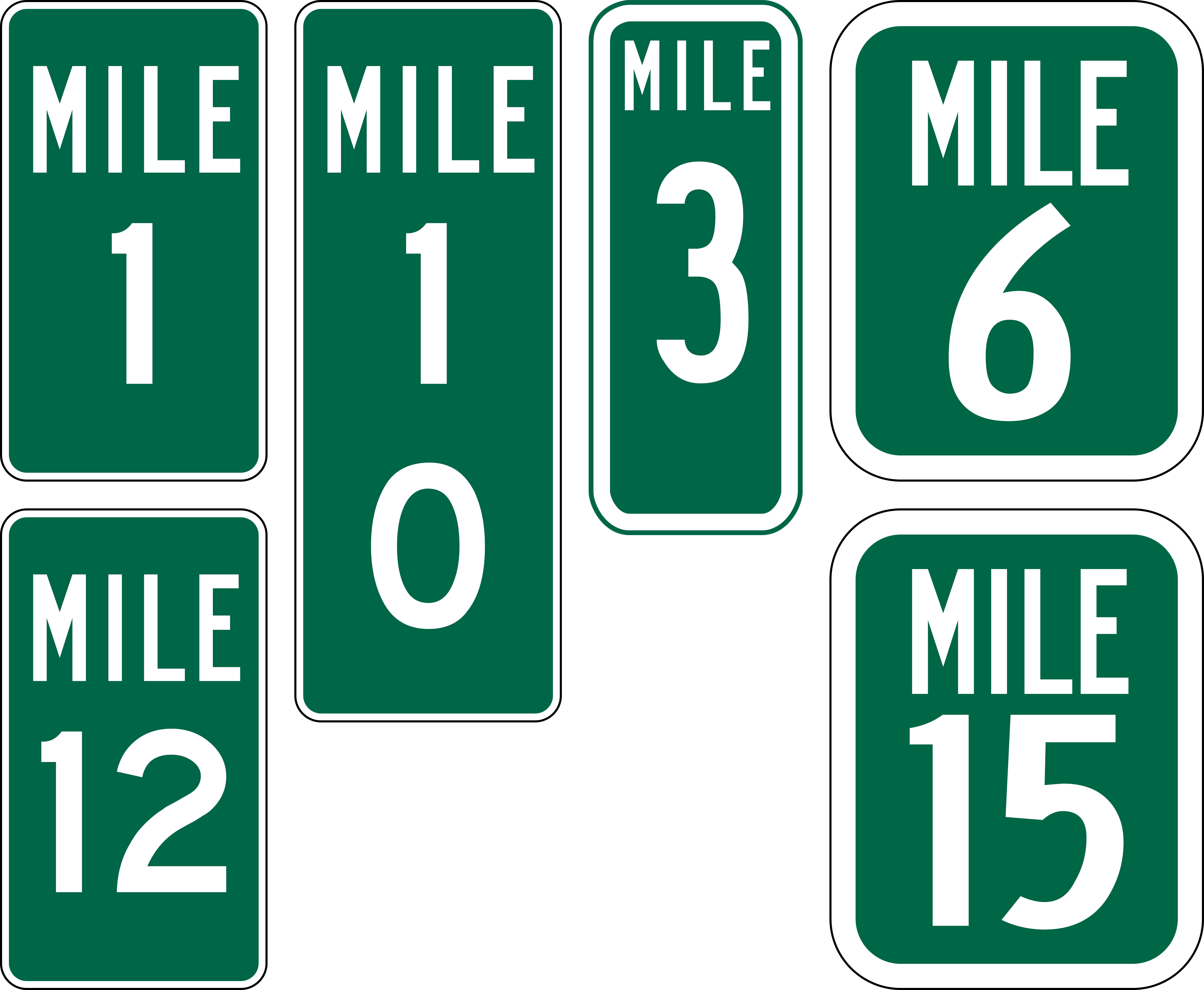
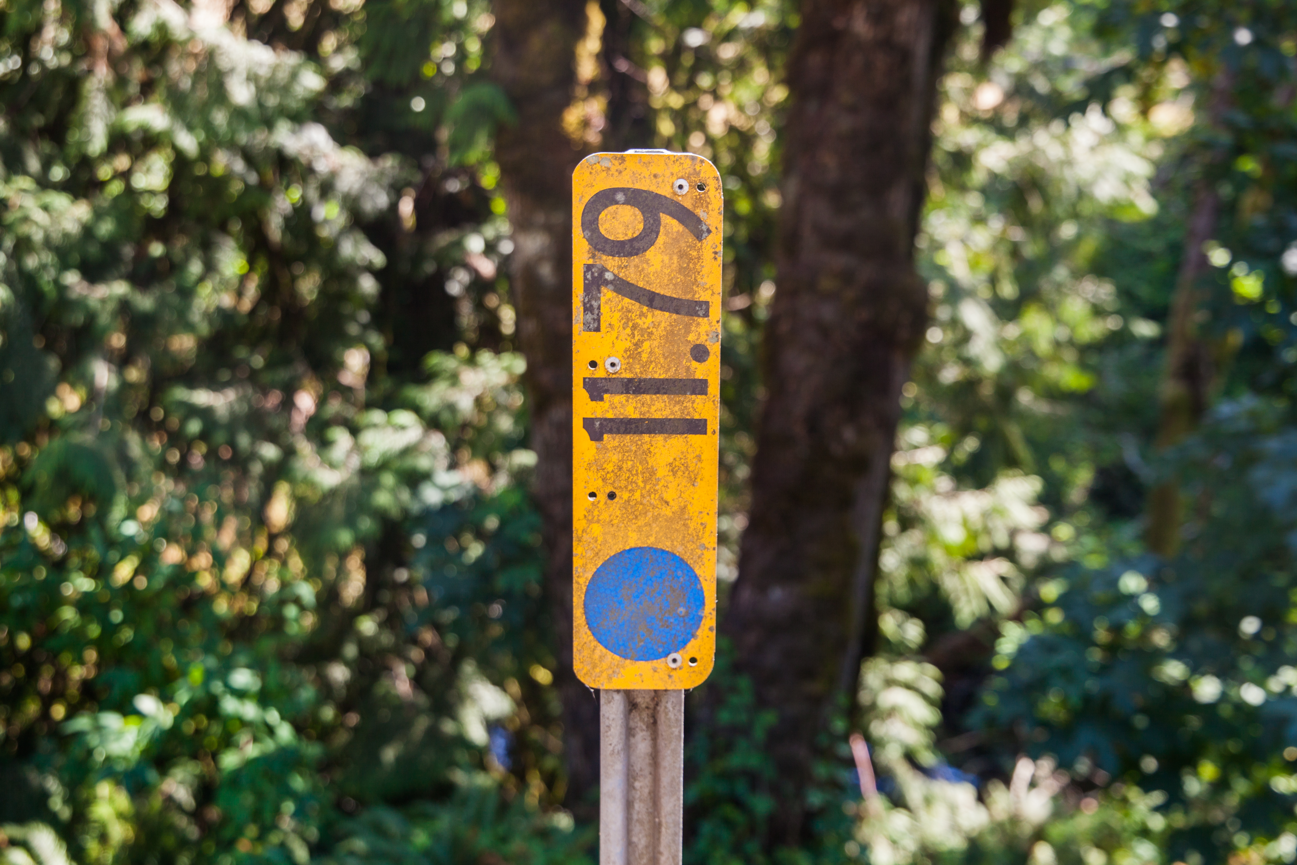
| 11:55, 23 September 2022 | Mp-county-tillamook-examples.png (file) |  |
270 KB | Added tiny milepost found on Gods Valley Road | 4 |
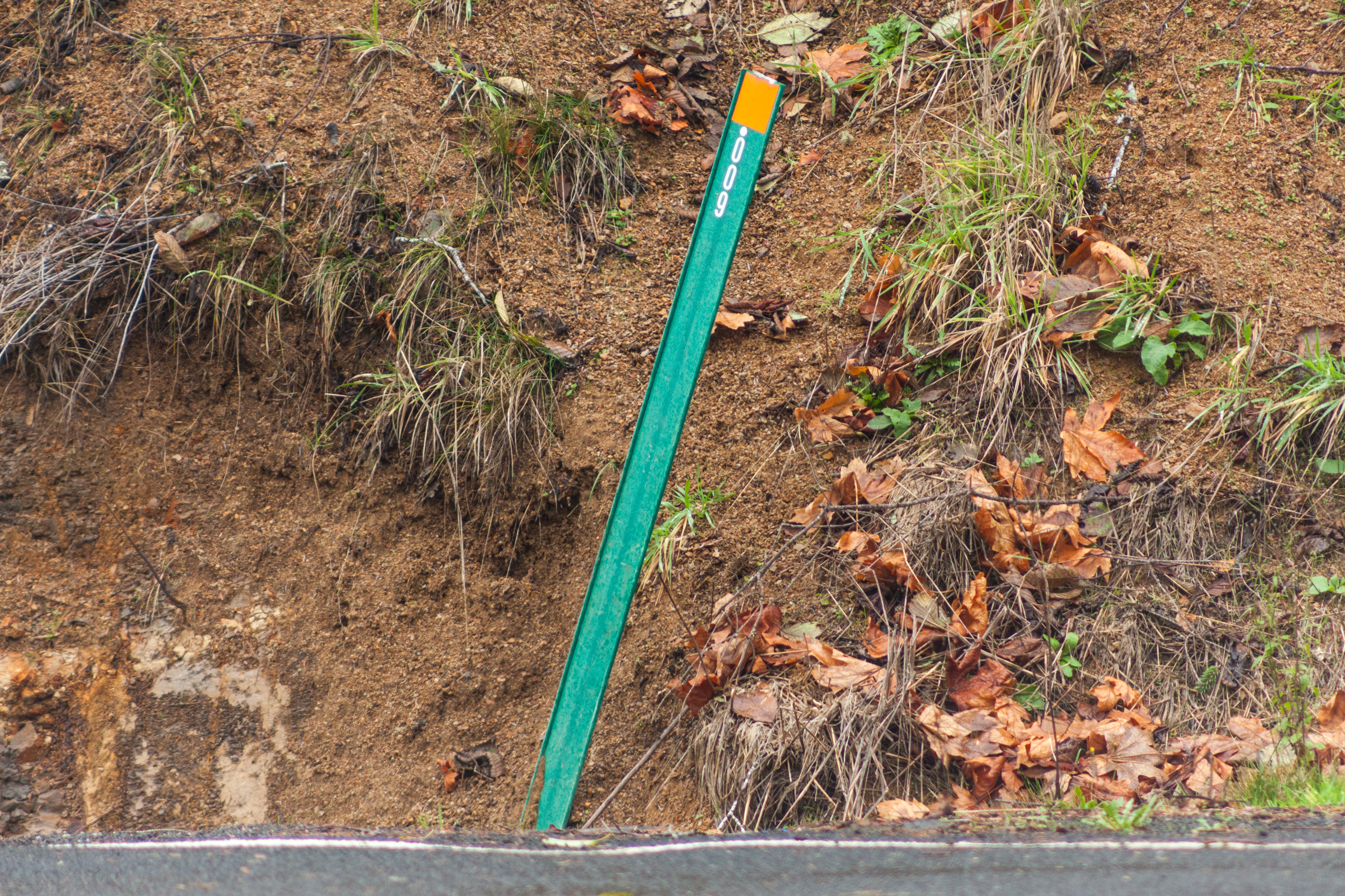
| 10:15, 23 September 2022 | 2021-11-28 youngs-river-rd-wicket-mp 6595.jpg (file) |  |
10.21 MB | A green milepost wicket at a culvert at MP 0.009 on Youngs River Road in Clatsop County.<br /> 📷 Jonathan Ledbetter<br /> 📆 28 November 2021 | 1 |
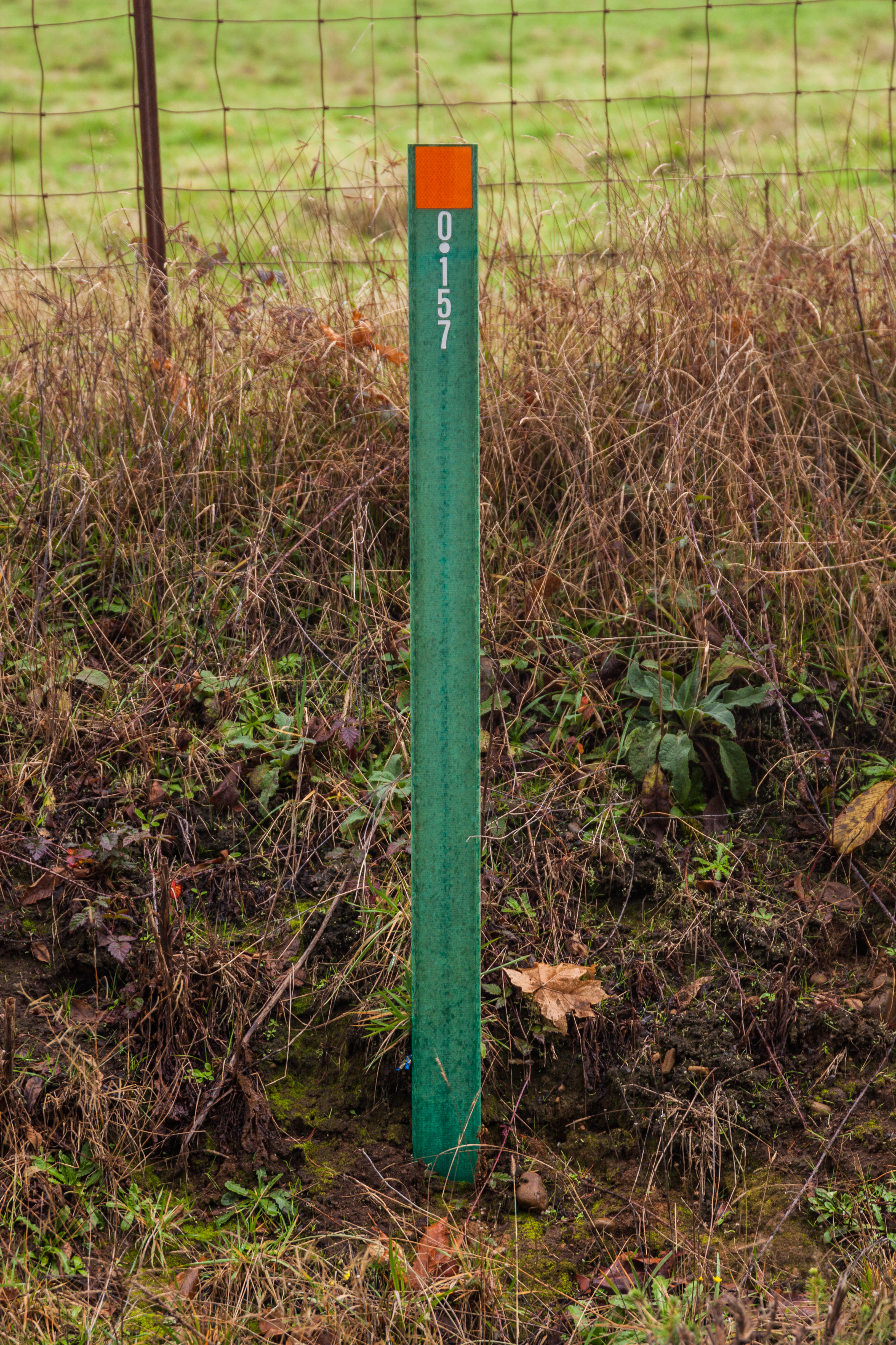
| 10:13, 23 September 2022 | 2021-11-28 saddle-mtn-rd-wicket-mp 6622.jpg (file) |  |
12.17 MB | A green milepost wicket at a culvert at MP 0.157 on Saddle Mountain Road in Clatsop County.<br /> 📷 Jonathan Ledbetter<br /> 📆 28 November 2021 | 1 |
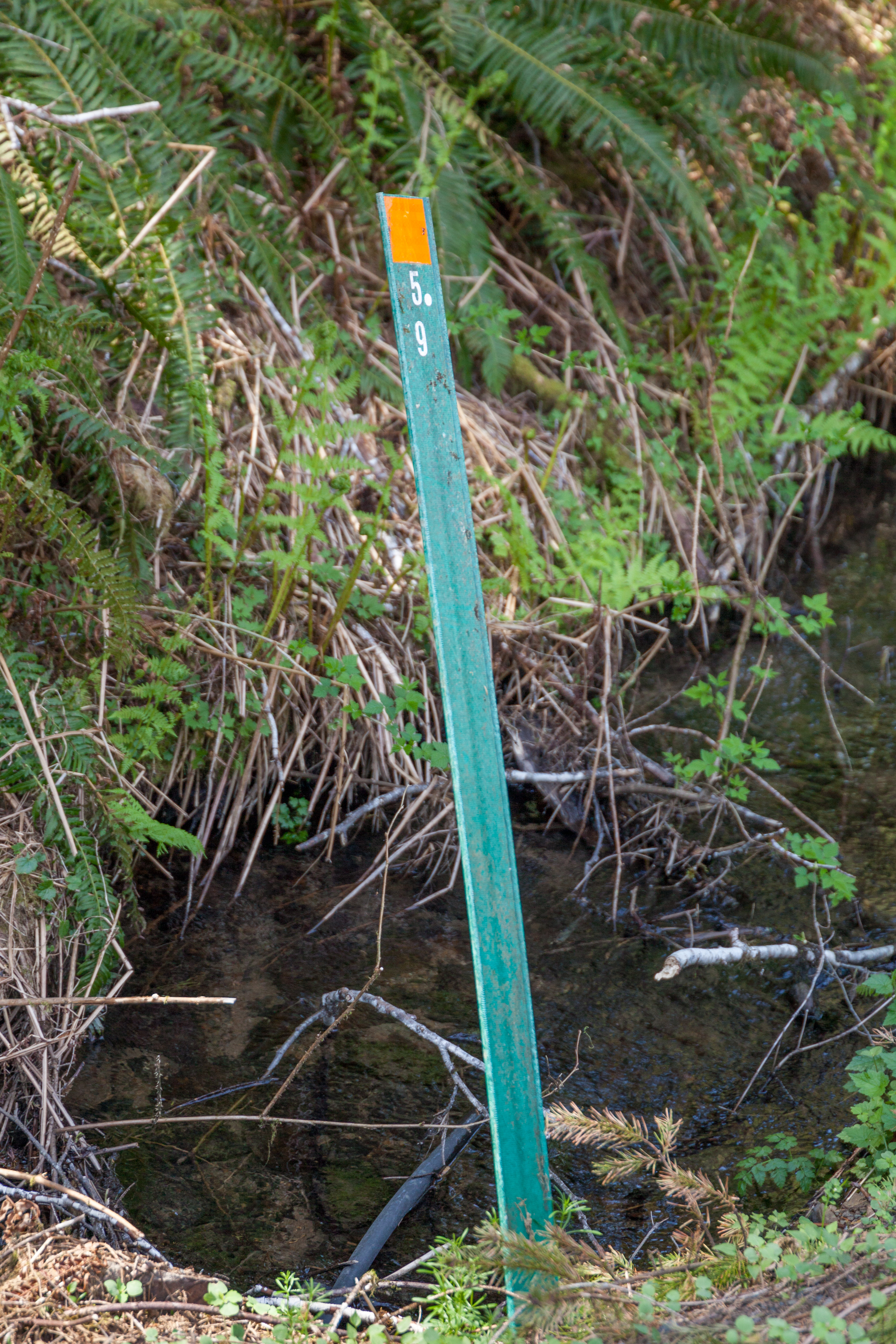
| 10:08, 23 September 2022 | 2021-04-18 hamlet-rd-wicket-mp 0913.jpg (file) |  |
13.97 MB | A green milepost wicket at a culvert at MP 5.9 on Hamlet Road in Clatsop County.<br /> 📷 Jonathan Ledbetter<br /> 📆 18 April 2021 | 1 |
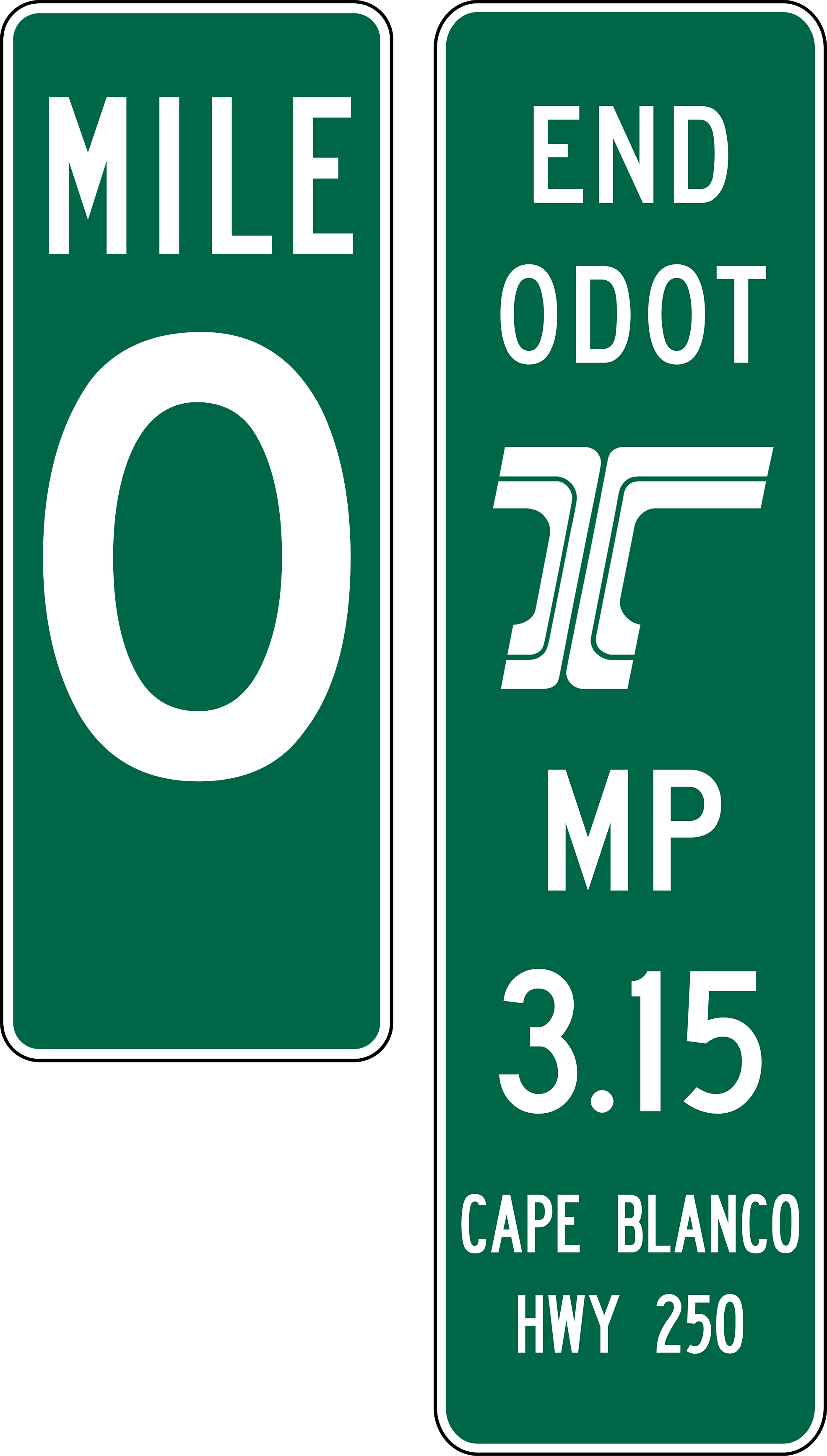
| 01:29, 23 September 2022 | 2020s 0mp+ODOT-R3-terminal-mp-example.png (file) |  |
285 KB | An example of a zero milepost first appearing around 2019, as well as ODOT Region 3's terminal milepost panels which started appearing around 2021.<br /> 📷 Jonathan Ledbetter<br /> 📆 23 September 2022 | 1 |
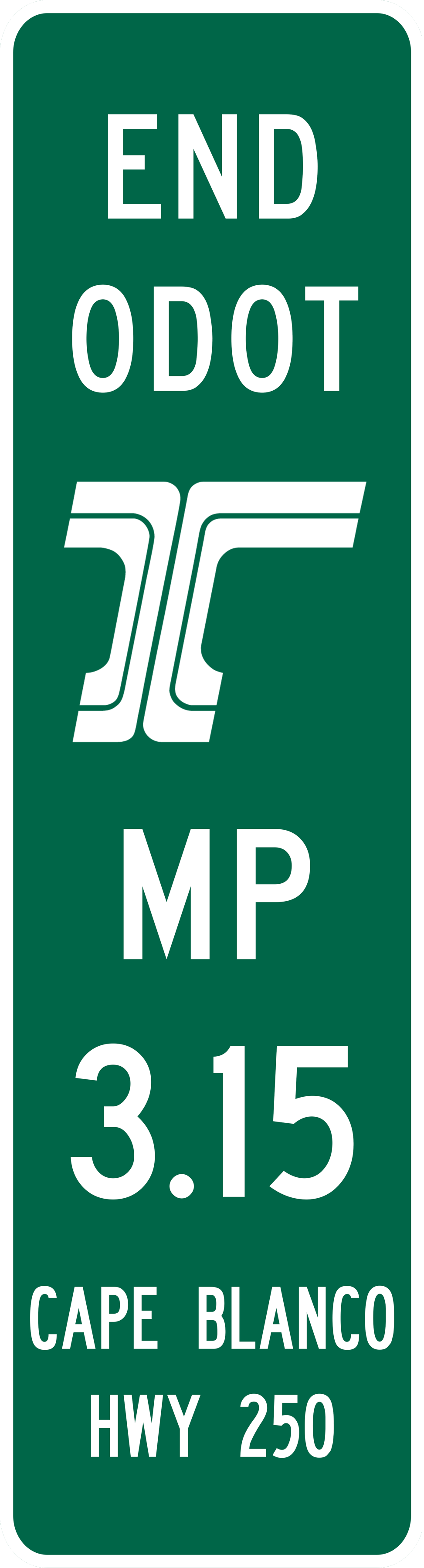
| 22:43, 22 September 2022 | 2020s ODOT-R3-terminal-mp-example.png (file) |  |
196 KB | An examples of ODOT Region 3's terminal milepost panels, which started appearing around 2021.<br /> 📷 Jonathan Ledbetter<br /> 📆 22 September 2022 | 1 |
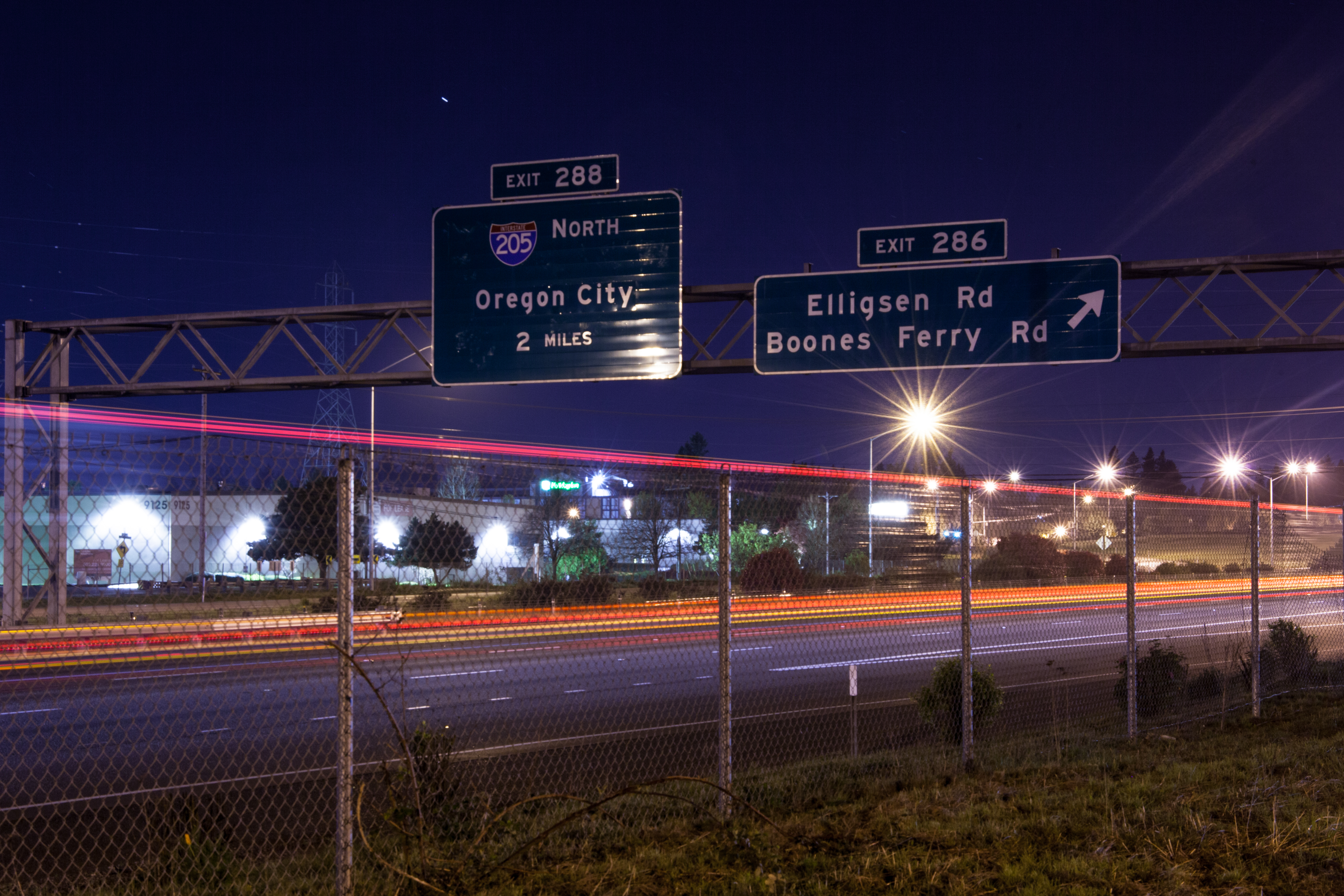
| 18:48, 13 September 2022 | 2020-04-12 i5-nb-exit-286-night 6958.jpg (file) |  |
9.88 MB | Night-time photo of the Exit 286 and 288 BGSes along Interstate 5 North at North Wilsonville.<br /> 📷 Jonathan Ledbetter<br /> 📆 12 April 2020 | 1 |
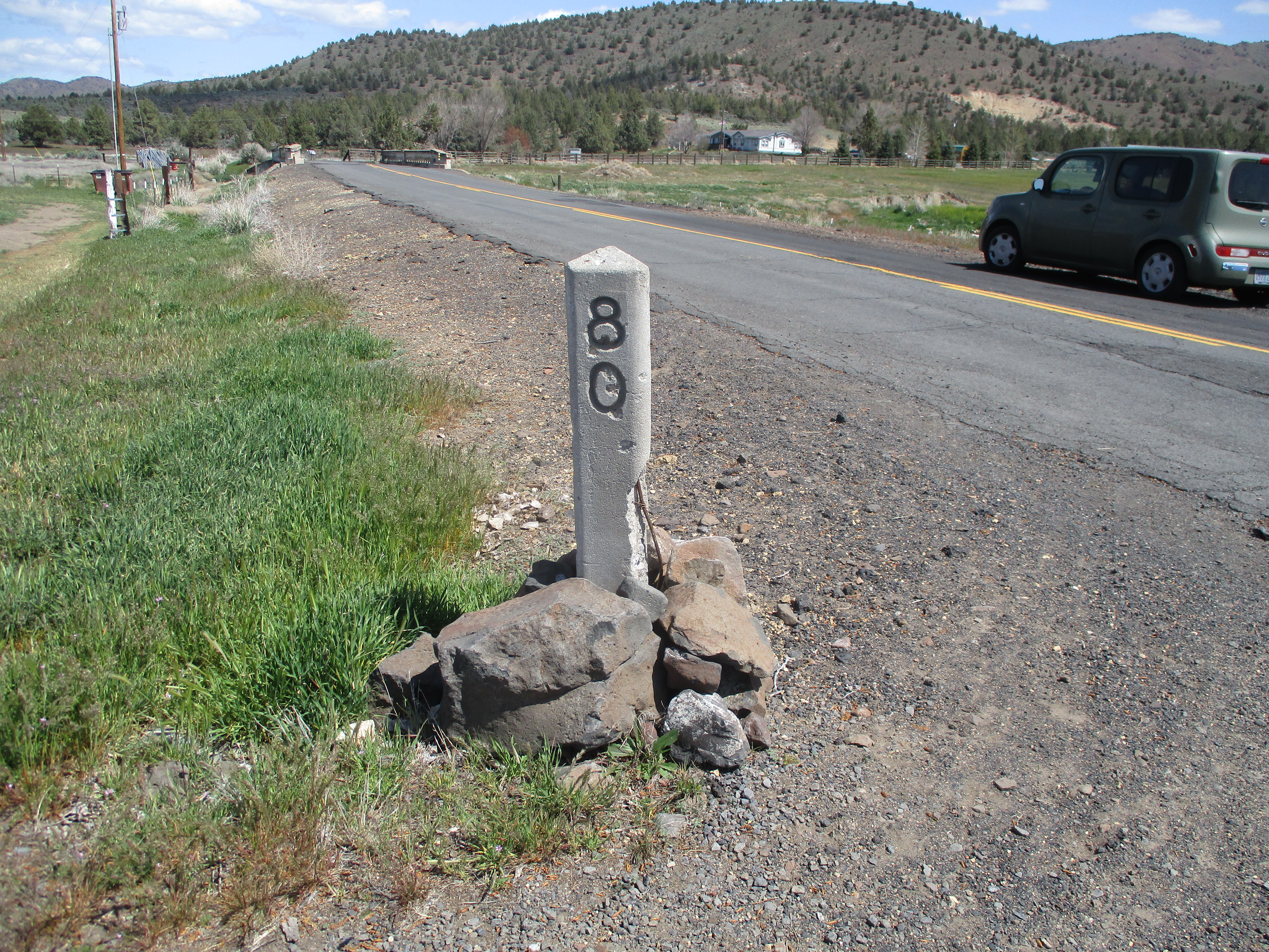
| 00:24, 12 September 2022 | 2022-04-29 orig-stone-milepost-80 k-poole.jpg (file) |  |
9.25 MB | Original concrete milepost 80 from The Dalles-California Highway, as found along NE Old US Highway 97 near Lyle Gap.<br /> 📷 Kirk J. Poole<br /> 📆 29 April 2022 | 1 |
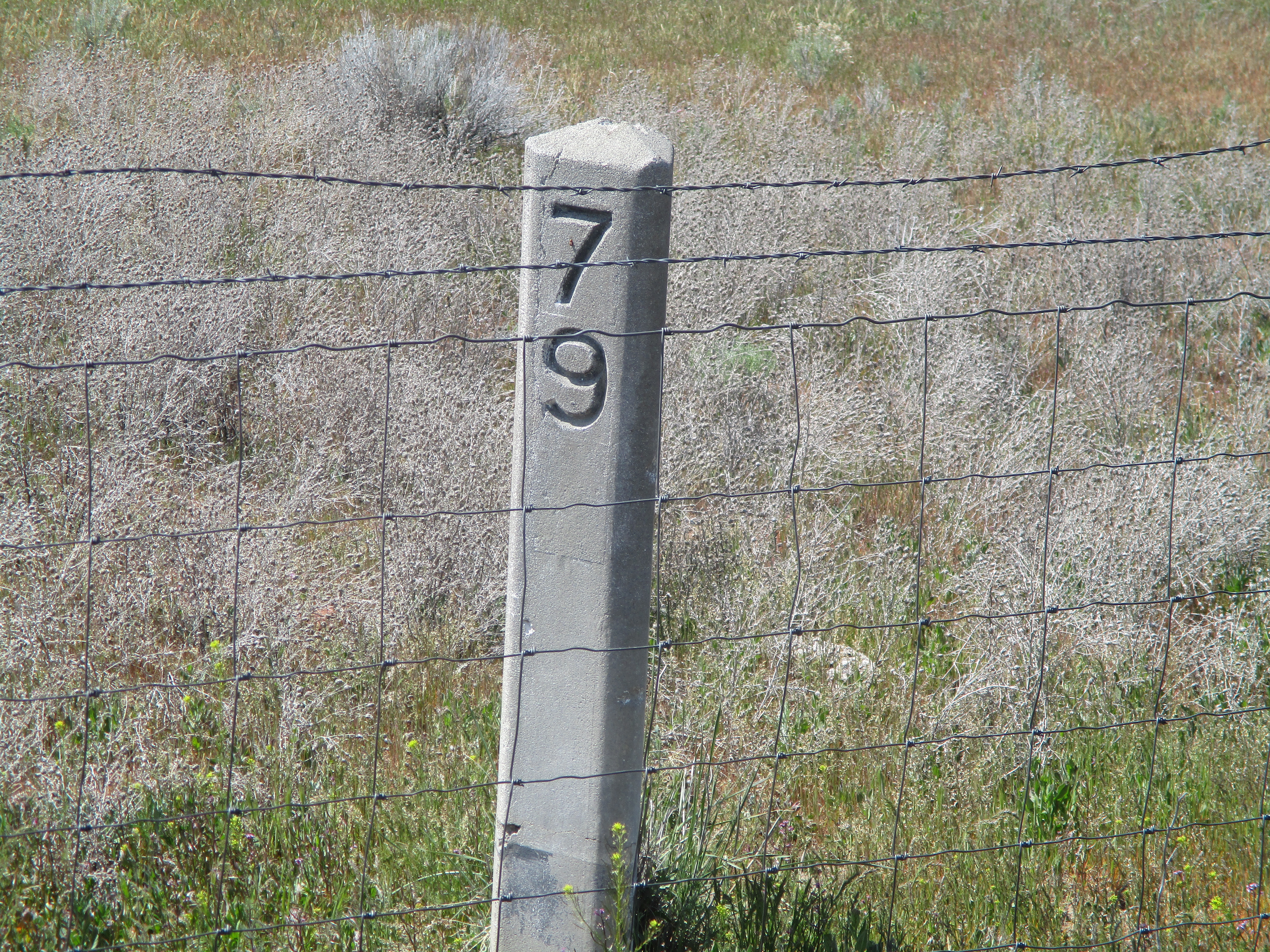
| 00:22, 12 September 2022 | 2022-04-29 orig-stone-milepost-79 k-poole.jpg (file) |  |
11.42 MB | Original concrete milepost 79 from The Dalles-California Highway, as found along NE Old US Highway 97 near Lyle Gap.<br /> 📷 Kirk J. Poole<br /> 📆 29 April 2022 | 1 |
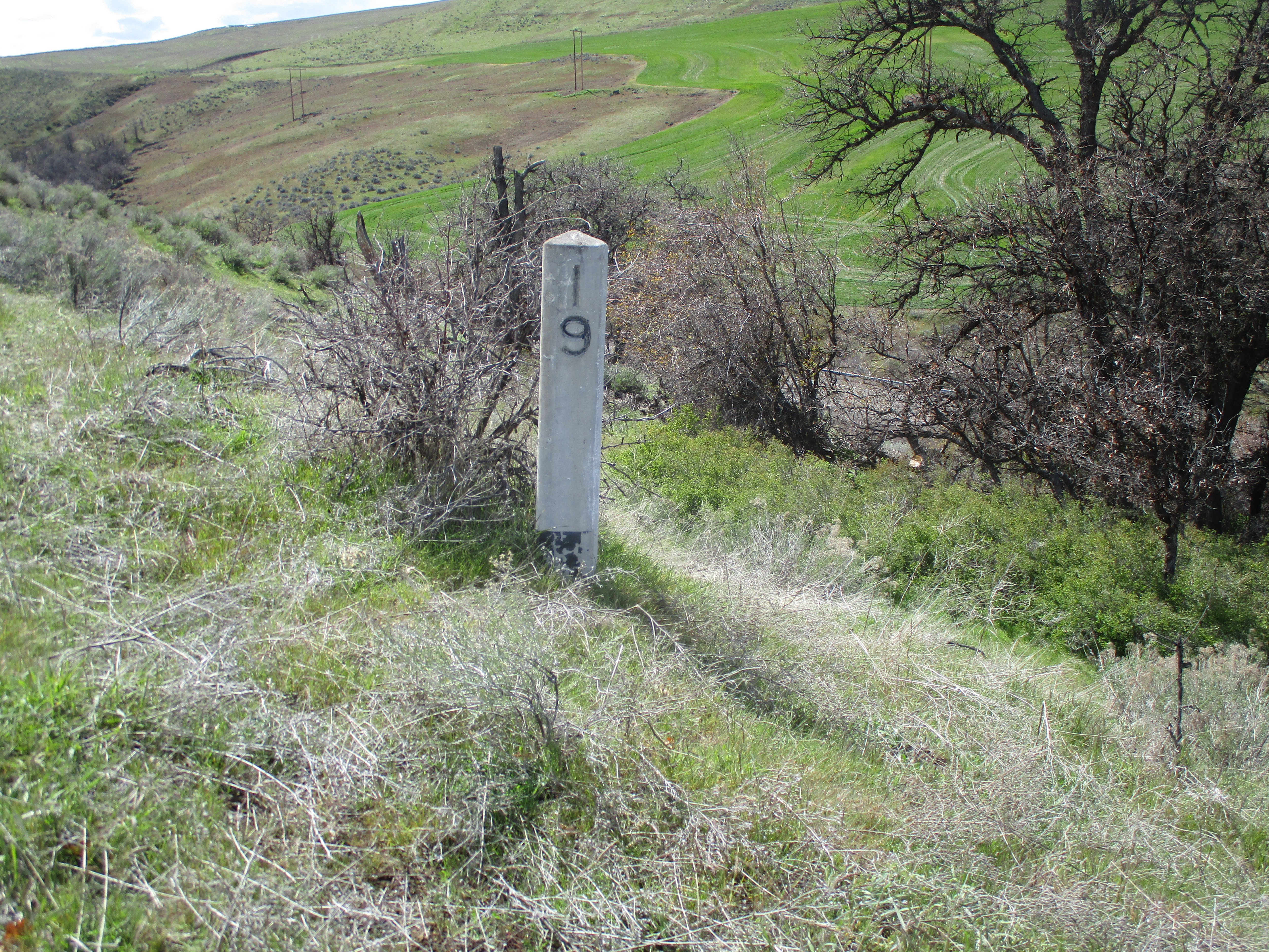
| 00:15, 12 September 2022 | 2022-04-15 orig-stone-milepost-19 k-poole 2.jpg (file) |  |
9.32 MB | Original concrete milepost 19 from The Dalles-California Highway, as found along an abandonned section of former OR-23/US-197 south of Dufur. Note the black paint inside the numerals and at the base, which are usually worn off other existing markers.<br /> 📷 Kirk J. Poole<br /> 📆 15 April 2022 | 1 |
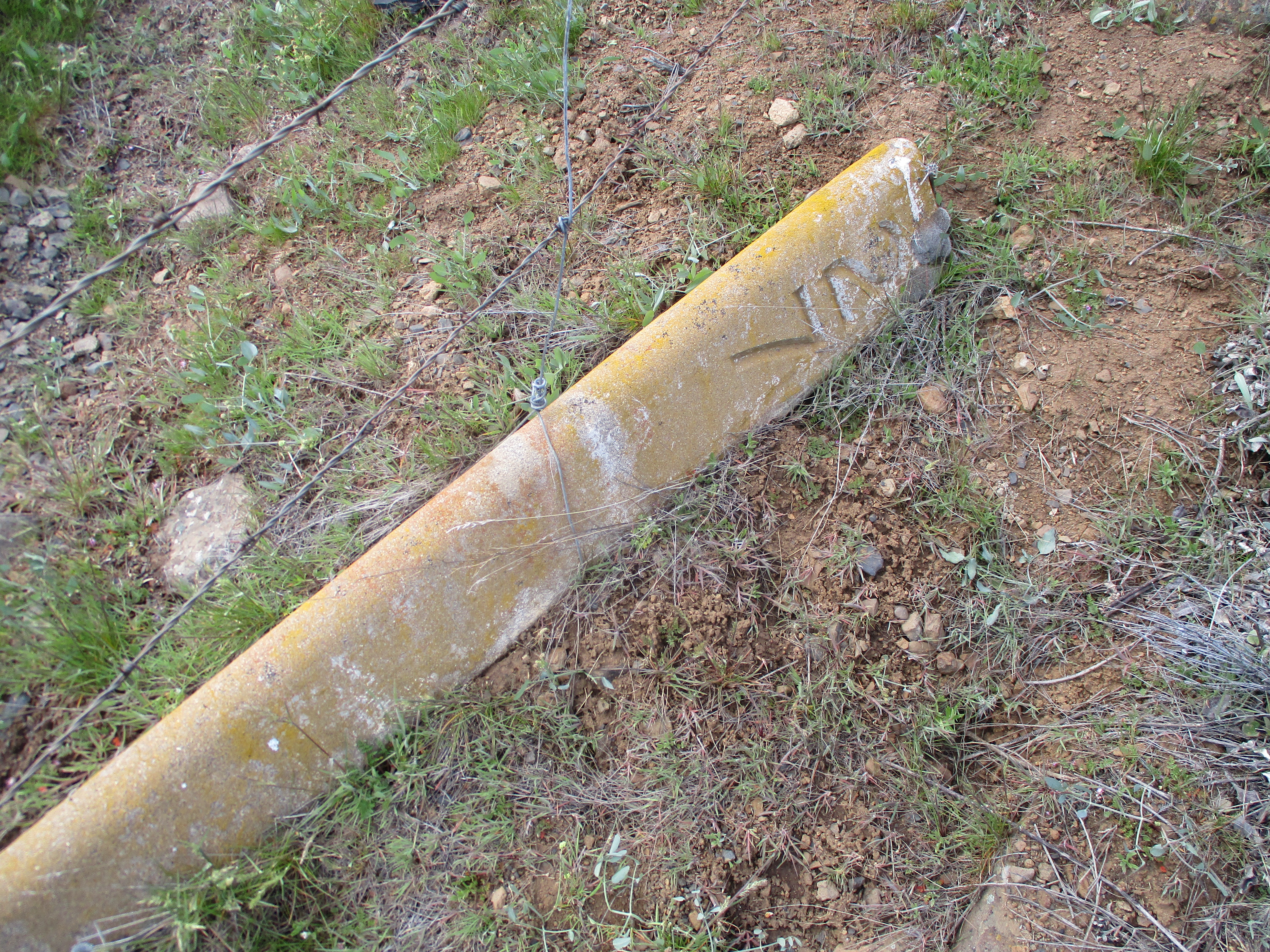
| 00:14, 12 September 2022 | 2022-04-15 orig-stone-milepost-27 k-poole.jpg (file) |  |
9.79 MB | Original concrete milepost 27 from The Dalles-California Highway, as found along Eightmile Rd. (former OR-23/US-197) near Tygh Ridge Summit and Tygh Grade Summit.<br /> 📷 Kirk J. Poole<br /> 📆 15 April 2022 | 1 |
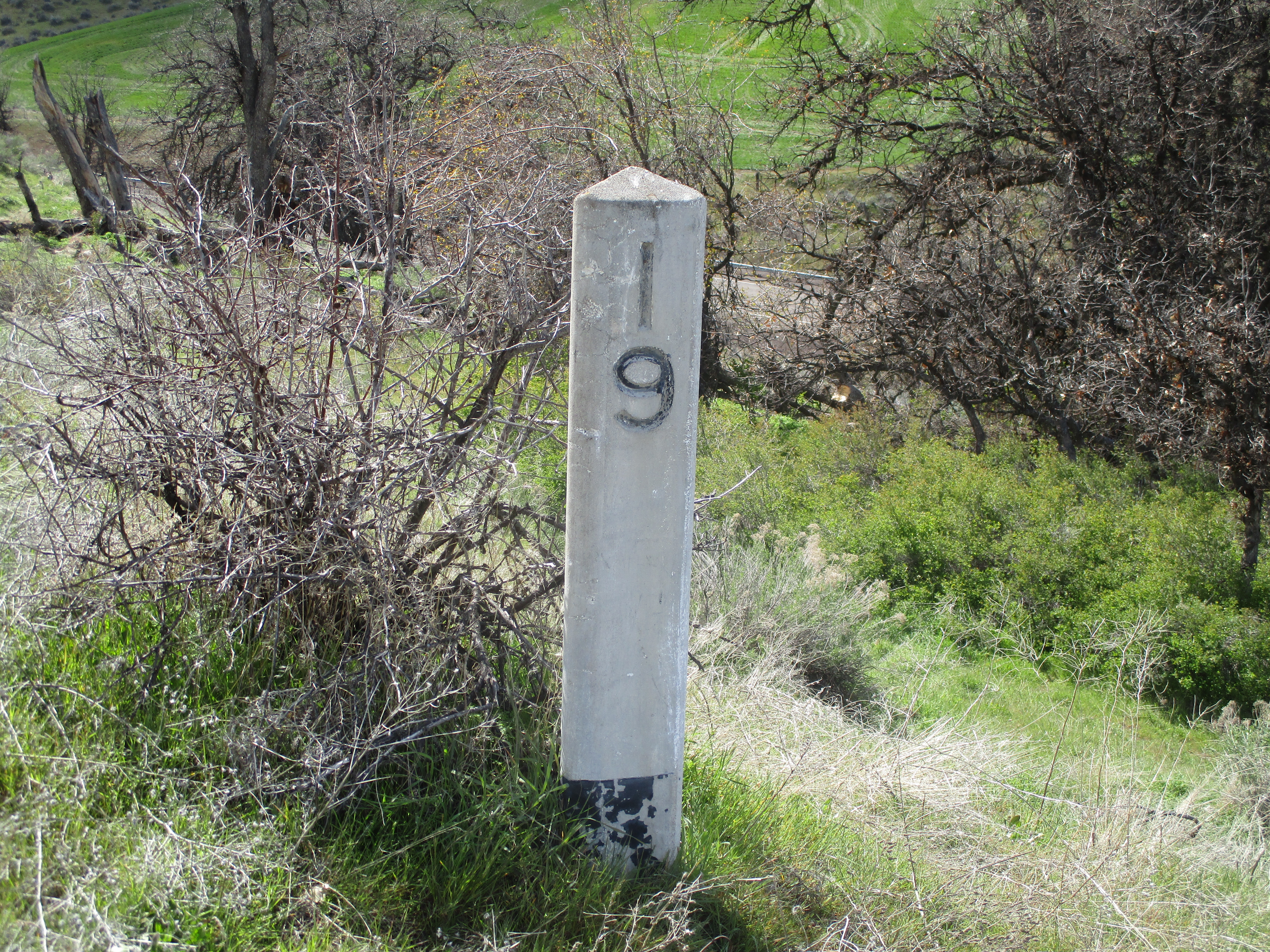
| 00:09, 12 September 2022 | 2022-04-15 orig-stone-milepost-19 k-poole 1.jpg (file) |  |
10.23 MB | Original concrete milepost 19 from The Dalles-California Highway, as found along an abandonned section of former OR-23/US-197 south of Dufur. Note the black paint inside the numerals and at the base, which are usually worn off other existing markers.<br /> 📷 Kirk J. Poole<br /> 📆 15 April 2022 | 1 |
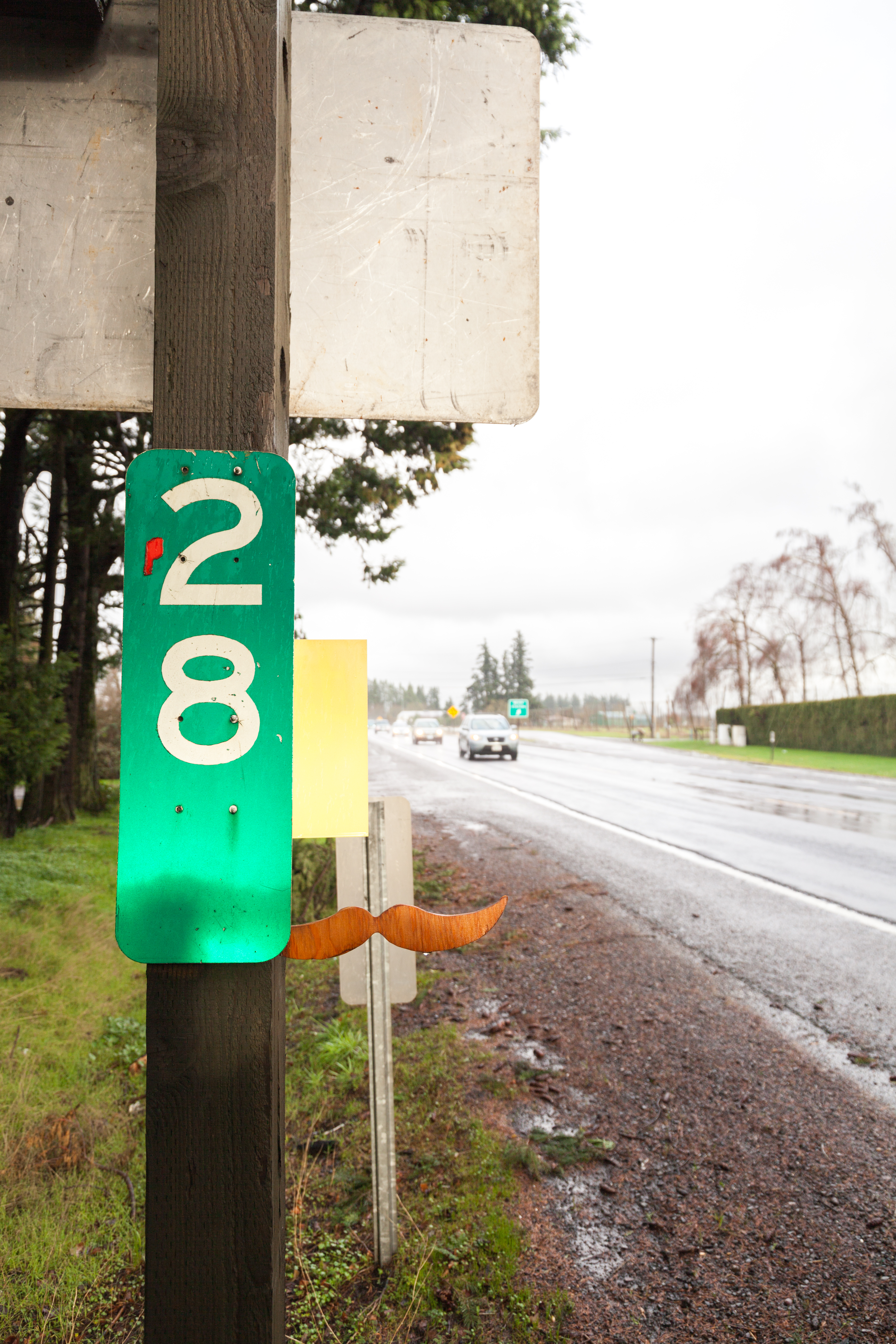
| 00:45, 12 July 2022 | 2021-12-24 state-1961-milepost 6705.jpg (file) |  |
10.92 MB | Milepost 28 along OR-99E near the OR-551 junction north of Hubbard. The mileposts are designed to the 1961 MUTCD specifications. The backside of a newer 1971 MUTCD spec milepost can be seen behind the mustache.<br /> 📷 Jonathan Ledbetter<br /> 📆 24 December 2021 | 1 |
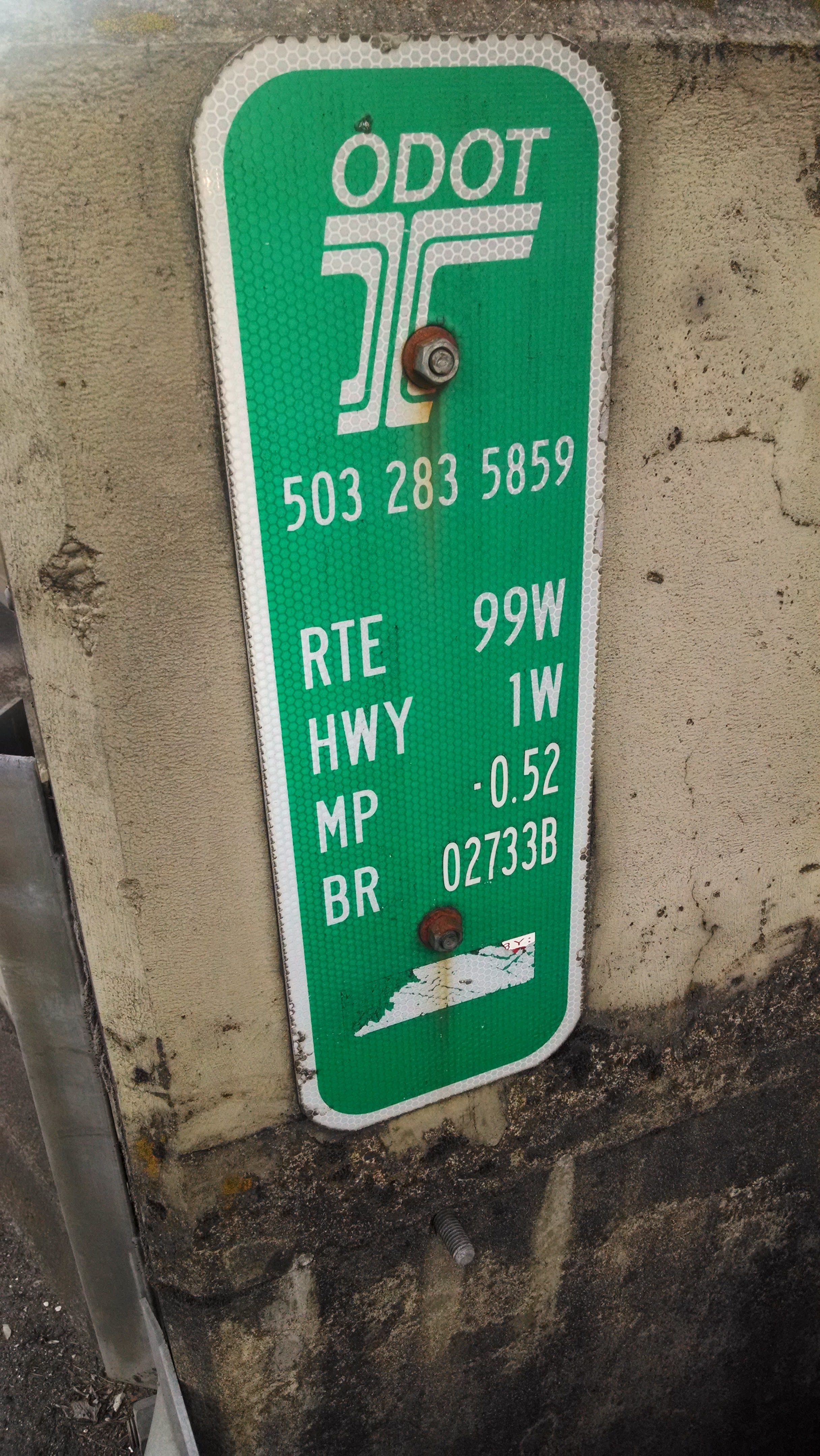
| 23:36, 20 August 2021 | 2014-07-30 state-inventory-marker 193623.jpg (file) |  |
2.23 MB | An ODOT bridge inventory marker on the onramp for the Steel Bridge at NW 1st Avenue & Everett Street in Portland. Note the negative mileage (MP -0.52) and the lack of structure or water body name on the marker.<br /> 📷 Jonathan Ledbetter<br /> 📆 30 July 2014 | 1 |
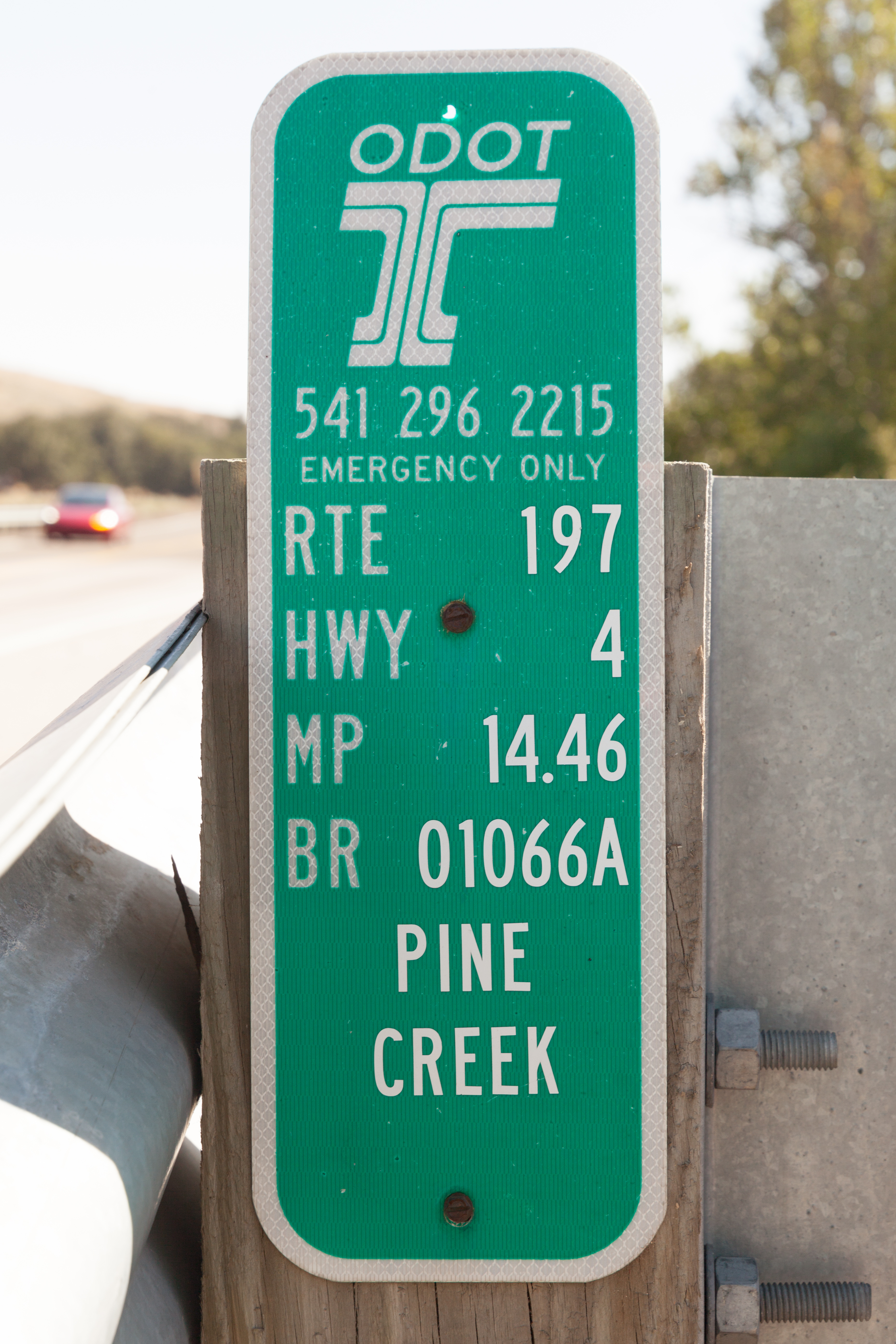
| 01:45, 25 July 2021 | 2021-07-24 state-inventory-marker 4615.jpg (file) |  |
8.78 MB | An ODOT bridge inventory marker for the bridge over Pine Creek on US-197 at MP 14.46 south of Dufur.<br /> 📷 Jonathan Ledbetter<br /> 📆 24 July 2021 | 1 |
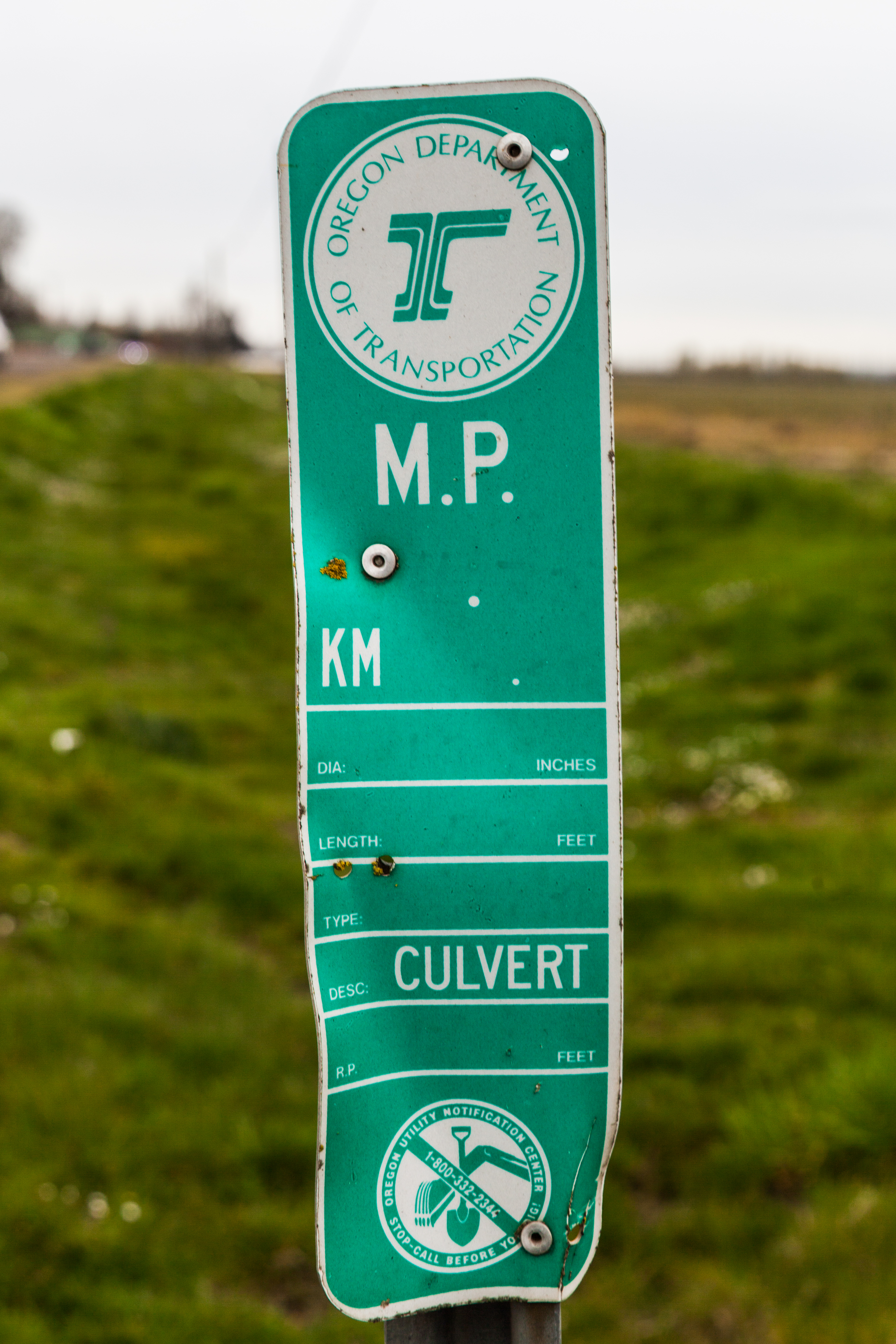
| 00:05, 14 July 2021 | 2018-03-30 state-culvert-marker 6716.jpg (file) |  |
11.48 MB | A green ODOT/OUNC culvert marker on OR-221 south of Dayton.<br /> 📷 Jonathan Ledbetter<br /> 📆 30 March 2018 | 1 |
| 00:03, 14 July 2021 | 2021-07-10 odot-yellow-culvert-marker 3741.jpg (file) |  |
9.97 MB | A yellow ODOT culvert marker on OR-224 between Carver and Barton.<br /> 📷 Jonathan Ledbetter<br /> 📆 10 July 2021 | 1 |
| 23:57, 13 July 2021 | 2021-05-28 state-stormwater-marker 1434.jpg (file) |  |
10.65 MB | An ODOT Type S2 stormwater facility inventory marker at the northern terminus of OR-127 near Linnton.<br /> 📷 Jonathan Ledbetter<br /> 📆 28 May 2021 | 1 |
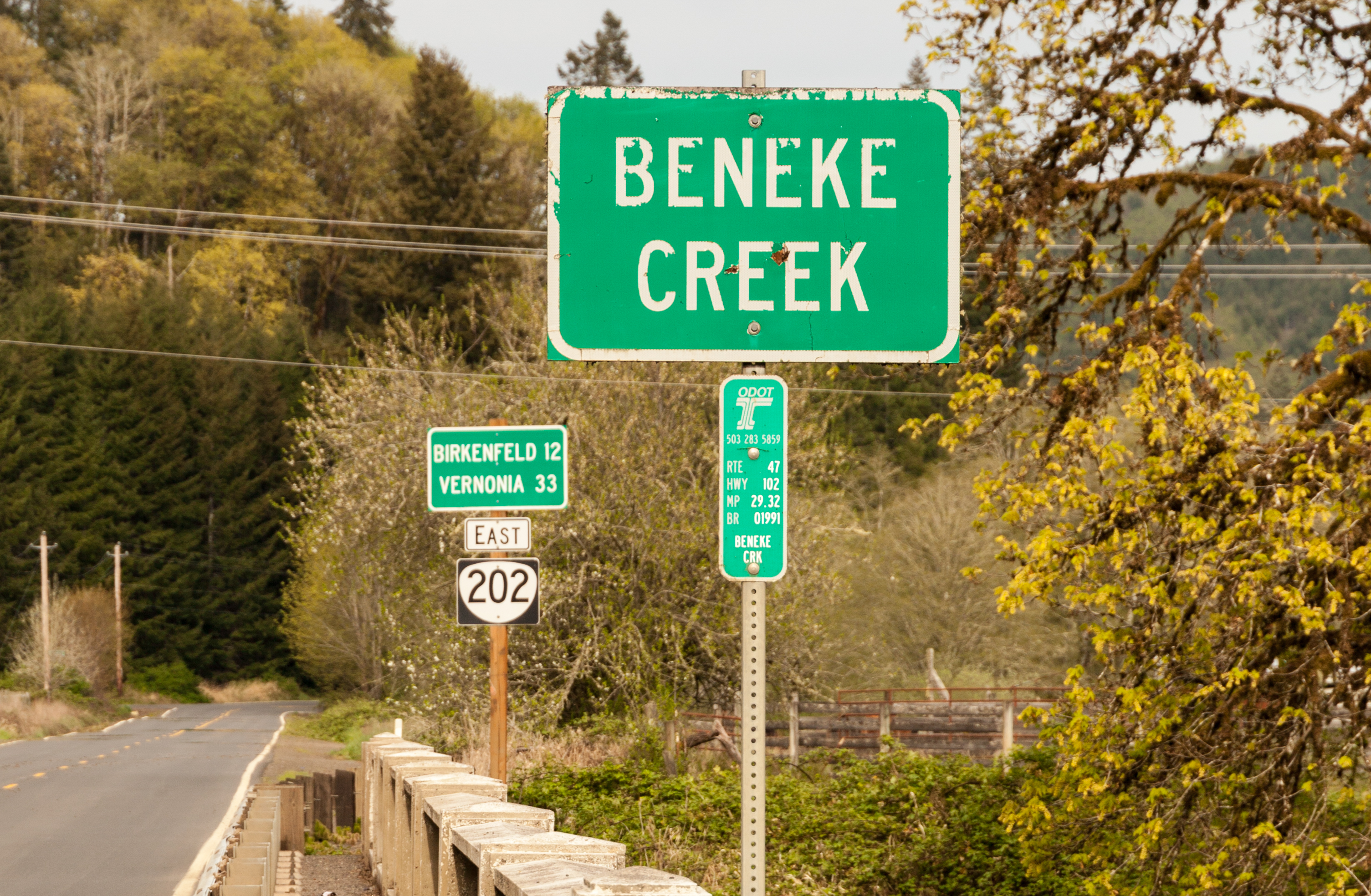
| 23:39, 13 July 2021 | 2020-04-26 state-inventory-marker 8180.jpg (file) |  |
4.24 MB | An ODOT bridge inventory marker for the OR-202 bridge over Beneke Creek at MP 29.32 in Jewell. Note that the Route is erroneously listed as OR-47.<br /> 📷 Jonathan Ledbetter<br /> 📆 26 April 2020 | 1 |
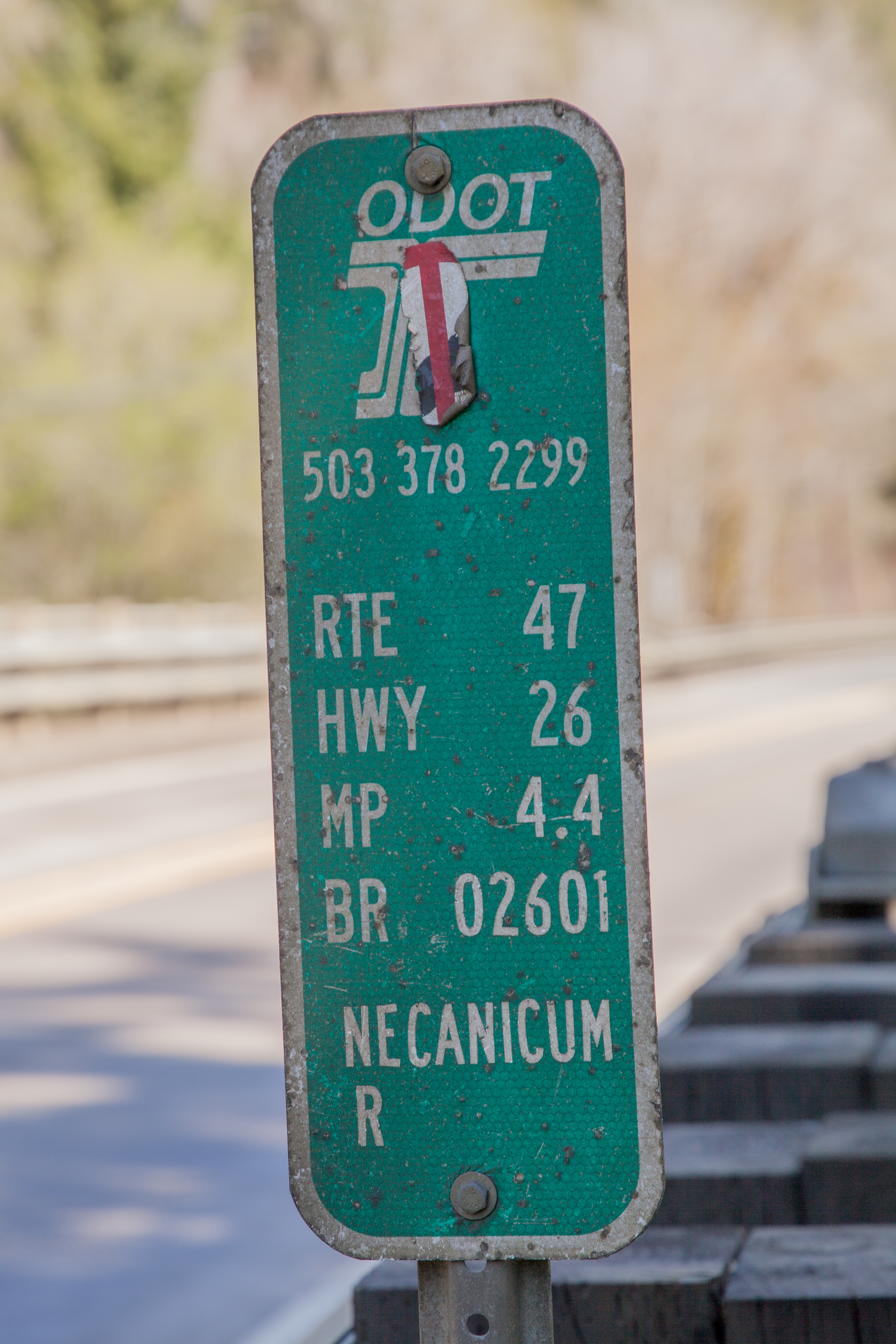
| 16:40, 13 July 2021 | 2021-04-18 state-inventory-marker 0850.jpg (file) |  |
9.99 MB | An ODOT bridge inventory marker for Black Bridge over the Necanicum River on US-26 at MP 4.40 near Cannon Beach Junction. Note that the Route and Highway numbers are flip-flopped from where they should be, and that the milepoint omits the trailing zero.<br /> 📷 Jonathan Ledbetter<br /> 📆 18 April 2021 | 1 |
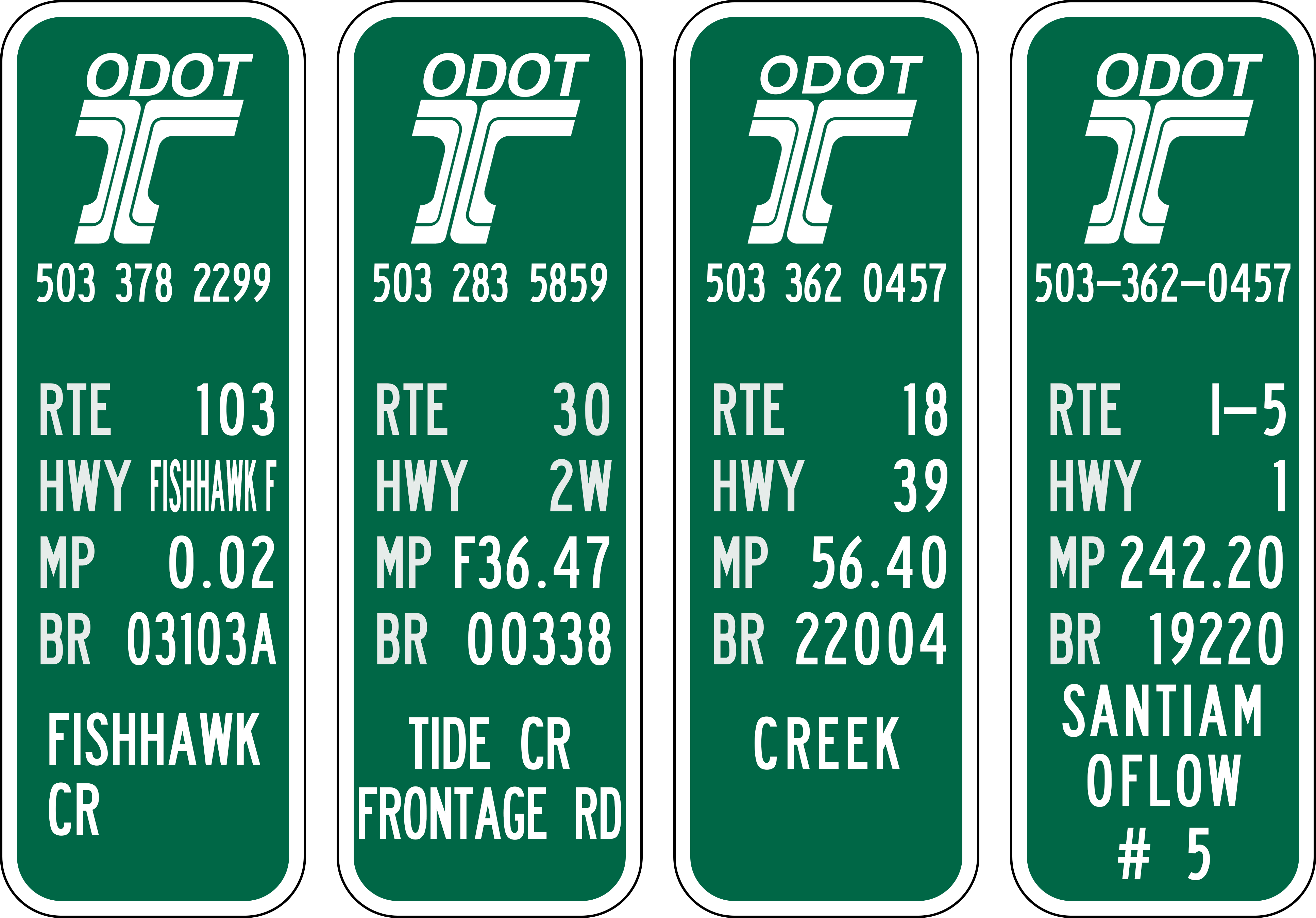
| 16:22, 13 July 2021 | 2020-04-26 state-inventory-marker 8149.jpg (file) |  |
10.67 MB | An ODOT bridge inventory marker for the OR-103 bridge over Fishhawk Creek at MP 0.02 in Jewell. Note the highway name crammed into the "HWY" spot, somewhat common on routes created in the early 2000s.<br /> 📷 Jonathan Ledbetter<br /> 📆 26 April 2020 | 1 |
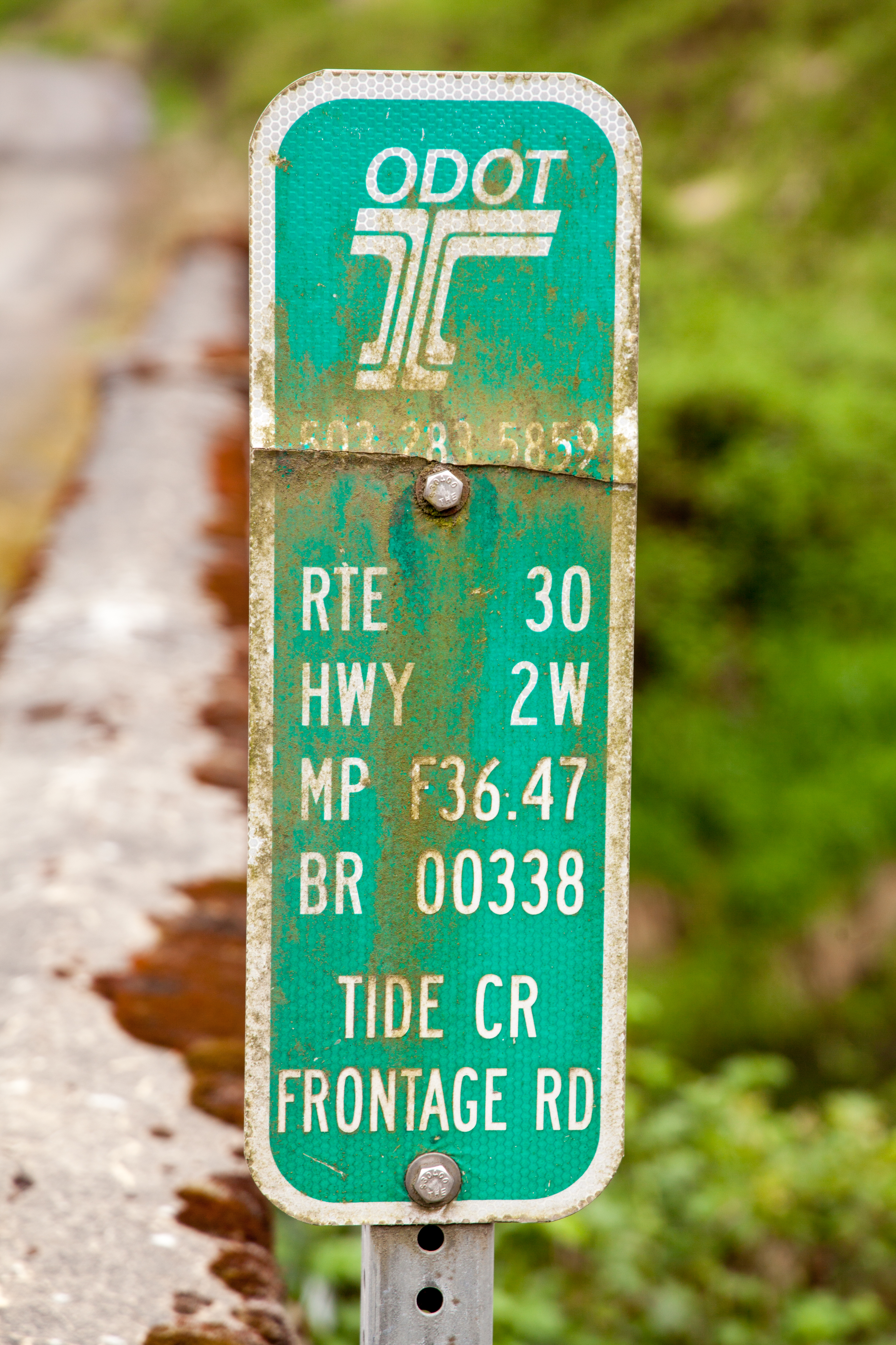
| 16:17, 13 July 2021 | 2020-04-19 state-inventory-marker 7479.jpg (file) |  |
12.58 MB | An ODOT bridge inventory marker for the original Tide Creek Bridge on former US-30 (now a frontage road) at MP F36.47 between Deer Island and Goble.<br /> 📷 Jonathan Ledbetter<br /> 📆 19 April 2020 | 1 |
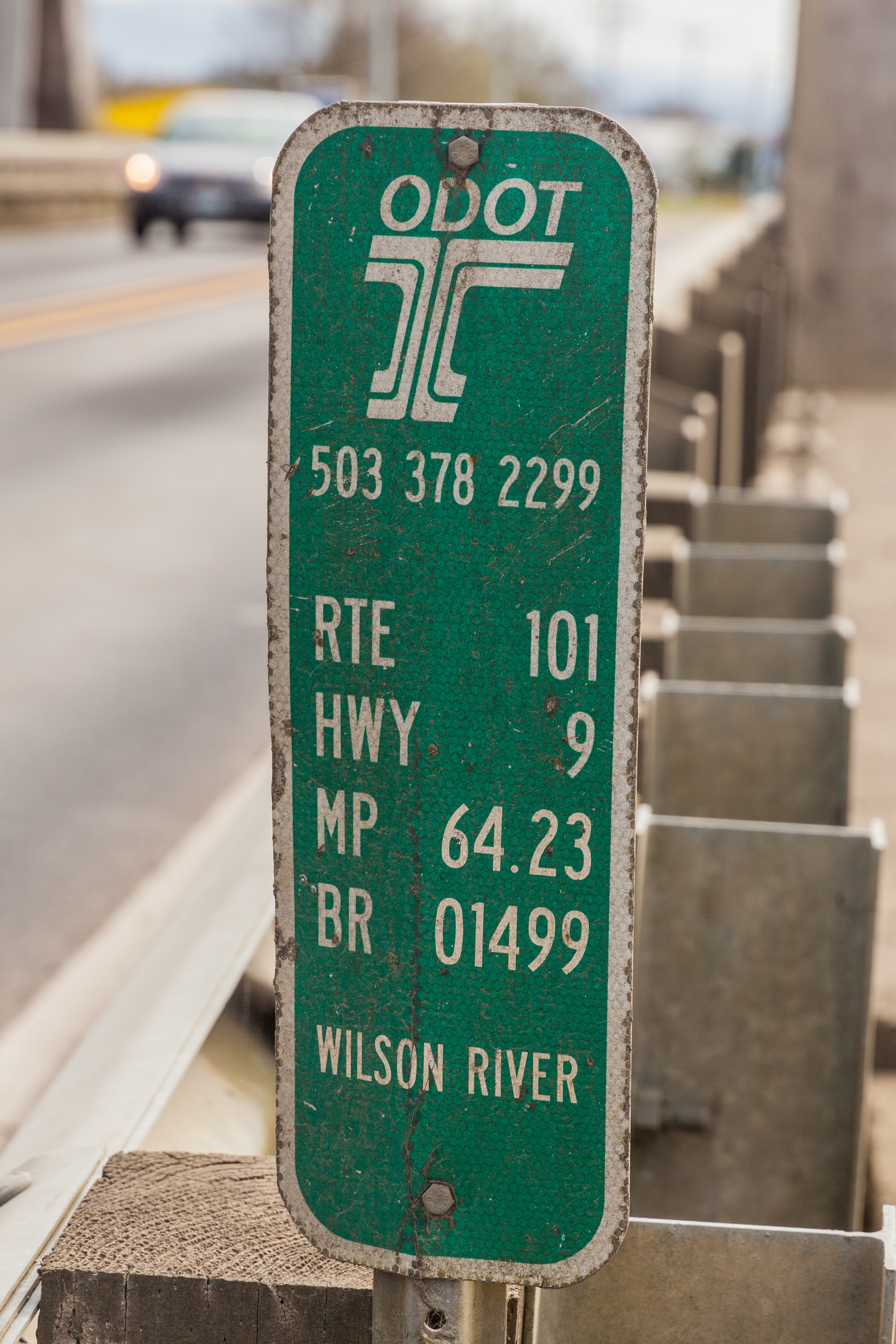
| 01:33, 13 July 2021 | 2018-04-03 state-inventory-marker 9669.jpg (file) |  |
9.78 MB | An ODOT bridge inventory marker for the Wilson River Bridge on US-101 at MP 64.23 in Tillamook.<br /> 📷 Jonathan Ledbetter<br /> 📆 3 April 2018 | 1 |
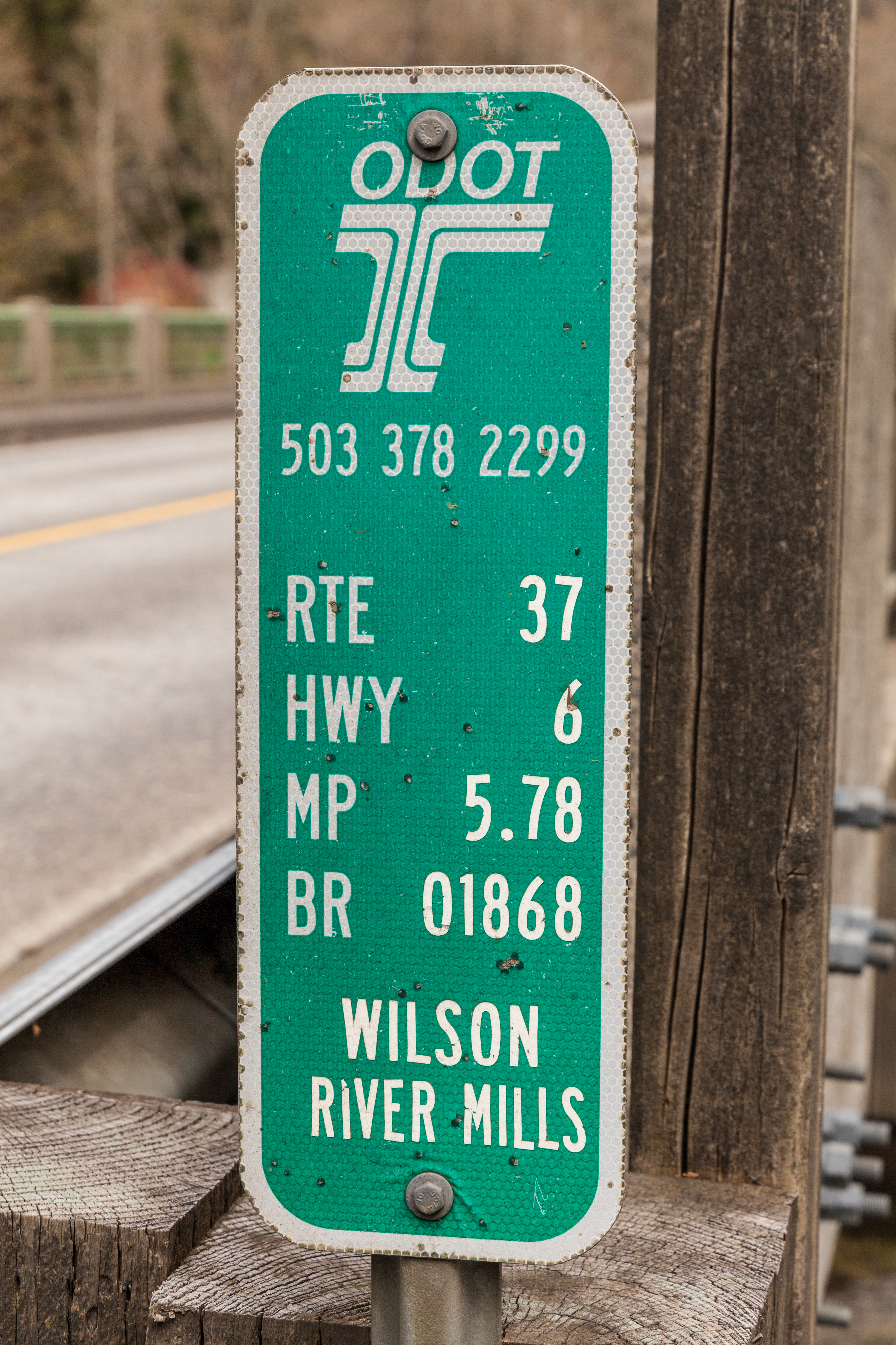
| 01:29, 13 July 2021 | 2018-04-03 state-inventory-marker 9400.jpg (file) |  |
14.95 MB | An ODOT bridge inventory marker for the OR-6 Mills Bridge over the Wilson River at MP 5.78 near Tillamook. Note that the Route and Highway numbers are flip-flopped from where they should be.<br /> 📷 Jonathan Ledbetter<br /> 📆 3 April 2018 | 1 |
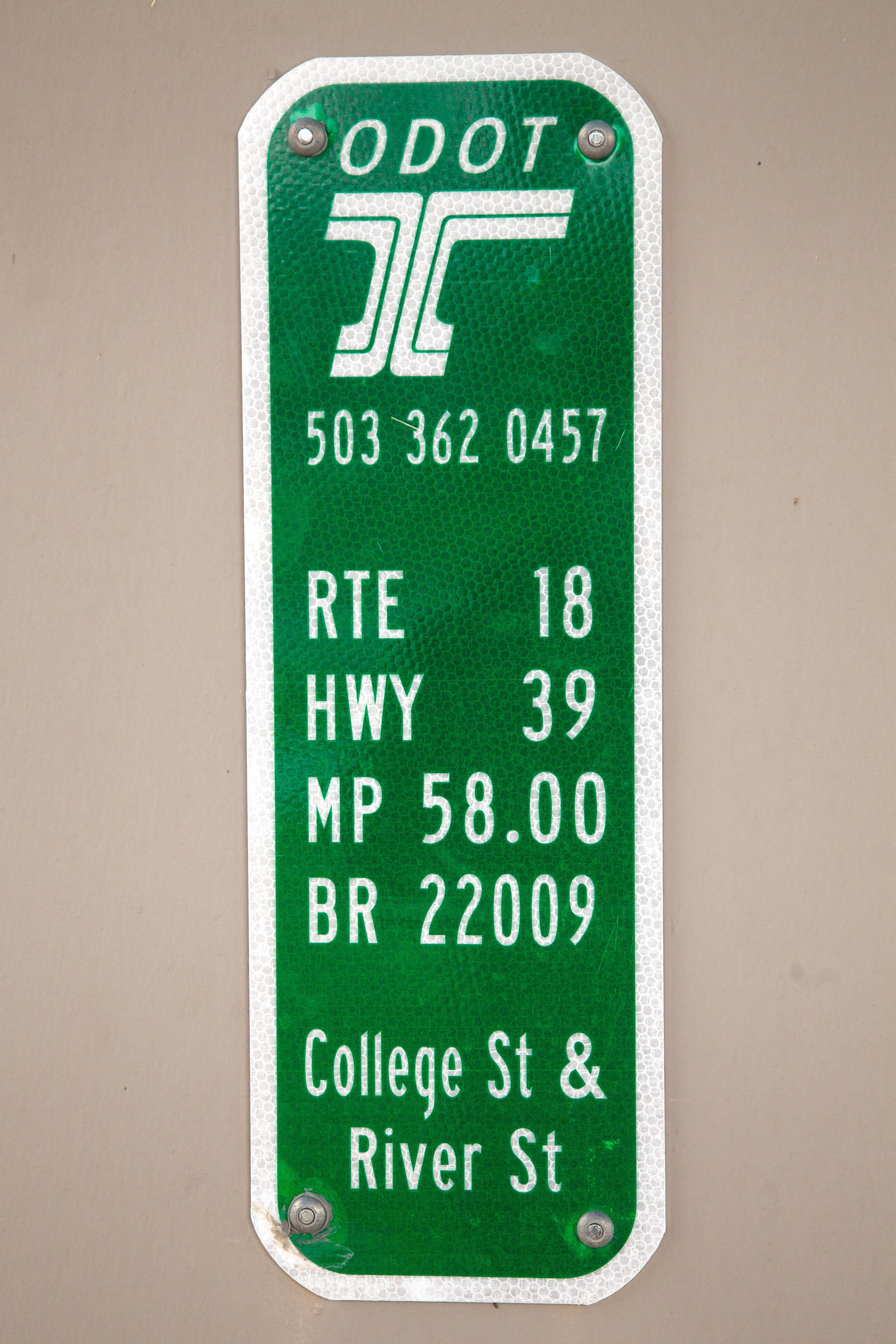
| 01:17, 13 July 2021 | 2018-02-25 state-inventory-marker 6359.jpg (file) |  |
14.65 MB | An ODOT bridge inventory marker for the OR-18 bridge at MP 58 over College and River Streets in Newberg.<br /> 📷 Jonathan Ledbetter<br /> 📆 25 February 2018 | 1 |
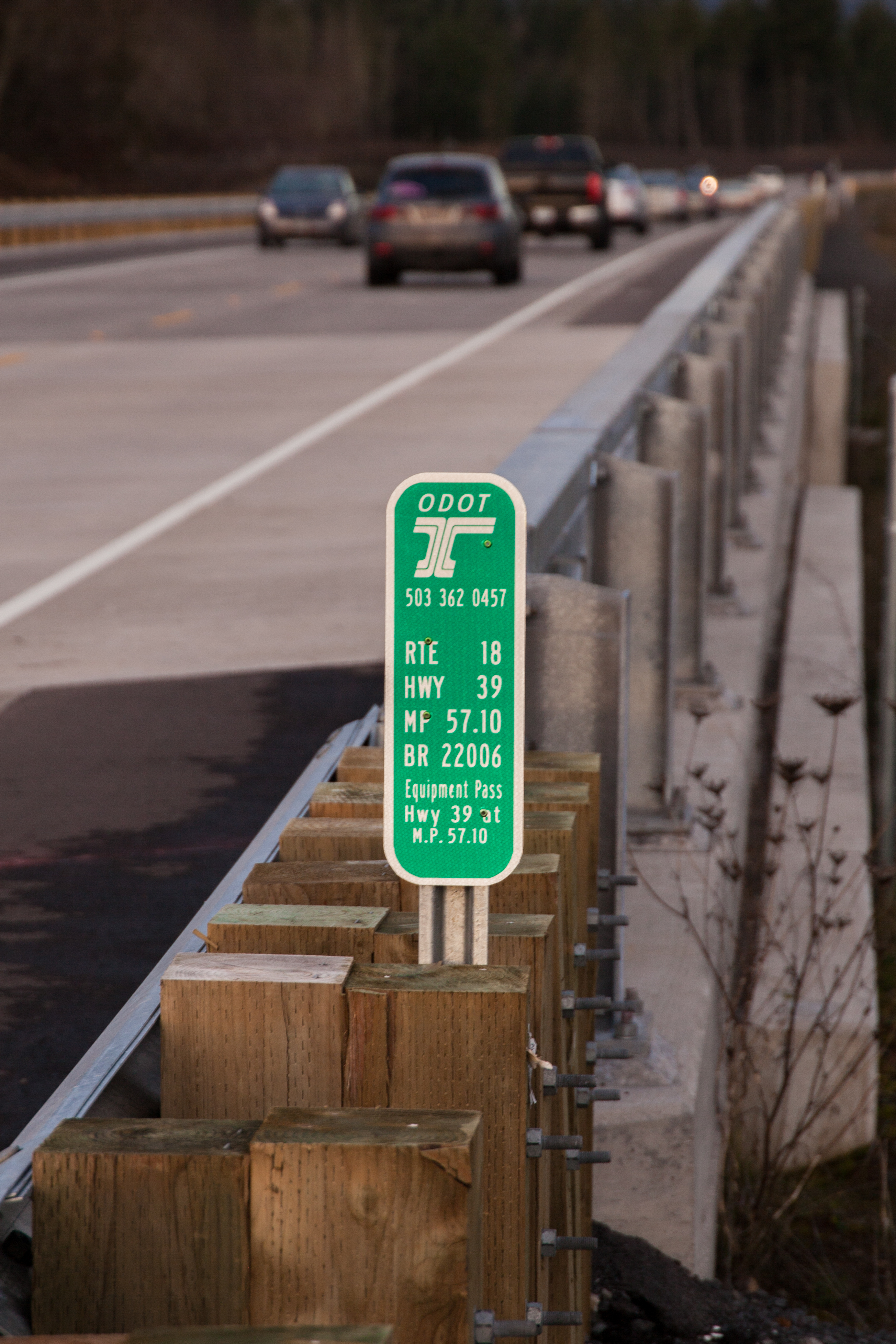
| 01:14, 13 July 2021 | 2018-01-06 state-inventory-marker 5969.jpg (file) |  |
5.63 MB | An ODOT bridge inventory marker for the OR-18 bridge over an equipment pass at MP 57.10 near Dundee. Note the redundant information in the description.<br /> 📷 Jonathan Ledbetter<br /> 📆 6 January 2018 | 1 |
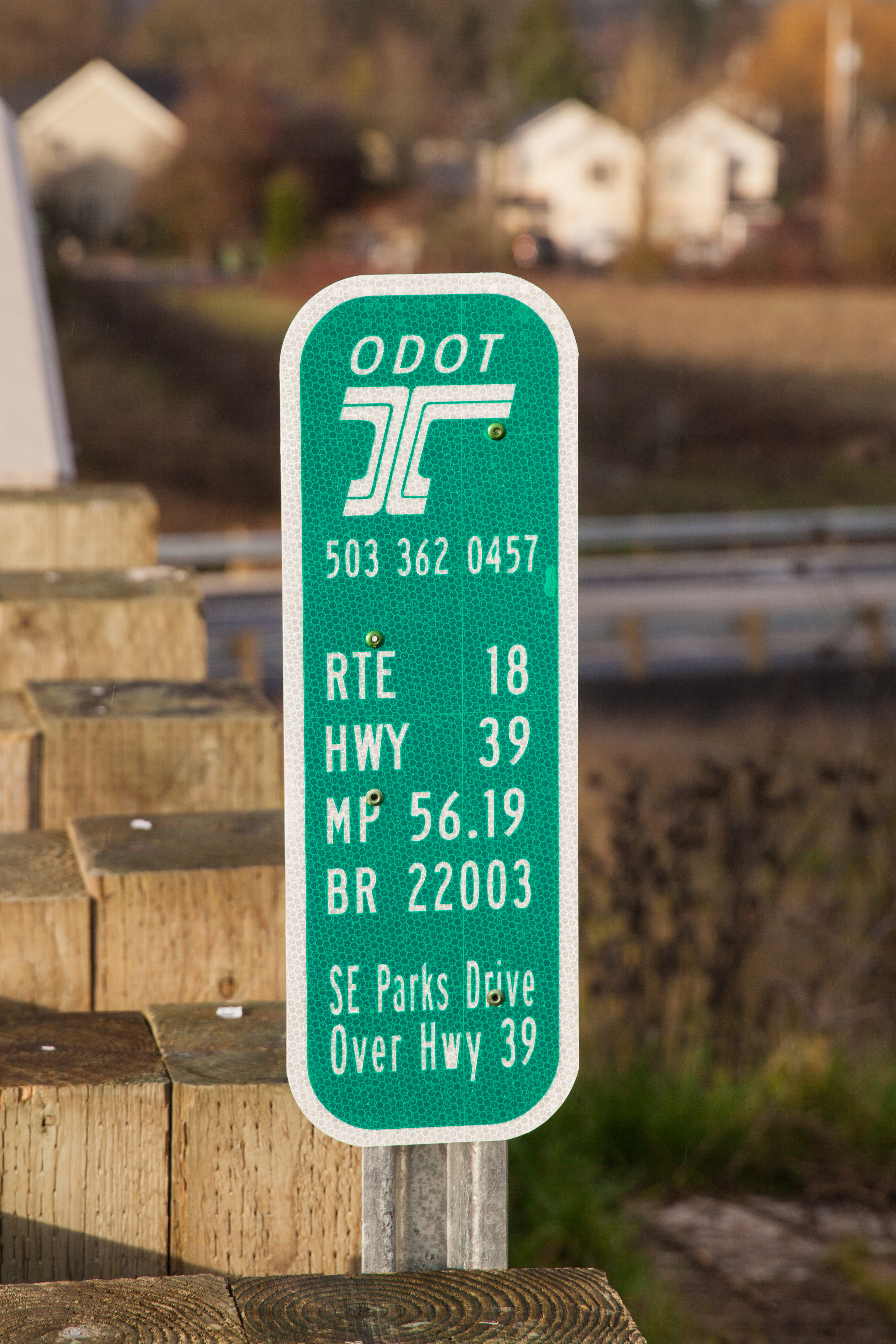
| 01:11, 13 July 2021 | 2018-01-06 state-inventory-marker 5371.jpg (file) |  |
11.39 MB | An ODOT bridge inventory marker for the SE Parks Drive overpass on OR-18 at MP 56.19 near Dundee.<br /> 📷 Jonathan Ledbetter<br /> 📆 6 January 2018 | 1 |
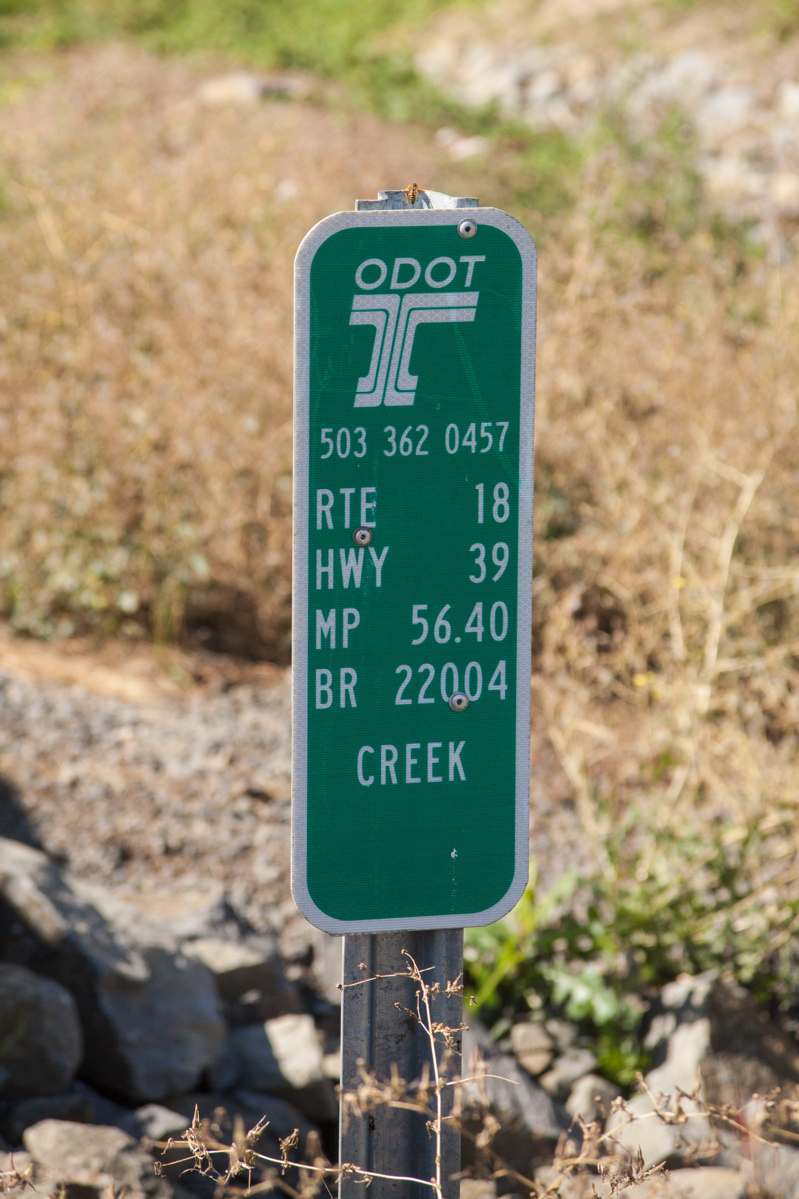
| 01:08, 12 July 2021 | 2017-09-23 state-inventory-marker 1749.jpg (file) |  |
8.33 MB | An ODOT bridge inventory marker on OR-18 at MP 56.40 for the bridge over a creek near Dundee. Photographed during the Play on the Bypass event on September 23, 2017.<br /> 📷 Jonathan Ledbetter<br /> 📆 23 September 2017 | 1 |
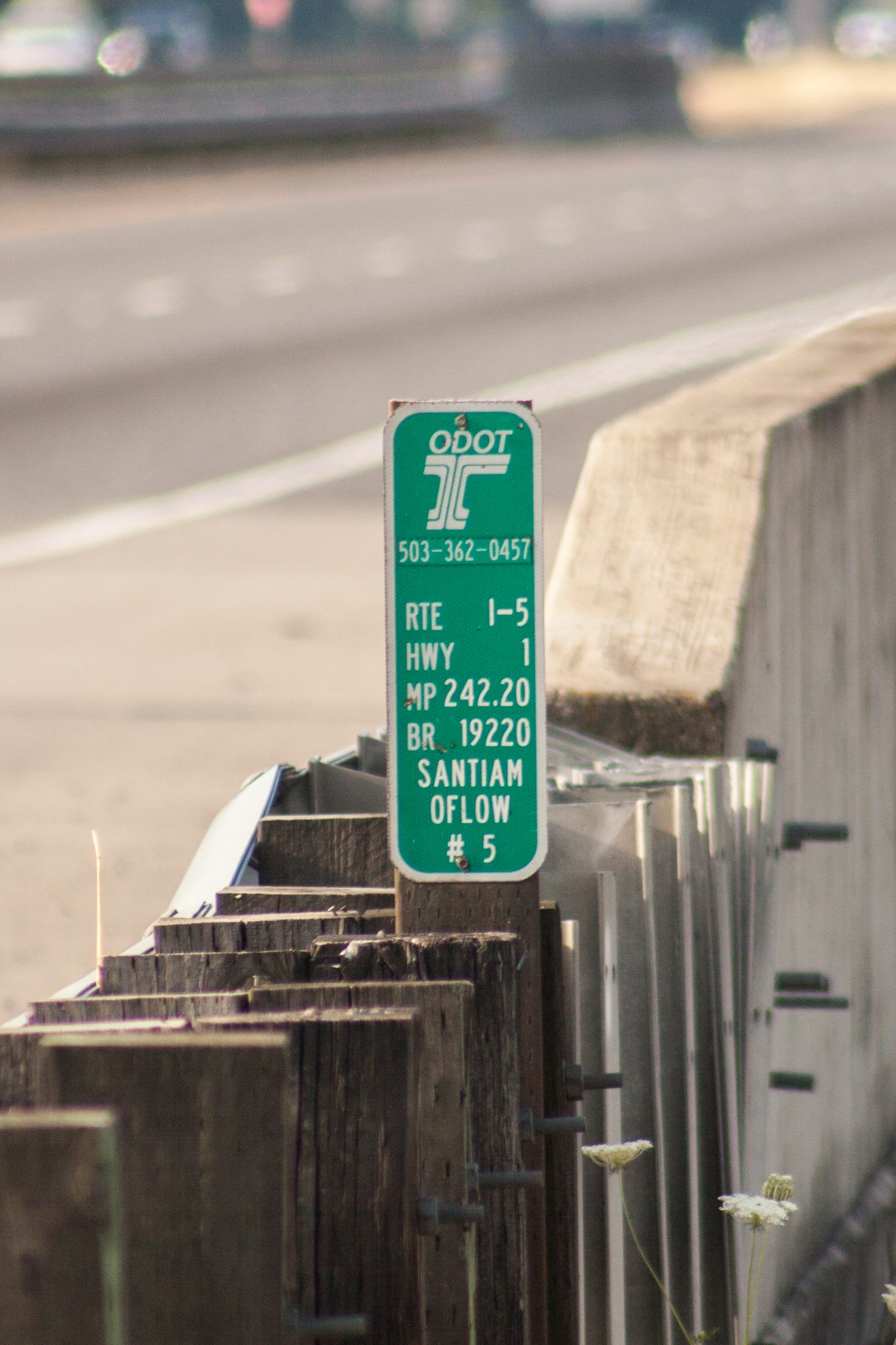
| 00:35, 12 July 2021 | 2016-08-13 state-inventory-marker 3219.jpg (file) |  |
2.03 MB | An ODOT bridge inventory marker on I-5 at MP 242.20 for the bridge over a Santiam River overflow.<br /> 📷 Jonathan Ledbetter<br /> 📆 13 August 2016 | 1 |
| 23:50, 11 July 2021 | Odot-bridge-inventory-marker-examples.png (file) |  |
367 KB | Examples of ODOT bridge inventory markers found along Oregon state highways.<br /> 📷 Jonathan Ledbetter<br /> 📆 12 July 2021 | 1 |
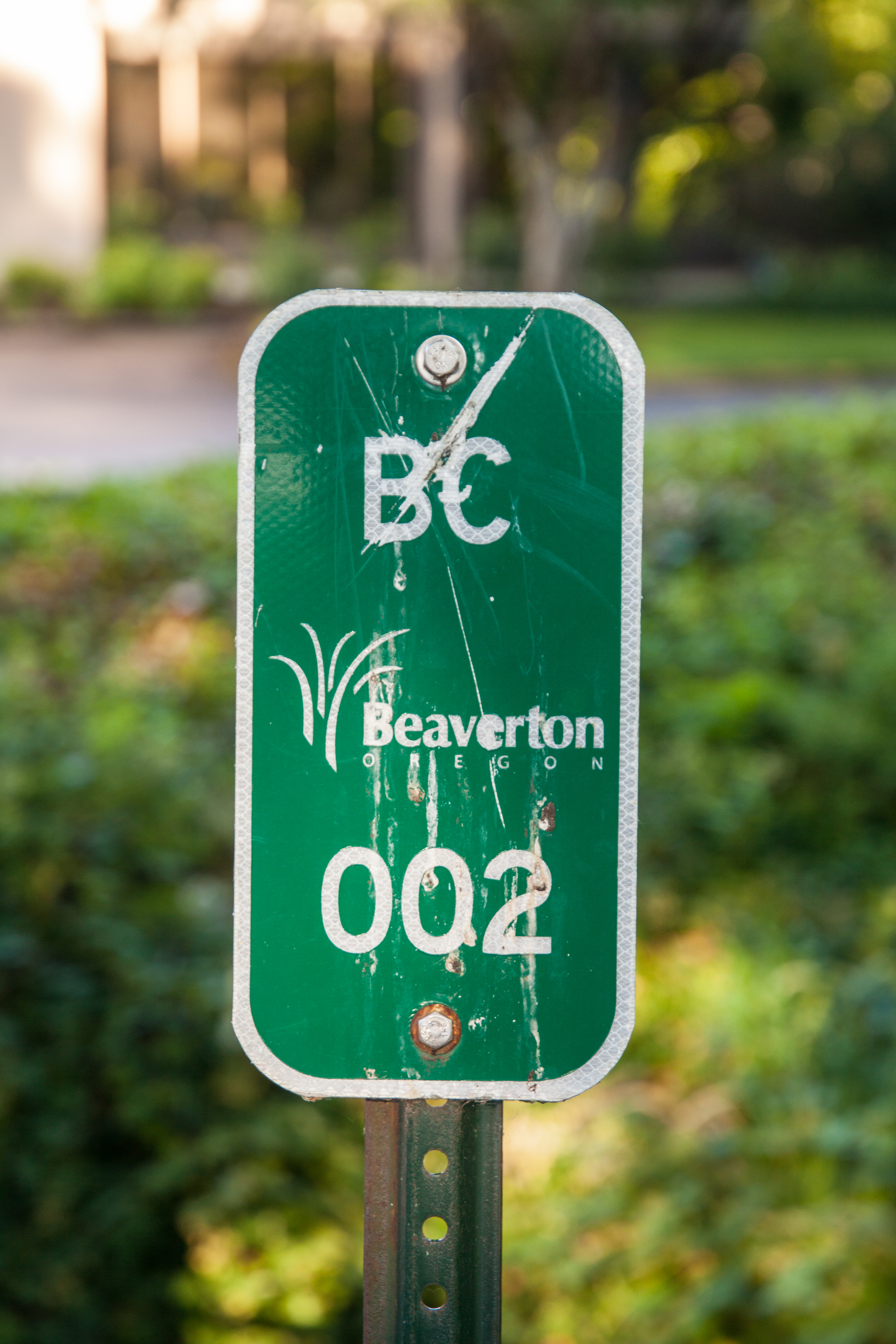
| 00:05, 5 July 2021 | 2021-07-04 beaverton-culvert-marker 3698.jpg (file) |  |
13.49 MB | A Beaverton culvert inventory marker with the city logo on SW Griffith Dr.<br /> 📷 Jonathan Ledbetter<br /> 📆 4 July 2021 | 1 |
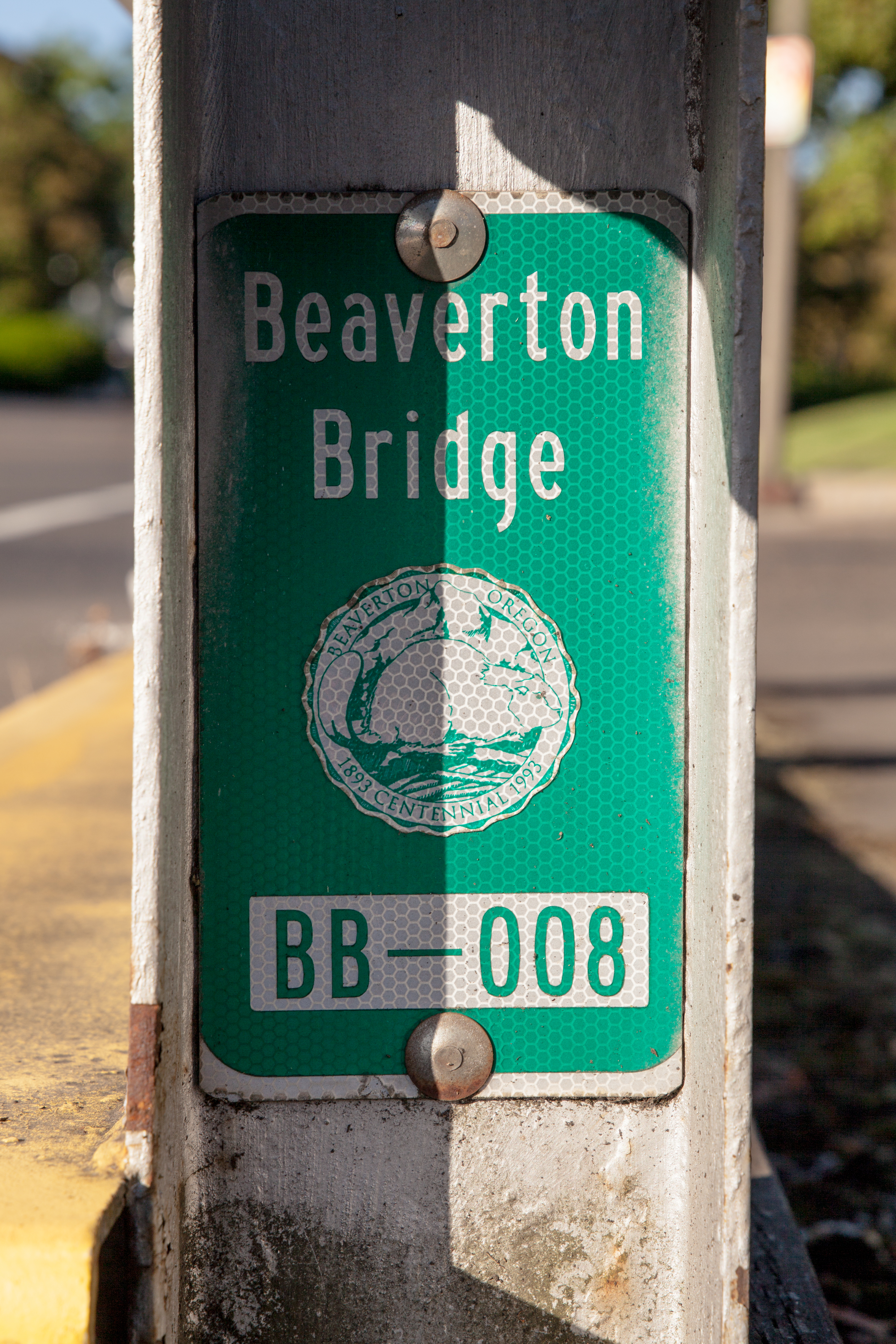
| 23:30, 4 July 2021 | 2021-07-04 beaverton-bridge-marker-seal 3703.jpg (file) |  |
13.6 MB | A Beaverton bridge inventory marker with the city logo on the bridge over Fanno Creek on Hall Blvd.<br /> 📷 Jonathan Ledbetter<br /> 📆 4 July 2021 | 1 |
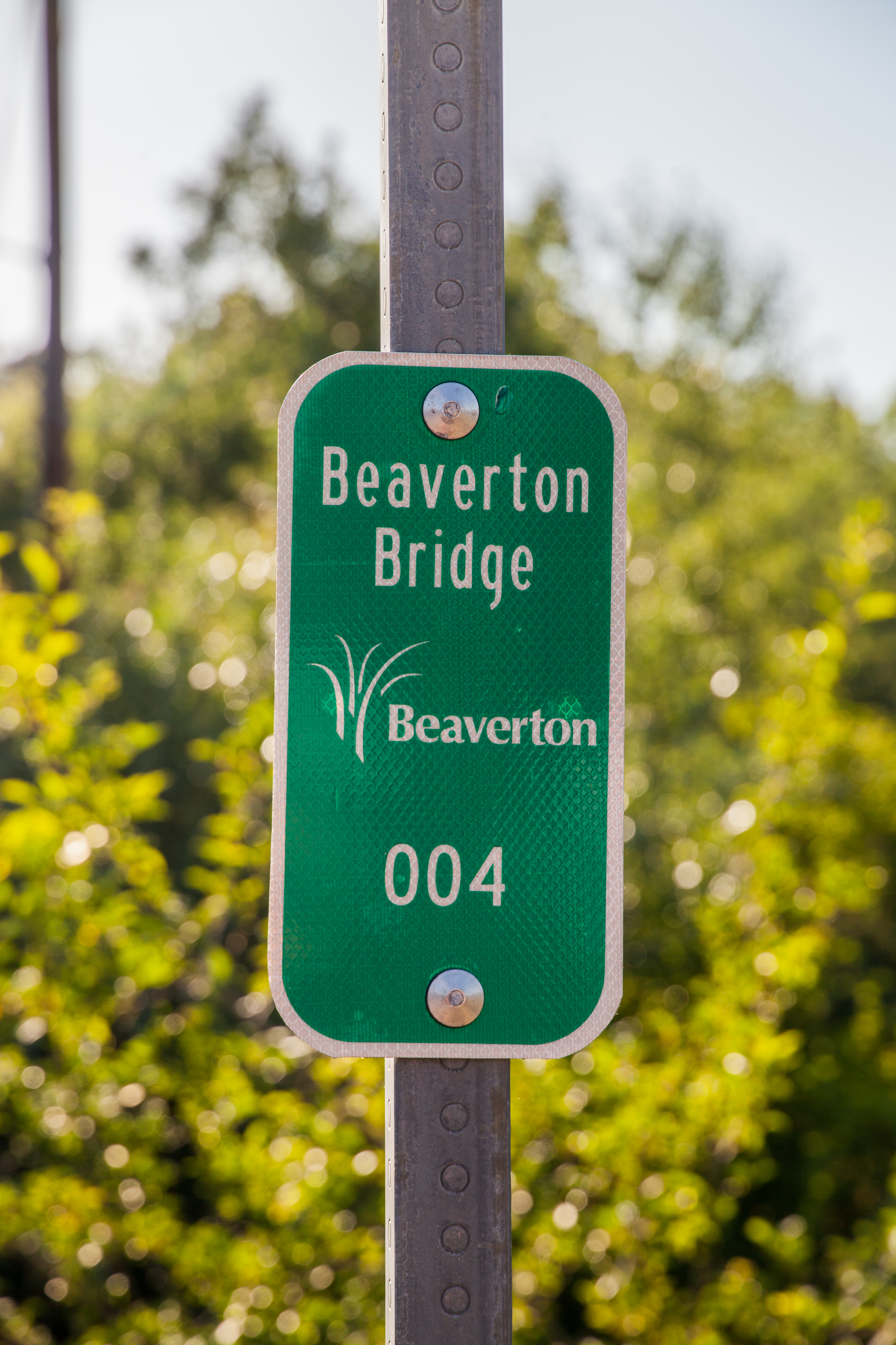
| 23:26, 4 July 2021 | 2021-07-04 beaverton-bridge-marker 3682.jpg (file) |  |
12.37 MB | A Beaverton bridge inventory marker on the bridge over Fanno Creek on Hall Blvd.<br /> 📷 Jonathan Ledbetter<br /> 📆 4 July 2021 | 1 |
| 02:09, 4 July 2021 | 2014-08-01 portland-culvert-marker 5174.jpg (file) |  |
4.68 MB | A Portland Bureau of Environmental Services culvert marker near Kelley Point.<br /> 📷 Jonathan Ledbetter<br /> 📆 1 August 2014 | 1 |
| 01:51, 4 July 2021 | Mp-city-portland-bridge-culvert-examples.png (file) |  |
267 KB | Examples of bridge and culvert markers found along Portland city streets.<br /> 📷 Jonathan Ledbetter<br /> 📆 4 July 2021 | 1 |
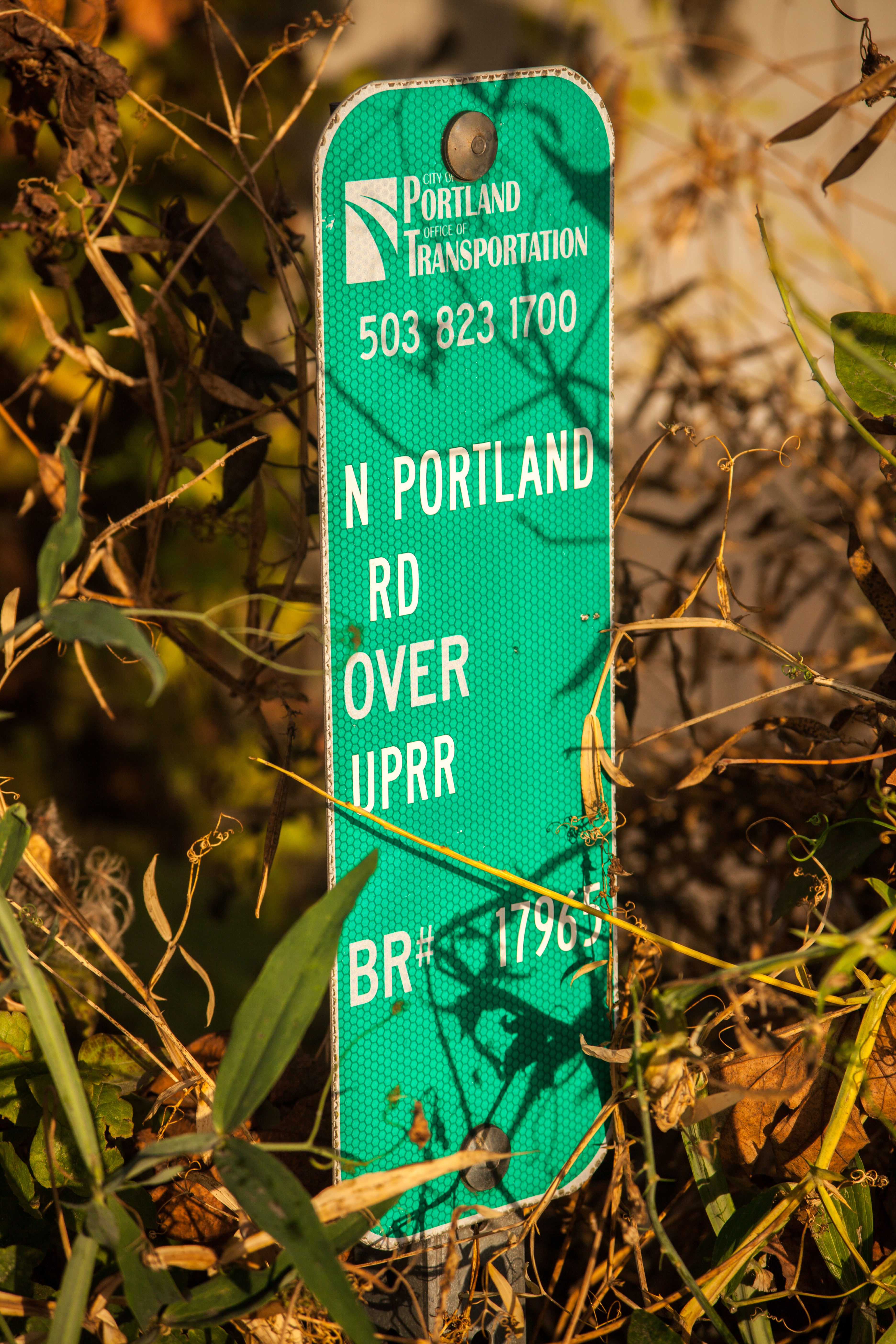
| 16:07, 3 July 2021 | 2015-10-18 portland-inventory-marker 8347.jpg (file) |  |
14.96 MB | A bridge inventory marker for the bridge over the Union Pacific Railroad tracks on N Portland Road near St. Johns.<br /> 📷 Jonathan Ledbetter<br /> 📆 18 October 2015 | 1 |
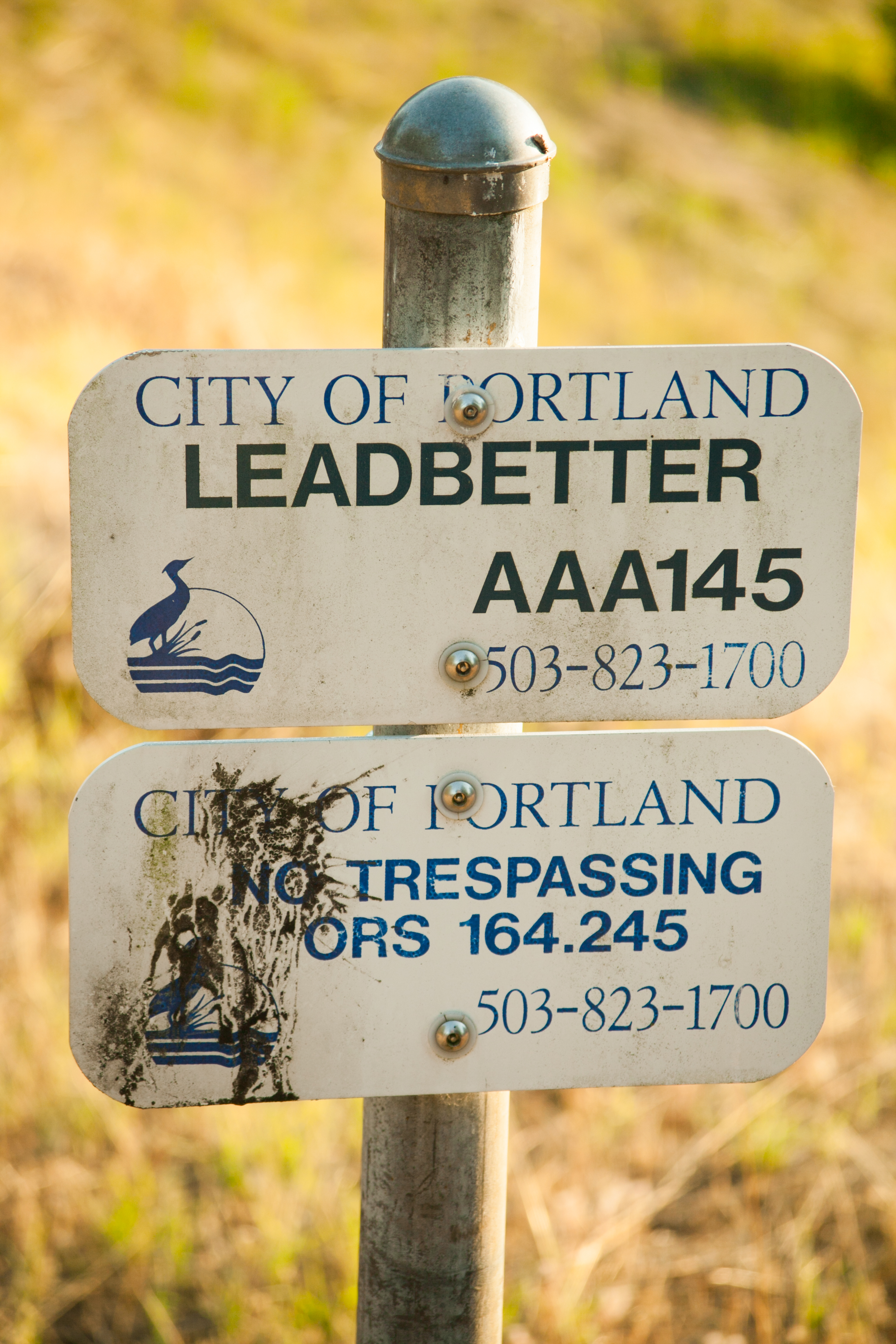
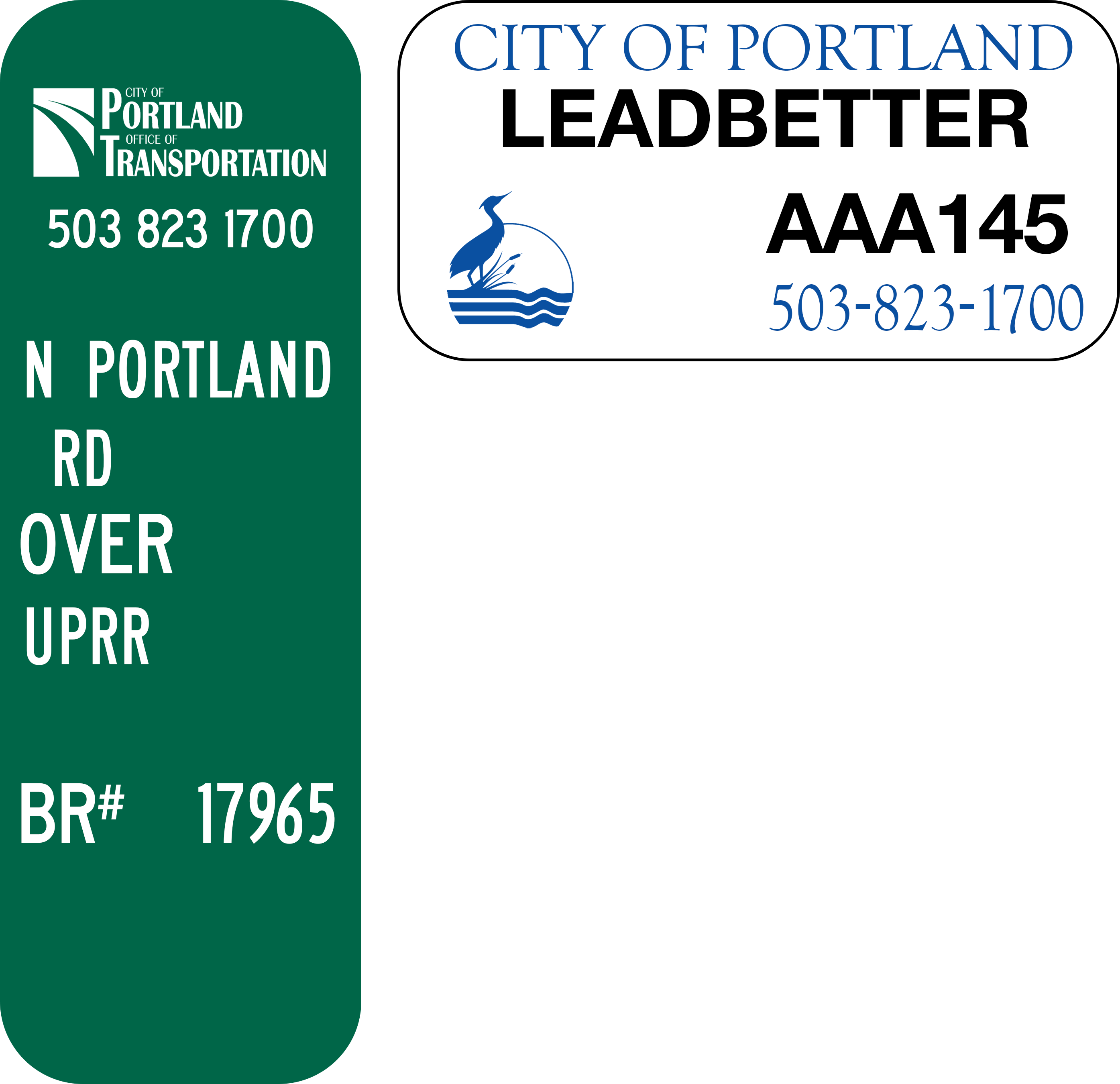
| 13:54, 3 July 2021 | Mp-city-portland-bridge.png (file) |  |
120 KB | An example of a bridge marker found along Portland city streets.<br /> 📷 Jonathan Ledbetter<br /> 📆 3 July 2021 | 1 |
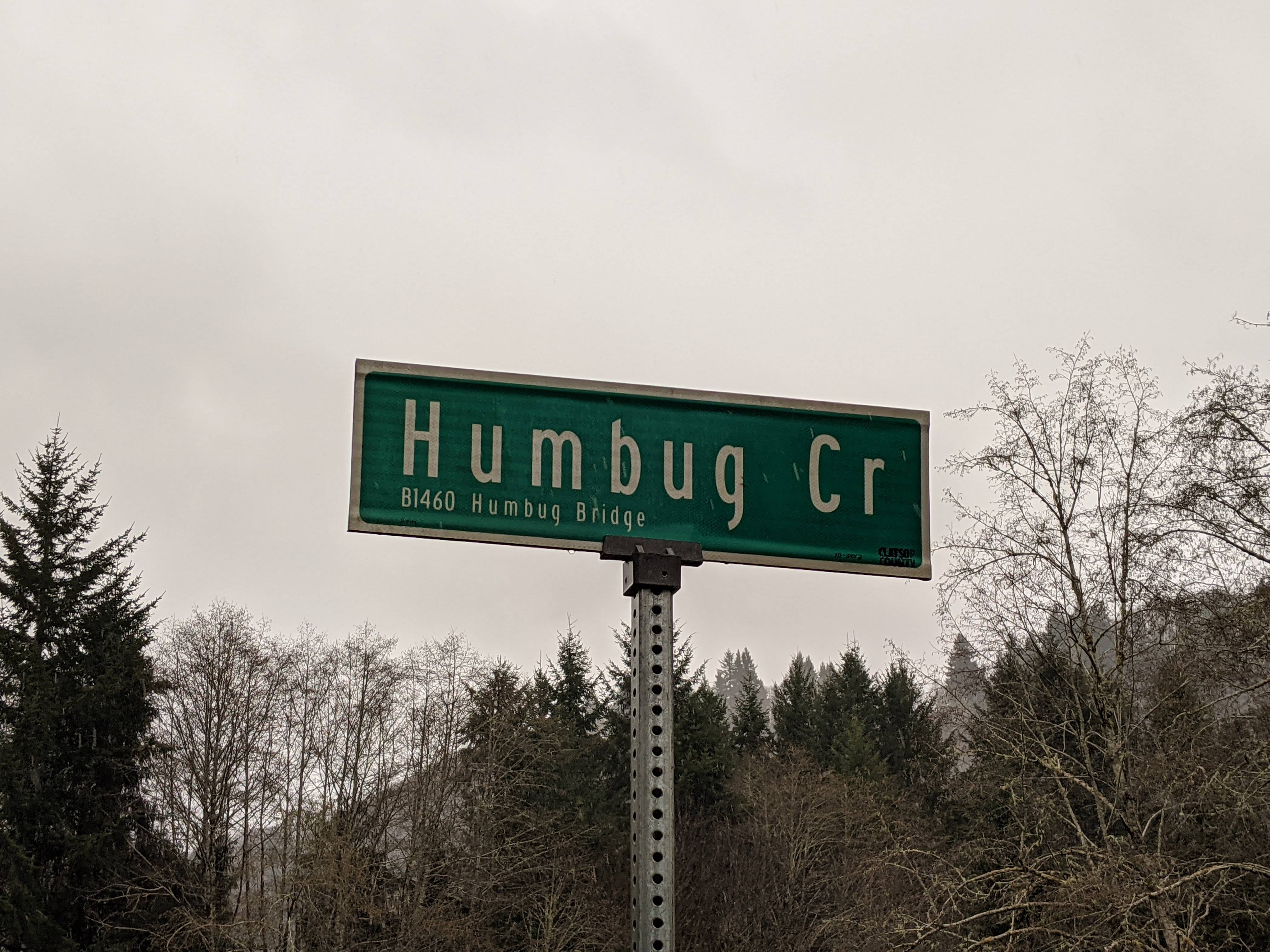
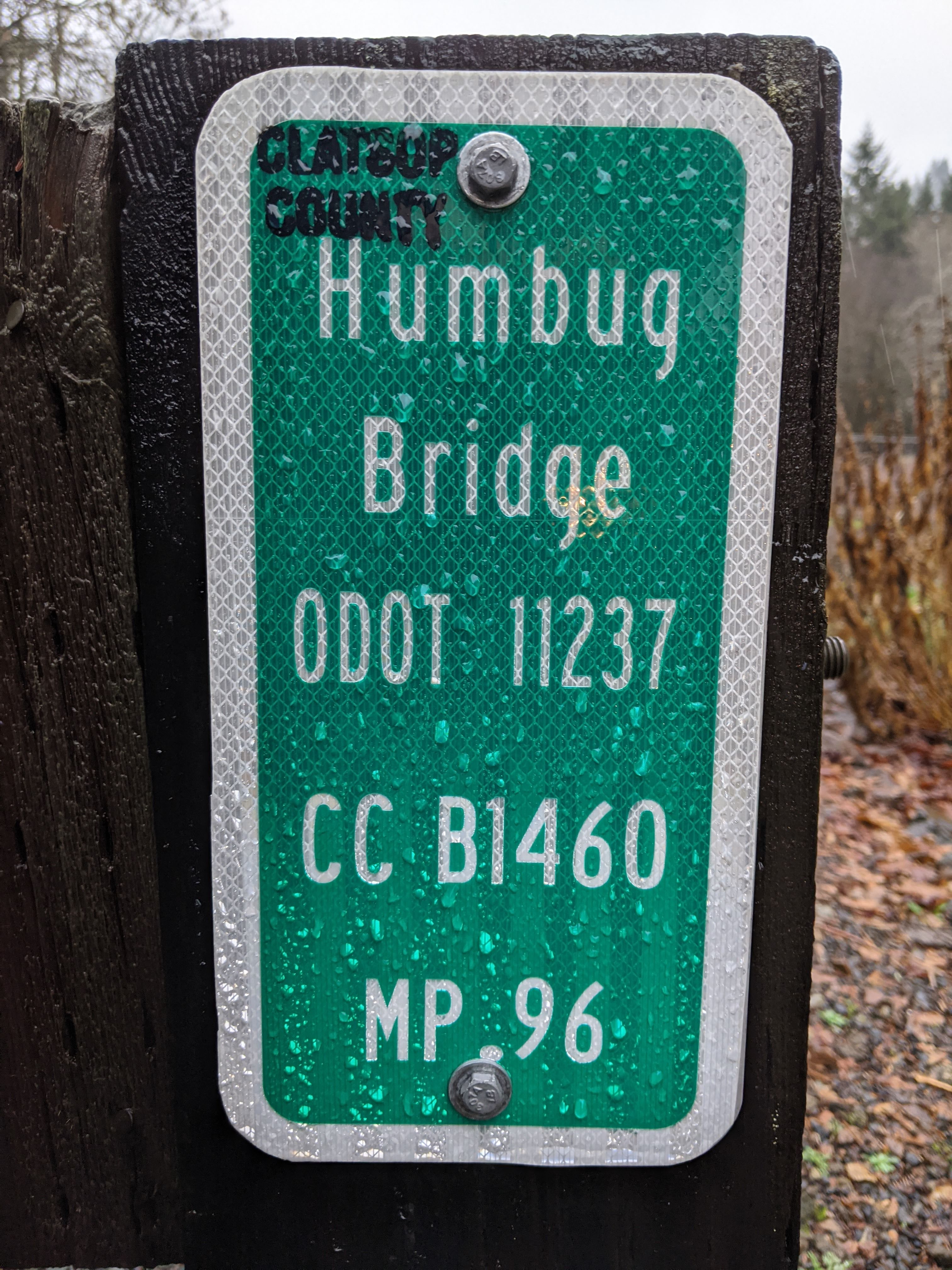
| 09:56, 3 July 2021 | 2021-01-02 clatsopco-bridge-sign 212359329.jpg (file) |  |
1.04 MB | A bridge sign for the Humbug Bridge over Humbug Creek on Lower Nehalem Road (Clatsop County #1404) near Elsie.<br /> 📷 Jonathan Ledbetter<br /> 📆 2 January 2021 | 1 |
| 09:55, 3 July 2021 | 2021-01-02 clatsopco-inventory-marker 212350500.jpg (file) |  |
1.96 MB | A bridge inventory marker at MP 0.96 on Lower Nehalem Road (Clatsop County #1404) near Elsie.<br /> 📷 Jonathan Ledbetter<br /> 📆 1 January 2021 | 1 |
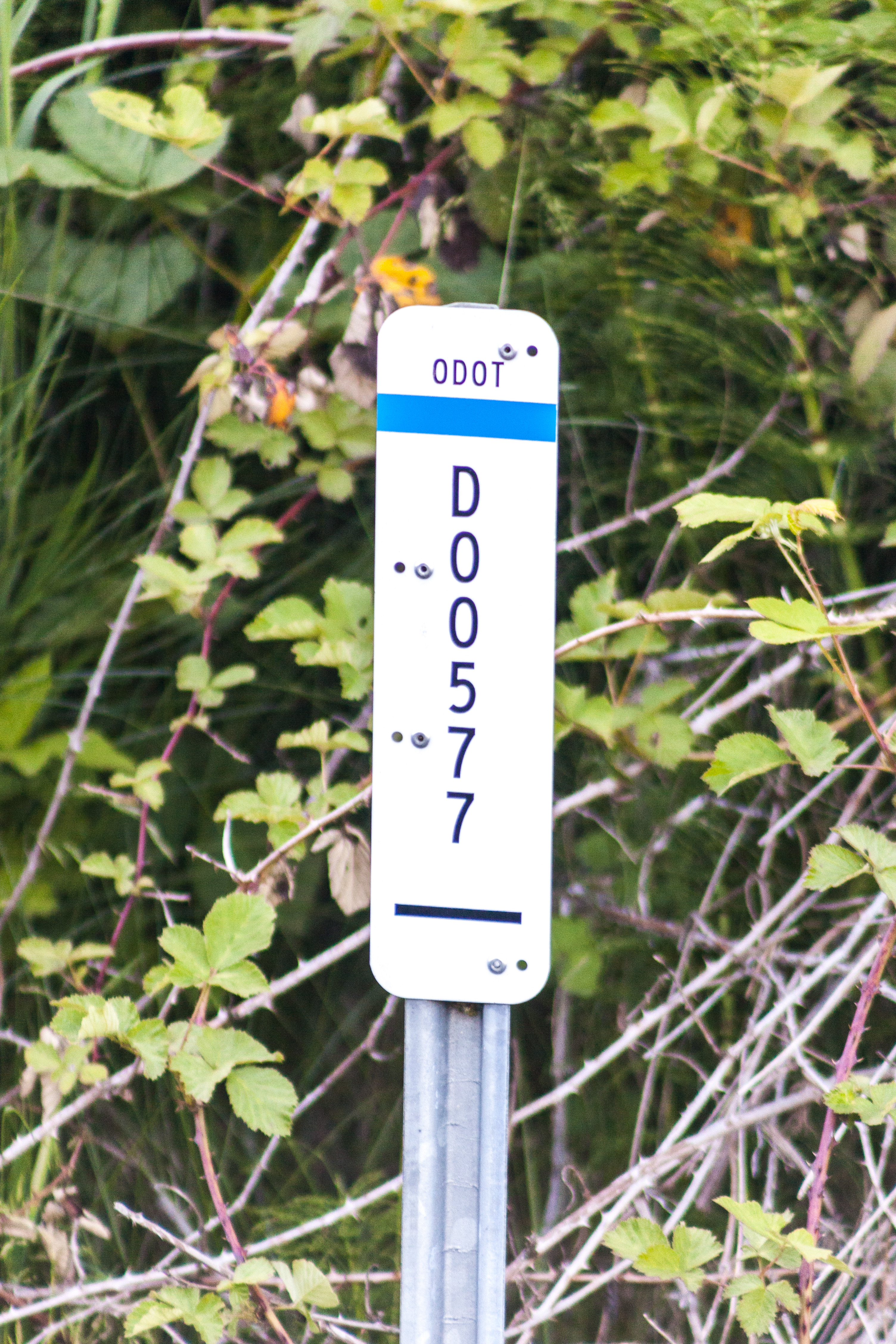
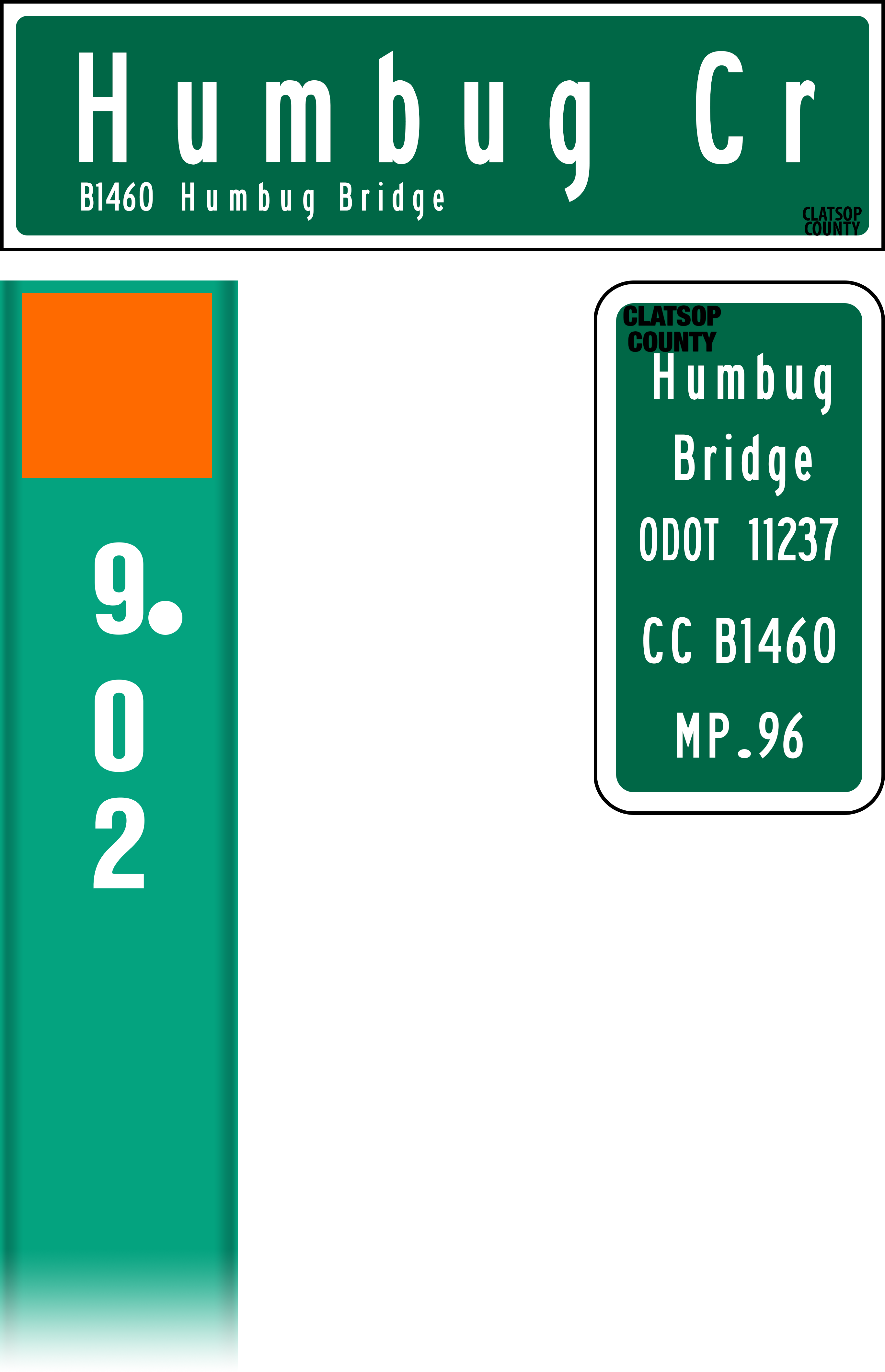
| 09:08, 3 July 2021 | Mp-county-clatsop-bridge-examples.png (file) |  |
336 KB | Added culvert marker flag, rearranged markers | 2 |
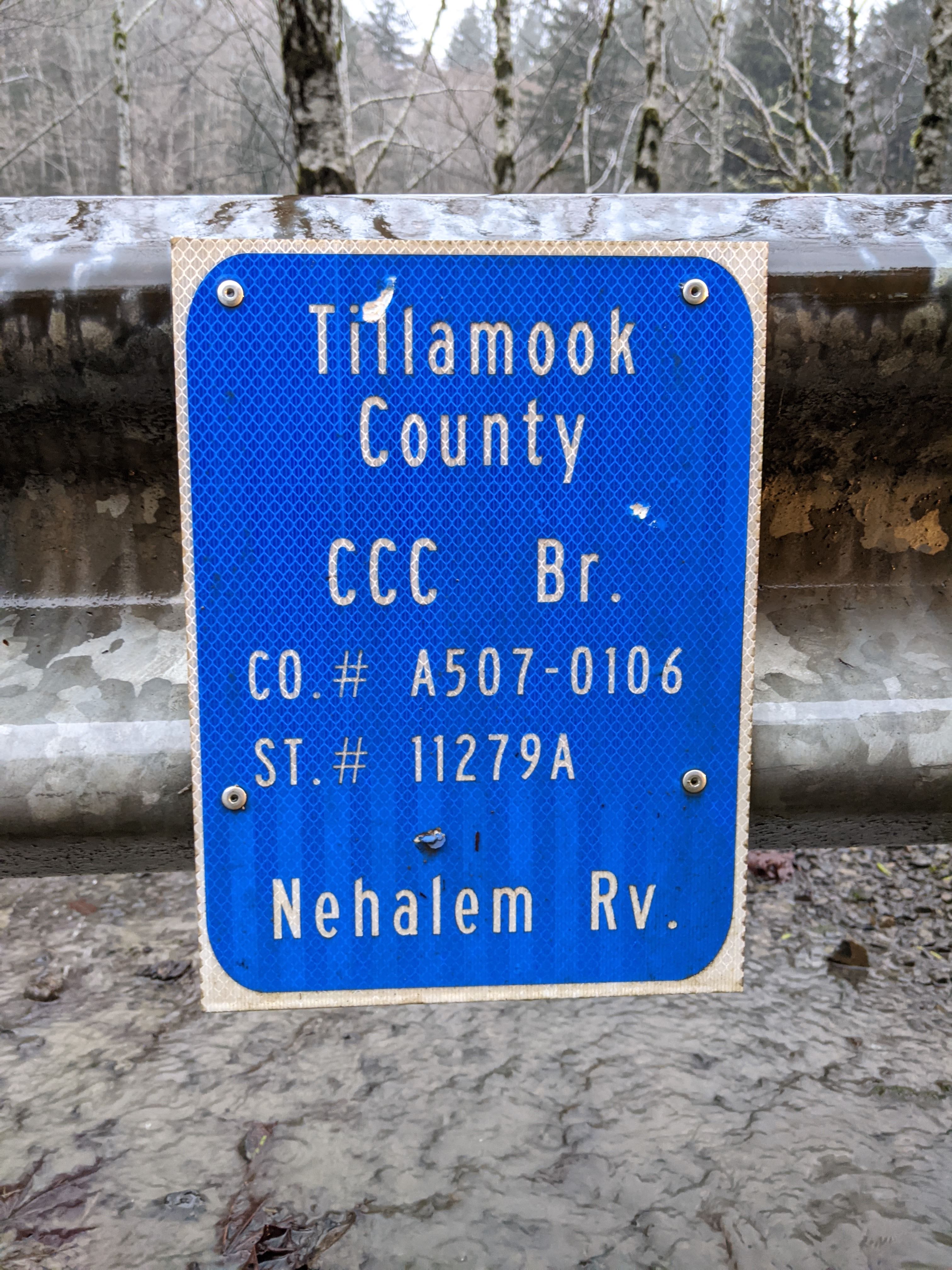
| 23:36, 2 July 2021 | 2021-01-02 tillamookco-inventory-marker 224230662.jpg (file) |  |
1.9 MB | A Tillamook County bridge inventory marker on Foss Road (Tillamook County #507) at the CCC Bridge over the Nehalem River.<br /> 📷 Jonathan Ledbetter<br /> 📆 2 January 2021 | 1 |
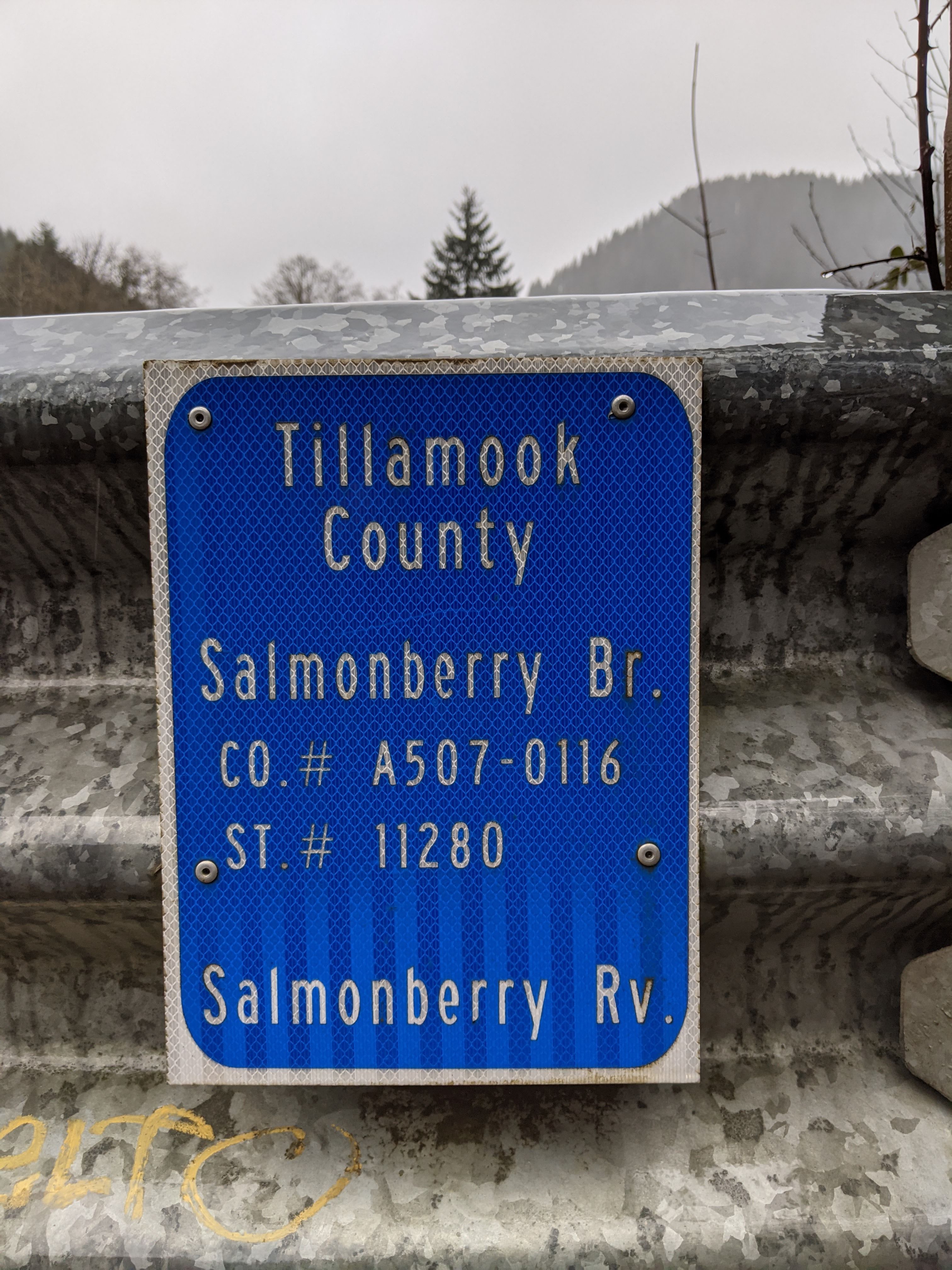
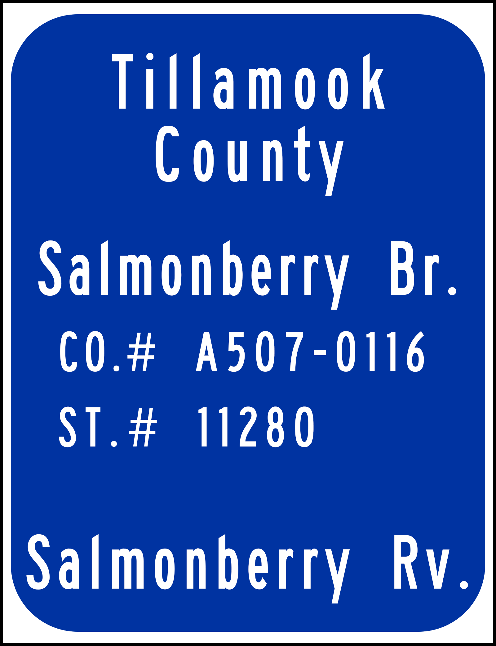
| 23:34, 2 July 2021 | 2021-01-02 tillamookco-inventory-marker 220959309.jpg (file) |  |
1.78 MB | A Tillamook County bridge inventory marker on Foss Road (Tillamook County #507) at the Salmonberry Bridge over the Salmonberry River.<br /> 📷 Jonathan Ledbetter<br /> 📆 2 January 2021 | 1 |
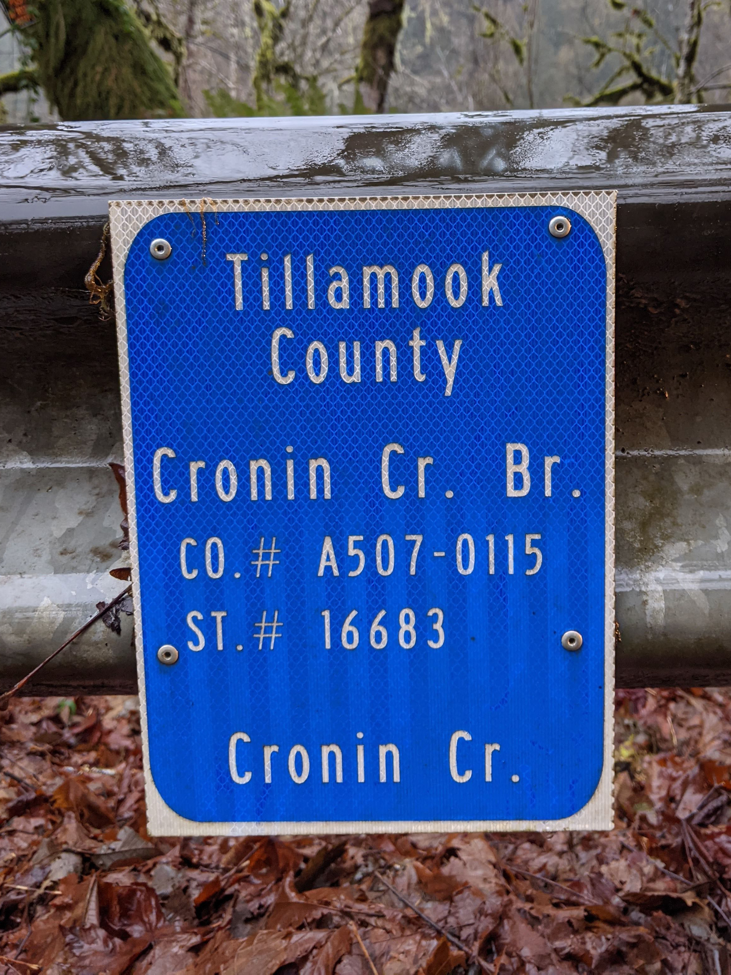
| 23:33, 2 July 2021 | 2021-01-02 tillamookco-inventory-marker 215922150.jpg (file) |  |
4.67 MB | A Tillamook County bridge inventory marker on Foss Road (Tillamook County #507) at the Cronin Creek Bridge over Cronin Creek.<br /> 📷 Jonathan Ledbetter<br /> 📆 2 January 2021 | 1 |
| 23:21, 2 July 2021 | Mp-county-tillamook-bridge.png (file) |  |
146 KB | Changed octothorpe thickness and centered blue rounded rectangle vertically and horizontally | 1 |
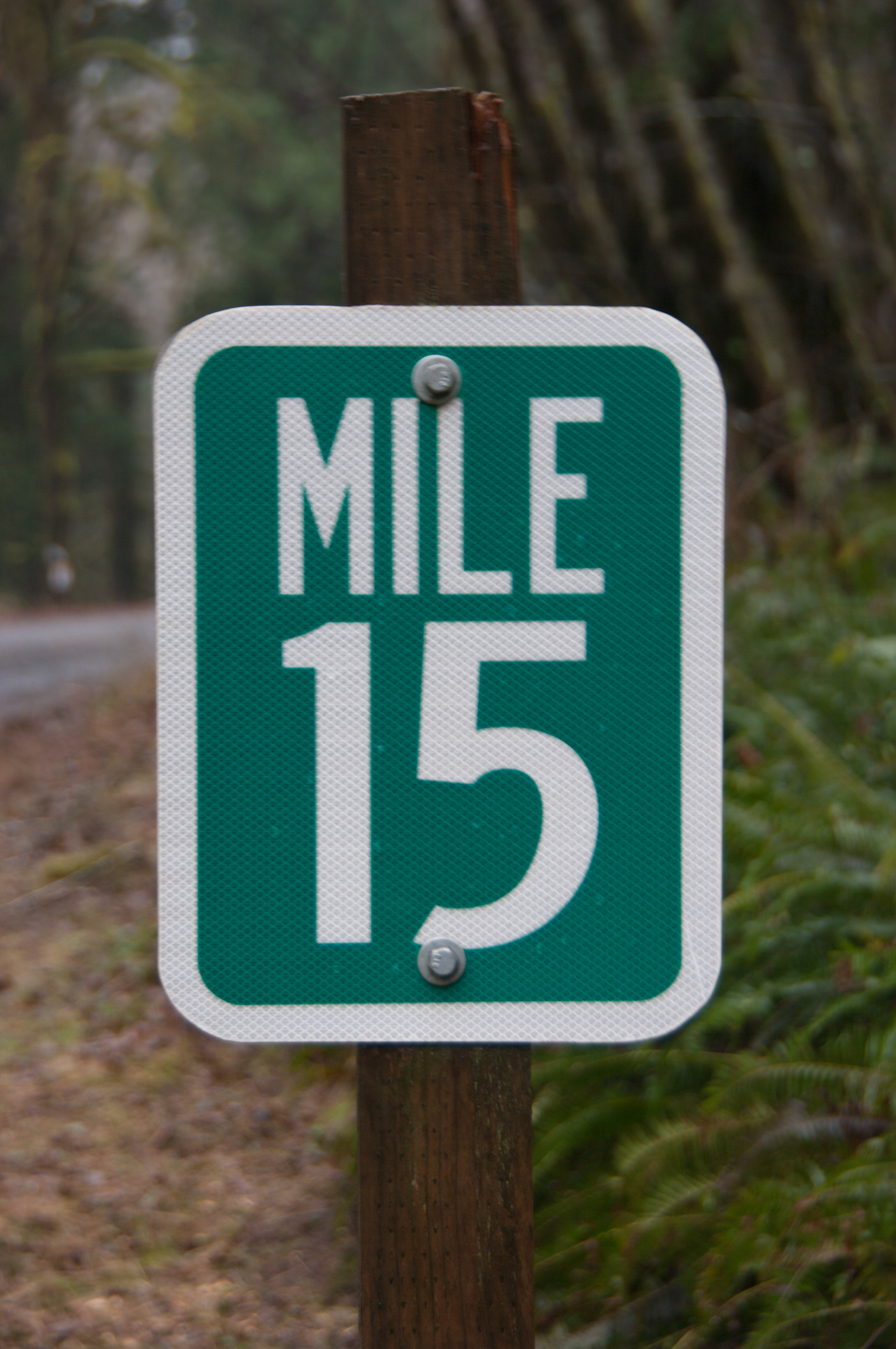
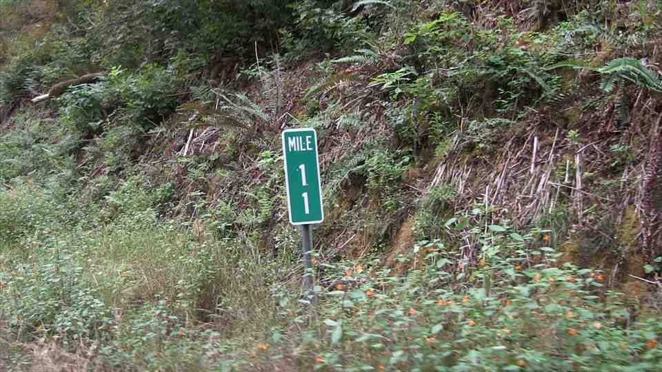
| 17:24, 2 July 2021 | 2021-01-02 tillamookco-milepost 6706.jpg (file) |  |
8.51 MB | A Tillamook County milepost at MP 15 on Foss Road (Tillamook County #507).<br /> 📷 Jonathan Ledbetter<br /> 📆 2 January 2021 | 1 |
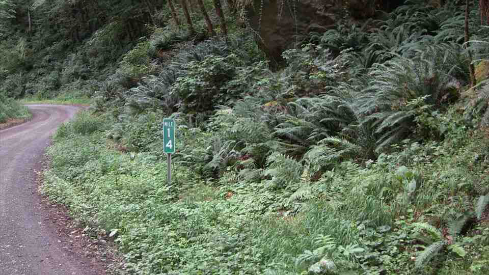
| 17:17, 2 July 2021 | 2014 tillamookco-vidlog Foss-Rd(507) MP14-NB(C2).jpg (file) | _MP14-NB(C2).jpg) |
170 KB | A D10-2 milepost at MP 14 of Foss Road (Tillamook County #507).<br /> 🖼 Tillamook County Video Log via [http://tillamook.streetpixweb.com/ StreetPix]<br /> 📆 2014 | 1 |
| 17:17, 2 July 2021 | 2014 tillamookco-vidlog Foss-Rd(507) MP11-NB(C2).jpg (file) | _MP11-NB(C2).jpg) |
211 KB | A D10-2 milepost at MP 11 of Foss Road (Tillamook County #507).<br /> 🖼 Tillamook County Video Log via [http://tillamook.streetpixweb.com/ StreetPix]<br /> 📆 2014 | 1 |
| 17:16, 2 July 2021 | 2018 tillamookco-vidlog Foss-Rd(507) MP12-NB(C2).jpg (file) | _MP12-NB(C2).jpg) |
147 KB | A D10-1 milepost, notable for containing a two-digit number in a space designed for one, at MP 12 of Foss Road (Tillamook County #507).<br /> 🖼 Tillamook County Video Log via [http://tillamook.streetpixweb.com/ StreetPix]<br /> 📆 2018 | 1 |
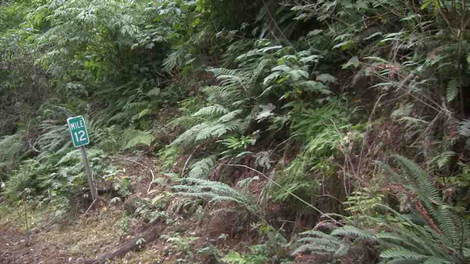
| 17:09, 2 July 2021 | 2021-01-02 tillamookco-milepost 6715.jpg (file) |  |
8.69 MB | A D10-1 milepost at MP 9 on Foss Road (Tillamook County #507).<br /> 📷 Jonathan Ledbetter<br /> 📆 2 January 2021 | 1 |
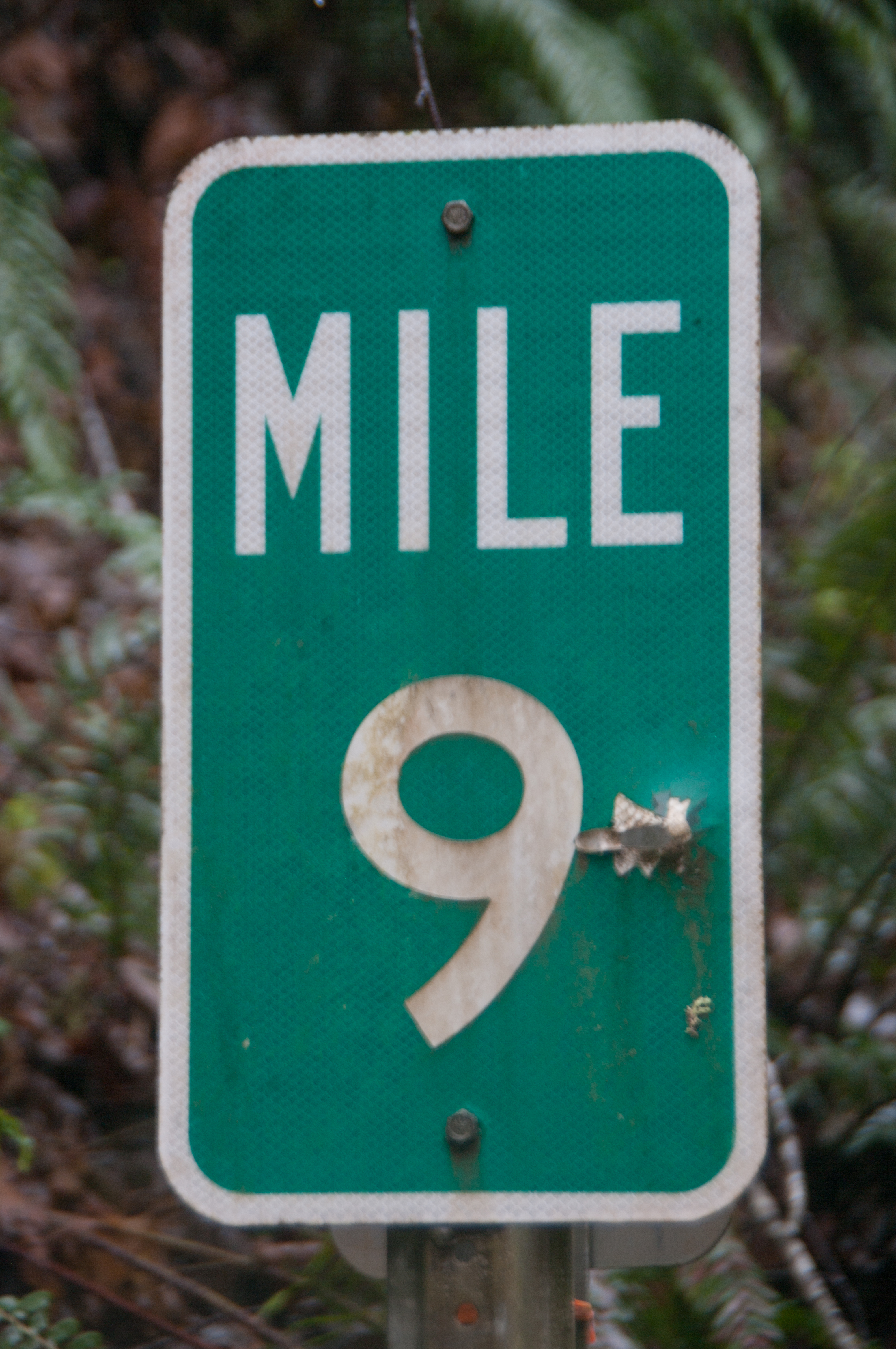
| 23:27, 30 June 2021 | 2021-06-20 washco-milepost 3559.jpg (file) |  |
13.04 MB | Milepost 4 on NW West Union Rd. (Washington County #52626) near Helvetia.<br /> 📷 Jonathan Ledbetter<br /> 📆 20 June 2021 | 1 |